Public Tags
Tag: Development·Land
Showing latest 50 of 89 images tagged with Development Land tag.
|
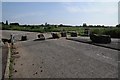
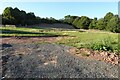
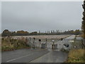
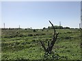
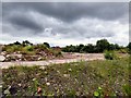
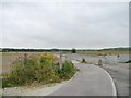
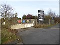
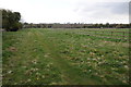
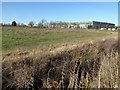
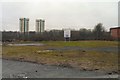
Development land
by Philip Halling geograph for square SO9547 Land off a roundabout on Wyre Road to development land on Pershore Trading Estate.
|
|
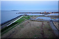
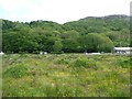
Development land, Leith Western Harbour
by Ian Taylor for square NT2677 At dusk. The land has been partitioned and access roads have been built.... (more)
|
|
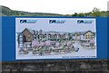
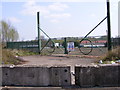
Land for development
by Bill Kasman for square NH8912 This placard refers to the proposed development shown in this image NH8912 : Land for development
|
|
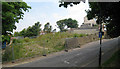
Development Land, Castle Hill Road
by Oast House Archive geograph for square TQ8209 Category: Development land An empty plot awaiting redevelopment.
|
|
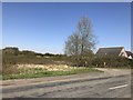
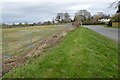
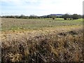
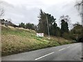
Land awaiting development
by Philip Halling geograph for square SO4154 Land awaiting development on the west side of the village of Dilwyn.
Tags:
top:Construction, DevelopmentX
Development Land
top:Farm, Fishery, Market GardeningX
FieldX
subject:FieldX
type:GeographX
|
|
Land awaiting development
by Philip Halling geograph for square SO4154 Land awaiting development on the west side of the village of Dilwyn.
Tags:
top:Construction, DevelopmentX
Development Land
top:Farm, Fishery, Market GardeningX
subject:FieldX
FieldX
type:GeographX
|
|
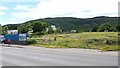
Land for development
by Bill Kasman geograph for square NH8912 In the centre of Aviemore just off Grampian Road.
Tags:
place:AviemoreX
top:City, Town CentreX
top:Construction, DevelopmentX
Development Land
type:GeographX
Grampian RoadX
Land Awaiting DevelopmentX
top:Roads, Road TransportX
|
|
Development land on High Road, Wisbech St Mary
by Richard Humphrey geograph for square TF4107 Tags:
top:Construction, DevelopmentX
Development Land
type:GeographX
Land Awaiting DevelopmentX
subject:RoadX
|
|
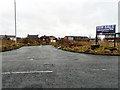
Talke: development land on Linley Road
by Jonathan Hutchins geograph for square SJ8253 Formerly site of the Linley Trading Estate, an approximately 8.79 acre site with... (more)
Tags:
top:Construction, DevelopmentX
Development Land
type:GeographX
Land Awaiting DevelopmentX
top:Suburb, Urban FringeX
place:TalkeX
former:Trading EstateX
|
|
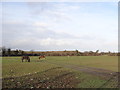
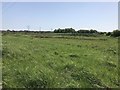
Grazing land for now
by Ian Paterson geograph for square O1140 Shame about the security gate (shadows evident in the foreground), or I'd... (more)
Tags:
top:Construction, DevelopmentX
Development Land
Development SiteX
top:Farm, Fishery, Market GardeningX
subject:GrazingX
|
|
Development land, Tetbury
by Philip Halling geograph for square ST8994 Land on the edge of Tetbury to the south of London Road available for redevelopment.
Tags:
top:Construction, DevelopmentX
Development Land
|
|
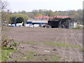
Nene Waterfront Regeneration in Wisbech
by Richard Humphrey geograph for square TF4610 Prime building land in Wisbech still awaiting regeneration after many years
|
|
Development land east of the March bypass in Cambridgeshire
by Richard Humphrey geograph for square TL4096 The northern extremity of this large area of land abuts the River Nene (old course)
Tags:
Development Land
Development SiteX
subject:FieldX
top:Flat LandscapesX
type:GeographX
top:Suburb, Urban FringeX
|
|
Development land off Denton Link Road
by Gerald England geograph for square SJ9295
The Denton Link Road is now open to traffic. The land by the side of it was... (more)
Tags:
Access RoadX
top:Derelict, DisusedX
Development Land
Dropped KerbX
type:GeographX
top:Roads, Road TransportX
|
|
Land for development
by Philip Halling geograph for square SO9233 Land beside the A46 on the Ashchurch Industrial Estate awaiting redevelopment.... (more)
Tags:
A Road (Classified A)X
top:Construction, DevelopmentX
Development Land
type:GeographX
subject:RoadX
top:Roads, Road TransportX
|
|
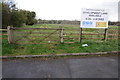
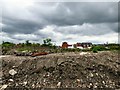
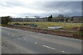
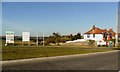
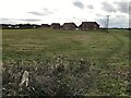
Pioneering development, north of South Kirkby
by Christine Johnstone geograph for square SE4411 First new building on the otherwise empty development land.
|
|
Derelict land off Denton Link Road.
by Gerald England geograph for square SJ9295
The land by the side of the Denton Link Road was part of the Oldham Batteries... (more)
|
|
Derelict land off Denton Link Road.
by Gerald England geograph for square SJ9295
The land by the side of the Denton Link Road was part of the Oldham Batteries... (more)
|
|
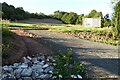
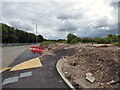
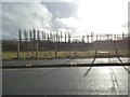
New road spur
by Philip Halling geograph for square SO8955 A new road spur off the A4636 built in preparation for the development of the... (more)
Tags:
top:Construction, DevelopmentX
Development Land
type:GeographX
subject:RoadX
RoadX
top:Roads, Road TransportX
|
|
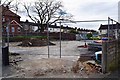
Development site on Wall Way
by Gerald England geograph for square SJ8995 A one acre site on land formerly occupied by railway coal yards is still for... (more)
|
|
Waiting for business
by Christine Johnstone geograph for square SE4412 Development land east of the new road, north of South Kirkby.
|
|
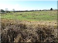
Building land at Bosbury
by Philip Halling geograph for square SO6943 This field is fenced off with Heras fencing in preparation for development.
Tags:
top:Construction, DevelopmentX
Development Land
top:Farm, Fishery, Market GardeningX
subject:FieldX
FieldX
type:GeographX
|
|
Building land at Bosbury
by Philip Halling geograph for square SO6943 This field is fenced off with Heras fencing in preparation for development.
Tags:
top:Construction, DevelopmentX
Development Land
top:Farm, Fishery, Market GardeningX
subject:FieldX
FieldX
type:GeographX
|
|
Land awaiting redevelopment
by Philip Halling geograph for square SO9233 Land beside the A46 awaiting redevelopment on the Ashchurch Industrial Estate.
|
|
Land awaiting redevelopment
by Philip Halling geograph for square SO9233 Land beside the A46 awaiting redevelopment on the Ashchurch Industrial Estate.
Tags:
top:Construction, DevelopmentX
Development Land
type:GeographX
top:IndustryX
subject:RedevelopmentX
|
|
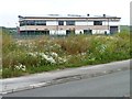
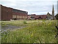
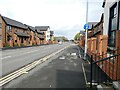
Land in Groves Street, Rodbourne, Swindon
by P L Chadwick geograph for square SU1384 This land, which was at one time part of the car park for the now closed Famous... (more)
|
|
Bilston Open Ground
by Gordon Griffiths geograph for square SO9496 The view of the development land for the Bilston Urban Village from Nettlefolds... (more)
|
|
Vacant land
by Gerald England geograph for square SD3228 A 0.61 acre piece of development land on the corner of South Promenade and... (more)
|
|
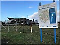
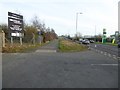
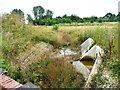
Development land drain, north of the new road
by Christine Johnstone geograph for square SE4411 Looking 'upstream'.
|
|
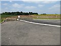
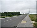
Footpath crossing on the new road
by Christine Johnstone geograph for square SE4412 Engneered to urban standards in the middle of empty development land. Looking... (more)
|
|
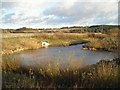
Environmental feature pond
by Antony Dixon geograph for square SK5258 This pond, situated between industrial development land and the A617 (Mansfield... (more)
|
|
Development land, west of Rye
by nick macneill geograph for square TQ9019 |
|
Land awaiting development, Tetbury
by Philip Halling geograph for square ST8994 These fields are on the edge of the town of Tetbury and are available for redevelopment.
|
|
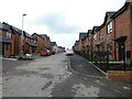
Development land and new housing in Wisbech St Mary
by Richard Humphrey geograph for square TF4108 Planning permission has recently been granted for houses to be built on this... (more)
Tags:
Development Land
subject:FieldX
type:GeographX
HousingX
top:Housing, DwellingsX
top:Village, Rural SettlementX
|
|
Siemens Mobility train manufacturing facility is coming to Goole
by Christine Johnstone geograph for square SE7223 Hoarding on development land, west of Tom Pudding Way.
|
|
Undeveloped land east of the bypass in March, Cambridgeshire
by Richard Humphrey geograph for square TL4096 Tags:
Development Land
Development SiteX
subject:FieldX
top:Flat LandscapesX
type:GeographX
top:Suburb, Urban FringeX
|
|
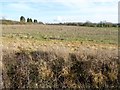
Farmland awaiting building #4
by Philip Halling geograph for square SO9333 Planning permission has been granted on this land beside the A46 near the hamlet... (more)
Tags:
top:Construction, DevelopmentX
Development Land
top:Farm, Fishery, Market GardeningX
FarmlandX
subject:FieldX
FieldX
type:GeographX
|
|
Farmland awaiting building #3
by Philip Halling geograph for square SO9333 Planning permission has been granted on this land beside the A46 near the hamlet... (more)
Tags:
top:Construction, DevelopmentX
Development Land
top:Farm, Fishery, Market GardeningX
FarmlandX
subject:FarmlandX
FieldX
type:GeographX
|
|
Farmland awaiting building #2
by Philip Halling geograph for square SO9333 Planning permission has been granted on this land beside the A46 near the hamlet... (more)
Tags:
top:Construction, DevelopmentX
Development Land
top:Farm, Fishery, Market GardeningX
subject:FarmlandX
FarmlandX
type:GeographX
|
|
Farmland awaiting building #1
by Philip Halling geograph for square SO9333 Planning permission has been granted on this land beside the A46 near the hamlet... (more)
Tags:
top:Construction, DevelopmentX
Development Land
top:Farm, Fishery, Market GardeningX
FarmlandX
subject:FarmlandX
FieldX
type:GeographX
|
|
Land waiting for development, Porthmadog
by Christine Johnstone geograph for square SH5639 A vacant plot in Parc Busnes Porthmadog Business Park, alongside the A497.
|
|
Black Country Gate
by Gordon Griffiths geograph for square SO9495 The view of the Gateway to development land alongside the Black Country Route... (more)
|
|
Black Country Scene
by Gordon Griffiths geograph for square SO9495 The view of development land alongside the Black Country Route (A463) in Bilston.
|
|
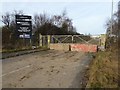
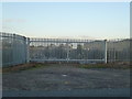
Gates to development land, Whittlesey
by Richard Humphrey geograph for square TL2795 This large site on Station Road is well fenced
|
|
Portwood Retail Park
by Gerald England geograph for square SJ8990 Derelict land adjacent to "Tesco Extra" (a part of which is just... (more)
|
|
Patterson Street (New)
by Gerald England geograph for square SJ9295
Patterson Street was a short street off Hyde Road SJ9295 : Patterson Street. At the end was... (more)
|

|
Development site, Lyonshall
by Philip Halling geograph for square SO3355 With heras fencing protecting this site this appears to be awaiting building and... (more)
|
|
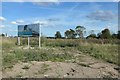
Nantwich Road, Middlewich
by Jonathan Hutchins geograph for square SJ6965 The sign states this is a development site with outline planning permission for... (more)
Tags:
A530X
Development Land
Development SiteX
Development Site NoticeX
type:GeographX
place:MiddlewichX
top:Roads, Road TransportX
subject:RoadsideX
|
|
Lance Corporal Andrew Breeze Way
by Gerald England geograph for square SJ9295
Formerly Edward Street but now part of the Denton Link Road. Edward... (more)
Tags:
place:DentonX
Development Land
type:GeographX
top:Housing, DwellingsX
former:Industrial SiteX
New Housing DevelopmentX
top:Roads, Road TransportX
Site of Oldham BatteriesX
WainhomesX
|
|
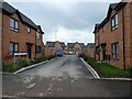
Dunlop Crescent
by Gerald England geograph for square SJ9295
On the Crown Point estate of new houses created by Wain Homes on the site of... (more)
|