Public Tags
Other tags: Railway
boundary stone:Railway
category:Railway
disused:Railway
embankment:Railway
former:Railway
near:Railway
subject:Railway
to:Railway
under:Railway
Showing latest 50 of 786 images tagged with dismantled:Railway tag.
|
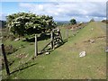
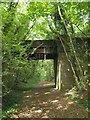
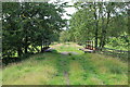
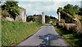
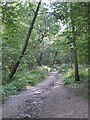
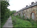
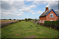
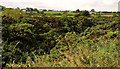
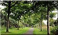
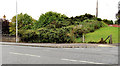
Bridleway leaving disused railway near Swelltor
by Derek Harper geograph for square SX5672 A way through the fence bordering the dismantled Princetown railway for... (more)
|
|
Line of Dismantled Railway - Bradford Road
by Betty Longbottom geograph for square SE2029 |
|
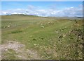
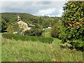
Former Selkirk - Galashiels railway route
by Jim Barton geograph for square NT4933 The track by the Tweed is on the route of the branch of the Waverley line opened... (more)
|
|
Former railway near Steer Point
by Derek Harper geograph for square SX5450 Brixton Footpath 30 follows the former line of the Yealmpton Branch railway; see... (more)
|
|
Bridge over former railway by Mudbank Lake
by Derek Harper geograph for square SX5450 A reverse view of SX5450 : Brixton: course of Yealmpton Branch. The bridge carries a path which runs beside the... (more)
|
|
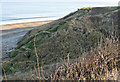
Former railway line, Foggintor
by Derek Harper geograph for square SX5673 This is roughly the site of King Tor Halt, named after the nearby King's... (more)
|
|
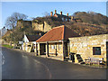
Public convenience, Sandsend
by Pauline E geograph for square NZ8612 The wall to the right is all that remains of the old alum works. Note the old,... (more)
Tags:
former:Alum WorksX
top:CoastalX
railway:DismantledX
Public ConvenienceX
top:Quarrying, MiningX
top:RailwaysX
top:Village, Rural SettlementX
|
|
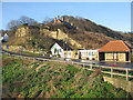
Dismantled railway, Lythe Bank
by Pauline E for square NZ8512 View from Sandsend Bridge, across the gridline towards what would have been the... (more)
|
|
Bridge remains
by Pauline E geograph for square NZ8712 A dismantled bridge which once carried the Whitby, Redcar and Middlesbrough... (more)
|
|
Golfers' footbridge
by Pauline E geograph for square NZ8811 Links two areas of the golf course and is roughly in the same position as a... (more)
|
|
Dismantled railway running through the golf course
by Pauline E geograph for square NZ8811 The long, raised humps are part of the remains of The Whitby, Redcar and... (more)
|
|
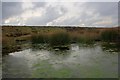
Pond, Farndale Moor
by Mick Garratt geograph for square NZ6500 In the background is the embankment of the former Rosedale Ironstone railway.
Tags:
top:Derelict, DisusedX
DismantledX
EmbankmentX
top:Heath, ScrubX
top:Lakes, Wetland, BogX
MoorX
PondX
RailwayX
top:RailwaysX
|
|
Dismantled railway
by Pauline E geograph for square SE5876 A choice of routes from this point: to Ampleforth, Yearsley & Gilling East... (more)
|
|
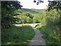
Approaching the dismantled railway line
by Pauline E geograph for square SE5876 Cattle like to gather in the corner of the field ahead churning up the footpath... (more)
|
|
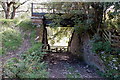
Bridge under the old Peebles railway, Altarstone
by Jim Barton geograph for square NT1535 An underpass for farm access through the railway embankment. The railway closed... (more)
|
|
Once a railway line ran here
by Jim Barton geograph for square NT1535 The line between Peebles and Broughton closed in 1954, and nearly 60 years of... (more)
Tags:
railway:DismantledX
top:RailwaysX
|
|
Ex-railway bridge over the Weston Burn, Stobo
by Jim Barton geograph for square NT1736 On the old Peebles to Symington line, still passable for walkers on this stretch... (more)
|
|
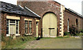
Former Richhill railway station, (3 of 3)
by Albert Bridge geograph for square H9249 See H9249 : Former Richhill railway station (2 of 3). The former goods shed before the restoration seen, in 2007,... (more)
|
|
Former Richhill railway station (2 of 3)
by Albert Bridge geograph for square H9249 See H9249 : Former Richhill railway station (1 of 3). The former station masters house, seen in H9249 : Old Richhill Station Master's House, refurbished and now a modern dwelling. in 2007,... (more)
|
|
Former Richhill railway station (1 of 3)
by Albert Bridge geograph for square H9249 Richhill was an intermediate station, between Portadown and Armagh, on the line... (more)
|
|
Former Ballyards viaduct, Milford near Armagh
by Albert Bridge geograph for square H8542 Ballyards viaduct carried the Armagh, Keady and Castleblaney line across what is... (more)
Tags:
railway:DismantledX
Great Northern Railway (Ireland)X
Milford (Co Armagh)X
former:Railway ViaductX
top:RailwaysX
|
|
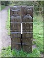
Reverse view of the carved seat on the old tramway
by Pauline E for square NZ8102 For the front view, see NZ8102 : Carved seat by the old horse drawn tramway
Tags:
Carved SeatX
railway:DismantledX
top:PathsX
top:RailwaysX
former:TramwayX
Whitby & Pickering RailwayX
|
|
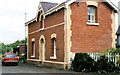
Incline Cottage
by Pauline E geograph for square NZ8202 Situated on the Rail Trail at the bottom of the incline, once part of the Whitby... (more)
|
|
Approaching the bottom of the incline
by Pauline E geograph for square NZ8201 This Rail Trail follows the trackbed of the dismantle Whitby & Pickering... (more)
|
|
View up the incline
by Pauline E geograph for square NZ8201 Dismantled track - once part of the Whitby & Pickering Railway. Built by... (more)
|
|
Rail Trail from Goathland to Grosmont
by Pauline E geograph for square NZ8301 Descending the incline from the Beck Hole Road. Built by George Stephenson as a... (more)
|
|
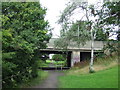
Bridge at New Herrington, near Sunderland
by Malc McDonald geograph for square NZ3352 This bridge was built to carry a road over a railway. The railway served a... (more)
Tags:
railway:DismantledX
Dismantled Railway LineX
place:New HerringtonX
Old Railway Line PathX
top:PathsX
former:Railway
Railway (Dismantled)X
Railway (Former)X
former:Railway LineX
Road Bridge Over Dismantled RailwayX
near:SunderlandX
|
|
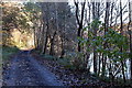
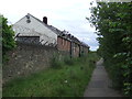
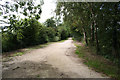
Railway path near Washington
by Malc McDonald geograph for square NZ3352 The path follows the route of a colliery railway. The railway closed long ago,... (more)
Tags:
railway:DismantledX
Dismantled Railway LineX
Old Railway Line PathX
top:PathsX
place:PhiladelphiaX
former:Railway
Railway (Dismantled)X
Railway (Former)X
former:Railway LineX
near:WashingtonX
|
|
Railway path near Washington
by Malc McDonald geograph for square NZ3352 This path follows the route of a colliery railway. Compare this image with... (more)
Tags:
railway:DismantledX
Dismantled Railway LineX
Old Railway Line PathX
top:PathsX
place:PhiladelphiaX
former:Railway
Railway (Dismantled)X
Railway (Former)X
former:Railway LineX
near:WashingtonX
|
|
Railway path, Philadelphia near Washington
by Malc McDonald geograph for square NZ3352 This path follows the route of a railway. The railway had served a nearby colliery.
Tags:
railway:DismantledX
Dismantled Railway LineX
Old Railway Line PathX
top:PathsX
place:PhiladelphiaX
former:Railway
Railway (Dismantled)X
Railway (Former)X
former:Railway LineX
near:WashingtonX
|
|
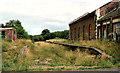
Site of colliery railway, Houghton-le-Spring
by Malc McDonald geograph for square NZ3350 This grassy bank once carried a railway which served Houghton Quarry.
Tags:
top:Derelict, DisusedX
railway:DismantledX
Dismantled Railway LineX
place:Houghton-Le-SpringX
Railway (Dismantled)X
place:WearsideX
|
|
Footpath to Rainton Meadows
by Malc McDonald geograph for square NZ3248 A footpath to Rainton Meadows Visitor Centre. At this point, the path follows... (more)
Tags:
railway:DismantledX
Dismantled Railway LineX
near:Houghton-Le-SpringX
top:PathsX
sign:Public FootpathX
Public FootpathX
former:Railway
Railway (Dismantled)X
former:Railway LineX
place:WearsideX
|
|
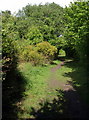
Old railway course
by Richard Croft geograph for square TF5280 View NNE from the site of Crabtree Lane crossing along the course of the... (more)
Tags:
top:Derelict, DisusedX
railway:DismantledX
top:Historic Sites and ArtefactsX
former:Railway
top:RailwaysX
top:Village, Rural SettlementX
|
|
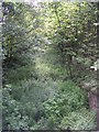
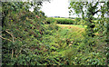
Old railway near Comber (2)
by Albert Bridge geograph for square J4466 An overgrown cutting, between Comber and Ballygowan, seen from the overbridge on... (more)
|
|
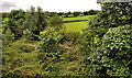
Old railway near Comber (1)
by Albert Bridge geograph for square J4566 An overgrown cutting, between Comber and Ballygowan, seen from an overbridge... (more)
|
|
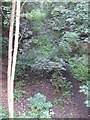
Along the cutting of the dismantled railway
by Pauline E geograph for square SE7971 But which one? Malton to Driffield? Or the Pickering Branch of the York and... (more)
Tags:
railway:DismantledX
top:RailwaysX
|
|
Old railway, Donaghadee (5)
by Albert Bridge geograph for square J5878 See J5878 : Old railway, Donaghadee (4). The old cutting - further west.
|
|
Old railway, Donaghadee (4)
by Albert Bridge geograph for square J5878 See J5878 : Railway path, Donaghadee (5). The shallow cutting (background in the previous photograph) as... (more)
|
|
Railway path, Donaghadee (5)
by Albert Bridge geograph for square J5878 See J5878 : Railway path, Donaghadee (4). The path, looking away from Donaghadee, to the west of the... (more)
Tags:
railway:DismantledX
DonaghadeeX
Old Railway Line PathX
PathX
top:PathsX
top:RailwaysX
top:Suburb, Urban FringeX
|
|
Railway path, Donaghadee (4)
by Albert Bridge geograph for square J5878 See J5978 : Railway path, Donaghadee (3). The view, along the path, towards Donaghadee, to the south... (more)
Tags:
railway:DismantledX
DonaghadeeX
Old Railway Line PathX
PathX
top:PathsX
top:RailwaysX
top:Suburb, Urban FringeX
|
|
Railway path, Donaghadee (3)
by Albert Bridge geograph for square J5978 See J5979 : Railway path, Donaghadee (2). The view, along the path, towards Donaghadee, to the south... (more)
Tags:
railway:DismantledX
DonaghadeeX
Old Railway Line PathX
PathX
top:PathsX
top:RailwaysX
top:Suburb, Urban FringeX
|

|
Railway path, Donaghadee (2)
by Albert Bridge geograph for square J5979 See J5979 : Railway path, Donaghadee (1). The view in the other direction (towards Newtownards) from... (more)
Tags:
top:City, Town CentreX
railway:DismantledX
DonaghadeeX
Old Railway Line PathX
PathX
top:PathsX
top:RailwaysX
|
|
Railway path, Donaghadee (1)
by Albert Bridge geograph for square J5979 Part of the trackbed of the old Belfast and County Down railway, to the south... (more)
Tags:
top:City, Town CentreX
railway:DismantledX
DonaghadeeX
Old Railway Line PathX
PathX
top:PathsX
top:RailwaysX
|
|
Once the railway line to Woodhall Spa
by roger geach geograph for square TF2365 Looking towards Woodhall Spa on the former trackbed of the railway line from... (more)
|
|
Old railway, Newtownards (2)
by Albert Bridge geograph for square J4974 See J4974 : Old railway, Newtownards (1). The course of the line on the other (eastern) side of the... (more)
|
|
Old railway, Newtownards (1)
by Albert Bridge geograph for square J4974 61 years after the Belfast and County Down lines from Belfast to Donaghadee (via... (more)
|
|
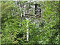
Old signal
by Ian Calderwood for square SK3828 This signal once controlled access to the main line at Chellaston East Junction... (more)
Tags:
top:Derelict, DisusedX
railway:DismantledX
top:PathsX
Railway Signal (Disused)X
top:RailwaysX
top:Woodland, ForestX
|

|
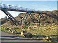
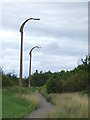
Cyclists on the Monsal Trail
by Mick Garratt geograph for square SK1871 Just coming out of the newly opened Headstone Tunnel.
Tags:
CyclistsX
railway:DismantledX
Dismantled Railway LineX
Monsal TrailX
National TrailX
top:PathsX
Public BridlewayX
Railway (Dismantled)X
Railway Bridge (Dismantled)X
top:RailwaysX
top:Sport, LeisureX
season:SummerX
TunnelX
top:UplandsX
White PeakX
|
|
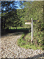
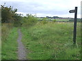
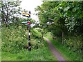
Signpost and footpath
by Rose and Trev Clough geograph for square NU2131 The path follows the line of the dismantled North Sunderland Railway, which... (more)
|
|
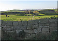
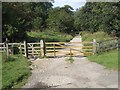
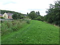
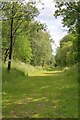
Route of Dismantled Railway
by Mick Garratt geograph for square SD7071 Near Moorgarth Farm.
Strictly private, according to the sign.
Tags:
top:Derelict, DisusedX
railway:DismantledX
top:Farm, Fishery, Market GardeningX
Railway (Dismantled)X
top:RailwaysX
Yorkshire DalesX
|