Public Tags
Tag: Disused·Lime·Kilns
Showing latest 50 of 84 images tagged with Disused Lime Kilns tag.

|
Lime kiln near Portaferry
by Rossographer geograph for square J5752 Long disused limekiln in a field a few miles north of Portaferry.
Tags:
Derelict Lime Kiln
Disused Lime Kiln
Disused Limekiln
top:Farm, Fishery, Market Gardening
type:Geograph
top:Historic Sites and Artefacts
subject:Kiln
Lime Kiln
former:Lime Kiln
Old Lime Kiln
|

|
Peter Lane Kiln
by Adrian Taylor geograph for square SD5073 A substantially built, disused lime kiln near Hyning Scout Wood.
Tags:
top:Derelict, Disused
Disused Lime Kiln
type:Geograph
top:Historic Sites and Artefacts
Lancashire
former:Lime Kiln
Lime Kiln
|

|
Paignton Zoo - disused lime kiln
by Chris Allen geograph for square SX8759 The Zoo is in part within old quarries and there are two disused lime kilns with... (more)
Tags:
top:Derelict, Disused
Disused Lime Kiln
top:Educational Sites
top:Historic Sites and Artefacts
former:Lime Kiln
place:Paignton
Zoo
|

|
Old lime kilns, Fulwell, Sunderland
by Malc McDonald geograph for square NZ3959 These lime kilns are a relic of quarries which used to occupy this site. The... (more)
Tags:
Disused Lime Kilns
place:Fulwell
listed building status:Grade II
Grade II Listed
Grade II Listed Structure
top:Historic Sites and Artefacts
subject:Kiln
former:Lime Kiln
Lime Kiln
Lime Kilns
near:Sunderland
county:Tyne & Wear
place:Wearside
|

|
Paignton Zoo - disused lime kiln
by Chris Allen geograph for square SX8759 One of two lime kilns in the lemur wood walk. There are disused quarries in the... (more)
Tags:
Disused Lime Kiln
top:Educational Sites
top:Historic Sites and Artefacts
former:Lime Kiln
place:Paignton
Zoo
|

|
View south to lime kiln and car park on Ballintoy Harbour
by Rod Grealish geograph for square D0345 Ballintoy Harbour is a small fishing harbour one kilometre north of the village... (more)
Tags:
built:1860-79
B1 Listed (Lime Kilns)
place:Ballintoy
townland:Ballintoy Demesne
subject:Ballintoy Harbour
postcode district:BT54
district:Causeway Coast and Glens
top:Coastal
county:County Antrim
Disused Lime Kilns
top:Docks, Harbours
type:Geograph
subject:Harbour
top:Historic Sites and Artefacts
top:Industry
Scheduled (Harbour Complex)
top:Village, Rural Settlement
|

|
Ruined lime kiln near the Wolfhouse Gallery
by Karl and Ali geograph for square SD4674 Almost completely destroyed and sprouting several trees. Some kilns around the... (more)
Tags:
Collapsed Lime Kiln
top:Derelict, Disused
Disused Lime Kiln
top:Grassland
ruin:Lime Kiln
top:Lowlands
top:Quarrying, Mining
|

|
Disused lime kiln at Black Dub
by Karl and Ali geograph for square SD7386 I have travelled along the Dee river bed several times but never noticed this... (more)
Tags:
top:Derelict, Disused
Disused Lime Kiln
top:Industry
ruin:Lime Kiln
Limekiln
plant:Ramsons
top:Uplands
top:Wild Animals, Plants and Mushrooms
plant:Wild Garlic
|

|
Lime kiln at Murgatroyd's Lime Works
by Ian Taylor for square SD8266 The central kiln of the large triple draw kiln, built in 1872.
See SD8266 : Entrance to the northern triple draw kiln, Langcliffe... (more)
|

|
Disused lime kiln, Warton Crag
by Karl and Ali for square SD4873 The kiln seems to have been built into the side of a natural limestone scar but... (more)
Tags:
top:Derelict, Disused
Disused Lime Kiln
top:Industry
ruin:Lime Kiln
top:Rocks, Scree, Cliffs
top:Uplands
top:Woodland, Forest
|

|
Free-ranging sheep and lime kilns
by Pauline E geograph for square NU1341 A small flock cropping the grass around the castle. To the right are the disused... (more)
Tags:
top:Coastal
Disused Lime Kilns
Flock of Sheep
place:Holy Island
top:Islands
top:Quarrying, Mining
|

|
Ruined lime kiln below Ibbeth Peril
by Karl and Ali geograph for square SD7486 I have travelled along the Dee river bed several times but never noticed this... (more)
Tags:
top:Derelict, Disused
Disused Lime Kiln
top:Industry
ruin:Lime Kiln
Limekiln
plant:Ramsons
top:Uplands
top:Wild Animals, Plants and Mushrooms
plant:Wild Garlic
|

|
Disused lime kiln above Stockdale
by Karl and Ali geograph for square NY4905 Although not obvious (to a non-geologist!) there is limestone in the vicinity;... (more)
Tags:
top:Derelict, Disused
Disused Lime Kiln
former:Lime Kiln
top:Paths
Public Footpath
top:Quarrying, Mining
Rural Industry
top:Uplands
|

|
Old lime kilns at Marsden
by Robert Graham geograph for square NZ4064 These were constructed in the 1870's and used to produce lime, using... (more)
Tags:
Coast Road
top:Derelict, Disused
Disused Lime Kilns
type:Geograph
top:Industry
subject:Kiln
top:Roads, Road Transport
|

|
Lime kiln near Walwick
by Karl and Ali geograph for square NY9070 The straight-sided openings seem to be a characteristic feature of local kilns,... (more)
Tags:
Derelict Lime Kiln
top:Derelict, Disused
Disused Lime Kiln
type:Geograph
top:Grassland
top:Lowlands
top:Quarrying, Mining
|

|
Hoffmann lime kiln at Craven Lime Works
by Ian Taylor for square SD8266 An internal view of the large oval kiln shown in SD8266 : The Hoffmann Kiln & SD8266 : The Hoffman Kiln.
|

|
Disused lime kiln, Curwen Woods
by Karl and Ali geograph for square SD5378 An unusually wide, shallow-arched opening. A zoom shot from the public footpath.
Tags:
top:Derelict, Disused
Disused Lime Kiln
Disused Limekiln
top:Grassland
top:Industry
ruin:Lime Kiln
top:Woodland, Forest
|

|
Disused lime kiln, Clawthorpe
by Karl and Ali geograph for square SD5377 Beside the public footpath just south of Oakwood Farm. Despite being overgrown... (more)
Tags:
top:Derelict, Disused
Disused Lime Kiln
Disused Limekiln
top:Industry
ruin:Lime Kiln
top:Lowlands
top:Paths
Public Footpath
|

|
Disused lime kiln, alongside the Coal Road
by Christine Johnstone geograph for square SD7890 Now just an overgrown low arch at the side of the road.
|

|
Benches in disused lime kilns, Lynmouth
by Jaggery for square SS7249 Located on the Esplanade, the kilns probably date from the late 18th century.... (more)
Tags:
top:Derelict, Disused
Disused Lime Kilns
|

|
Lime kiln on western side of Beacon Hill
by Trevor Littlewood geograph for square NY6209 A disused lime kiln with a limestone outcrop beside it. The source of stone for... (more)
Tags:
Disused Lime Kiln
type:Geograph
top:Industry
Limestone Outcrop
top:Quarrying, Mining
top:Rocks, Scree, Cliffs
top:Uplands
|

|
Lime kiln display board, Warton Crag
by Karl and Ali geograph for square SD4972 There are several disused kilns around Warton Crag. This one has been made safe... (more)
Tags:
top:Derelict, Disused
Display Board
Disused Lime Kiln
top:Industry
Information Board
top:Lowlands
top:Village, Rural Settlement
|

|
Hill slope with lime kiln
by Trevor Littlewood geograph for square NY8838 The stonework appears to be a wall of a small building but it's the... (more)
Tags:
top:Derelict, Disused
Disused Lime Kiln
type:Geograph
Hill Slope
top:Historic Sites and Artefacts
top:Industry
top:Uplands
|

|
Lime kiln by Froghall basin in Staffordshire
by Roger D Kidd geograph for square SK0247 There is a row of six disused lime kilns here east of the restored Froghall... (more)
|

|
Lime kilns by Froghall basin in Staffordshire
by Roger D Kidd for square SK0247 There is a row of six disused lime kilns here east of the restored Froghall... (more)
|

|
The Hoffman kiln, Llanymynech
by Humphrey Bolton geograph for square SJ2621 This type of kiln was developed in Germany for firing bricks, and was adapted... (more)
Tags:
top:Derelict, Disused
Disused Lime Kiln
type:Geograph
Heritage Area
top:Historic Sites and Artefacts
Hoffmann Kiln
top:Industry
top:Lowlands
top:Woodland, Forest
|

|
Townhead Lime Kiln
by Trevor Littlewood geograph for square NY6434 Townhead Lime Kiln, seen across Ardale Beck. It's in excellent condition... (more)
Tags:
top:Derelict, Disused
Disused Lime Kiln
type:Geograph
Hill Roads
Hill Slopes
top:Industry
top:Roads, Road Transport
top:Uplands
|

|
Derelict lime kilns
by John Baker geograph for square ST5347 A little way off Lime Kiln Lane. Also featured in Sharon Loxton’s ST5347 : Lime kilns in Lime Kiln Lane and... (more)
|

|
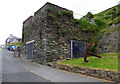
Lime kiln, Amlwch Port
by Ian Taylor geograph for square SH4593 The lime was needed for smelting, and was used for ships' ballast.
The... (more)
|
|
Lime kiln, Amlwch Port
by Ian Taylor geograph for square SH4593 The lime was needed for smelting, and was used for ships' ballast.
|

|
Ruined lime kiln near High Barugh
by Karl and Ali geograph for square NY6406 Next to some small limestone quarries.
Tags:
top:Derelict, Disused
Disused Lime Kiln
top:Grassland
ruin:Lime Kiln
Pastureland
top:Quarrying, Mining
top:Uplands
|

|
Twyford Pumping Station - lime kilns and industrial railway
by Chris Allen geograph for square SU4924 Until WWII Twyford burnt its own lime for use in water softening and this rare... (more)
|

|
Ruined lime kiln near Rawridding
by Karl and Ali geograph for square SD6888 Limestone is evident outcropping nearby and was probably quarried to feed this... (more)
Tags:
top:Derelict, Disused
Disused Lime Kiln
top:Industry
ruin:Lime Kiln
top:Quarrying, Mining
top:Uplands
|

|
The site of Cairnshalloch lime kilns
by Mary and Angus Hogg geograph for square NS4010 The old kilns were constructed along the edge of this slope with two on the... (more)
Tags:
top:Derelict, Disused
Disused Lime Kilns
type:Geograph
top:Moorland
top:Quarrying, Mining
top:Uplands
|

|
Entrance to one of the vertical haft draw kilns, Llanymynech
by Humphrey Bolton geograph for square SJ2621 There are two of these, built in the 1870s. They are large examples of the... (more)
Tags:
top:Derelict, Disused
Disused Lime Kiln
type:Geograph
Heritage Area
top:Historic Sites and Artefacts
top:Industry
top:Lowlands
|

|
Lime kiln, Cotter End
by Ian Taylor geograph for square SD8293 Looking SE down Wensleydale from above the kiln. Cotterdale is on the left.
Tags:
top:Derelict, Disused
Disused Lime Kiln
type:Geograph
top:Industry
subject:Kiln
top:Uplands
View
|

|
Old Lime Kiln in the Stinchar Valley
by Mary and Angus Hogg geograph for square NX2291 Lime kilns were important facilities in the 18th century when significant... (more)
Tags:
Disused Lime Kiln
top:Farm, Fishery, Market Gardening
top:Historic Sites and Artefacts
top:Rivers, Streams, Drainage
top:Uplands
top:Woodland, Forest
|

|
Former lime kilns, Goytre Wharf
by Jaggery geograph for square SO3106 Statues Link depicting workers are in the... (more)
|

|
Lime kiln, Cotter End
by Ian Taylor geograph for square SD8293 |

|
Former lime kilns at Consall Forge in Staffordshire
by Roger D Kidd geograph for square SJ9949 Old lime kilns are seen from the Caldon Canal/River Churnet at Consall Forge.... (more)
|

|
Former lime kilns at Consall Forge in Staffordshire
by Roger D Kidd geograph for square SJ9949 Old lime kilns are seen here from the Caldon Canal/River Churnet at Consall... (more)
|

|
Lime kiln, High Dyke
by Ian Taylor geograph for square SD8094 Swarth Fell (left) and Wild Boar Fell are in the background.
Tags:
top:Derelict, Disused
Disused Lime Kiln
Fellside
type:Geograph
top:Industry
subject:Kiln
top:Uplands
|

|
Disused Lime Kiln
by Russel Wills geograph for square SD7286 At Peggleswright above the River Dee.
Tags:
Disused Lime Kiln
top:Farm, Fishery, Market Gardening
type:Geograph
top:Grassland
subject:Kiln
top:Uplands
|

|
Lime kiln above Row
by Karl and Ali geograph for square SD4489 This impressively large kiln above the footpath is remarkably well-preserved and... (more)
Tags:
top:Derelict, Disused
Disused Lime Kiln
type:Geograph
Grade II Listed Structure
top:Grassland
top:Industry
top:Lowlands
|

|
Calcining Kilns associated with the Iron Mining Industry, Rosedale Chimney Bank, North Yorkshire Moors, Yorkshire
by Christine Matthews geograph for square SE7294 Rosedale Chimney is a mountain pass at an elevation of 312 m above the sea... (more)
|

|
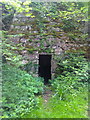
Lime kilns near Lindisfarne Castle
by Jim Barton geograph for square NU1341 19th century lime kilns,restored by the National Trust.
|
|
Lime kiln, Hampsfell Road
by Humphrey Bolton for square SD4078 This is a Grade II listed structure, 'probably early 19C' according to... (more)
Tags:
top:Derelict, Disused
Disused Lime Kiln
top:Industry
subject:Kiln
Listed Building Grade II
top:Lowlands
top:Woodland, Forest
|

|
Rocks on beach at low tide
by Trevor Littlewood geograph for square NU2328 Loose boulders and low rock exposures on the broad beach at the northern end of... (more)
Tags:
Boulders
top:Coastal
top:Derelict, Disused
Disused Lime Kilns
top:Docks, Harbours
type:Geograph
Harbour
top:Industry
Low Rock Exposures
top:Rocks, Scree, Cliffs
Sandy Beach
|
|
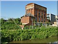
Former Firepool Pumping Station and lime kilns
by Stephen Craven geograph for square ST2325 This complex of industrial buildings, disused since the 1960s, is listed grade... (more)
|

|
Disused lime kiln
by Russel Wills geograph for square SD9286 Near High Blean House.
Tags:
top:Derelict, Disused
Disused Lime Kiln
type:Geograph
top:Grassland
top:Rocks, Scree, Cliffs
top:Uplands
|
