Public Tags
Tag: Disused·Station
Showing latest 50 of 52 images tagged with Disused Station tag.

|
Blake Hall station, near Ongar
by Malc McDonald geograph for square TL5203 Blake Hall station was opened in 1865, on the railway line linking Epping with... (more)
Tags:
near:Chipping Ongar
Converted Former Railway Station
Converted Railway Station
housing:Converted Railway Station
Disused Railway Station
Disused Station
county:Essex
Former Railway Station Buildings
Former Railway Station House
type:Geograph
place:Greensted Green
Heritage Railway
near:Ongar
subject:Railway Station
Railway Station (Disused)
Railway Station Building (Converted)
Railway Station Platform (Disused)
top:Railways
|

|
Disused station platform, Hannington Station (Highworth Branch Line), near Swanborough
by Vieve Forward geograph for square SU1891 Remains of the station platform of the disused Hannington Station can still be... (more)
|

|
Railway tracks near Eynsford
by Malc McDonald geograph for square TQ5365 Railway tracks heading north near Eynsford, towards Swanley. The railway is... (more)
|

|
Way Out sign
by Adrian Taylor for square TQ3082 With slightly faded lettering, this sign in King’s Cross Thameslink Station... (more)
Tags:
top:City, Town Centre
type:Close Look
top:Derelict, Disused
Direction Sign
Disused Railway Station
Disused Station
type:Inside
Kings Cross
Kings Cross Thameslink
subject:Railway Station
disused:Railway Station
top:Railways
Sign
Station Way Out Sign
White Tiles
|
|
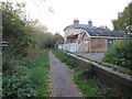
Takeley railway station
by Malc McDonald geograph for square TL5621 The former railway station at Takeley, in north Essex. The station closed to... (more)
Tags:
near:Bishops Stortford
Course of Dismantled Railway
Cycling and Walking Trail
top:Derelict, Disused
Dismantled Railway Line
Disused Railway Station
Disused Station
county:Essex
path:Flitch Way
Flitch Way
Former Railway Station Buildings
Former Railway Station Site
type:Geograph
National Cycle Network
NCN
NCN16
Path on Dismantled Railway
top:Paths
subject:Railway Station
top:Railways
Shared Use Path
place:Takeley
|

|
Loch Skerrow Station
by Adrian Taylor geograph for square NX6068 The remains of Loch Skerrow Station on the former Portpatrick and Wigtownshire... (more)
Tags:
top:Derelict, Disused
Disused Railway
Disused Railway Platform
Disused Station
Dumfries and Galloway
type:Geograph
top:Historic Sites and Artefacts
Platform
Portpatrick & Wigtownshire Joint Railway
Railway
subject:Railway Station
Railway Station Platform
top:Railways
Station
former:Station
Station Platform
top:Uplands
|

|
Airie Hill from Loch Skerrow Station
by Adrian Taylor for square NX6268 The bleak granite Airie Hill (291m) seen from Loch Skerrow Station on the former... (more)
Tags:
type:Cross Grid
top:Derelict, Disused
Disused Railway
Disused Railway Platform
Disused Station
Dumfries and Galloway
Fence Post
Granite
subject:Hill
Platform
Portpatrick & Wigtownshire Joint Railway
Railway
Railway Station Platform
top:Railways
former:Station
Station
Station Platform
top:Uplands
|

|
Site of Manchester Exchange Station
by David Dixon geograph for square SJ8398 The area in front, immediately to the west of Victoria Station was the site of... (more)
|

|
West of Victoria
by David Dixon geograph for square SJ8398 Looking to the west from the footbridge at the western end of Manchester... (more)
|

|
Abandoned Escalator
by Adrian Taylor for square TQ3082 In the concourse of the disused King’s Cross Thameslink Station, this ascending... (more)
|

|
Mayfield Station
by David Dixon geograph for square SJ8497 |

|
Abandoned Escalator
by Adrian Taylor for square TQ3082 In the disused King’s Cross Thameslink Station, this ascending escalator took... (more)
Tags:
top:City, Town Centre
top:Derelict, Disused
Disused Escalator
Disused Station
subject:Escalator
type:Inside
Kings Cross Thameslink
London
Pentonville Road
Railway Station
top:Railways
Rubbish
|

|
Stairs to the platforms
by Adrian Taylor for square TQ3082 These stairs lead down from the street level concourse and ticket barriers to... (more)
Tags:
Advertising
Advertising Sign
top:City, Town Centre
top:Derelict, Disused
Disused Station
type:Inside
Kings Cross
Kings Cross Thameslink
Railway Station
top:Railways
subject:Stairs
White Tiles
|
|
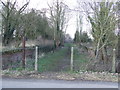
Disused Station
by Keith Evans geograph for square TL7537 All that now remaining of the former railway station at Great Yeldham, Essex;... (more)
|

|
The former Horam station on the Cuckoo Trail
by Marathon geograph for square TQ5717 The Cuckoo Trail which is an 18 mile long cycling and walking route between... (more)
|

|
The former Horam station on the Cuckoo Trail
by Marathon geograph for square TQ5717 The Cuckoo Trail which is an 18 mile long cycling and walking route between... (more)
|

|
The former Horam station on the Cuckoo Trail
by Marathon geograph for square TQ5717 The Cuckoo Trail which is an 18 mile long cycling and walking route between... (more)
|

|
The former Bishopstone Beach Halt
by Marathon geograph for square TQ4600 The line to Seaford from Newhaven was opened on 1st June 1864. Bishopstone Beach... (more)
Tags:
top:Derelict, Disused
Disused Station
type:Geograph
top:Historic Sites and Artefacts
top:Railways
|

|
Gunnislake old railway station
by John Winder geograph for square SX4271 This is the original railway station at Gunnislake, which at the time this... (more)
|

|
The former Crouch End station on the Parkland Walk
by Marathon geograph for square TQ3087 The Parkland Walk is the former track of the branch railway line which ran from... (more)
Tags:
top:Derelict, Disused
Disused Station
type:Geograph
top:Historic Sites and Artefacts
top:Park and Public Gardens
Parkland Walk
top:Paths
top:Railways
|
|
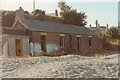
Llanerchymedd station building
by John Winder geograph for square SH4184 Here's another view of the derelict station building at Llanerchymedd,... (more)
|

|
Okehampton Station footbridge 1995
by John Winder geograph for square SX5994 What with the old LSWR line through Okehampton being in the news recently as a... (more)
|
|
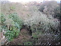
Dunure Station (disused)
by Les Hull geograph for square NS2616 The Maidens and Dunure Light Railway was a light railway worked by the Glasgow... (more)
Tags:
Disused Station
top:Railways
|

|
Fraserburgh Railway Station
by Richard Sutcliffe geograph for square NJ9966 The station at the terminus of the former Formartine and Buchan Railway closed... (more)
Tags:
Disused Engine Shed
Disused Station
type:Geograph
top:Historic Sites and Artefacts
subject:Railway Station
top:Railways
top:Religious Sites
|

|
Disused railway station at Endon in Staffordshire
by Roger D Kidd geograph for square SJ9253 Looking towards Stoke-on-Trent from the level crossing on Station Road.
|

|
Disused railway station at Endon in Staffordshire
by Roger D Kidd geograph for square SJ9253 Looking towards Stoke-on-Trent from the level crossing on Station Road.
|

|
The old Twenty station
by Marathon geograph for square TF1520 The Midland & Great Northern Joint Railway began as a series of locally... (more)
Tags:
top:Business, Retail, Services
top:Derelict, Disused
Disused Station
Double Glazing Company
top:Flat Landscapes
top:Railways
|

|
The former Twenty station
by Marathon geograph for square TF1520 The Midland & Great Northern Joint Railway began as a series of locally... (more)
Tags:
top:Business, Retail, Services
top:Derelict, Disused
Disused Station
Double Glazing Company
top:Flat Landscapes
top:Railways
|

|
Redbrook viaduct
by John Winder geograph for square SO5309 This is the Redbrook railway viaduct, on the now dismantled Wye Valley line... (more)
|

|
Okehampton station 1995
by John Winder geograph for square SX5994 Another shot of Okehampton railway station, taken before its restoration in... (more)
|

|
Smallford Station Building
by Des Blenkinsopp geograph for square TL1907 The old Smallford Station which closed to passengers in 1951 has recently been... (more)
|

|
Tide Mills Halt Station sign 'I Love You'
by PAUL FARMER geograph for square TQ4600 |

|
King’s Cross Thameslink Station
by Adrian Taylor for square TQ3082 The stairs leading from platform level up to street level at the closed... (more)
Tags:
top:City, Town Centre
top:Derelict, Disused
Disused Station
Handrails
type:Inside
Kings Cross
Kings Cross Thameslink
Mosaic
Railway Station
top:Railways
subject:Stairs
White Tiles
|

|
The site of High Halstow Halt
by Marathon geograph for square TQ7775 Situated on Wybournes Lane, a quiet no through road leading only to Wybournes... (more)
|

|
Disused railway station at Endon in Staffordshire
by Roger D Kidd geograph for square SJ9253 |
|
Llanerchymedd railway station
by John Winder geograph for square SH4184 Taken while on holiday in the early 1990s. At the time, the railway had not long... (more)
|

|
Disused railway station at Endon, Staffordshire
by Roger D Kidd geograph for square SJ9253 The former North Staffordshire Railway route from Stoke to Caldon Low quarry... (more)
|

|
Millennium Milepost, Horam Station
by Des Blenkinsopp geograph for square TQ5717 Millennium Mileposts can be found along the routes making up the Sustrans... (more)
Tags:
Cycleway and Footpath
top:Derelict, Disused
Disused Station
type:Geograph
top:Paths
Sustrans Millennium Milepost
|

|
Disused railway station at Endon in Staffordshire
by Roger D Kidd geograph for square SJ9253 Tags:
top:Canals
Disused Railway
Disused Station
type:Geograph
top:Railways
top:Village, Rural Settlement
|

|
Old cable works, Lower Lydbrook
by John Winder geograph for square SO5817 Taken from the site of Lydbrook Junction station, which was at the junction of... (more)
|

|
Okehampton Station goods shed
by John Winder geograph for square SX5994 Here's Okehampton goods shed in 1995. This has been refurbished and is now... (more)
|

|
Cycleway on the Platform, Horam Station
by Des Blenkinsopp geograph for square TQ5717 So many old railway routes have been wasted. It's nice to find one that... (more)
|

|
Restored Signal Box at the Disused Hartington Station
by Chris Heaton geograph for square SK1461 Staging post on the Tissington Trail
|

|
Lintz Green Station
by Robert Graham geograph for square NZ1556 A former station on the old Derwent Valley Railway, now the Derwent Walk... (more)
Tags:
Disused Station
Former Railway Station Site
Former Railway Walk
type:Geograph
top:Lowlands
top:Paths
subject:Railway Station
top:Railways
Stone Bridge
|

|
Old station yard, Hougham
by Simon Mortimer geograph for square SK9044 Site of Hougham station, opened by the Great Northern Railway in August 1855 and... (more)
|

|
Disused railway at Endon in Staffordshire
by Roger D Kidd geograph for square SJ9253 |

|
Inside Okehampton goods shed
by John Winder for square SX5994 This may be of interest to anyone who's stayed in Okehampton youth hostel... (more)
|

|
Crouch End Station, Parkland Walk
by Mark Percy geograph for square TQ2987 This section of the old GNR Finsbury Park - Edgware route was planned to be... (more)
Tags:
Disused Station
type:Geograph
top:Paths
subject:Railway Station
top:Railways
top:Suburb, Urban Fringe
|

|
Crouch End Station, Parkland Walk
by Mark Percy geograph for square TQ2987 This section of the old GNR Finsbury Park - Edgware route was planned to be... (more)
Tags:
Disused Station
type:Geograph
top:Park and Public Gardens
top:Paths
subject:Railway Station
top:Suburb, Urban Fringe
|

|
Otterington Signal Box
by Chris Heaton geograph for square SE3887 Beside the site of the now closed Otterington Station - on the East Coast... (more)
|
