Public Tags
Tag: Diversion
Other tags: sign:Diversion
Showing latest 50 of 76 images tagged with Diversion tag.

|
Bath Street and a diversion, Ashby-de-la-Zouch
by Oliver Mills geograph for square SK3516 Showing a road diversion during the Christmas food festival. This diversion... (more)
Tags:
place:Ashby
Ashby De La Zouch
road:Bath Street
top:Business, Retail, Services
top:City, Town Centre
Diversion
type:Geograph
top:People, Events
top:Roads, Road Transport
subject:Street
|
|
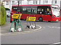
Conflicting traffic diversions, North Acton
by David Hawgood for square TQ2081 Contractors working on roads which joined A40 Western Avenue suggest diversion... (more)
Tags:
Bus
type:Close Look
sign:Diversion
top:Roads, Road Transport
subject:Roadworks
top:Suburb, Urban Fringe
|

|
Diversion
by Richard Webb geograph for square NR9028 Here in Blackwaterfoot is a diversion sign for traffic from Pirnmill to... (more)
Tags:
Diversion
top:Roads, Road Transport
|

|
Diversion in Goodrich
by Jaggery geograph for square SO5719 A red sign shows that the road ahead gives access as far as the nursery.
A... (more)
Tags:
Diversion
sign:Diversion
Diversion Sign
top:Roads, Road Transport
top:Village, Rural Settlement
|
|
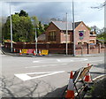
Diversion at Cwrt-y-defaid road junction
by Jaggery geograph for square SS8085 Signs at the junction of the A48 and Water Street (B4283) show that the road is... (more)
|
|
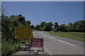
Road Closed sign
by Bob Harvey geograph for square TF0819 The yellow sign reads
"A15 closed here from 12th July until 30th July for... (more)
Tags:
A151
road:A151
near:Bourne
Diversion
type:Geograph
top:Lowlands
Mid Summer
Road Closed Sign
top:Roads, Road Transport
subject:Roadworks
season:Summer
|

|
Road junction of Carr Lane and B5500
by Jonathan Hutchins geograph for square SJ7850 This is the other end of the diversion off the B5367 seen in... (more)
Tags:
road:B5500
sign:Diversion
Diversion
Diversion Sign
type:Geograph
subject:Road Junction
Road Junction
top:Roads, Road Transport
T Junction
|
|
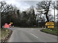
Closed north end of B5367
by Jonathan Hutchins geograph for square SJ7849 The road is closed at this point to enforce the diversion on the right along... (more)
Tags:
road:B5367
B5367
sign:Diversion
Diversion
Diversion Sign
type:Geograph
Road Block
Road Closed
Road Closed Ahead
Road Closed Signs
Road Closure
Road Closure Signs
subject:Road Junction
Road Junction
Roadblock
top:Roads, Road Transport
|

|
Temporary diversion on the Lune Valley Ramble
by Christine Johnstone geograph for square SD4964 The direct route to the M6 overbridge is closed for 2-3 years while they build... (more)
Tags:
subject:Cycle Route
sign:Diversion
path:Footpath
Footpath Diversion
Former Railway Route
Lune Valley Ramble
path:Offroad Cycleway
Path Diversion Notice
top:Paths
Riverside Cycle Path
Traffic-Free Cycle Route
|

|
Diversion at the northern end of Tunnel Terrace, Newport
by Jaggery geograph for square ST3088 From today, Tuesday May 3rd 2016, traffic can no longer turn right ahead because... (more)
Tags:
Diversion
top:Roads, Road Transport
|

|
Diversion in Newport city centre
by Jaggery geograph for square ST3188 In January 2015, traffic is being diverted along Upper Dock Street.
The usual... (more)
|

|
Diversion near Clarence Place, Newport
by Jaggery geograph for square ST3188 During roadworks in Clarence Place in late November 2014, Corporation Road... (more)
|

|
Diversion by the Rose and Crown
by Glyn Baker geograph for square TL5842 One of the paper additions to the diversion sign read "Closed For... (more)
Tags:
top:Business, Retail, Services
Diversion
type:Geograph
Public House
top:Roads, Road Transport
Village Scene
top:Village, Rural Settlement
|

|
Diversion on Tudwick Road
by Glyn Baker geograph for square TL8913 There were diversion and road closed signs all over the place today but I never... (more)
Tags:
top:Boundary, Barrier
Diversion
type:Geograph
Hedge
Road Closed Sign
Road Junction
top:Roads, Road Transport
|

|
Diversion, Warwick
by Robin Stott geograph for square SP2865 The signs at the top of Priory Road make no sense. The arrows are pointing the... (more)
Tags:
top:City, Town Centre
postcode district:CV34
Diversion
type:Geograph
top:Lowlands
Mixed Use
top:Roads, Road Transport
Temporary Signs
place:Warwick
|

|
Bridleway diversion at Lower Farm
by Chris Holifield geograph for square TM2945 |
|
Lincoln: houses at junction of Yarborough Road and Carline Road
by Christopher Hilton geograph for square SK9672 |

|
Diverted traffic/Traffig gwyriad sign facing Malpas Road, Newport
by Jaggery geograph for square ST3091 In April 2016 an English/Welsh temporary sign indicates the diversion
(via... (more)
Tags:
Bilingual
sign:Diversion
Diversion Sign
English/Welsh
type:Geograph
top:Roads, Road Transport
top:Suburb, Urban Fringe
Temporary Road Sign
colour:Yellow
|
|
Gwyriad/Diversion sign facing Hillcroft, Johnston
by Jaggery geograph for square SM9310 In February 2016, all traffic must turn left here.
Out of shot on the right,... (more)
Tags:
sign:Diversion
Diversion Sign
type:Geograph
top:Roads, Road Transport
top:Village, Rural Settlement
|

|
Diversion sign facing the B4297 south of Bynea
by Jaggery geograph for square SS5598 Viewed on Good Friday, March 25th 2016, on the approach
to the distinctive... (more)
Tags:
road:B4297
sign:Diversion
Diversion Sign
top:Roads, Road Transport
top:Village, Rural Settlement
|

|
Road diversion on the way down from Barhaugh Hall
by Oliver Dixon geograph for square NY6851 The very minor road down from Barhaugh Hall on the east bank of the South Tyne... (more)
|

|
Road diversion on the way to Barhaugh Hall
by Oliver Dixon geograph for square NY6851 The very minor road up to Barhaugh Hall on the east bank of the South Tyne has... (more)
|
|
Diversion in the Taff Trail, Rhydyfelin
by Simon Mortimer geograph for square ST0988 Looking north-west, at the point where the trail crosses Dynea Road. Cyclists... (more)
|

|
Diversion on Werneth Avenue
by Gerald England geograph for square SJ9593 Due to construction work on Lilly Street, traffic going down Werneth Avenue is... (more)
|

|
Diverted traffic turn right here, Newport
by Jaggery geograph for square ST3188 During roadworks in Clarence Place in late November 2014, Corporation Road... (more)
|

|
Road diversion
by Lairich Rig geograph for square NS4483 Storms had recently caused the collapse of a bridge (NS4483 : Site of destroyed Gallangad Bridge). The farms in... (more)
Tags:
Diversion
top:Roads, Road Transport
|

|
New Footpath
by John Leeming geograph for square TL3805 One end of a new right of way, part of a diversion of a former route which... (more)
|

|
Park Gate Road Closed
by Glyn Baker geograph for square TL8219 You can see the reason for the diversion TL8518 : Church Hill Level Crossing Closed.
|

|
On foot from Portsmouth Harbour to London Waterloo (4880)
by Basher Eyre geograph for square TQ2876 Diversion sign at the top of Queenstown Road
|

|
On foot from Portsmouth Harbour to London Waterloo (3654)
by Basher Eyre geograph for square TQ1367 Diversion sign in Island Farm Road
|

|
Drainage works on Clifton Long Reach
by Bill Boaden geograph for square SE5952 The footpath by the Ouse has to undertake a small diversion. The works consisted... (more)
|
|
Ditton: footpath diversion around housing development
by Stephen Craven geograph for square TQ7057 Category: Public footpath The development is as shown in TQ7057 : Footpath through New Houses on New Road. The footpath from East Malling has... (more)
|

|
Footpath diversion signs, Marley Works
by Stephen Craven for square TQ8853 Category: Signpost The public footpath through the Marley Works must have been diverted some time... (more)
|

|
Diversion in Ashdon
by Glyn Baker geograph for square TL5741 Essex & Suffolk Water were digging up the road further on
see TL5842 : Diversion by the Rose and Crown.... (more)
Tags:
Diversion
type:Geograph
Harcamlow Way
top:Paths
Road Junction
top:Roads, Road Transport
top:Village, Rural Settlement
|

|
Path closed, by Balgreen
by Craig Wallace geograph for square NT2272 A section of the Water of Leith Walkway was closed, due to Scottish Water sewage... (more)
Tags:
Diversion
place:Edinburgh
type:Geograph
top:Paths
top:Suburb, Urban Fringe
path:Water of Leith Walkway
|

|
Another diversion on The Thames Path
by Philip Jeffrey geograph for square SU5979 |
|
Diversion on the B1028
by Glyn Baker geograph for square TM0422 The actual digging etc. was out of shot beyond the Horse & Groom.
Tags:
top:Business, Retail, Services
Diversion
type:Geograph
Public House
top:Roads, Road Transport
Roundabout
|

|
Pride in the gardens
by Anthony Vosper geograph for square SX9980 A rainbow bench in Manor Gardens recognises the diversity of the town of Exmouth.
|
|
Welsh / English temporary signs, Rowan Way, Newport
by Jaggery geograph for square ST3090 Showing ROAD CLOSED / DIVERSION and their Welsh equivalents. Rowan Way beyond... (more)
Tags:
sign:Diversion
type:Geograph
Road Closed Sign
top:Roads, Road Transport
top:Suburb, Urban Fringe
Temporary Road Signs
Welsh/English
|

|
Rainbow crossing, Parade, Royal Leamington Spa
by Robin Stott geograph for square SP3165 Resurfaced, this busy pedestrian crossing celebrates the town's diversity.
Tags:
top:City, Town Centre
postcode district:CV32
Diversity
type:Geograph
top:Lowlands
top:Paths
Pedestrian Crossing
Rainbow Colours
place:Royal Leamington Spa
|

|
Diversion, by Comar
by Craig Wallace geograph for square NH3431 Looks like the road had been slipping down the hill on the left, towards the... (more)
|

|
Road diversion at Leith
by M J Richardson geograph for square NT2676 The A901 [Lindsay Road] is closed to eastbound traffic for the next year or so,... (more)
Tags:
top:Construction, Development
Diversion
place:Edinburgh
Edinburgh Trams
type:Geograph
place:Leith
top:Lowlands
top:Roads, Road Transport
subject:Roadworks
top:Suburb, Urban Fringe
|

|
Junction of Kirk Bank and Station Road, Threshfield
by Stephen Craven geograph for square SD9863 At some time the road layout has changed here so that Station Road (ahead) leads... (more)
Tags:
sign:Diversion
type:Geograph
Road Junction
top:Roads, Road Transport
top:Village, Rural Settlement
|
|
Caledonian Canal towards Kytra
by Craig Wallace geograph for square NH3406 The path on the left is part of the Great Glen Way and NCN Route 78. It looks... (more)
Tags:
Caledonian Canal
top:Canals
Diversion
type:Geograph
long distance path:Great Glen Way
top:Paths
national cycle network:Route 78
|

|
Diversion AHEAD, Bath Road, Marlborough
by Jaggery geograph for square SU1868 The yellow temporary sign faces eastbound traffic on the A4 Bath Road on... (more)
|

|
Which way can I go?
by Bob Harvey geograph for square SJ6660 The road junction in Church Minshull, with both directions carrying a temporary... (more)
Tags:
Diversion
Diversion Sign
type:Geograph
top:Lowlands
subject:Road Junction
top:Roads, Road Transport
top:Village, Rural Settlement
|

|
Landslide diversion
by Bill Boaden geograph for square SS8248 The South West Coast Path has to climb further up the hillside to get round the landslip.
Tags:
top:Coastal
Diversion
type:Geograph
Hillside
top:Paths
South West Coast Path
top:Uplands
top:Woodland, Forest
|

|
Two trees and a change of route
by Anthony Vosper geograph for square ST5365 A road closure results in a short diversion.
Tags:
sign:Diversion
type:Geograph
Road Junction
top:Roads, Road Transport
top:Village, Rural Settlement
|
|
Diversion - road closed - at a major junction in Bridgwater
by Jaggery geograph for square ST3037 This is the junction of the A39 The Drove (on the left) and the A38 Bristol... (more)
Tags:
A Roads Junction
sign:Diversion
type:Geograph
Road Closed
Road Closed Sign
Road Junction
top:Roads, Road Transport
|

|
Diversion - road ahead closed, Bournemouth
by Jaggery geograph for square SZ0990 Temporary signs facing Bath Road block one lane of Russell Cotes Road on May 25th 2016.
|
