|
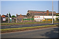
Demolition in progress - Drill Hall main shed
by Rose and Trev Clough
geograph for square NY4056
|

|
Forrest Hill
by M J Richardson
geograph for square NT2573
No.5, the Royal Scots HQ building is at the top, with part of the drill hall... (more)
|

|
Drill hall roof, viewed from Forrest Hill
by M J Richardson
for square NT2573
It was not possible to get a full view from ground level.
|
|
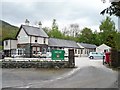
Keswick's former drill hall, south side
by Christine Johnstone
geograph for square NY2723
Once a World war One drill hall. Now home to both an outdoor activities hostel... (more)
|
|
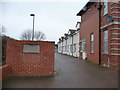
Entrance to I - 7 The Drill Hall, Park Lane
by Christine Johnstone
geograph for square NZ6016
Guisborough's First World War Drill Hall has been converted into housing.... (more)
|
|
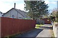
End view of drill halls in Capel Road/Enid Road
by John M
geograph for square SN6901
The smaller modern Cadet Force Drill Hall lies behind the Great War era Drill Hall.
|
|
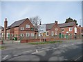
Northallerton's World War One Drill Hall
by Christine Johnstone
geograph for square SE3693
On the west side of Thirsk Road, near the junction with the A167.
|
|
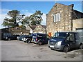
Ilkley's former Drill Hall, rear elevation
by Christine Johnstone
geograph for square SE1248
According to Ilkley Civic Society's blue plaque, the Drill Hall was built... (more)
|
|
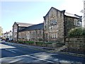
Ilkley's former Drill Hall, front elevation
by Christine Johnstone
geograph for square SE1248
According to Ilkley Civic Society's blue plaque, the Drill Hall was built... (more)
|
|
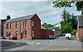
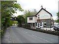
Former drill hall, Overton Road
by Lairich Rig
geograph for square NS3879
The picture shows the junction of Middleton Street (running from left to right)... (more)
|
|
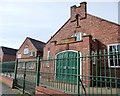
Keswick's former drill hall, west side
by Christine Johnstone
geograph for square NY2723
Built alongside a former railway line. Once a World War One drill hall. Now home... (more)
|
|
Headquarters, 4th Battalion, Green Howards
by Christine Johnstone
geograph for square SE3693
The central section of Northallerton's First World War Drill Hall, on the... (more)
|

|
Inside the workshop
by M J Richardson
for square NT2573
A somewhat different view to what it would have been 100 years ago.
|

|
HQ of the Royal Scots
by M J Richardson
for square NT2573
Plaque at 5 Forrest Hill commemorating the rebuilding of the HQ in 1905.
|

|
5 Forrest Hill
by M J Richardson
for square NT2573
The main entrance to the HQ building, with newly restored stonework.
|
|
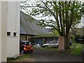
Rear of Ware Drill Hall - Amwell End
by John M
geograph for square TL3514
Grade II listed drill hall dating from 1899 with a two storey front block and... (more)
|
|
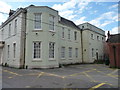
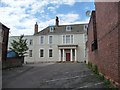
East side, Nether Hall
by Christine Johnstone
geograph for square SE5703
Grade 2 listed building. Built in the early or mid 1700s and later altered. A... (more)
|
|
Entrance on south side, Nether Hall
by Christine Johnstone
geograph for square SE5703
Grade 2 listed building. Built in the early or mid 1700s and later altered. A... (more)
|

|
WW1 drill hall 28 York Place
by M J Richardson
geograph for square NT2574
The site of a WW1 drill hall of the City of Edinburgh Royal Engineers (No1 Works... (more)
|
|
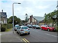
Lomond Street, Helensburgh
by Lairich Rig
geograph for square NS3082
Not far ahead is one end of a footbridge over the railway line; Lomond Street... (more)
|
|
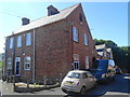
Former Drill Hall on Henry Street (2)
by John M
geograph for square NZ3450
The two storey building at right angles to the hall would have administration... (more)
|

|
Former Drill Hall, Snowdon Street, Porthmadog
by Christine Johnstone
geograph for square SH5638
A World War One drill hall. Seren Ffestiniog cyf now use it as a furniture... (more)
|

|
British Legion Club and former Drill hall, Porthmadog
by Christine Johnstone
geograph for square SH5638
The bigger hall was a World War One drill hall. Seren Ffestiniog cyf now use it... (more)
|

|
Former drill hall, Blaenau Ffestiniog
by Christine Johnstone
geograph for square SH6945
West side.
|

|
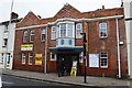
Former drill hall, Dorvill Road, Blaenau Ffestiniog
by Christine Johnstone
geograph for square SH6945
East side, fronting Dorvill Road, between the railway line and The Square.
|
|
Ware Drill Hall - Amwell End
by John M
geograph for square TL3514
Grade II listed drill hall dating from 1899 with a two storey front block and... (more)
|
|
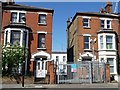
Vehicle entrance to Fulham's former WW1 Drill Hall
by Christine Johnstone
geograph for square TQ2378
On the west side of Rowan Road. The drill hall is the whitewashed building... (more)
|
|
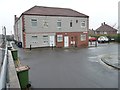
Marlborough Court, Skelton, from the south-west
by Christine Johnstone
geograph for square NZ6619
Skelton's former First World War drill hall, now converted to housing.
|
|
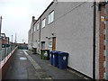
Marlborough Court, Skelton, west side
by Christine Johnstone
geograph for square NZ6619
A First World War Drill Hall that has been converted to housing.
|
|
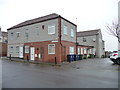
Marlborough Court, Skelton, from the south-east
by Christine Johnstone
geograph for square NZ6619
A First World War Drill Hall that has been converted to housing.
|
|
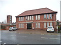
Guisborough's Drill Hall, now housing
by Christine Johnstone
geograph for square NZ6016
On the north side of Park Lane, immediately east of the Fire Station.
|

|
Aspatria's former drill hall, from the north
by Christine Johnstone
geograph for square NY1441
A former First World War drill hall on the east side of Outgang Road. In the two... (more)
|

|
Aspatria's former drill hall, from the west
by Christine Johnstone
geograph for square NY1441
A former First World War drill hall on the east side of Outgang Road. In the two... (more)
|

|
Thornton's Printers, Chapel Street, Thirsk
by Christine Johnstone
geograph for square SE4381
A former Drill Hall, in use by 1914.
|

|
Former WW1 Drill Hall, Guiseley [4]
by Christine Johnstone
geograph for square SE1841
Victoria Road [east frontage, from the south-east]. The building has been... (more)
|

|
Former WW1 Drill Hall, Guiseley [3]
by Christine Johnstone
geograph for square SE1841
Back Carrington Terrace [west] frontage.
|

|
Former WW1 Drill Hall, Guiseley [2]
by Christine Johnstone
geograph for square SE1841
The Back Cavendish Road [north] frontage.
|

|
Former WW1 Drill Hall, Guiseley [1]
by Christine Johnstone
geograph for square SE1841
The Victoria Road [main, east] frontage. The building has been converted to flats.
|
|
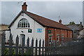
ACF Drill Hall - High Street
by John M
geograph for square ST6654
Behind the Riverside Bar which provided the drill sergeant's... (more)
|
|
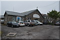
Cadet Force Drill Hall - Drill Hall Lane
by John M
geograph for square ST6243
Pre-WW1 drill hall off Charlton Road.
|

|
The former Drill Hall, 346 Sheffield Road, Birdwell
by Christine Johnstone
geograph for square SE3400
Currently occupied by Tardis Tackle [a fishing supplies shop]. Previously, Rain... (more)
|

|
WW1 Drill hall at Grindlay Court
by M J Richardson
geograph for square NT2473
At the time of WW1 the home of 1 Lowland Brigade Royal Field Artillery (HQ, 1... (more)
|

|
Drill Hall at Grindlay Court
by M J Richardson
geograph for square NT2473
At the time of WW1 the home of 1 Lowland Brigade Royal Field Artillery (HQ, 1... (more)
|
|
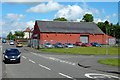
Leven Street Motors, Bonhill
by Lairich Rig
geograph for square NS3979
This large building at the junction of Burn Street (shown on the left) and... (more)
|

|
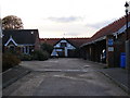
Drill Hall
by Richard Croft
geograph for square SK9771
The Drill Hall on Broadgate, seen from St.Rumbold Street multi-storey car park... (more)
|
|
The Old Drill Hall
by Geographer
geograph for square TM3877
Category: Drill Hall
Off Old Brewery Yard
|

|
The Old Drill Hall
by Geographer
geograph for square TM3877
Category: Drill Hall
Off Old Brewery Yard
|

|
Argyll Road
by Gerald England
geograph for square SH7881
On the left is the site of the recently demolished Police Station. Next to it is... (more)
|

|
Llandudno Drill Hall
by Richard Hoare
geograph for square SH7882
The police station next door is being demolished.
|

|
Rifle Street
by Gerald England
geograph for square SD9205
Looking at the old drill hall from the corner of Radcliffe Street.
|
