Public Tags
Tag: Drumlin
Showing latest 50 of 304 images tagged with Drumlin tag.
|
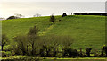
Drumlin near Lisburn
by Albert Bridge geograph for square J2962 A well-rounded drumlin, at Clogher, on the south western side of the Lisburn –... (more)
|
|
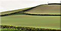
Drumlin near Killinchy (1)
by Albert Bridge geograph for square J5259 The south western side of a classic east Down drumlin, beside the Ballymorran... (more)
|

|
Drumlins, Saintfield (2)
by Albert Bridge geograph for square J4159 Close to the end of the best of the mid-Down drumlin belt, this part of drumlin... (more)
|
|
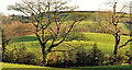
Drumlins, Saintfield (1)
by Albert Bridge for square J4159 Three rows of drumlins, each higher than the other, at Ballyagherty, to the... (more)
|
|
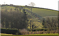
Drumlin near The Temple, Carryduff
by Albert Bridge geograph for square J3560 A classic rounded drumlin, very much typical of this part of Co Down, to the... (more)
|
|
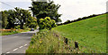
Drumlin near Strangford (2)
by Albert Bridge geograph for square J5448 The northern side of this drumlin J5448 : Drumlin near Strangford (1) beside the Strangford Road... (more)
|

|
Drumlins near Newtownards (3)
by Albert Bridge for square J4672 A passing cloud casts a shadow over the drumlins to the south west of Killynether Wood.
|
|
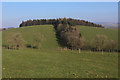
Butter Haw Hill - A Perfect Drumlin
by Chris Heaton geograph for square SD9255 A perfectly rounded drumlin, topped by a small wood as seen from the Pennine Way.
|
|
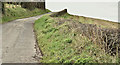
The Ballyrussell Road, Gransha, Comber - March 2017(1)
by Albert Bridge geograph for square J4269 The view south, along the narrow Ballyrussell Road, as it cuts through a typical... (more)
|
|
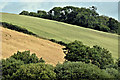
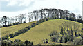
Drumlin, Ballyrenan, Downpatrick (July 2016)
by Albert Bridge for square J4746 Nicely-rounded and lightly-wooded drumlin to the east of the Belfast Road.
Tags:
type:Cross GridX
place:DownpatrickX
Drumlin
top:Farm, Fishery, Market GardeningX
top:LowlandsX
|
|
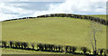
Drumlin, Saintfield - April 2016(2)
by Albert Bridge geograph for square J3958 See J3958 : Drumlin and trees, Saintfield (December 2012). The same drumlin, visible from the... (more)
|
|
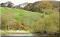
Drumlin, Saintfield - April 2016(1)
by Albert Bridge geograph for square J3958 Well-rounded drumlin to the south east of the Ballynahinch Road J3958 : The Ballynahinch Road, Saintfield (April 2016).
|
|
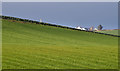
Drumlin by the Quoile, Downpatrick (May 2015)
by Albert Bridge geograph for square J5047 A nicely-rounded example of an east Down drumlin. This one, seen from the... (more)
|
|
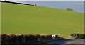
Drumlins, Comber/Newtownards
by Albert Bridge geograph for square J4870 Standard north Down drumlins, south of Scrabo, to the west of the Comber/Newtownards road.
|
|
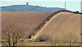
Drumlin, Dundonald (2)
by Albert Bridge geograph for square J4272 A large drumlin field, on the western side of the Comber Road, approaching... (more)
|
|
Drumlin and hedge near Comber
by Albert Bridge for square J4570 A drumlin, divided by a hedge, on the eastern side of the Comber Greenway.
|

|
Drowned drumlins, Strangford Lough
by Albert Bridge for square J5261 Many of the islands in Strangford Lough are drowned drumlins. This view is... (more)
|
|
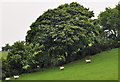
Hedge and drumlin near Saintfield
by Albert Bridge geograph for square J3860 A hedge, partly grown into trees, on the side of a standard mid-Down drumlin, at... (more)
|
|
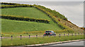
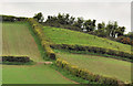
Bisected drumlin near Loughbrickland
by Albert Bridge geograph for square J1040 A drumlin, on the southern side of Loughbrickland, bisected by the building of... (more)
|
|
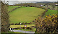
Drumlin near Killinchy (2)
by Albert Bridge geograph for square J5259 See J5259 : Drumlin near Killinchy (1). The north eastern side of the same drumlin.
|
|
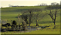
Drumlin near Loughinisland
by Albert Bridge geograph for square J4146 A classic example of a mid-Down drumlin. This one, seen from The Heights, is to... (more)
|
|
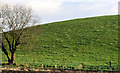
Drumlin fields near Comber (5)
by Albert Bridge for square J4567 Side-lit drumlin fields on the eastern side of the Old Ballygowan Road... (more)
|
|
Drumlin, Ballygowan/Saintfield (1)
by Albert Bridge for square J4461 The northern side of a drumlin (of standard shape and size for the locality),... (more)
|
|
Drumlin country (40)
by Albert Bridge for square J4571 Two drumlins forming a “basket of eggs”, to the north of the Ballyrainey Road... (more)
|
|
Drumlins, Saintfield (3)
by Albert Bridge geograph for square J4159 Side lighting emphasises the folds, at the end of the mid-Down drumlin belt, on... (more)
|
|
Drumlin, Listooder near Ballynahinch (2)
by Albert Bridge geograph for square J4252 The size and profile of drumlins varies. This one is across the Ballynahinch –... (more)
|
|
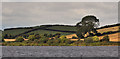
Drumlin, Listooder near Ballynahinch (1)
by Albert Bridge geograph for square J4252 An excellent example of a large and well-rounded mid-Down drumlin. This one is... (more)
|
|
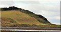
Drumlins near Portaferry
by Albert Bridge for square J5854 Drumlins at Ardquin, to the west of Lough Cowey J5954 : Lough Cowey near Portaferry (1) – a common sight in... (more)
|
|
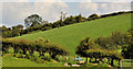
Coastal drumlin, Kircubbin
by Albert Bridge for square J5962 A well-rounded drumlin, between Kircubbin Bay (foreground) and the Doctor’s Bay,... (more)
|
|
Drumlin country (39)
by Albert Bridge geograph for square J4661 A drumlin, typical of this area, at Drumreagh to the north east of Saintfield.... (more)
|

|
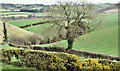
Drumlins near Newtownards (2)
by Albert Bridge geograph for square J4771 Part of the drumlin belt to the south west of Killynether Wood – visible in the... (more)
|
|
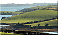
Drumlins, Ballymagliff, Comber/Dundonald (March 2017)
by Albert Bridge geograph for square J4271 Drumlins and flowering whins seen from this gate J4271 : Field gate, Ballymagliff, Comber/Dundonald (March 2017).
|
|
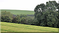
Drumlins, Ballymorran Bay, Strangford Lough
by Albert Bridge for square J5260 The view is towards Ballymorran Bay J5260 : Ballymorran Bay, Strangford Lough, at about 2½ hours after low... (more)
Tags:
top:CoastalX
DrumlinsX
top:Farm, Fishery, Market GardeningX
top:Geological InterestX
KillinchyX
LoughshoreX
top:LowlandsX
Strangford LoughX
|
|
Drumlins, Killaney near Banbridge
by Albert Bridge geograph for square J1847 A standard piece of drumlin country in this part of west Down – drumlins seen... (more)
|
|
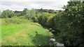
Longfield River
by Richard Webb geograph for square H8801 The boundary between Co. Monaghan of the big drumlins and Co. Louth of smaller... (more)
|

|
Drumlins near Harrow Hill
by Stephen Craven geograph for square SJ5567 Category: Drumlins The small knolls evident in the low mid-winter sunshine in this photo are... (more)
|
|
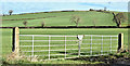
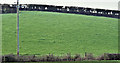
Field gates, Ballyrainey, Dundonald/Comber (March 2017)
by Albert Bridge geograph for square J4471 Two field gates on the northern side of the Ballyrainey Road J4471 : The Ballyrainey Road near Comber (3). An... (more)
Tags:
top:Boundary, BarrierX
place:ComberX
Drumlin
place:Dundonald (Co Down)X
top:Farm, Fishery, Market GardeningX
Field GatesX
subject:GateX
GatesX
type:GeographX
|
|
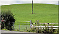
Drumlins, Ballydrain, Comber - February 2017(2)
by Albert Bridge geograph for square J4965 See J4965 : Drumlins, Ballydrain, Comber - February 2017(1). Another example slightly further south.
|
|
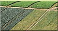
Field gate, Ballyrenan, Downpatrick (July 2016)
by Albert Bridge geograph for square J4745 A gate, leading to a drumlin, on the western side of the Belfast Road.
Tags:
top:Boundary, BarrierX
place:DownpatrickX
Drumlin
top:Farm, Fishery, Market GardeningX
Field GateX
GateX
subject:GateX
type:GeographX
|
|
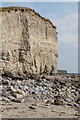
Cabbages, Killynether, Newtownards (October 2015)
by Albert Bridge geograph for square J4771 Cabbages and other vegetables growing, on a drumlin, to the south of Killynether Wood.
|
|
Knocknagoneen
by Ian Capper geograph for square M2522 The cliffs of Knocknagoneen, one of a group of drumlins protecting Rusheen Bay... (more)
Tags:
near:BarnaX
near:BearnaX
CliffX
top:CoastalX
Drumlin
top:Geological InterestX
Glacial TillX
place:KnocknagoneenX
top:Rocks, Scree, CliffsX
|
|
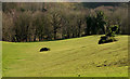
Drumlins, Barnett Demesne, Belfast
by Albert Bridge for square J3268 Malone House J3269 : Malone House, Belfast sits on top of a drumlin in the Lagan valley. This view... (more)
|
|
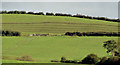
Drumlin, Ballynahinch
by Albert Bridge geograph for square J3751 See J3751 : Cattle and drumlin, Ballynahinch. Part of the same drumlin slightly to the north west. My... (more)
|
|
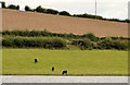
Drumlin, Loughbrickland lake
by Albert Bridge geograph for square J1140 A drumlin rising above the eastern side of Loughbrickland lake. The Lough End... (more)
|
|
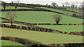
Drumlin fields, Hillsborough (1)
by Albert Bridge for square J2658 Drumlin fields on the eastern side of the Ballynahinch Road J2558 : The Ballynahinch Road, Hillsborough (6). Quite... (more)
|
|
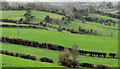
Drumlin fields near Ballygowan
by Albert Bridge geograph for square J4465 Fields, among the less-pronounced drumlins, at Magherascouse, between Ballygowan... (more)
|
|
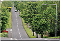
The Carnreagh Road, Hillsborough
by Albert Bridge geograph for square J2459 A minor road, running north from the Ballynahinch Road, through the drumlins,... (more)
|
|
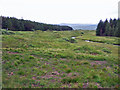
Drumlins in Glen Varragill
by Richard Dorrell geograph for square NG4734 Category: Drumlins The flatter ground in the southern end of Glen Varragill is dotted with small... (more)
|
|
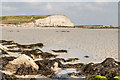
Silverstrand beach
by Ian Capper geograph for square M2422 The sandy Silverstrand beach (Trá na gCeann), a Blue Flag beach near Barna... (more)
Tags:
near:BarnaX
BeachX
near:BearnaX
CliffX
top:CoastalX
Drumlin
top:Estuary, MarineX
top:Geological InterestX
place:IllaunafamonaX
place:KnocknagoneenX
top:Rocks, Scree, CliffsX
place:SilverstrandX
|
|
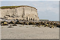
Knocknagoneen
by Ian Capper geograph for square M2422 The cliffs of Knocknagoneen, viewed from Silverstrand beach. Knocknagoneen is... (more)
Tags:
near:BarnaX
BeachX
near:BearnaX
CliffX
top:CoastalX
Drumlin
top:Estuary, MarineX
top:Geological InterestX
place:IllaunafamonaX
place:KnocknagoneenX
top:Rocks, Scree, CliffsX
place:SilverstrandX
|
