
|
Dry River Bed
by Nigel Mykura
geograph for square SK0955
This shows the dry river bed of the Manifold River just south of Wettonmill. The... (more)
|

|
The dry bed of the River Kennet from footbridge near Silbury Hill, Avebury
by Ruth Sharville
for square SU1068
There was a drought in most of the south of England during summer 2022, but... (more)
|

|
River Dee and footbridge at Lenny's Leap
by Karl and Ali
geograph for square SD7386
At this point the bed of the river is largely dry apart from pools and a few... (more)
|

|
The bed of the Dee at Lenny's Leap, Dentdale
by Karl and Ali
geograph for square SD7386
The rocky channel, gorges, steps and pools of the normally 'dry' River... (more)
|

|
Dry river bed, Great Asby
by Humphrey Bolton
geograph for square NY6713
This is Asby Beck, which looks as if its bed is on limestone and flow in dry... (more)
|

|
Disappearing River
by Nigel Mykura
geograph for square SK0956
This shows the point where the River Manifold disappears into a sink hole in the... (more)
|

|
Depth gauge in dry stream bed
by David Martin
for square SU3132
The Wallop Brook is completely dry in a record-breaking dry summer.
|

|
Dry bed of River Fromus, from Tiggins Lane, Kelsale
by Christopher Hilton
geograph for square TM3865
|

|
Slit canyon, River Dee in Dentdale
by Karl and Ali
for square SD7386
A short distance below Hell's Cauldron is a deep, narrow slot canyon on the... (more)
|

|
Dry River Redlake at Bucknell
by David Martin
geograph for square SO3573
At other points there were pools in the deepest parts of the channel, but here... (more)
|

|
The dry bed of Whinhowe Gill on SW side of Sweet Bridge
by Roger Templeman
geograph for square SD5798
|

|
Dried Up River Ash
by Glyn Baker
geograph for square TL4424
|

|
Fifield Bavant: view towards the church along the dry River Ebble
by Christopher Hilton
geograph for square SU0124
Mid summer had left the bed of the Ebble completely dry. For the same view in... (more)
|

|
Stepping stones over the Skirfare
by Karl and Ali
geograph for square SD9173
The bed is dry today so not really required.
|

|
The dry bed of the Skirfare, Littondale
by Karl and Ali
geograph for square SD9172
The water is subterranean just here.
|

|
The River Manifold below Beeston Tor
by Bill Boaden
geograph for square SK1054
The river bed is completely dry, with the river running underground somewhere.... (more)
|

|
Flood Cavern entrance, River Dee, Dentdale
by Karl and Ali
geograph for square SD7386
Under the large overhang is the usually-choked entrance to this 122m-long cave.... (more)
|

|
A straight River Dever
by Mr Addlepated
geograph for square SU5239
A very dry river bed after three weeks of record warm weather.
|

|
Standing in a dry river bed
by Mr Addlepated
geograph for square SU5239
It is in fact marked on the map as a 'water jump'. A new term for me... (more)
|

|
The bed of the River Manifold
by Bill Boaden
geograph for square SK0955
The river is completely dry.
|

|
The bed of the River Manifold
by Bill Boaden
geograph for square SK0954
The river has run completely dry, probably flowing through limestone underground... (more)
|

|
Dry river bed at Ballyvaghan
by Oliver Dixon
geograph for square M2207
Characteristic of limestone country, this river will only fill with water in the... (more)
|

|
Footbridge over the River Kennet, near Silbury Hill, Avebury
by Ruth Sharville
geograph for square SU1068
|

|
The dry bed of the River Kennet, seen from footbridge, near Silbury Hill, Avebury
by Ruth Sharville
geograph for square SU1068
|

|
Where's the River
by Paul Buckingham
geograph for square SE6785
The dried up bed of the Hodge Beck at the ford close by St Gregory's... (more)
|

|
Lathkill Waterfall minus water
by Andy Stephenson
geograph for square SK1865
Despite Autumn being well under way, the river hasn't recovered from the... (more)
|

|
Lyd Well is dry
by Des Blenkinsopp
geograph for square ST9898
People like their rivers to start somewhere definite, even though rivers often... (more)
|

|
Dry bed of Winterscales Beck, with Ribblehead Viaduct in background
by Roger Templeman
geograph for square SD7479
|

|
Dry river channel
by Oliver Dixon
geograph for square NZ0461
Immediately adjacent to the churchyard wall of Bywell St Peters is this overflow... (more)
|
|
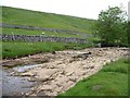
River Wharfe disappearing under a dry waterfall
by Christine Johnstone
geograph for square SD8880
The water is going under the falls [through cracks in the limestone], rather... (more)
|
|
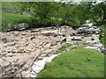
Dry waterfall on the River Wharfe
by Christine Johnstone
geograph for square SD8880
The water is going under the falls [through cracks in the limestone], rather... (more)
|

|
River Skirfare, Littondale
by Ian Taylor
geograph for square SD8974
Looking downstream. The river has disappeared underground, leaving a few pools... (more)
|

|
River Skirfare, Littondale
by Ian Taylor
geograph for square SD8974
Looking upstream. The river has disappeared underground, leaving a few pools on... (more)
|

|
Inside the River Dever 'water jump'
by Mr Addlepated
geograph for square SU5239
There is clearly still some moisture in the river bed which has sustained the... (more)
|

|
Manthorpe Bridge, The River is Dry
by Tony Atkin
geograph for square TF0616
It is late Summer and the East Glen River is dry. There is no water flowing... (more)
|

|
New Bridge, Littondale
by Ian Taylor
geograph for square SD8974
Carries a farm access road over the River Skirfare, which has disappeared... (more)
|

|
Stort Riverbank
by Glyn Baker
geograph for square TL4433
The beaten track follows the river the right of way passes through the wheat... (more)
|

|
The River Dever
by Mr Addlepated
geograph for square SU5139
View from the footbridge. Not that one needed to use the bridge, the whole of... (more)
|

|
Stone flagged footbridge over dry River Lathkill
by Martin Dawes
geograph for square SK2066
|

|
Dry River Stort in Clavering
by Glyn Baker
geograph for square TL4731
Looking from High Street to The Druce
|

|
Old Bridge to Essex
by Glyn Baker
for square TL4433
These steel beams link Hertfordshire & Essex across the dried up River Stort.
|

|
A dry River Nidd below Limley Farm
by Martin Dawes
geograph for square SE1075
On the Nidderdale Way, Limley Farm can be seen through the trees
|

|
Crossing River Nidd at Dry Wath (ford)
by Martin Dawes
geograph for square SE1075
An apt description, I presume in winter it flows man has not created that riverbed
|

|
River Nidd gone underground south of Dry Wath
by Martin Dawes
geograph for square SE1075
The water carved rocks show that it does or has flowed on the surface for many years
|

|
Deepdale Beck 'joins' the River Dee
by Karl and Ali
geograph for square SD7186
Today, neither watercourse is actually running at their confluence. The water... (more)
|

|
Dry river
by Philip Jeffrey
geograph for square SP5634
|

|
Dry river valley in Chapel-le-Dale
by Bill Boaden
geograph for square SD7377
Chapel Beck is running underground for a while.
|
|
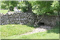
Culvert in wall on south side of A684
by Roger Templeman
for square SD9889
|
|
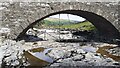
Bridge taking track over River Skirfare 1km west of Litton
by Roger Templeman
geograph for square SD8974
|

|
View across the River Dever
by Mr Addlepated
geograph for square SU5239
The river flows from right to left, at this point it is about to enter the... (more)
|
