
|
Dry riverbed
by Richard Dorrell
geograph for square NG5227
Such riverbeds on the flank of Beinn Dearg Mhòr quickly become rushing torrents... (more)
|

|
Dry riverbed
by Richard Dorrell
geograph for square NH3465
Looking south from on top of a small dam, the bed of the Allt Coire Mhuilidh is... (more)
|

|
Dry riverbed of the River Alyn
by TCExplorer
geograph for square SJ1963
|

|
Erosion at work
by Richard Dorrell
geograph for square NG5227
Although dry today, heavy rain or melting snow can quickly turn this rocky... (more)
|

|
Old Pump by the Leach
by Des Blenkinsopp
geograph for square SP1906
The River Leach, which is only seen above ground here when the water table in... (more)
|

|
The non-river Kennet
by Stephen Craven
geograph for square SU1068
|

|
Dry Bed of River Greta
by David Robinson
geograph for square NY9512
This section of the river Greta is often seen dry as the water seeps beneath the... (more)
|

|
View west along the dry bed of River Skirfare at New Bridge
by Luke Shaw
geograph for square SD8974
|

|
Dry bed of River Fromus, from Tiggins Lane, Kelsale
by Christopher Hilton
geograph for square TM3865
|

|
Dry Colne In London Colney
by Glyn Baker
geograph for square TL1803
This summer has been rather dry!
|

|
The dry bed of the Skirfare, Littondale
by Karl and Ali
geograph for square SD9172
The water is subterranean just here.
|

|
The bed of the Dee at Lenny's Leap, Dentdale
by Karl and Ali
geograph for square SD7386
The rocky channel, gorges, steps and pools of the normally 'dry' River... (more)
|

|
Stepping stones over the Skirfare
by Karl and Ali
geograph for square SD9173
The bed is dry today so not really required.
|

|
River Dee and footbridge at Lenny's Leap
by Karl and Ali
geograph for square SD7386
At this point the bed of the river is largely dry apart from pools and a few... (more)
|

|
Looking for the Leach 4
by Des Blenkinsopp
geograph for square SP1906
This is about 100 metres upstream from the temporary source of the River Leach.... (more)
|

|
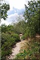
A Dried Up River Stort
by Glyn Baker
geograph for square TL4432
The gradient here is quite steep when the river is flowing it must be quite impressive.
|
|
Dried Up Colne
by Glyn Baker
geograph for square TL1803
|

|
Dry river bed at Ease Gill Kirk
by Bill Boaden
geograph for square SD6680
This is marked on the map as a stream, but it must be running underground somewhere.
|

|
Bed of the River Alyn
by TCExplorer
geograph for square SJ1962
Only a short distance on from SJ1962 : River Alyn and the river bed has run dry, as the... ( more) |
|
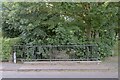
The bridge
by Bob Harvey
geograph for square SK9219
|
|
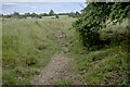
River Witham downstream
by Bob Harvey
geograph for square SK9219
|
|
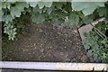
The bed of the Witham
by Bob Harvey
for square SK9219
|
|
The course of the River Witham
by Bob Harvey
geograph for square SK9219
|

|
Looking southeast along dry bed of Beldon Beck from footbridge
by Luke Shaw
geograph for square SE0091
|

|
Flood Cavern entrance, River Dee, Dentdale
by Karl and Ali
geograph for square SD7386
Under the large overhang is the usually-choked entrance to this 122m-long cave.... (more)
|

|
Slit canyon, River Dee in Dentdale
by Karl and Ali
for square SD7386
A short distance below Hell's Cauldron is a deep, narrow slot canyon on the... (more)
|

|
Looking for the Leach 3
by Des Blenkinsopp
geograph for square SP1906
Another view of the temporary source of the lower River Leach, pictured and... (more)
|

|
River Stort at Meesden Bridge
by Glyn Baker
geograph for square TL4432
Looking upstream towards the bridge.
|

|
Looking down Afon Prysor from Maentwrog Dam
by Bill Harrison
geograph for square SH6737
The river is barely a trickle in summer; most water from the lake is piped to... (more)
|

|
In Jaggers Clough
by Graham Hogg
geograph for square SK1387
Looking over Nether Moor to Woodlands Valley
|
