|
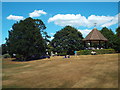
Golders Hill Park, near Golders Green
by Malc McDonald
geograph for square TQ2586
Golders Hill Park, photographed during a hot, dry spell in summer 2018. The... (more)
|
|
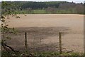
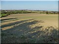
Ploughed field in dry weather, Bonnington
by Jim Barton
geograph for square NT2538
A few weeks have passed without substantial rain in April.
|
|
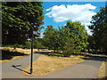
Paths in Golders Hill Park, near Golders Green
by Malc McDonald
geograph for square TQ2587
Paths in Golders Hill Park, in north west London.
The grass has turned from... (more)
|
|
Drain in dry weather, Whitminster
by Christine Johnstone
geograph for square SO7707
This drain is [or was] a feeder for the Stroudwater Canal.
|
|
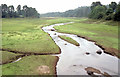
The Vartry reservoir, Roundwood (1990-1)
by Albert Bridge
geograph for square O1903
As I remember 1990 was an exceptionally dry year. This view, north, from the... (more)
|
|
Knock Loch
by Richard Webb
geograph for square NT6472
The loch in a meltwater channel has dried up a bit leaving a white deposit on... (more)
|

|
Canal overflow weir
by Stephen Craven
geograph for square TQ1179
This weir is on the Grand Union Canal (Paddington branch) at Southall. Excess... (more)
|
|
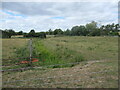
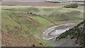
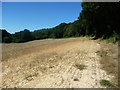
A very dry field near Gawthorpe
by Stephen Craven
geograph for square SE2723
April had been surprisingly dry this year, and the fields were already getting dusty.
|
|
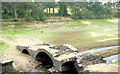
Penbank weir on the River Calder
by Christine Johnstone
geograph for square SE3825
Almost dry. The nearest fish pass is bone dry, but water still flows down the... (more)
|
|
The northern edge of Stroud
by Christine Johnstone
geograph for square SO8306
Where the newish houses on Wheelers Walk meet the Cotswolds AONB.
|
|
The valley of Ruscombe Brook
by Christine Johnstone
geograph for square SO8306
In the Cotswolds AONB, just north of Stroud.
|

|
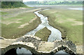
River Calder below Penbank weir
by Christine Johnstone
geograph for square SE3825
The water level is unusually low after a long dry spell, but there is still a... (more)
|
|
The impact of a dry spring on a Wakefield footpath
by Christine Johnstone
geograph for square SE3422
This is a shortcut between two public footpaths which meet at right angles.... (more)
|
|
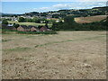
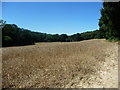
Crop failure at the highest point of a wheatfield
by Christine Johnstone
geograph for square TQ5637
The result of a hot, dry summer and a south-facing hillside.
|

|
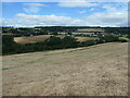
Wheatfield below Ramslye Wood
by Christine Johnstone
geograph for square TQ5637
On a south-facing slope it has suffered badly from the dry, hot summer.
|
|
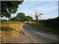
Hobb Lane, heading eastwards from the B5013
by Christine Johnstone
geograph for square SK0729
|
|
The Vartry Reservoir, Roundwood (1990-3)
by Albert Bridge
geograph for square O1903
|
|
The Vartry reservoir, Roundwood (1990-2)
by Albert Bridge
geograph for square O1903
|
|
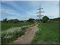
Public footpath from Bottomboat to Lake Yard
by Christine Johnstone
geograph for square SE3524
In an area that was once busy with collieries and mineral lines, on the north... (more)
|
|
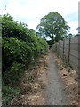
Public footpath between back gardens
by Christine Johnstone
geograph for square SE3422
Heading to the Aberford Road, on the north-east fringe of Wakefield.
|
|
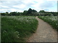
Emerging into a wheatfield below Ramslye Wood
by Christine Johnstone
geograph for square TQ5637
The public footpath keeps to the top edge of the parched field.
|
|
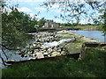
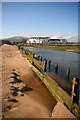
The Front Haverigg from River Lazy
by Andy Deacon
geograph for square SD1678
The properties at The Front, Haverigg are seen from the sandy west bank of the... (more)
|