Public Tags
Tag: Drying
Showing images tagged with Drying tag.

|
Working Oast House on South Street, Boughton-under-Blean, Kent
by Oast House Archive geograph for square TR0558 Category: Oast house The 20th century six kilned (4 square and 2 internal) oast house is still... (more)
|

|
Dried Up Pond by Footpath 10
by Glyn Baker geograph for square TL9210 The pond was tinder dry it must have dried out months ago.
|

|
Oast House at Finches Farm, Five Oak Green Road, Five Oak Green, Kent
by Oast House Archive geograph for square TQ6445 Category: Oast house Once electricity began to be introduced to the oast house, fans were used to... (more)
|

|
Dry lochan, Beàrnaraigh/Berneray
by Claire Pegrum geograph for square NF9183 According to the OS map, there should be a lochan here. However during a... (more)
Tags:
top:Coastal
loch:Dry
Dry Lake Bed
type:Geograph
top:Islands
top:Lakes, Wetland, Bog
subject:Lochan
Sand Dunes
|

|
Dry pond
by David Lally geograph for square SH5623 The pond shown on the OS map is well-and-truly dry.
|

|
Dry Pond
by John Myers geograph for square TQ8893 Still fringed with flag iris, this small pond within a wide hedge field border... (more)
Tags:
pond:Dry
top:Farm, Fishery, Market Gardening
top:Flat Landscapes
top:Paths
top:Village, Rural Settlement
|

|
Dry pond
by Alan Murray-Rust geograph for square SK7045 The southern part of what is mapped as quite a large pond, but which was well... (more)
|

|
Bell 2 Oast House, Beltring Hop Farm, Beltring, Kent
by Oast House Archive geograph for square TQ6747 Category: Oast house The flues directed the smoke from the plenum chamber.
|

|
Dry Wath
by Mick Garratt geograph for square SE1075 A dry River Nidd.
|

|
Dried-up pond, Garden Plantation
by Christine Johnstone geograph for square SE3414 On the north side of the footpath, near the eastern boundary.
|

|
2011 : Dry valley near Heytesbury
by Maurice Pullin geograph for square ST9444 On the edge of Salisbury Plain, the valley will continue dry (no stream at the... (more)
Tags:
Dry
top:Farm, Fishery, Market Gardening
top:Geological Interest
top:Grassland
Heytesbury
top:Rivers, Streams, Drainage
Valley
Water Table
|
|
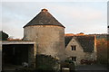
Drying stove - painswick
by Chris Allen geograph for square SO8609 An iconic symbol of the Cotswold and Wiltshire woollen industry and lauded as... (more)
|

|
Boggy land south of Townfield Lane
by Christine Johnstone geograph for square SJ7572 A pond on the map, but a muddy patch in reality.
|

|
Hop Processing Building at Finches Farm
by Oast House Archive geograph for square TQ6445 Category: Hops, hop poles, hop fields The hops bines are brought here for the hops flowers to separated from the... (more)
|

|
Hop Processing Building at Crow Plain Farm
by Oast House Archive for square TQ7047 Category: Hops, hop poles, hop fields The hops bines are brought here for the hops flowers to separated from the... (more)
|

|
Hop Processing Building at Pierce Mill
by Oast House Archive geograph for square TQ6448 Category: Hops, hop poles, hop fields The hops bines were brought here for the hops flowers to separated from the... (more)
|

|
Hop Processing Building at Remingtons Farm
by Oast House Archive geograph for square TQ6940 Category: Hops, hop poles, hop fields The hops bines are brought here for the hops flowers to be separated from the... (more)
|

|
Dry dewpond, off Tideswell Lane
by Christine Johnstone geograph for square SK1976 On the north bank of Middleton Dale.
|

|
Site of Loch of Wasday, Rousay, Orkney
by Claire Pegrum geograph for square HY3830 The loch is shown on the OS 1:25,000 map (as viewed on Get a Map 6/6/12), but... (more)
|

|
Willow clump
by John Myers geograph for square TQ9094 A tiny pathside pond, currently completely dry.
Tags:
pond:Dry
top:Farm, Fishery, Market Gardening
bucket:Landscape
top:Lowlands
top:Paths
top:Rivers, Streams, Drainage
trees:Willows
|

|
Hop Processing Building at Crow Plain Farm
by Oast House Archive geograph for square TQ7047 Category: Hops, hop poles, hop fields The waste product of the hop process piled adjacent the building. The hop... (more)
|
