Public Tags
Tag: Estate·Track
Other tags: category:Estate Track
Showing latest 50 of 380 images tagged with Estate Track tag.

|
Estate Tracks Following River Findhorn
by Stephen Crawshaw geograph for square NH8537 The River Findhorn viewed from an estate track on the eastern shore linking... (more)
Tags:
Cawdor Estate
top:Country Estates
Estate Track
type:Geograph
top:Grassland
top:Lowlands
top:Moorland
River
subject:River
River Findhorn
river:River Findhorn
top:Rivers, Streams, Drainage
top:Roads, Road Transport
Track
subject:Track
|
|
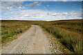
Estate track north of Hunder Beck
by Andy Waddington geograph for square NY8915 Category: Estate track Not yet shown on 1:25000 or smaller scale mapping, the estate track leads from... (more)
Tags:
category:Access Land
top:Country Estates
category:Estate Track
type:Geograph
top:Moorland
top:Paths
top:Uplands
|

|
Estate Track South of Ballachrochin
by Stephen Crawshaw geograph for square NH8435 Remote estate track in Cawdor Estate, south of Ballachrochin. The southern... (more)
Tags:
Cawdor Estate
top:Country Estates
top:Energy Infrastructure
Estate Track
type:Geograph
top:Moorland
top:Paths
wind farm:Tom Nan Clach
subject:Track
Track
top:Uplands
Wind Farm
|
|
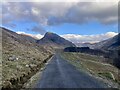
Killilan Estate Track, Glen Elchaig
by Stephen Crawshaw geograph for square NG9727 The gravel estate track through Glen Elchaig from Killilan to Iron Lodge. Sgùrr... (more)
Tags:
top:Country Estates
Estate
Estate Track
type:Geograph
Glen
place:Glen Elchaig
top:Grassland
Gravel Track
Mountain
top:Roads, Road Transport
subject:Track
Track
top:Uplands
top:Woodland, Forest
|
|
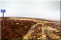
Estate track SW of Bolts Law
by Andy Waddington geograph for square NY9344 Category: Estate track In contrast to the old Weardale and Rookhope railway trackbed, the estate track... (more)
|
|
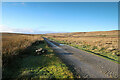
Estate track north of Ravock
by Andy Waddington geograph for square NY9514 Category: Estate track From the end of the public road at West Stoney Keld, the estate track heads west... (more)
|

|
Estate track near An Leitir
by Stephen Crawshaw geograph for square NH0127 Gravel track in Killilan Estate, passing ruined township An Leitir. Carn na... (more)
Tags:
top:Country Estates
top:Derelict, Disused
Estate Track
type:Geograph
near:Glen Elchaig
Gravel Track
subject:Loch
subject:Mountain
top:Roads, Road Transport
Township
Track
subject:Track
Tractor
top:Uplands
|

|
Estate track near Loch na Leitreach
by Stephen Crawshaw geograph for square NH0127 Gravel track in Killilan Estate leading to Iron Lodge. The track is used by... (more)
Tags:
Estate Track
top:Farm, Fishery, Market Gardening
type:Geograph
near:Glen Elchaig
Gravel Track
top:Roads, Road Transport
subject:Track
Track
top:Uplands
Woodland
top:Woodland, Forest
|

|
Killinan Estate Track, Glen Elchaig
by Stephen Crawshaw geograph for square NH0026 Gravel estate track from Killinan to Iron Lodge, through Glen Elchaig. Two small... (more)
Tags:
top:Country Estates
Estate Track
Forest
type:Geograph
place:Glen Elchaig
Glen Elchaig
Gravel Track
top:Heath, Scrub
top:Roads, Road Transport
top:Rocks, Scree, Cliffs
subject:Track
Track
top:Uplands
Woodland
top:Woodland, Forest
|
|
Plastic track on Great Dodd
by Andy Waddington geograph for square NY8816 Category: Estate track A shooting hut near the top of Great Aygill Sike in the large area of CROW... (more)
Tags:
category:Access Land
top:Country Estates
category:Estate Track
type:Geograph
top:Moorland
top:Paths
top:Uplands
|

|
Estate track on High Dolphin Seat
by Andy Waddington geograph for square NY8208 Category: Estate track Even on the most recent online 1:25000 mapping (as of 2022) the estate track is... (more)
|

|
Estate track on Peatmoor Hill
by Andy Waddington geograph for square NY8209 Category: Estate track Even on the most recent online 1:25000 mapping (as of 2022) the estate track is... (more)
|
|
Estate track towards Five Pikes
by Andy Waddington geograph for square NZ0032 Category: Estate track In the minimalist view, the track comes from Bollihope and goes along Sunnyside... (more)
Tags:
top:Country Estates
category:Estate Track
type:Geograph
top:Moorland
top:Paths
category:Restricted Byway
top:Uplands
|
|
Estate track on North Moor
by Andy Waddington geograph for square NY9213 Category: Estate track The estate track started four and a half kilometres to the east at West Stoney... (more)
|

|
Carnach House, Srath Duilleach
by Stephen Crawshaw geograph for square NH0228 An estate building at Carnach in Srath Duilleach, part of Killilan Estate. The... (more)
Tags:
top:Derelict, Disused
Estate Building
Estate Track
type:Geograph
near:Glen Elchaig
top:Grassland
Gravel Track
subject:House
top:Housing, Dwellings
Mountain
top:Roads, Road Transport
subject:Track
Track
top:Uplands
|
|
Estate track on North Dodd
by Andy Waddington geograph for square NY9314 Category: Estate track The estate track leaves the A66 opposite Old Spital, heads north onto North Moor... (more)
|
|
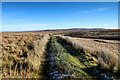
Kettlepot Road
by Andy Waddington geograph for square NY8607 Category: Estate track Originally created to serve an area of mines exploiting the Tan Hill Coal under... (more)
|
|
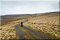
Estate track heading towards Boltslaw incline
by Andy Waddington geograph for square NY9443 Category: Estate track A long and often bleak estate track winds its way across Stanhope Common via the... (more)
|
|
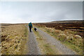
Estate track climbs above Smiddy Burn
by Andy Waddington geograph for square NY9543 Category: Estate track Beyond the NY9643 : Upmarket shooting hut, Stanhope Common which marks the end of the public right of way, the track... (more)
|

|
Estate track Lethen House
by valenta geograph for square NH9351 Estate track from the former West Lodge to Lethen House
Tags:
top:Country Estates
Estate Track
type:Geograph
top:Lowlands
near:Nairn
top:Roads, Road Transport
subject:Track
top:Woodland, Forest
|

|
Forestry track in Ardverikie Estate
by Dorothy Carse geograph for square NN5288 An estate track through conifer plantations.
Tags:
top:Country Estates
Estate Track
Forestry Track
top:Roads, Road Transport
top:Uplands
top:Woodland, Forest
|

|
Argocat by the Glen Markie track
by Karl and Ali geograph for square NN5896 These sturdy vehicles are used by the estates to carry visitors and estate... (more)
|

|
Track in Blair Castle estate
by Jim Barton geograph for square NN8666 A track leading westwards through estate parkland with fields and trees.
Tags:
top:Country Estates
Estate Parkland
Estate Track
top:Farm, Fishery, Market Gardening
Farmland
type:Geograph
top:Paths
top:Roads, Road Transport
top:Woodland, Forest
|

|
Track near Gelder Shiel
by Dorothy Carse geograph for square NO2588 An estate landrover track going towards Lochnagar.
Tags:
top:Country Estates
Estate Track
Landrover Track
top:Moorland
top:Roads, Road Transport
subject:Track
top:Uplands
|

|
Track junction, Ardverikie
by Dorothy Carse geograph for square NN5187 An estate track through conifer plantations.
Tags:
top:Country Estates
Estate Track
Forestry Track
top:Roads, Road Transport
Track Junction
top:Uplands
top:Woodland, Forest
|

|
Empingham Estate, Private
by Christine Johnstone geograph for square SK9610 Padlocked and gated track along the west side of Three Corner Plantation.
|

|
Estate tracks near Harcus
by Jim Barton geograph for square NT2448 A junction of tracks on the Portmore estate.
Tags:
top:Country Estates
Estate Track
top:Farm, Fishery, Market Gardening
Farmland
type:Geograph
top:Paths
top:Roads, Road Transport
top:Woodland, Forest
|

|
Killilan Estate Road, Glen Elchaig
by Stephen Crawshaw geograph for square NG9528 A tarmac section of the estate road in Glen Elchaig. Vehicle access is... (more)
Tags:
top:Country Estates
Estate Road
Estate Track
type:Geograph
place:Glen Elchaig
top:Lowlands
Mountain
subject:Road
Road
Road (Private)
top:Roads, Road Transport
Telegraph Pole
Tree
top:Woodland, Forest
|

|
Estate track off the bridleway, near New Bridge, Harewood
by Humphrey Bolton geograph for square SE3143 Perhaps one day we will have the 'right to roam' and will be able to... (more)
Tags:
top:Country Estates
Estate Track
type:Geograph
top:Lowlands
top:Roads, Road Transport
subject:Track
top:Woodland, Forest
|
|
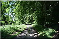
Track on the Fetternear Estate
by Bill Harrison geograph for square NJ7216 There are several kilometres of paths and tracks on the estate with some nice... (more)
Tags:
top:Country Estates
Estate Track
type:Geograph
Overhanging Trees
top:Roads, Road Transport
top:Woodland, Forest
|

|
Estate track approaching Dail na Seilg
by Graham Robson geograph for square NN6497 The Cluny estate track approaching the bothy and river crossing at Dail na... (more)
|

|
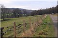
Estate track north of Gallovie
by Graham Robson geograph for square NN5589 A track on the Ardverikie estate north of Gallovie. A cattle grid stops... (more)
|
|
Track in Blair Castle estate
by Jim Barton geograph for square NN8466 This track west of the castle forms part of a circular walking route to the... (more)
Tags:
top:Country Estates
Estate Parkland
Estate Track
top:Farm, Fishery, Market Gardening
Farmland
type:Geograph
top:Paths
Post and Wire and Fence
top:Roads, Road Transport
top:Woodland, Forest
|

|
Rough Estate Track
by Rude Health geograph for square SH8840 Looking back up the rough estate track beside woodland.
|

|
Track to Corrour Estate, Moy
by Jim Barton geograph for square NN4382 The start of the 11 mile track to Corrour at the bridge over the River Spean.... (more)
|

|
Track entering Blarnabee Wood
by Dorothy Carse geograph for square NH2749 An estate track from moorland goes through the wood to Inverchoran.
Tags:
top:Country Estates
Estate Track
top:Moorland
top:Roads, Road Transport
subject:Track
top:Uplands
top:Woodland, Forest
|

|
Estate track
by Liz Gray for square NN8794 A 4x4 track that leads almost to the summit of Mullach Clach a Bhlair
|

|
The Peckforton Estate near Stanner Nab
by Jeff Buck geograph for square SJ5357 The track continues into the private Peckforton Estate with the public footpath... (more)
Tags:
county:Cheshire
country:England
Estate
Estate Track
top:Paths
place:Peckforton
place:Peckforton Hills
place:Peckforton Woods
Woodland
top:Woodland, Forest
|

|
Estate Track
by Rude Health geograph for square NB2910 We descended between Beannan Mòr and Beannan Beag so were very pleased to walk... (more)
Tags:
Beannan Beag
Beannan Mor
top:Country Estates
Estate Track
top:Islands
place:Isle of Lewis
top:Moorland
top:Paths
top:Uplands
|

|
A new track beside Caochan Crom
by Dorothy Carse geograph for square NH7518 This new track on Dalmigavie Estate crosses the burn below Carn an Radhaire.
Tags:
top:Country Estates
Estate Track
Hill Track
top:Moorland
top:Roads, Road Transport
top:Uplands
|

|
Track towards Carn Coire na h-Eirghe
by Dorothy Carse geograph for square NH7518 A new hill track on Dalmigavie Estate.
Tags:
top:Country Estates
Estate Track
Hill Track
top:Moorland
top:Roads, Road Transport
top:Uplands
|

|
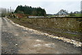
Moorland track on Cawdor Estate
by Dorothy Carse geograph for square NH8734 Cawdor Estate track on grouse moors. 2/3 of this square is inside the boundary... (more)
Tags:
top:Country Estates
Estate Track
Grouse Moor
top:Moorland
top:Roads, Road Transport
top:Uplands
Windfarm Site
|
|
Ditchley Park estate
by Graham Horn geograph for square SP3921 One of the private estate tracks. The footpath, used by Shakespeare's Way,... (more)
Tags:
top:Country Estates
Estate Track
Long Distance Path
top:Paths
top:Roads, Road Transport
Shakespeare Way
|

|
Low Deer Park
by Adrian Taylor geograph for square NY5123 This estate track through the Low Deer Park is a public footpath from Whale to... (more)
Tags:
top:Country Estates
Cumbria
Deer Park
Estate Track
type:Geograph
Lowther Park
top:Paths
Public Footpath
Public Footpath on Track
top:Roads, Road Transport
subject:Track
Westmorland and Furness
top:Woodland, Forest
|

|
Permissive footpath on an estate track, Harewood
by Humphrey Bolton geograph for square SE3244 Here the track approaches another one crossing from the main road to the right... (more)
Tags:
top:Country Estates
Estate Track
type:Geograph
top:Lowlands
top:Paths
Permissive Path
top:Roads, Road Transport
subject:Track
top:Woodland, Forest
|

|
Permissive footpath on an estate track, Harewood
by Humphrey Bolton geograph for square SE3244 This track runs parallel with the main road, which does not have a footway.
Tags:
top:Country Estates
Estate Track
type:Geograph
top:Lowlands
top:Paths
Permissive Path
top:Roads, Road Transport
subject:Track
top:Woodland, Forest
|

|
Track at Millbraehead
by Jim Barton geograph for square NT2139 The track to Kirkton Manor through the estate at Barns, also on the Tweed Walk to Peebles.
Tags:
top:Country Estates
Estate Track
type:Geograph
top:Paths
top:Roads, Road Transport
Stone Gateposts
top:Woodland, Forest
|

|
Track to Skiprig, Portmore Estate
by Jim Barton geograph for square NT2448 A track to Portmore Loch past Skiprig and Boreland farm.
Tags:
top:Country Estates
Estate Track
type:Geograph
top:Paths
top:Roads, Road Transport
top:Woodland, Forest
|

|
Track, Penicuik Estate
by Jim Barton geograph for square NT2158 The track from Penicuik near Low Pond.
|
|
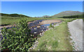
The Clashgour track follows the Abhainn Shira
by Andy Waddington geograph for square NN2642 Category: Estate track Tags:
top:Country Estates
category:Estate Track
type:Geograph
top:Moorland
top:Paths
top:Rivers, Streams, Drainage
top:Uplands
|
