Geograph - photograph every grid square
About tags on Geograph
Tags
Geographical Context
Subjects
Types
Other Prefixes
Public Tags
Related Tags
|
Coverage Map
Tag:
Farmland·Road
Showing images tagged with
Farmland Road
tag.
View all tagged images
-
In Browser
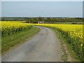
Farmland road near Ditchford Farm
by
Philip Halling
geograph for square
SP2338
This farmland road to the south of Ditchford Farm and Ditchford Cottages is not... (
more
)
Tags:
Arable Land
top:
Farm, Fishery, Market Gardening
subject:
Farmland
Farmland Road
Farmland road
by
Philip Halling
geograph for square
TF9531
A concrete farmland road giving access to arable land near Little Snoring.
Tags:
Arable Land
top:
Farm, Fishery, Market Gardening
Farmland
subject:
Farmland
Farmland Road
Road to the Kennels
by
Philip Halling
geograph for square
SO8644
Road to the Kennels through a field of oilseed rape on Kennel Bank. Beyond the... (
more
)
Tags:
top:
Farm, Fishery, Market Gardening
Farmland
subject:
Farmland
Farmland Road
crop:
Oil Seed Rape
Farm access road to Copy House through fields with sheep
by
Luke Shaw
geograph for square
SD9144
Tags:
Electricity Transmission Poles
top:
Energy Infrastructure
top:
Farm, Fishery, Market Gardening
Farmland Road
type:
Geograph
Grass Fields
top:
Roads, Road Transport
Sheep in Fields
Farm road and footpath
by
Philip Halling
geograph for square
SO8936
Farm road and footpath between Twyning Green and Twyning church.
Tags:
top:
Farm, Fishery, Market Gardening
Farmland Road
Footpath
type:
Geograph
top:
Paths
subject:
Road
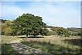
Road to Landbarn Farm
by
Des Blenkinsopp
geograph for square
TQ1349
Situated at the foot of the North Downs scarp, Landbarn Farm is part of the... (
more
)
Tags:
Chalk Escarpment
Escarpment
Farm Road
top:
Farm, Fishery, Market Gardening
Farmland Road
type:
Geograph
National Trust Property
Wooded Escarpment
top:
Woodland, Forest
Chicken beside track to Windy Ridge Farm
by
Luke Shaw
geograph for square
SK7214
Tags:
top:
Farm, Fishery, Market Gardening
Farmland Road
Free Range Hens
type:
Geograph
Grass Field
top:
Roads, Road Transport
Cattle grid on road towards High Greenside Farm
by
Roger Templeman
geograph for square
NY7003
Tags:
Cattlegrid
Dry Stone Walls
top:
Farm, Fishery, Market Gardening
Farmland Road
type:
Geograph
Grass Field
top:
Grassland
gate:
Metal
top:
Roads, Road Transport
Lonely road to Pentrefelin...
by
Bill Harrison
geograph for square
SH5238
...from St Cynhaearn's Church, some 900 metres south of the village.
Tags:
top:
Boundary, Barrier
Dry Stone Walls
top:
Farm, Fishery, Market Gardening
Farmland Road
type:
Geograph
top:
Lowlands
top:
Roads, Road Transport
Sheep Pastures
Busk Lane blocked
by
Roger Templeman
geograph for square
SD9485
Tags:
Dry Stone Walls
top:
Farm, Fishery, Market Gardening
Farmland Road
type:
Geograph
top:
Roads, Road Transport
top:
Uplands
View more in the Image Search
or
in Browser
View images matching 'Farmland Road' anywhere
in
the tags
Don't click these:
PotMel 1
PotMel 2
☰
Home
View
Search
Marked Images
Maps
Browser
Explore
Showcase
New Images
Collections
Interact
Games
Discussions
Blog
Contributors
Submit
Statistics
Leaderboards
General
FAQ
Help Pages
Sitemap
Contact Us
Support Us
sponsored by
🔍︎
What to search:
Photos
Enter keywords or a location/postcode to search nearby images
Enter a Grid Reference
Placenames
Collections
Website Pages
Everything
Others:
Advanced Search
|
Image Browser
Or:
Coverage Map
|
Searchable Map
You are not logged in
|
login
|
register