
|
Low wall and two fences bounding coniferous plantation
by Trevor Littlewood
geograph for square NN7742
The location is west of Meall Greigh, a minor feature of the hill, Meall a'... (more)
|

|
Gate onto the moor near Dockwell Farm
by Derek Harper
geograph for square SX6963
South Brent bridleway 28 ends here, and the access land begins on the other... (more)
|

|
Dry stone wall, Dockwell
by Derek Harper
geograph for square SX6963
A stroll for funnelling livestock on or off the moor begins at this bend in the... (more)
|

|
Footpath from Weydon Lane
by Derek Harper
geograph for square SU8346
Farnham footpath 131 runs around the rear of a builders merchant's yard.
|

|
Fence and wall near Buttoner House Farm
by Derek Harper
geograph for square SE2250
In the distance is Prospecthouse Farm.
|

|
Drystone wall climbing up towards Nab End
by Christine Johnstone
geograph for square NY4315
Seen from Ramps Gill valley bottom.
|

|
Entrance to Stanford Hall Rehabilitation Estate from Leake Lane at South Lodge
by Roger Templeman
geograph for square SK5423
|

|
Farmland above the Avon
by Derek Harper
geograph for square SX6762
|

|
Stroll near Dockwell Farm
by Derek Harper
geograph for square SX6963
A funnel of moorland that allows livestock to be herded off the moor, leading... (more)
|

|
Fence on wall, Upton
by Derek Harper
geograph for square SX9164
|

|
All Hallows Road, Preston
by Derek Harper
geograph for square SX8962
Houses on the northern side of the road.
|

|
Houses on Weston Lane
by Derek Harper
geograph for square SX8159
|

|
Wellswood Path leaves driveway
by Derek Harper
geograph for square SX9264
The last stretch of the path on the left (also footpath TQ 82) is hard to... (more)
|

|
Fence on wall, Decoy
by Derek Harper
geograph for square SX8669
Beside Newton Abbot Footpath 1, with Kingskerswell Road ahead.
|

|
Moorland by Skerraton Gate
by Derek Harper
geograph for square SX7065
The easternmost edge of the access land hereabouts. The fence on the wall can... (more)
|

|
Taking no chances
by Derek Harper
geograph for square SX9167
Category: Public footpath
The owner of the property to the left of this footpath (TQ 24) seems anxious to... (more)
|

|
Postbox, Preston Down
by Derek Harper
geograph for square SX8862
|

|
Rear of Magdalene Road, Torquay
by Derek Harper
geograph for square SX9164
|

|
Fence on wall, Paignton
by Derek Harper
geograph for square SX8761
Stepped in unison as they climb the hill round the bend at the junction also... (more)
|

|
Converted farm buildings, Berry Pomeroy
by Derek Harper
geograph for square SX8261
Seen across the main road through the village. Most prominent here is the... (more)
|

|
Puddle by the path to Buttoner House Farm
by Derek Harper
geograph for square SE2250
Cattle pasture with a rather adversorial clutch of the beasts around the corner... (more)
|

|
Wishings Road, Brixham
by Derek Harper
geograph for square SX9255
Briseham Road (foreground) meets Wishings Road.
|

|
Ashburton Road, Bovey Tracey
by Derek Harper
geograph for square SX8177
Seen from where the road (carrying NCN272) crosses over the Monks Way by-pass,... (more)
|

|
Steps to Lower Audley Road
by Derek Harper
geograph for square SX9065
The wall and fence keep time with the steps.
|

|
Path to Bench Tor Close, Shiphay
by Derek Harper
geograph for square SX8865
Starting with steps, from Meavy Avenue.
|
|
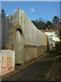
Path, Chelston
by Derek Harper
geograph for square SX9064
An interesting fence on top of a door in an arch. The path links Mallock Road to... (more)
|

|
Cattle grid, Ingram
by Derek Harper
geograph for square NU0116
|

|
Approaching Ball Gate
by Derek Harper
geograph for square SX6761
From the open moor. South Brent bridleway 18 arrives from the left; after... (more)
|

|
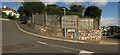
Skerraton Gate
by Derek Harper
geograph for square SX7065
Through which Dean Prior bridleway 1 enters the open access land into a large... (more)
|
|
Inverteign, Teignmouth
by Derek Harper
geograph for square SX9372
|

|
Path to Buttoner House Farm
by Derek Harper
geograph for square SE2250
|

|
Roundham Gardens
by Derek Harper
geograph for square SX8959
With houses on one side and a strip of park on the seaward, clifftop side. This... (more)
|

|
Linfurlong. Rowde
by Derek Harper
for square ST9862
The thatched cottage is listed : "late C17 timber-frame recased in red... (more)
|

|
Junction, Redland
by Derek Harper
geograph for square ST5874
In the foreground is Clyde Road, the road turning off it is Elliston Road. The... (more)
|
|
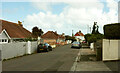
Burridge Road, Chelston
by Derek Harper
geograph for square SX8964
|

|
Meadfoot Road, Torquay
by Derek Harper
geograph for square SX9263
Looking down the road from close to the junction with Lower Woodfield Road.
|

|
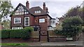
Houses, Shaldon
by Derek Harper
geograph for square SX9372
Left of centre is Ivygarth... (more)
|
|
#2 Edgerton Road
by Roger Templeman
geograph for square SE2637
Ordnance Survey documents indicate that a benchmark levelled at 113.419m above... (more)
|

|
Preston Down Road
by Derek Harper
geograph for square SX8962
The one-way section passes the end of Duchy Drive (right) at the corner where... (more)
|

|
Mural, Westbury Park
by Derek Harper
for square ST5775
A colourful addition of a pair of hedgehogs to a previously dull wall on Greendale Road.
|

|
Houses on Haslam Road, Torquay
by Derek Harper
geograph for square SX9165
Extra roof space has been added to the house on the right in the three years... (more)
|

|
Wall, Middle Warberry Road
by Derek Harper
geograph for square SX9264
A retaining wall that reflects the steep slope of Warberry Hill. Clematis spills... (more)
|

|
Brambles on footpath, Barton
by Derek Harper
geograph for square SX9167
|

|
Edge of the moor near Dockwell Farm
by Derek Harper
geograph for square SX6963
The Cumstock Track enters a stroll on the right, which continues on the other... (more)
|

|
Elliston Lane has reopened
by Derek Harper
geograph for square ST5874
|

|
Coast Path west of Carnfathach
by M J Roscoe
geograph for square SM9340
The path follows the fence line so far and then starts to descend to the right.... (more)
|

|
Fallodon Way, Bristol
by Derek Harper
geograph for square ST5776
One of three right bends on the road as it passes the Childrens Playground.
|

|
Footpath meets Kingswear Road
by Derek Harper
geograph for square SX9053
Kingswear footpath 18 reaches its terminus at the junction with Raddicombe Drive... (more)
|

|
Dawlish Road, Teignmouth
by Derek Harper
geograph for square SX9473
|

|
Hoopers Close, Totnes
by Derek Harper
geograph for square SX8160
The built-up area of the town continues to extend eastwards. Houses on this... (more)
|
