About tags on Geograph

Public Tags

Related Tags | Coverage Map
Tag:  Fenced·Hedges  

Showing latest 50 of 110 images tagged with Fenced Hedges tag.

View all tagged images - In Browser
:

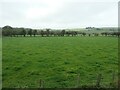
SE9127 : Solitary sheep beside a fenced hedge by Graham Hogg Solitary sheep beside a fenced hedge by Graham Hogg
geograph for square SE9127
What is the purpose of this short stretch of fenced hedge? Whatever it is,... (more)
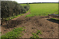
SK0334 : Gappy hedge, west of Hothill Lane by Christine Johnstone Gappy hedge, west of Hothill Lane by Christine Johnstone
geograph for square SK0334
Made stock-proof with a post and wire fence.
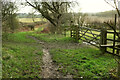
SK0252 : Hedge reinforced with a fence, south of Ladymeadows Farm by Christine Johnstone Hedge reinforced with a fence, south of Ladymeadows Farm by Christine Johnstone
geograph for square SK0252
The hedge is steadily becoming a row of trees, no longer stock-proof.
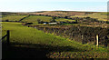
SX8764 : Misty hedge, Gallows Gate by Derek Harper Misty hedge, Gallows Gate by Derek Harper
geograph for square SX8764
Category: Hedge
A hedge disappears into the mist at a ghostly tree. Seen from Hellevoetsluis... (more)
SX8074 : Field near Halford Cross by Derek Harper Field near Halford Cross by Derek Harper
geograph for square SX8074
Looking left from SX8074 : Field near Halford Cross, The fence hedge is alongside the lane to... (more)
SX9056 : Field, Churston by Derek Harper Field, Churston by Derek Harper
geograph for square SX9056
A narrow rectangular field, 400 metres long but only 50 metres wide. This looks... (more)
SD3776 : Field boundaries between Templand and Birkby Hall by Christine Johnstone Field boundaries between Templand and Birkby Hall by Christine Johnstone
geograph for square SD3776
Both the drystone wall and the hedges are strengthened with fences.
NZ1824 : Overgrown hedges near Bridge House by Christine Johnstone Overgrown hedges near Bridge House by Christine Johnstone
geograph for square NZ1824
Strengthened by fences and probably no longer stockproof.
SE1986 : Hedged and fenced field boundary, west of Rookwith by Christine Johnstone Hedged and fenced field boundary, west of Rookwith by Christine Johnstone
geograph for square SE1986
The fence on its own is no longer stock-proof.
SK0713 : Field boundary, running north from Smithy Lane by Christine Johnstone Field boundary, running north from Smithy Lane by Christine Johnstone
geograph for square SK0713
A fenced hedge, with a roadside gap.
SX7167 : Fields near Button by Derek Harper Fields near Button by Derek Harper
geograph for square SX7167
Taken 13 years before SX7167 : Sheep pasture near Button, with Brook Wood on the right.
SO1022 : Field boundary near Pwll-y-hwyaid by Derek Harper Field boundary near Pwll-y-hwyaid by Derek Harper
geograph for square SO1022
A gate and fenced hedge just above the line of Talybont-on-Usk footpath 8/1 and... (more)
Tags: top:Boundary, Barrier   national park:Brecon Beacons   top:Farm, Fishery, Market Gardening   Fenced Hedge   type:Geograph   Grass Field   Hillside   top:Lowlands   fence:Post and Wire   gate:Steel   Trees on Field Boundary   long distance path:Usk Valley Walk  
SE3361 : Warren Cottage by Derek Harper Warren Cottage by Derek Harper
geograph for square SE3361
From the Knaresborough Round on Warren Lane. Also shown at SE3361 : Approaching Warren Cottage.
SX8074 : Field near Halford Cross by Derek Harper Field near Halford Cross by Derek Harper
geograph for square SX8074
A similar view to SX8074 : Field near Halford Cross 16 years on, and taken a month earlier in the... (more)
SP2842 : Field boundary near Cod Brook by Derek Harper Field boundary near Cod Brook by Derek Harper
geograph for square SP2842
A view from the bridleway near Upper St Dennis. The stream runs next to the... (more)
SX9156 : Path by The Grove by Derek Harper Path by The Grove by Derek Harper
geograph for square SX9156
Following a relatively recently-planted hedge around an abrupt corner of the... (more)
Tags: top:Farm, Fishery, Market Gardening   Fenced Hedge   Field   type:Geograph   top:Lowlands   Path   top:Paths   fence:Post and Wire   Wood   top:Woodland, Forest  
SX9056 : Field, Churston by Derek Harper Field, Churston by Derek Harper
geograph for square SX9056
Looking right from SX9056 : Field, Churston. The hedge ahead borders the John Musgrave... (more)
SY5287 : Sheep by Swyre Road by Derek Harper Sheep by Swyre Road by Derek Harper
geograph for square SY5287
A closer view of some of the sheep seen in SY5287 : Sheep by Swyre Road, with some conspicuous... (more)
SX8568 : Sheep pasture south of Abbotskerswell by Derek Harper Sheep pasture south of Abbotskerswell by Derek Harper
geograph for square SX8568
The field shown in SX8568 : Sheep pasture south of Abbotskerswell from a different angle, from the point where... (more)
SX8649 : Pasture by Swannaton Road by Derek Harper Pasture by Swannaton Road by Derek Harper
for square SX8649
The field also abuts the A379 on its western upper side. Dartmouth Footpath 4... (more)
SX7766 : Field near Tidwell by Derek Harper Field near Tidwell by Derek Harper
for square SX7766
The same view as SX7766 : Field near Tidwell, which was taken twelve hears before; this was... (more)
SX7666 : Bridleway to Tidwell by Derek Harper Bridleway to Tidwell by Derek Harper
geograph for square SX7666
Staverton bridleway 16 goes through a succession gates as it moves through... (more)
SX8766 : Valley near North Whilborough by Derek Harper Valley near North Whilborough by Derek Harper
geograph for square SX8766
Looking right from SX8766 : Valley near North Whilborough past an oak tree turning colour.
SX8766 : Valley near North Whilborough by Derek Harper Valley near North Whilborough by Derek Harper
geograph for square SX8766
A view from Churchway Lane, with cattle grazing, and a glimpse of houses at... (more)
SE3361 : Farmland by Warren Lane by Derek Harper Farmland by Warren Lane by Derek Harper
geograph for square SE3361
Looking right from SE3361 : Warren Lane, with a field boundary, and Mires Covert in the... (more)
Tags: Arable Farmland   Fenced Hedges   type:Geograph   long distance path:Knaresborough Round   top:Lakes, Wetland, Bog   top:Lowlands   Pool   Roadside Hedge   fences:Timber   Wood   top:Woodland, Forest  
SE3461 : Junction on Knaresborough Round by Derek Harper Junction on Knaresborough Round by Derek Harper
geograph for square SE3461
The gate and stile on the right are shown in SE3461 : Gate on Knaresborough Round. The Knaresborough... (more)
Tags: Bridleway Junction   top:Farm, Fishery, Market Gardening   Farmland   Fenced Hedge   type:Geograph   Hedges   long distance path:Knaresborough Round   top:Lowlands   top:Paths   Route with Public Access   Stile   fence:Timber   gate:Timber   Trees  
SS4727 : Sheep near Southcott by Derek Harper Sheep near Southcott by Derek Harper
geograph for square SS4727
A detail of SS4727 : Sheep near Southcott, with a little extra on the left. Mark's Copse is... (more)
SX7063 : Bridleway past Dockwell Farm by Derek Harper Bridleway past Dockwell Farm by Derek Harper
geograph for square SX7063
South Brent bridleway 28 heads along the side of the field, formerly an enclosed... (more)
Tags: Bridleway   national park:Dartmoor   Farm   top:Farm, Fishery, Market Gardening   Fenced Hedge   type:Geograph   Hedges   top:Lowlands   top:Moorland   Moorland   Pasture   top:Paths   fence:Post and Wire   Trees   top:Uplands   Valley   Wood  
SX7666 : Bridleway near Tidwell by Derek Harper Bridleway near Tidwell by Derek Harper
geograph for square SX7666
Category: Bridleway
Another view down SX7766 : Field near Tidwell from the gateway through the field boundary at its... (more)
SY4690 : Start of footpath near West Bay by Derek Harper Start of footpath near West Bay by Derek Harper
geograph for square SY4690
Although the 1:25000 map clearly shows the path leaving Station Road some 80... (more)
SP3632 : Footpath to Hook Norton by Derek Harper Footpath to Hook Norton by Derek Harper
geograph for square SP3632
Footpath 253 25/10 has to take a sideways step to the left here to run beside... (more)
SX7451 : Towards Preston by Derek Harper Towards Preston by Derek Harper
geograph for square SX7451
One of at least 25 Prestons across England. The buildings that you can see are... (more)
SX8361 : Farmland near Berry Pomeroy by Derek Harper Farmland near Berry Pomeroy by Derek Harper
for square SX8361
From Berry Pomeroy footpath 6. The nearest hedge runs beside the lane to... (more)
SE3260 : Low Moor Lane by Derek Harper Low Moor Lane by Derek Harper
geograph for square SE3260
The gate can be seen in the background of SE3260 : Knaresborough Round southeast of Brearton, as the Knaresborough... (more)
SE3361 : Warren Lane by Derek Harper Warren Lane by Derek Harper
geograph for square SE3361
A route with public access carrying the Knaresborough Round. Ahead is SE3361 : Warren Cottage.
NY1734 : Hedge strengthened with wire mesh, near Linskeldfield by Christine Johnstone Hedge strengthened with wire mesh, near Linskeldfield by Christine Johnstone
geograph for square NY1734
Otherwise the sheep would get through.
SX7563 : Wortley Copse by Derek Harper Wortley Copse by Derek Harper
geograph for square SX7563
Looking left from SX7563 : Dart valley at Wortley Copse. The wood shown is contiguous with Wortley... (more)
SX9480 : Edge of Salmon's Copse by Derek Harper Edge of Salmon's Copse by Derek Harper
geograph for square SX9480
This foreground area of lower land is where headwaters of the Mowlish Stream... (more)
SX9269 : Fields above Herring Cove by Derek Harper Fields above Herring Cove by Derek Harper
geograph for square SX9269
Pastures on the slope above the coast path, seen from footpath TQ3 on the short... (more)
SX7674 : Field near Bagtor Woods by Derek Harper Field near Bagtor Woods by Derek Harper
geograph for square SX7674
From a gateway by the Dartmoor Way as it follows the lane from Horridge.
SX7154 : Sheep at Ley by Derek Harper Sheep at Ley by Derek Harper
geograph for square SX7154
On the other side of the lane from the farm drive.
SX8062 : Grattons Lane by Derek Harper Grattons Lane by Derek Harper
geograph for square SX8062
A reverse view of SX8062 : Grattons Lane.
SP0633 : Field on the Cotswold Way by Derek Harper Field on the Cotswold Way by Derek Harper
geograph for square SP0633
Looking in the opposite direction to SP0633 : Pasture on Cotswold Way from beside the gate seen in... (more)
Tags: long distance path:Cotswold Way   top:Farm, Fishery, Market Gardening   Fenced Hedge   type:Geograph   Hedges   top:Lowlands   Pasture   Trees on Field Boundaries   long distance path:Winchcombe Way   top:Woodland, Forest   Woods  
SX8163 : Hems valley by Derek Harper Hems valley by Derek Harper
geograph for square SX8163
The lane to Bycellar Bridge seen a little further north from SX8162 : Lane north of Littlehempston.
SW9475 : Field near Treverrow by Derek Harper Field near Treverrow by Derek Harper
geograph for square SW9475
Looking left from SW9475 : Field near Treverrow, with walkers showing the route of footpath 547... (more)
SX8473 : Trees by Greycoat Lane by Derek Harper Trees by Greycoat Lane by Derek Harper
geograph for square SX8473
Along a hedge on the north side of the road.
ST3896 : Overgrown stile to road by M J Roscoe Overgrown stile to road by M J Roscoe
geograph for square ST3896
Usk Valley Walk crosses the stile into the village of Llantrisant.
Tags: top:Boundary, Barrier   Fenced Hedge   Field   type:Geograph   top:Grassland   subject:Hedge   Overgrown Stile   top:Paths  
SX8261 : Fields near Berry Pomeroy by Derek Harper Fields near Berry Pomeroy by Derek Harper
for square SX8261
Looking a little more to the left than SX8361 : Farmland near Berry Pomeroy, and, as with SX8361 : Fields near Berry Pomeroy,... (more)
SX8361 : Fields near Berry Pomeroy by Derek Harper Fields near Berry Pomeroy by Derek Harper
geograph for square SX8361
Looking more to the right than SX8361 : Farmland near Berry Pomeroy, and in winter rather than summer.... (more)
SX8558 : Farmland on Windmill Hill by Derek Harper Farmland on Windmill Hill by Derek Harper
geograph for square SX8558
View more in the Image Search or in Browser
View images matching 'Fenced Hedges' anywhere in the tags
Don't click these: PotMel 1 PotMel 2