|
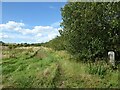
Field Edge
by Adrian Taylor
for square NZ2452
Field edge near Pelton House Farm Estate. This field was a part of Newfield... (more)
|

|
The Cumbria Way near Parkhouse Wood
by Adrian Taylor
for square NY3745
The public footpath from Bell Bridge to Rose Bridge, the route of The Cumbria... (more)
|

|
Public Footpath
by Adrian Taylor
geograph for square NY4453
The public footpath from Baxter Fold near Cumwhinton to Wolfe Bridge near Scotby... (more)
|

|
Public bridleway, edge of ploughed field, near Highway
by Vieve Forward
geograph for square SU0473
Public bridleway along edge of ploughed field.
|

|
Field edge near High Farm
by Adrian Taylor
geograph for square SD4078
A public footpath from Hampsfell to Grange-over-Sands follows the edge of the... (more)
|

|
The Cumbria Way near Keldray Farm
by Adrian Taylor
geograph for square SD2784
The Cumbria Way follows the public footpath from Knapperthaw to Gawthwaite along... (more)
|

|
Public footpath near Chessington
by Malc McDonald
geograph for square TQ1863
A public footpath along the edge of a field near Chessington, on the outer... (more)
|

|
Field edge near Warnell Hall
by Adrian Taylor
geograph for square NY3541
The public footpath from Warnell Hall to Sebergham Bridge follows the fence... (more)
|

|
Public footpath near Great Munden
by Malc McDonald
geograph for square TL3623
The signpost to the left of the image indicates the route of two public... (more)
|

|
Field edge, Whitefield
by Adrian Taylor
geograph for square NY2433
A public footpath from Horsemoor Hills to Overwater Hall runs beside the fence;... (more)
|

|
A bright new morning
by Bob Harvey
geograph for square TF0820
The edge of Bourne Woods in the morning. There is a fenced off edge to the... (more)
|

|
Public footpath near Houghton-le-Spring
by Malc McDonald
geograph for square NZ3750
A public footpath along the edge of a field near Houghton-le-Spring, to the... (more)
|

|
Public footpath along edge of field
by Jonathan Hutchins
geograph for square SJ8247
Public footpath Silverdale 14 skirts the edge of a field towards Silverdale... (more)
|

|
Public footpath along edge of field
by Jonathan Hutchins
geograph for square SJ8247
Public footpath Silverdale 14 skirts the edge of a field towards Silverdale... (more)
|

|
Field Edge Path
by Gordon Griffiths
geograph for square SO8696
The view of the field edge path near Langley Road in Lower Penn.
|

|
Field Edge
by Chris McAuley
geograph for square TQ5234
A field with frost, with the field edge clearly marked with fence and trees.
|

|
Wooded edge of mown field
by Christine Johnstone
geograph for square SO3076
At the southern edge of Pentre.
|

|
Field Entrance
by Bob Harvey
geograph for square TF0820
The entrance to the Blind Well field is in Cedar Drive. You can just make out a... (more)
|

|
Field Edge on the Bridleway between Sutton and Balk
by Chris Heaton
geograph for square SE4881
The bridleway hits a ploughed field at this point - deeply furrowed and... (more)
|

|
Cattle grazing near Axbridge
by Malc McDonald
geograph for square ST4254
Cattle grazing in a field in Somerset. In the background is the small hamlet of... (more)
|

|
Cattle near Axbridge
by Malc McDonald
geograph for square ST4254
Inquisitive cattle in a field near Axbridge in Somerset. A public footpath... (more)
|

|
Footpath in a field, near Dormansland
by Malc McDonald
geograph for square TQ4143
A footpath runs along the edge of this field in the Surrey countryside.
This... (more)
|
|
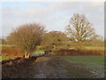
Footpath in a field, near Dormansland
by Malc McDonald
geograph for square TQ4143
A public footpath runs along the edge of this field in the Surrey countryside.... (more)
|
|
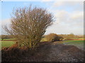
Footpath in a field, near Dormansland
by Malc McDonald
geograph for square TQ4143
A public footpath runs along the edge of this field, in Surrey countryside.... (more)
|

|
Field Edge And Wood
by Keith Evans
geograph for square TM2491
Field edge and the edge of Spring Wood near to Hempnall Green, Norfolk.
|

|
Field View
by Gordon Griffiths
geograph for square SO8696
The view of the field edge path from Langley Road in Lower Penn.
|
|
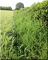
Edge of field, Greystones
by Derek Harper
geograph for square SU0029
|

|
Ploughed field at the edge of Harvington
by Christine Johnstone
geograph for square SP0649
The hedge hides the first building in the village as you approach from the north-east.
|

|
The edge of a crop field near Tiffenden Manor Farm
by Julian P Guffogg
geograph for square TQ9135
I believe the footpath is supposed to run straight through this field, but I... (more)
|

|
Field edge near Park View
by Adrian Taylor
geograph for square NY4362
|

|
Field edge footpath, east of Brickfield Farm
by Christine Johnstone
geograph for square SJ8561
Above the west bank of a stream called the Howty.
|

|
Field edge near Warnell
by Adrian Taylor
geograph for square NY3441
The public footpath from Parkhead to Warnell follows the fence on the opposite... (more)
|

|
Field edge near Hartrigg
by Adrian Taylor
geograph for square NY3440
A footpath from Parkhead to Warnell Hall follows the edge of this field near... (more)
|

|
Field edge by Forcett Lane
by Andy Waddington
geograph for square NZ1707
Category: Field edge
This is one of those squares with roads but nowhere to walk, that one drives... (more)
|

|
Normally hidden
by Bob Harvey
geograph for square TF0820
This ditch, and the post-and-wire fence at the edge of the wood, are normally... (more)
|

|
Rambling Rose at the stile
by Bob Harvey
for square TF0820
Well, the former stile at any road.
This is Rosa arvensis, the Musk or Field... (more)
|

|
Field edge near Diglake
by Jonathan Hutchins
geograph for square SJ8151
|

|
Field edge near Manor Farm
by Vieve Forward
geograph for square SU0898
The bridleway is supposed to run through the trees to the left, but was hard to... (more)
|

|
Field edge near Scot Hay
by Jonathan Hutchins
geograph for square SJ8047
Footpath Audley 75 follows the line of the field edge.
|

|
Field edge near Scot Hay
by Jonathan Hutchins
geograph for square SJ8047
Footpath Audley 75 follows the line of the field edge.
|

|
Sedgley Field Edge
by Gordon Griffiths
geograph for square SO9195
The view of the field edge between the Goldthorn Park Estate Wolverhampton and... (more)
|

|
Field edge near Stone-in-Oxney
by Marathon
geograph for square TQ9328
After weeks of rain all the local footpaths were very muddy so although the... (more)
|
|
Field edge by Ledall Cottage
by Steve Daniels
geograph for square SP6108
The footpath across the field has been ploughed up. The edge of the field has... (more)
|

|
Field edge
by Ian Capper
geograph for square TQ3447
Field edge alongside bridleway from Lodge Farm to South Park.
|

|
Field edge
by Ian Capper
geograph for square TQ3447
Field edge alongside bridleway from Lodge Farm to South Park.
|

|
Field edge
by Ian Capper
geograph for square TQ3347
Field edge on bridleway from Lodge Farm to South Park.
|
|
Ploughed field at the edge of Kinsley
by Christine Johnstone
geograph for square SE4114
At the western end of Tombridge Crescent [which is behind the hedge].
|

|
Reflections, Lower Cumberworth
by Christine Johnstone
geograph for square SE2209
The first house in Top Road is reflected in the soggy edge of a crop field.
|

|
Edge of a small wood above the Banwy
by Christine Johnstone
geograph for square SJ1207
Seen from a Welshpool & Llanfair railway train.
|

|
Autumn light, framed
by Bob Harvey
geograph for square TF0820
The brightness of the wood edge on an autumn morning, framed from within the... (more)
|
