Public Tags
Tag: Floating·Bridge
Showing images tagged with Floating Bridge tag.
|
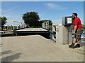
The new floating bridge at Martham Ferry
by Adrian S Pye geograph for square TG4419 The operator, on the right pumps water out of the bridge's tanks until it... (more)
Tags:
Floating Bridge
top:Rivers, Streams, Drainage
|

|
Floating Bridge, Cowes
by Paul Gillett for square SZ5095 The Cowes chain ferry operates 365 days a year and conveys foot passengers and... (more)
|

|
Floating Bridge, Cowes
by Paul Gillett geograph for square SZ5095 The Cowes chain ferry operates 365 days a year and conveys foot passengers and... (more)
Tags:
top:Coastal
place:Cowes
top:Docks, Harbours
Floating Bridge
river:Medina
top:Rivers, Streams, Drainage
|

|
Chain Ferry at East Cowes (Floating Bridge)
by David Dixon geograph for square SZ5095 The Cowes Floating Bridge is a vehicular chain ferry which crosses connects... (more)
Tags:
Car Ferry
Chain Ferry
top:Coastal
Cowes Harbour
top:Docks, Harbours
top:Estuary, Marine
Floating Bridge
Hempel
River
river:River Medina
top:Rivers, Streams, Drainage
|

|
River Medina, Cowes Floating Bridge (Chain Ferry)
by David Dixon geograph for square SZ5095 The Cowes Floating Bridge is a vehicular chain ferry which crosses connects... (more)
Tags:
Car Ferry
Chain Ferry
top:Coastal
Cowes Harbour
top:Docks, Harbours
top:Estuary, Marine
Floating Bridge
Hempel
River
river:River Medina
top:Rivers, Streams, Drainage
|

|
Chain Ferry at West Cowes (Cowes Floating Bridge)
by David Dixon geograph for square SZ5095 The Cowes Floating Bridge is a vehicular chain ferry which crosses connects... (more)
Tags:
Car Ferry
Chain Ferry
top:Coastal
Cowes Harbour
Floating Bridge
Hempel
River
river:River Medina
top:Rivers, Streams, Drainage
|

|
Cowes Floating Bridge – 1978
by Alan Murray-Rust for square SZ5095 Leaving East Cowes. This is probably 'Bridge No.5', which was in... (more)
Tags:
Chain Ferry
type:Close Look
top:Docks, Harbours
Floating Bridge
top:Historic Sites and Artefacts
river:Medina
top:Rivers, Streams, Drainage
top:Roads, Road Transport
|

|
The Floating Bridge in East Cowes
by Steve Daniels geograph for square SZ5095 The Floating Bridge is a chain car ferry running between East and West Cowes.
|

|
Floating Bridge no 6
by Ian Capper for square SZ5095 The latest incarnation of the chain ferry which operates between East Cowes and... (more)
Tags:
building:Bell Cottages
pub:Bell Inn
Car Ferry
Chain Ferry
place:Cowes
type:Cross Grid
top:Docks, Harbours
Floating Bridge
boat:Floating Bridge No 6
Grade II Listed
road:Medina Road
pub:The Bell Inn
|

|
The pontoon at Barley Cove
by Oliver Dixon geograph for square V7625 This floating bridge connects the car park over the river to the wonderful beach... (more)
Tags:
Beach
subject:Bridge
top:Coastal
Floating Bridge
Notice
top:Paths
Pontoon
River
top:Rivers, Streams, Drainage
Sand Dunes
Sign
|

|
Floating bridge, Canary Wharf
by Steve Fareham geograph for square TQ3780 Spanning over West India Quay.
|

|
Waiting for King Harry Ferry
by Chris Allen geograph for square SW8439 A line of cars queue for the chain ferry (floating bridge) at the eponymous King... (more)
|
|
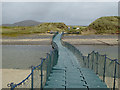
The pontoon at Barley Cove
by Oliver Dixon geograph for square V7625 This floating bridge connects the car park over the river to the wonderful beach... (more)
Tags:
top:Coastal
Floating Bridge
top:Paths
subject:Pontoon
Pontoon
River
top:Rivers, Streams, Drainage
Sand Dunes
|

|
Cowes: the chain ferry
by Chris Downer for square SZ5095 The floating bridge crosses the River Medina and links Cowes with East Cowes. We... (more)
|

|
Floating Jetty at Emsworth
by Colin Smith geograph for square SU7405 Running from The Promenade to Emsworth Channel where small boats have more time... (more)
|
|
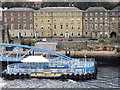
Shields Ferry Terminal, North Shields
by Colin Smith geograph for square NZ3567 Floating passenger ferry terminal at New Quay, overlooked by a grand terrace of... (more)
Tags:
top:City, Town Centre
top:Docks, Harbours
Floating Bridge
place:North Shields
Passenger Ferry Terminal
top:Rivers, Streams, Drainage
river:Tyne
|
|
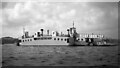
Torpoint ferry
by Ian Taylor for square SX4455 One of two replacement chain ferries built c1960 with a capacity of 30 cars.... (more)
Tags:
Chain Ferry
type:Close Look
top:Estuary, Marine
subject:Ferry
Floating Bridge
Hamoaze
top:Roads, Road Transport
Torpoint Ferry
|

|
The river at Barley Cove
by Oliver Dixon geograph for square V7725 Looking down to the river which enters Barley Cove. The holiday development of... (more)
Tags:
Beach
top:Coastal
Floating Bridge
Holiday Accommodation
top:Paths
Pontoon
River
subject:River
top:Rivers, Streams, Drainage
Sand Dunes
|
|
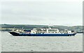
Torpoint Ferry – 4
by Alan Murray-Rust geograph for square SX4455 Broadside view of Lynher II on passage from Torpoint. Rame peninsula in the background.
Tags:
Chain Ferry
top:Docks, Harbours
top:Estuary, Marine
Ferry
Floating Bridge
type:Geograph
top:Roads, Road Transport
river:Tamar
|
|
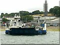
Torpoint Ferry – 3
by Alan Murray-Rust geograph for square SX4455 Tamar II awaiting departure from the Devonport side. Note the double-deck bus on... (more)
Tags:
Bus Service
Chain Ferry
top:Docks, Harbours
Double Decker Bus
top:Estuary, Marine
Ferry
Floating Bridge
type:Geograph
top:Roads, Road Transport
river:Tamar
|
|
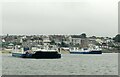
Torpoint Ferry – 2
by Alan Murray-Rust geograph for square SX4455 Lynher II on passage from Torpoint with Plym II unloading.
Tags:
Chain Ferry
top:Docks, Harbours
top:Estuary, Marine
Ferry
Floating Bridge
type:Geograph
top:Roads, Road Transport
|
|
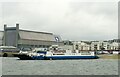
Torpoint Ferry – 1
by Alan Murray-Rust for square SX4455 Tamar II awaiting departure from the Devonport side.
Tags:
Chain Ferry
type:Cross Grid
top:Docks, Harbours
top:Estuary, Marine
Ferry
Floating Bridge
top:Roads, Road Transport
|
