|
River Usk flood gauge, Usk
by Jaggery
for square SO3700
The flood gauge is on the east bank of the River Usk, viewed from Usk Bridge.... (more)
|
|
Roadside flood gauge near the River Frome, Bromyard
by Jaggery
geograph for square SO6554
Alongside the B4203 east of the River Frome, which looks like a stream today.... (more)
|
|
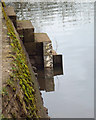
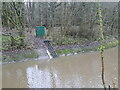
Flood gauge at the outlet sluice, Calder Park
by Christine Johnstone
geograph for square SE3218
The eastern and western lakes can rise up to 3 metres without overtopping the... (more)
|
|
Flood gauge by the River Derwent
by Pauline E
geograph for square SE7871
Across the river is the converted mill and to the right, Morrisons supermarket.
|

|
The water just reaches the flood gauge, River Avon, southeast Warwick
by Robin Stott
geograph for square SP2965
|
|
Footbridge and flood gauge at the ford
by Christine Johnstone
geograph for square NZ6503
Where the road through upper Westerdale crosses Clough Gill. The ford has been... (more)
|
|
Flood gauge at the dry ford, Barmoor Lane
by Christine Johnstone
geograph for square TA0091
Capable of measuring up to six feet of water.
|
|
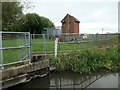
Flood gauge and pumping station, Shardlow
by Christine Johnstone
geograph for square SK4430
At the eastern ind of the inland port, where a drain enters the Trent & Mersey Canal.
|
|
Flood level gauge, Marsh Drain, Kellington
by Alan Murray-Rust
geograph for square SE5525
In a major flood, these fields will be under water.
|
|
Flood gauge
by Alan Murray-Rust
geograph for square SP2557
Erected following the severe floods on the River Avon in 2007
|
|
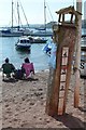
Flood gauge, back beach, Teignmouth
by Robin Stott
geograph for square SX9372
|
|
River flood height gauge and lifebuoy near English Bridge, Shrewsbury
by Jaggery
for square SJ4912
Near the bottom of steps from Wyle Cop at the western end of English Bridge over... (more)
|
|
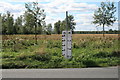
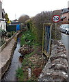
Flood Depth Gauge
by Paul Franks
geograph for square TL7608
Beside Church Road, south of Boreham.
|
|
Flood Gauge at Hasfield
by Ian S
geograph for square SO8227
|
|
Flood Gauge on Wainlode Lane
by Ian S
geograph for square SO8426
|
|
Flood gauge by the River Esk
by Pauline E
geograph for square NZ8809
Near the point from which boats can be hired.
|
|
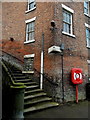
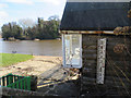
Steps down to the river
by Christine Johnstone
geograph for square SO8454
On the east bank of the Severn, just upstream of Worcester Bridge. The white... (more)
|
|
Flood gauge, Rookery Lane ford
by Robin Stott
geograph for square SP1866
The lane crosses the Tapster Brook a metre or two into the next square SP1766.
|
|
Brook height gauge, Lea
by Jaggery
geograph for square SO6621
The brook here flows between a house and the B4222 near the A40 crossroads
in... (more)
|
|
Calibrating the Avon, Warwick, 6 the longer river level gauge near the gauging station
by Robin Stott
for square SP2965
It starts where the little one finishes Link |
|
Calibrating the Avon, Warwick, 4 the short river level gauge at the gauging station
by Robin Stott
for square SP2965
|
|
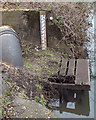
Monitoring equipment, Eller Beck, Skipton Woods
by Christine Johnstone
geograph for square SD9952
A depth gauge and some pipes [for sampling?]. This is a Woodland Trust site,... (more)
|
|
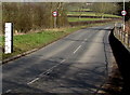
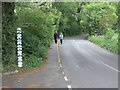
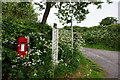
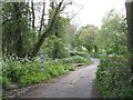
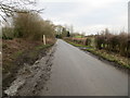
Boroughbridge Road approaching Dordy Flats Wood
by Peter Wood
geograph for square SE3466
Looking eastward. A dip in the road at this point makes it susceptible to flooding.
|