|
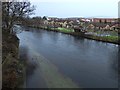
Flooded footpath beside the River Leven
by Lairich Rig
geograph for square NS3981
|

|
Flooding at Iford, near Bournemouth
by Malc McDonald
geograph for square SZ1393
In late January 2026, Storm Chandra brought strong winds and heavy rain to parts... (more)
|

|
Flooded ground at Bernard's Mead, near Christchurch
by Malc McDonald
geograph for square SZ1393
In January 2026, Storm Chandra brought strong winds and heavy rain to parts of... (more)
|

|
Flooding at Iford, near Bournemouth
by Malc McDonald
geograph for square SZ1393
In late January 2026, Storm Chandra brought strong winds and heavy rain to parts... (more)
|

|
Flooded River Stour, Iford, near Bournemouth
by Malc McDonald
geograph for square SZ1393
In late January 2026, Storm Chandra brought strong winds and heavy rain to parts... (more)
|

|
Flood water at Cold Harbour Corner
by Richard Humphrey
geograph for square TF4206
Next to the River Nene south of Wisbech St Mary
The same area the previous... (more)
|

|
Land near Young's Farm
by Lairich Rig
geograph for square NS3976
Dalmoak Farm, as it is called on the map, is also known locally as Young's... (more)
|

|
Trees in floodwater, Iford Playing Fields, near Bournemouth
by Malc McDonald
geograph for square SZ1492
Trees stand on a waterlogged playing field near Iford, on the outskirts of... (more)
|

|
Location of the Hovertrain experiment (Old Bedford River)
by Beverley Newbigging
geograph for square TL4178
Professor Eric Laithwaite was the inventor of the linear electric motor and he... (more)
|

|
York, Tower Street, in the September 2012 floods
by Nigel Thompson
geograph for square SE6051
At the base of Clifford's Tower, this is looking toward Bishopsgate Bridge.... (more)
|

|
Flooding at Cold Harbour Corner
by Richard Humphrey
geograph for square TF4206
Next to the River Nene south of Wisbech St Mary
|

|
Flooded grassland at Cold Harbour Corner
by Richard Humphrey
geograph for square TF4206
Next to the River Nene south of Wisbech St Mary
|

|
Flooded ground beside the cycle route
by Lairich Rig
geograph for square NS5162
The picture was taken from the footpath / cycle path. Just south of here, in an... (more)
|
|
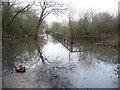
Flooding on The Lines, north of Brigshaw Lane
by Christine Johnstone
geograph for square SE4029
Pretty well impassable without wellingtons or a horse.
|
|
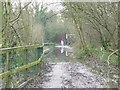
Where walkers fear to tread, Great Preston
by Christine Johnstone
geograph for square SE4029
Horse and rider using the flooded Lines [a permitted bridleway and former... (more)
|

|
A flooded area in Delamere Forest
by Ian Greig
geograph for square SJ5571
|

|
Path to North Lees
by Derek Harper
geograph for square SE2973
Footpath 15 102 16/3 runs along the edge of an field of wheat, with an area in... (more)
|

|
Flooded Paddock
by Glyn Baker
geograph for square ST4837
Taken from A39 Street Road. Round here this hardly counts as a flood just a bit damp!
|

|
Flooded former railway cutting, south of Lee Lane
by Christine Johnstone
geograph for square SE3411
This line closed to passengers in 1930, and to freight in 1961. It is now part... (more)
|

|
Flooding alongside The Lines at Woodend
by Christine Johnstone
geograph for square SE4028
The former Ledston branch of the Leeds, Castleford & Pontefract Junction... (more)
|
|
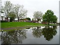
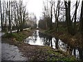
Flooded canal bank, Rochdale Canal, Miles Platting
by Christine Johnstone
geograph for square SJ8599
It's been raining a lot, and a boat is coming down the nearby locks.
|
|
Flooded railway route, near Balderton Lake
by Christine Johnstone
geograph for square SK8052
The national cycle route 64 shifts eastward here, by a couple of metres.
|

|
Flooded meadow, Cockington
by Derek Harper
geograph for square SX8963
|
|
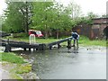
High water levels at Lock 58, Rochdale Canal
by Christine Johnstone
geograph for square SD8807
On a rainy day, as a boat descends the Laneside flight of locks at Slattocks,... (more)
|
