Public Tags
Tag: Fold
Showing latest 50 of 143 images tagged with Fold tag.
|
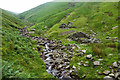
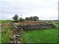
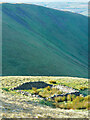
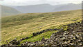
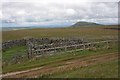
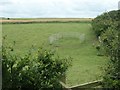
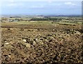
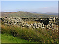
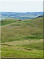
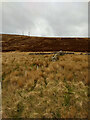
Michael's Sheepfold
by Mick Garratt geograph for square NY3408 On the tourist trail although not many Wordsworth devotees make it this far up... (more)
Tags:
top:Derelict, DisusedX
top:Farm, Fishery, Market GardeningX
Fold
subject:Fold
type:GeographX
SheepfoldX
top:UplandsX
WordsworthX
|
|
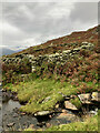
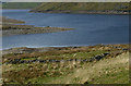
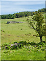
Washfold, Hollow Moss Beck
by Mick Garratt geograph for square SD2093 A pen for holding sheep waiting to be washed. The following is quoted from the... (more)
|
|
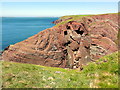
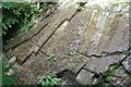
Folded Old Red Sandstone at Cobbler's Hole
by Tony Atkin geograph for square SM8002 Accessed via a short fenced path off the road, this spectacular folded rock is... (more)
|

|
Small fold on the foreshore at Clarach
by Rudi Winter for square SN5884 The rocky foreshore at Clarach Link consists... (more)
|
|
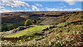
Sheep fold northeast of Tongue House Close
by Mick Garratt geograph for square SD2498 For further info. see MNA117875 | National Trust Heritage Records. 2015.... (more)
Tags:
top:Farm, Fishery, Market GardeningX
subject:Fold
Fold
type:GeographX
top:Historic Sites and ArtefactsX
Sheep FoldX
|
|
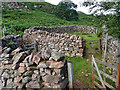
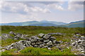
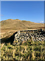
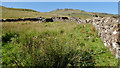
Old sheep fold
by Ian Calderwood geograph for square SK2553 Still reasonably intact, though apparently now disused, this sheep fold is... (more)
Tags:
Drystone SheepfoldX
top:Farm, Fishery, Market GardeningX
subject:Fold
type:GeographX
Old SheepfoldX
Sheep FoldX
top:UplandsX
|
|
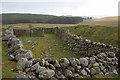
Ruined sheep fold at Warren Moor
by Mick Garratt geograph for square NZ6108 NYM HER No: 9698
A post medieval sheep fold identified from historic mapping... (more)
Tags:
top:Derelict, DisusedX
top:Farm, Fishery, Market GardeningX
Fold
type:GeographX
top:Historic Sites and ArtefactsX
subject:RuinX
RuinX
Sheep FoldX
|
|
Ruined fold, Marsden
by Humphrey Bolton geograph for square SE0213 This fold is shown, without a caption, on the 1850 six-inch map.
Tags:
CRoW Access LandX
top:Derelict, DisusedX
top:Farm, Fishery, Market GardeningX
ruin:Fold
subject:Fold
type:GeographX
top:MoorlandX
top:UplandsX
|
|
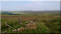
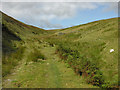
Sheep Fold
by Mick Garratt geograph for square NY2001 Three gates to open and close on the Public Footpath.
|
|
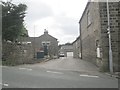
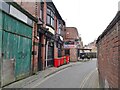
Joseph Mott House
by Gerald England geograph for square SJ9088 Joseph Mott House at 53 Buxton Road, Heaviley is a locally listed building.... (more)
|
|
Tilted mudstone strata in Groudle Glen
by Alan Murray-Rust for square SC4178 The island's geology shows many examples of folding and upheaval. These... (more)
|
|
Old sheep fold
by Nigel Brown geograph for square SN7686 Category: Sheepfold Barely above the scarred shores of Nant-y-moch reservoir. Now the sheep use... (more)
|
|
Sheep fold
by Nigel Brown geograph for square SN9073 Category: Sheepfold This short spur off the end of the landrover track leads to near the old sheep... (more)
|
|
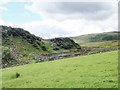
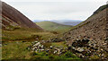
Rowantree Grains Fold
by Mick Garratt geograph for square SD6695 |
|
Sheep folds, ancient and modern, situated along Crosdale Beck
by Mick Garratt geograph for square SD6493 |
|
Ruined sheep fold at Middle Heads
by Mick Garratt geograph for square NZ6301 See NYM HER No: 13394.
Tags:
top:Derelict, DisusedX
top:Farm, Fishery, Market GardeningX
Fold
subject:Fold
type:GeographX
top:Historic Sites and ArtefactsX
SheepfoldX
|
|
Fold, Helvellyn Gill
by Mick Garratt geograph for square NY3216 |
|
Fold, Broad Tongue
by Mick Garratt geograph for square NY2005 |
|
Rowantree Fold
by Mick Garratt geograph for square NY3421 |

|
Rake Fold, off Rawsons Rake, Holcombe
by Christine Johnstone geograph for square SD7816 The lane is shown on the map surveyed in the 1840s, with a building on it, but... (more)
|
|
Fold, Dalkeith Park
by Mick Garratt for square NT3468 Tags:
type:Close LookX
top:Country EstatesX
Country ParkX
top:Farm, Fishery, Market GardeningX
Fold
subject:Fold
|
|
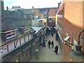
Farmer's Fold View
by Gordon Griffiths geograph for square SO9198 The view of an alley off the Mander's Centre. Fold derives from the... (more)
Tags:
subject:AlleywayX
City StreetX
top:City, Town CentreX
Fold
type:GeographX
Shopping CentreX
place:West MidlandsX
place:WolverhamptonX
|
|
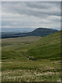
Barbaryrigg Fold
by Mick Garratt geograph for square NY3522 In the distance is the 537m hill Great Mell Fell (NY3925).
In the... (more)
|
|
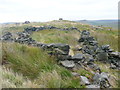
Carreg y Fran
by Ian Medcalf geograph for square SH9218 Hen gorlannau efallai / Old folds perhaps.
|
|
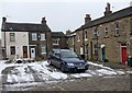
Crowther Fold - Keighley Road
by Betty Longbottom geograph for square SE0838 Tags:
Fold
top:Suburb, Urban FringeX
|
|
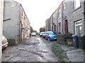
Manor Fold - March Cote Lane
by Betty Longbottom geograph for square SE1136 Tags:
Fold
top:Suburb, Urban FringeX
|
|
Corrie Fold - Sapgate Lane
by Betty Longbottom geograph for square SE1032 Tags:
Fold
top:Suburb, Urban FringeX
|
|
Pearson Fold - Wyke Lane
by Betty Longbottom geograph for square SE1627 Tags:
Fold
top:Suburb, Urban FringeX
|
|
Fenton Fold - Wyke Lane
by Betty Longbottom geograph for square SE1627 Tags:
Fold
top:Suburb, Urban FringeX
|
|
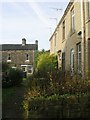
Stone Fold - Bankside Terrace
by Betty Longbottom geograph for square SE1438 Tags:
Fold
top:Suburb, Urban FringeX
|
|
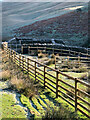
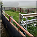
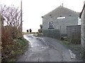
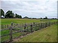
Temporary animal fold, south of Hoddy Cows spring
by Christine Johnstone geograph for square TA1873 Cattle are used to control the vegetation at Hoddy Cows spring - an SSSI.
|
|
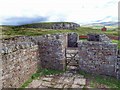
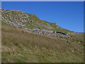
Sheepfold, Cronkley
by Mick Garratt geograph for square NY8628 |
|
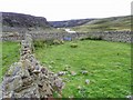
East Cow Green Sheep Fold
by Mick Garratt geograph for square NY8130 |
|
Sheep Fold
by Mick Garratt geograph for square NY8127 |
|
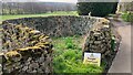
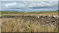
Derelict stone walled enclosure
by Russel Wills geograph for square NU1227 The original 'stell' (a fold for cattle) for the adjacent Stell... (more)
|
|
Gated track, north side of St Clement's churchyard
by Christine Johnstone geograph for square TR0325 Probably used as an animal fold?
|
|
Groovebeck Fold
by Mick Garratt geograph for square NY3722 |
|
Sheep fold above the mountain road
by Nigel Brown geograph for square SH7933 Category: Sheepfold |
|
Old sheep fold
by Nigel Brown geograph for square SH6520 Category: Sheepfold Quite a complex structure, with several chambers.
|
|
Old sheep fold, Glen Ceitlein
by Nigel Brown geograph for square NN1547 Category: Sheepfold The sheep have long gone. In the distance is the end of Meall nan Eun, with... (more)
|
|
Low Moss Sheepfold
by Mick Garratt geograph for square NY4117 For further info see Heritage Gateway - Results. 2012. Heritagegateway.org.uk... (more)
|
|
Sheepfold north of The Grange
by Mick Garratt geograph for square SE5796 See NYM NP HER No.: 10162
Tags:
top:Farm, Fishery, Market GardeningX
Fold
subject:Fold
type:GeographX
top:Historic Sites and ArtefactsX
SheepfoldX
|
|
Post-medieval sheepfold built on the site of a Romano-British settlement
by Mick Garratt geograph for square NT9329 "These are the remains of a Roman period settlement to the east of... (more)
|
|
Sheepfold
by Mick Garratt geograph for square NT9028 A sheepfold is shown on the first edition Ordnance Survey map see Maps.nls.uk.... (more)
Tags:
top:Farm, Fishery, Market GardeningX
Fold
subject:Fold
type:GeographX
top:Historic Sites and ArtefactsX
SheepfoldX
|
|
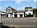
Wheeler's Fold Pub
by Gordon Griffiths geograph for square SO9198 The view of McGhee's Irish Pub in Wolverhampton.
Tags:
City StreetX
top:City, Town CentreX
Fold
type:GeographX
Irish PubX
PubX
subject:Public HouseX
county:West MidlandsX
place:WolverhamptonX
|
|
Sheepfold, Addamcombe Hole
by Mick Garratt geograph for square NY1919 Tags:
top:Derelict, DisusedX
top:Farm, Fishery, Market GardeningX
Fold
subject:Fold
type:GeographX
SheepfoldX
|
|
Bield, Kingsdale
by Mick Garratt geograph for square HY3711 Not sure what the Orcadian equivalent is, but in the North of England this would... (more)
|
|
Bield, Kingsdale
by Mick Garratt geograph for square HY3711 Not sure what the Orcadian equivalent is, but in the North of England this would... (more)
|
|
Sheepfold, Tòrr na Mòine
by Mick Garratt geograph for square NM5562 |
|
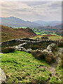
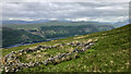
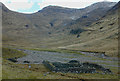
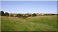
Fold in the hills east of Launde
by David Kemp geograph for square SK8004 Taken from the southern side of the valley of the River Chater.
|