Public Tags
Tag: Footpath·Through·Woods
Showing latest 50 of 129 images tagged with Footpath Through Woods tag.
|
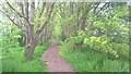
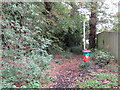
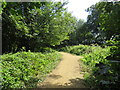
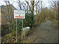
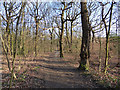
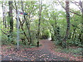
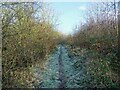
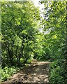
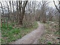
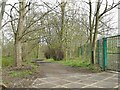
Footpath off Peakirk Road, Glinton
by Paul Bryan geograph for square TF1606 This tree-lined footpath leading off from Peakirk Road, east of Glinton, joins... (more)
|
|
Footpath off Peakirk Road, Glinton
by Paul Bryan geograph for square TF1606 This tree-lined footpath leading off from Peakirk Road, east of Glinton, joins... (more)
|
|
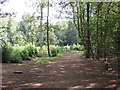
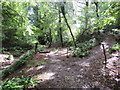
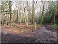
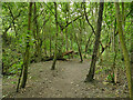
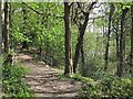
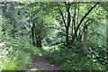
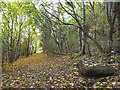
Lower path in Post Hill woods
by Stephen Craven geograph for square SE2332 There are two north-south public footpaths through the woods: one higher up the... (more)
|
|
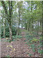
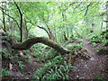
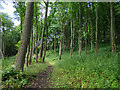
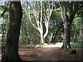
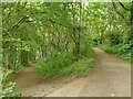
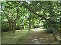
Woodland footpath at Red Hill (1)
by Stephen Craven geograph for square SP2260 A path through a fairly young wood (probably planted soon after the centre... (more)
|
|
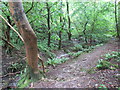
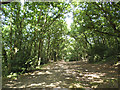
Footpath through woodland near Brighton
by Malc McDonald geograph for square TQ3210 A footpath through woodland on the South Downs, near Brighton.
Tags:
near:BrightonX
county:East SussexX
path:FootpathX
FootpathX
Footpath in WoodlandX
Footpath Through Woods
type:GeographX
subject:PathX
top:PathsX
Public FootpathX
area:South DownsX
national park:South DownsX
South DownsX
footpath:WoodlandX
top:Woodland, ForestX
|
|
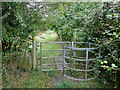
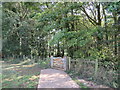
Kissing gate at Red Hill
by Stephen Craven geograph for square SP2260 A path through a fairly young wood (probably planted soon after the centre... (more)
Tags:
Footpath Through Woods
type:GeographX
Kissing GateX
top:PathsX
Public FootpathX
top:Woodland, ForestX
|
|
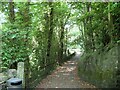
Footpath in Post Hill woods
by Stephen Craven geograph for square SE2433 This is one of the public footpaths in the woods, which was probably originally... (more)
|
|
Path through woods in Bathpool Park
by Jonathan Hutchins geograph for square SJ8352 This path does not in fact follow the exact route of public footpath Kidsgrove... (more)
Tags:
Bathpool ParkX
Footpath Through Woods
type:GeographX
public footpath:Kidsgrove FP 183X
top:Park and Public GardensX
subject:PathX
top:PathsX
top:Woodland, ForestX
|
|
Public footpath near Whippingham
by Malc McDonald geograph for square SZ5192 A public footpath leading into woodland near Whippingham on the Isle of Wight.
Tags:
near:CowesX
near:East CowesX
FootpathX
Footpath in WoodlandX
Footpath Through Woods
type:GeographX
place:Isle of WightX
subject:PathX
Path Through WoodsX
top:PathsX
Public FootpathX
near:WhippinghamX
Woodland PathX
top:Woodland, ForestX
|
|
Footpath through woods near Cheddar
by Malc McDonald geograph for square ST4555 A public footpath through woodland near Cheddar in Somerset.
This image was... (more)
Tags:
near:CheddarX
Footpath Through Woods
type:GeographX
subject:PathX
top:PathsX
Public FootpathX
county:SomersetX
top:Woodland, ForestX
|
|
Footpath through woods near Cheddar
by Malc McDonald geograph for square ST4555 A public footpath through woodland near Cheddar in Somerset. The path is to the... (more)
Tags:
near:CheddarX
Footpath Through Woods
type:GeographX
subject:PathX
top:PathsX
Public FootpathX
county:SomersetX
top:Woodland, ForestX
|
|
Footpath through woods near Cheddar
by Malc McDonald geograph for square ST4555 A public footpath through woodland near Cheddar in Somerset.
This image was... (more)
Tags:
near:CheddarX
Footpath Through Woods
type:GeographX
subject:PathX
top:PathsX
Public FootpathX
top:Rivers, Streams, DrainageX
county:SomersetX
StreamX
top:Woodland, ForestX
|
|
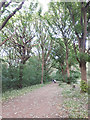
Path through woodland, near Brighton
by Malc McDonald geograph for square TQ3209 A path through woodland in the South Downs National Park, near Brighton.
Tags:
near:BrightonX
FootpathX
path:FootpathX
Footpath in WoodlandX
Footpath Through Woods
type:GeographX
subject:PathX
top:PathsX
Public FootpathX
national park:South DownsX
South DownsX
area:South DownsX
Sunlight and ShadowsX
Sunshine and ShadeX
footpath:WoodlandX
top:Woodland, ForestX
|
|
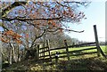
Path into woodland, near Brighton
by Malc McDonald geograph for square TQ3210 A path into woodland on the South Downs, near Brighton.
Tags:
near:BrightonX
county:East SussexX
path:FootpathX
FootpathX
Footpath GateX
Footpath in WoodlandX
Footpath Through Woods
Gate Across Public FootpathX
type:GeographX
subject:PathX
top:PathsX
Public FootpathX
Public Footpath GateX
South DownsX
area:South DownsX
national park:South DownsX
footpath:WoodlandX
top:Woodland, ForestX
|
|
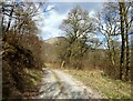
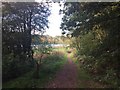
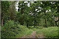
Path through the woods
by Stephen Craven geograph for square NZ1000 The public footpath from Skelton Lane to Cordilleras Lane passes through... (more)
|
|
Woodland track, Forge Brow
by Adrian Taylor geograph for square NY2824 The track runs through the woods below Brundholme Road. It is a permitted... (more)
Tags:
Blease FellX
FootpathX
Footpath in WoodlandX
Footpath Through Woods
type:GeographX
near:KeswickX
Permitted PathX
top:Roads, Road TransportX
subject:TrackX
TreesX
Woodland TrackX
top:Woodland, ForestX
|
|
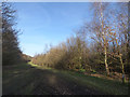
Path on Southborough Common
by Malc McDonald geograph for square TQ5742 A footpath across Southborough Common, near Tunbridge Wells in Kent.
The path... (more)
Tags:
Footpath Through Woods
type:GeographX
county:KentX
Muddy FootpathX
Muddy PathX
subject:PathX
Path Through WoodsX
top:PathsX
Public FootpathX
place:SouthboroughX
near:Tunbridge WellsX
top:Woodland, ForestX
|
|
Sunlight and shadows in woodland near Brighton
by Malc McDonald geograph for square TQ3209 Sunlight and shadows in woodland in the South Downs National Park, near Brighton.
Tags:
near:BrightonX
path:FootpathX
FootpathX
Footpath in WoodlandX
Footpath Through Woods
type:GeographX
top:PathsX
Public FootpathX
national park:South DownsX
South DownsX
area:South DownsX
Sunlight and ShadowsX
Sunshine and ShadeX
footpath:WoodlandX
subject:WoodlandX
top:Woodland, ForestX
|
|
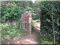
Footpath waymarkers on the edge of Long Wood
by Simon Mortimer geograph for square SU7189 Long Wood is a typical Chilterns beechwood with holly as an understorey shrub.... (more)
Tags:
trees:BeechX
Beech WoodlandX
ChilternsX
place:ChilternsX
Footpath JunctionX
Footpath MarkerX
Footpath Through Woods
Footpath Way MarkerX
Footpath WaymarkerX
type:GeographX
tree:HollyX
top:LowlandsX
subject:WoodlandX
top:Woodland, ForestX
|
|
Redundant stile in Post Hill woods
by Stephen Craven geograph for square SE2332 Older maps do show a field boundary coming down to the beck at this point; the... (more)
|
|
Entrance to Post Hill woods from Troydale
by Stephen Craven geograph for square SE2332 The notice is warning of the dangers of muddy tracks and flooding from the beck.
|
|
Footpath through wood to Tweed riverbank
by Martin Dawes geograph for square NT8844 Estate path not a Public footpath
|
|
Bramley Fall: lower path
by Stephen Craven geograph for square SE2436 One of the few paths through these woods that is shown as a public right of way... (more)
|
|
Footpath through Ord Wood
by Stephen Craven geograph for square NH5250 Little of the original woodland is left, only this short section with a footpath... (more)
|
|
Path through Middleton Park
by Stephen Craven geograph for square SE2929 The location within the woods is approximate, but certainly along the path on... (more)
|
|
Path through The Clearings, Middleton
by Stephen Craven geograph for square SE2929 The location within the woods is approximate.
|
|
Path through woodland near Markbeech
by Malc McDonald geograph for square TQ4941 A footpath through woodland near Markbeech, in Kent. Here, a bridge carries the... (more)
Tags:
Bridge Over StreamX
near:CowdenX
near:East GrinsteadX
near:EdenbridgeX
FootpathX
bridge:Footpath Over StreamX
Footpath Through Woods
type:GeographX
county:KentX
near:MarkbeechX
subject:PathX
bridge:Path Over StreamX
top:PathsX
Public FootpathX
near:Tunbridge WellsX
top:Woodland, ForestX
|
|
Footpath through wood in Bathpool Park
by Jonathan Hutchins geograph for square SJ8352 Tags:
Bathpool ParkX
Footpath Through Woods
type:GeographX
public footpath:Kidsgrove FP 201X
top:Lakes, Wetland, BogX
top:Park and Public GardensX
subject:PathX
top:PathsX
top:Woodland, ForestX
|
|
Public footpath near Cowes
by Malc McDonald geograph for square SZ5093 A public footpath through woodland near Cowes on the Isle of Wight.
Tags:
near:CowesX
Footpath in WoodlandX
Footpath Through Woods
type:GeographX
place:Isle of WightX
subject:PathX
top:PathsX
Public FootpathX
sign:Public FootpathX
Public Footpath SignX
Public Footpath SignpostX
footpath:WoodlandX
|
|
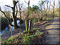
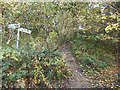
Public footpath signpost near Cheddar
by Malc McDonald geograph for square ST4555 A signpost indicating the route of a public footpath through woodland near... (more)
Tags:
near:CheddarX
Footpath SignX
Footpath SignpostX
Footpath Through Woods
type:GeographX
top:PathsX
Public FootpathX
Public Footpath SignX
Public Footpath SignpostX
subject:SignpostX
county:SomersetX
top:Woodland, ForestX
|
|
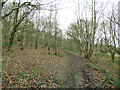
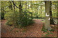
Track through Cottingley Wood
by Stephen Craven geograph for square SE1037 This path runs along the top of a steep slope to the right.
|
|
Path through the woods, Pasture Hills
by Stephen Craven geograph for square SE2634 The path from Redcote bridge where it leaves the canal side and heads up through... (more)
|
|
Frosty footpath in Maybury Wood
by Ian Calderwood geograph for square SK3116 A field path to Blackfordby which runs along the edge of Maybury Wood and past... (more)
Tags:
FootpathX
Footpath Through Woods
FrostX
Frosty PathX
type:GeographX
subject:PathX
top:PathsX
top:Woodland, ForestX
|
|
Coffee break at Rabbitbank Wood
by Robert Graham geograph for square NZ1148 Convenient spot for a little break on my walk. The footpath comes along the... (more)
|
|
Footpath through woods near Pinnell Bridge
by Stephen Craven geograph for square SE1224 This was once part of Sunny Vale Gardens, also known as Walterclough Valley or... (more)
|
|
Path in Bramley Fall Woods
by Stephen Craven geograph for square SE2436 One of the principal paths through the woods.
|
|
Path into woodland near Brighton
by Malc McDonald geograph for square TQ3209 A path passes through a gap in a wall, leading into woodland in the South Downs... (more)
Tags:
near:BrightonX
path:FootpathX
FootpathX
Footpath in WoodlandX
Footpath Through Woods
Gap in WallX
type:GeographX
subject:PathX
top:PathsX
Public FootpathX
area:South DownsX
national park:South DownsX
South DownsX
Sunlight and ShadowsX
Sunshine and ShadeX
footpath:WoodlandX
top:Woodland, ForestX
|

|
Footpath through the wood
by Stephen Craven geograph for square SJ9458 A short stretch of woodland on the western shore of Rudyard Lake.
|
|
Footpath north through Pakenham Wood
by John Myers geograph for square TL9367 |
|
Footpath through Daffy Wood below the railway
by Stephen Craven geograph for square SE2438 The railing guards a drop to a stream emerging from a culvert under the railway... (more)
|
|
Footpath to Scott Hall Road
by Stephen Craven geograph for square SE3035 This path up through the woodland above Scott Wood Lane probably once led to the... (more)
|
|
Path in Slindon Woods
by PAUL FARMER geograph for square SU9907 |
|
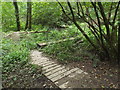
Footpath down to footbridge, Little Craig-y-borion Wood
by M J Roscoe geograph for square SN1608 Path from bridlepath down to footpath and wooden bridge SN1608 : Footbridge and steps at path junction.
Tags:
Footpath Through Woods
Footpath WaymarkerX
type:GeographX
National Trust LandX
top:PathsX
subject:WoodlandX
top:Woodland, ForestX
|
|
Footpath junction on Woodhouse Ridge
by Stephen Craven geograph for square SE2935 The path to the right is the public footpath that runs all the way along the top... (more)
|
|
Gill Banks, The Cumbria Way Alternative Route
by Adrian Taylor geograph for square SD2878 The Cumbria Way Alternative Route from Gill Banks to Old Hall Farm follows this... (more)
Tags:
CumbriaX
ldp:Cumbria WayX
long distance path:Cumbria WayX
Cumbria WayX
long distance footpath:Cumbria WayX
FootpathX
Footpath Through Woods
type:GeographX
Long Distance PathX
Long Distance Walking RouteX
subject:PathX
top:PathsX
Public FootpathX
top:Suburb, Urban FringeX
long distance path:The Cumbria WayX
The Cumbria Way Alternative RouteX
UlverstonX
place:UlverstonX
Walking RouteX
top:Woodland, ForestX
|
|
Footpath to Gamble Hill
by Stephen Craven geograph for square SE2433 A public footpath through a patch of woodland adjacent to the Stanningley Bypass.
|
|
Scott Wood Lane (4)
by Stephen Craven geograph for square SE2935 Once a vehicular route north from Leeds, this is now only a public footpath but... (more)
|
|
Path through Bostall Woods
by Stephen Craven geograph for square TQ4678 A broad path leading uphill through oak woodland from opposite Rochdale Road to... (more)
|
|
Path through Bostall Woods
by Stephen Craven geograph for square TQ4678 A broad path leading uphill through oak woodland from Wickham Lane to Bostall Hill.
|
|
Footpath to Tatton Park
by Stephen Craven geograph for square SJ7578 This footpath gives access to the park via Dog Wood on the east side of Tatton Mere.
|