|
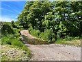
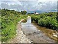
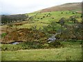
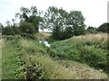
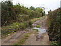
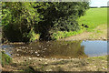
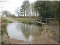
Panope Ford
by Adrian Taylor
geograph for square NY0501
The ford on Whitriggs Beck at Panope. The track is the public bridleway from... (more)
|
|
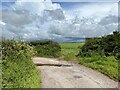
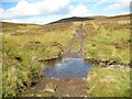
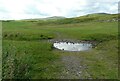
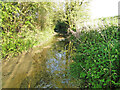
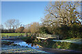
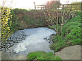
Ford near Stony How
by Adrian Taylor
geograph for square NY0500
In spite of rain clouds in the background, dry weather has reduced this small... (more)
|
|
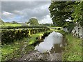
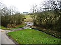
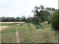
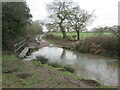
Ford near Burrow Hall
by Adrian Taylor
geograph for square SD6176
This ford is on a farm access track between Over Burrow and Leck Beck Barn... (more)
|
|
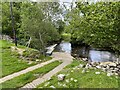
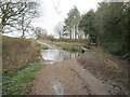
Ford near Tommy Bridge
by Adrian Taylor
geograph for square SD7286
Adjacent to the Dales Way, this concreted ford across the River Dee carries a... (more)
|
|
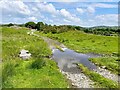
Burnt Moor Ford
by Adrian Taylor
geograph for square NY0500
This long paved ford at Burnt Moor is unusual insofar as Whitriggs Beck does not... (more)
|
|
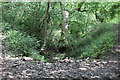
Dry ford on Nant Cwm-crach
by M J Roscoe
geograph for square ST1799
Looking downstream; the stream bed in Cwm Crach is dry. The edge of a track... (more)
|
|
Ford near Cow Pasture Wood
by Adrian Taylor
geograph for square SD3678
Crossing Hill Mill Brook, a tributary of the River Eea, this ford is on the... (more)
|
|
Whit Beck Ford
by Adrian Taylor
geograph for square NY2825
The track across the ford is the bridleway from Latrigg Car Park to Skiddaw... (more)
|
|
Farm track fording Great Rundale Beck
by Christine Johnstone
geograph for square NY6927
Below the western flanks of Brownber Hill.
|
|
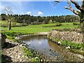
Ford on a farm track south of Southwaite Farm
by Christine Johnstone
geograph for square NY4425
Created by Southwaite Beck, a tributary of Dacre Beck.
|
|
Skiddaw Forest Ford
by Adrian Taylor
geograph for square NY2829
The private 'road' to Skiddaw House crosses the River Caldew by a... (more)
|
|
Ford on the Old River Slea, from the south
by Christine Johnstone
geograph for square TF0947
The track is a restricted byway. Walkers can divert right to a small footbridge.
|
|
Ford on the Old River Slea, from the north-west
by Christine Johnstone
geograph for square TF0947
The track is a restricted byway.
|
|
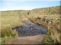
Ford on rough track
by Richard Sutcliffe
geograph for square NS7279
The track only goes about 100m before crossing another burn and then fizzling out.
|
|
Ford and footbridge on the Old River Slea
by Christine Johnstone
geograph for square TF0947
The footbridge is most welcome as the ford is about knee deep.
|

|
Ford on the Old River Slea, from the north-east
by Christine Johnstone
geograph for square TF0947
Seen from the footbridge. The ford goes across the front of the photo, carrying... (more)
|
|
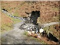
Charleton Wath
by Adrian Taylor
geograph for square NY2736
The old road from Longlands to Green Head crosses Charleton Gill at Charleton... (more)
|
|
Ford near High Cark Hall
by Adrian Taylor
geograph for square SD3782
Crossed by a public bridleway, a small stone clapper bridge is provided for pedestrians.
|
|
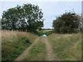
Ford on Rydon lane
by Anthony Vosper
geograph for square SX9986
This little stream criss crosses the nearby tracks and paths as it flows West... (more)
|
|
The River Deben and the longest ford in the country
by Adrian S Pye
geograph for square TM1663
The ford is tarred for its whole length, which is just over a half mile. Only an... (more)
|
|
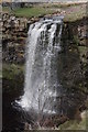
Hellgill Force from south bank of the river
by Roger Templeman
geograph for square SD7796
There is a ford for the track across the gill which can be seen beyond the top... (more)
|
|
Ford on Tawstock Stream
by Derek Harper
geograph for square SS5529
|
|
Ford at Stratfield Turgis
by Des Blenkinsopp
geograph for square SU6859
A bridge takes the public footpath across, while vehicles on the farm road have... (more)
|
|
Looking south at ford on Bealey's Lane
by Martin Dawes
geograph for square SE9945
|
|
Where a beck changes its name. Ford on Bealey's Lane
by Martin Dawes
geograph for square SE9945
Moor Beck comes in from the left and Bealey's Beck exits right
|
|
Ford and footbridge Bealey's Lane
by Martin Dawes
geograph for square SE9945
|

|
Ford at Court Farm, Longhope
by John Winder
geograph for square SO6819
There's a bridge just out of shot to the right which prevents pedestrians... (more)
|
|
Pollution in the River Deben
by Adrian S Pye
geograph for square TM1663
The river is only two miles long at this point and already it is polluted with... (more)
|