Public Tags
Tag: Forest·Clearing
Other tags: category:Forest Clearing
Showing latest 50 of 74 images tagged with Forest Clearing tag.

|
Forest break and clearing near Sròn An Aighe
by Stephen Crawshaw geograph for square NG3746 Taken from break in forestry, with large clearing directly to the north, just... (more)
Tags:
Bog
subject:Bog
Clearing
subject:Clearing
Clearing in the Woods
Cloud
weather:Cloud
Forest Break
Forest Clearing
Forestry
subject:Forestry
Forestry and Land Scotland
type:Geograph
Tufts of Grass
Woodland Clearing
top:Woodland, Forest
|

|
Forest clearing, Culstank Moss
by Craig Wallace geograph for square NJ0220 Most of Culstank Moss is now Scots pine forest. This clearing is largely rough... (more)
|

|
Forest clearing at Howlers Slade
by Philip Halling geograph for square SO5911 Forest clearing at Howlers Slade in the Forest of Dean.
|

|
Trees and frost, Boblainy Forest
by Craig Wallace geograph for square NH4836 A small clearing in Boblainy Forest, close to the Bruiach Burn. This area is... (more)
|

|
View over Loch Meiklie, from Glenurquhart Forest
by Craig Wallace geograph for square NH4328 A clearing in the forest gives good views across the glen, with Loch Meiklie... (more)
|

|
Forest road and clearing, Eigg
by Jim Barton geograph for square NM4786 A sizeable clearing has been made out of shot to the left, with a widened forest... (more)
Tags:
Coniferous Plantation
place:Eigg
Forest Clearing
type:Geograph
top:Paths
top:Roads, Road Transport
top:Woodland, Forest
|

|
Path through a forest clearing
by Bill Boaden geograph for square SK2467 The clearing is completely surrounded by forest, and although it is on the top... (more)
|

|
Clearing in Chopwell Woods
by Robert Graham geograph for square NZ1357 The forest is mostly conifers. However, the Forestry Commission are clear... (more)
|

|
Clearing, Elder Slack
by Mick Garratt geograph for square SE5875 |

|
Cleared area of Macclesfield Forest
by Stephen Craven geograph for square SJ9672 A large area of conifer plantation has been cleared.
|

|
Clearing in the plantation, Balnacarn
by Craig Wallace geograph for square NH2715 A wide clearing in this conifer plantation. The Allt Baile nan Carn joins with... (more)
|

|
Track, Boblainy Forest
by Craig Wallace geograph for square NH4737 The main track through the forest, from Ardendrain to Culburnie. Passing through... (more)
Tags:
place:Boblainy Forest
Dreich
Forest Clearing
Forest Track
type:Geograph
Gravel Track
top:Roads, Road Transport
top:Woodland, Forest
|

|
Deer Herd in the Forest, Pollie Hill, Sutherland
by Andrew Tryon geograph for square NC7517 A small herd of deer in a clearing within the plantation on Pollie Hill,... (more)
|

|
Cleared area of Old Wythes Wood
by Oliver Dixon geograph for square NY4233 The North Pennine escarpment can be dimly seen in the distance.
Tags:
subject:Clearing
Forest
Forest Clearing
type:Geograph
Plantation
Silver Birch
top:Woodland, Forest
|

|
A cleared area of Greystoke Forest
by Oliver Dixon geograph for square NY4134 Tags:
subject:Clearing
top:Farm, Fishery, Market Gardening
Field
Forest Clearing
type:Geograph
top:Heath, Scrub
Scrub
Trees
top:Woodland, Forest
|

|
A clearing in the forest, Longridge Fell
by Karl and Ali geograph for square SD6641 A clearing in the gloomy confines of the plantation which covers much of the... (more)
|

|
Forest clearing, by Coire Buidhe
by Craig Wallace geograph for square NH3124 A large clearing in this conifer plantation, on a rather grey day.
This area is... (more)
Tags:
Conifer Plantation
Forest Clearing
top:Grassland
top:Moorland
top:Rivers, Streams, Drainage
Stream
top:Woodland, Forest
|

|
Rocky clearing in the plantation, Balnacarn
by Craig Wallace geograph for square NH2615 Some rocks, heather and grass in this clearing in the forest. The surrounding... (more)
Tags:
Forest Clearing
Forestry Plantation
tree:Lodgepole Pine
top:Moorland
top:Rocks, Scree, Cliffs
top:Woodland, Forest
|

|
Clearing Sunshine Plain
by Roger Jones geograph for square TQ4298 The cut logs in the foreground are evidence of recent pro-active management to... (more)
Tags:
place:Epping Forest
county:Essex
Forest Clearing
place:High Beach
Logs
place:Sunshine Plain
top:Woodland, Forest
|

|
Clearing near Rushey Plain
by Roger Jones geograph for square TQ4198 An area where the trees have been thinned out in recent years.
|

|
Line of the Elan Valley Reservoir pipes
by Philip Halling geograph for square SO7477 I was curious as to the reason for this clearing creating a straight line... (more)
|

|
Clearing in the Forest of Dean
by Jeff Buck geograph for square SO6113 The Forest of Dean south of Upper Lydbrook.
Tags:
country:England
Forest
Forest Clearing
place:Forest of Dean
type:Geograph
county:Gloucestershire
top:Woodland, Forest
|

|
Upper Whitelea Green
by Philip Halling geograph for square SO6110 a forest clearing at Upper Whitelea Green in the Forest of Dean.
|

|
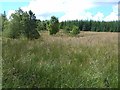
Deforested area revealing building remains
by Barry Hunter geograph for square SH6539 Category: Forest This area has recently had the evergreen forest cleared. A building previously... (more)
Tags:
Deforestation
Evergreen Forest
subject:Forest
Forest Clearing
Moelwyn Bach
Moelwyn Mawr
Trees
top:Woodland, Forest
|
|
Forest clearing at Dunn's Sike
by Oliver Dixon geograph for square NY7793 Some broadleaf trees provide relief from the endless conifers.
|

|
Forest Clearing, Spadeadam Forest
by Les Hull geograph for square NY6575 |

|
Clearing, Ashbury Plantations
by Derek Harper geograph for square SX5395 A view of the clearing also shown in SX5395 : Ashbury Plantations, from the lane north of the golf course.
|

|
Open area below forest track
by Andy Waddington geograph for square NN2233 Category: Forest clearing |

|
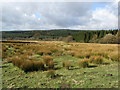
Summit, Creag an t-Seilich
by Craig Wallace geograph for square NH5134 This rocky outcrop is within a clearing in the forest. Good views over the... (more)
Tags:
Forest Clearing
type:Geograph
plant:Heather
top:Moorland
Rocky Outcrop
View
top:Woodland, Forest
|
|
A View over Gisburn Forest
by Chris Heaton geograph for square SD7557 Looking west from over the clearing around Hesbert Hall
|
|
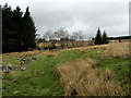
Clearing in Gisburn Forest
by Chris Heaton geograph for square SD7557 Part of Hesbert Hall's pastures, with evidence of re-planting of conifers... (more)
|

|
Clearing, Rumster Forest, Caithness
by Claire Pegrum geograph for square ND2240 |

|
Forest clearing (Mar'2012)
by Stanley Howe geograph for square NO5998 |
|
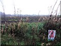
Glenone Forest
by Kenneth Allen geograph for square C9702 Looking west; this area has been cleared.
Tags:
Forest Clearing
top:Woodland, Forest
|

|
Clearing in the forest
by Bill Harrison geograph for square NO1913 |

|
Track, Auchmore Wood
by Craig Wallace geograph for square NH4850 A power line heading down the hill, through a wide clearing.
Tags:
power line:Beauly - Mossford
Electricity Pylon
top:Energy Infrastructure
Forest Clearing
Forest Track
type:Geograph
Power Line
top:Roads, Road Transport
top:Woodland, Forest
|

|
The road to Johnby
by Oliver Dixon geograph for square NY4134 A cleared area of Greystoke Forest to the right.
Tags:
Country Road
Forest Clearing
type:Geograph
subject:Road
top:Roads, Road Transport
Woodland
top:Woodland, Forest
|

|
Stone wall, by the Allt Iarairidh
by Craig Wallace geograph for square NH3416 The remains of a stone wall in a forest clearing, next to the Allt Iarairidh.... (more)
|

|
Forest clearing at Bamff
by M J Richardson geograph for square NO2251 Timber management on the Bamff Estate.
Tags:
place:Bamff
top:Country Estates
Forest Clearing
top:Lowlands
place:Perth and Kinross
top:Woodland, Forest
|

|
Plantation on Scobchester Down
by Derek Harper geograph for square SX5196 A clearing by the road in what is mapped as Halwill Forest, which I suppose is a... (more)
|

|
Forestry Break near Loch Craggie, Sutherland
by Andrew Tryon geograph for square NC6307 Eye catching golden light in a forestry break to the north of Loch Craggie, near... (more)
Tags:
Autumn
subject:Clearing
Forest Clearing
type:Geograph
Long Grass
place:Scotland
place:Scottish Highlands
place:Sutherland
Upland Forest
top:Uplands
top:Woodland, Forest
|

|
Clearing in Laund Pasture Plantation
by Stephen Craven geograph for square SE0757 Part of the Bolton Abbey estate.
|

|
Clearing in Raincliffe Woods
by Ian S geograph for square SE9987 |
|
Hesbert Hall
by Chris Heaton geograph for square SD7557 Small farm located in a large clearing that is completely surrounded by Gisburn Forest.
|

|
Clearing in Stone Ivens Plantation
by Karl and Ali geograph for square SD3693 On the rough and wet descent from Black Brows there is a view just above the... (more)
|

|
Power line, by Fasnakyle
by Craig Wallace geograph for square NH3229 Tall pylons passing through a wide clearing. This is a spur off the Beauly-Denny... (more)
Tags:
Beauly-Denny Power Line
Electricity Pylon
top:Energy Infrastructure
Forest Clearing
type:Geograph
top:Grassland
Power Line
top:Woodland, Forest
|

|
Plantation clearing
by M J Richardson geograph for square NS9959 Part of the forestry near Baad's Mill
Tags:
Baads Mill
Conifer Plantation
Forest Clearing
subject:Forestry
top:Grassland
top:Uplands
place:West Lothian
top:Woodland, Forest
|

|
Forestry track, Glen Banvie Wood
by jeff collins geograph for square NN8267 This small clearing in the wood was full of various butterflies as well as... (more)
|

|
Sunshine Plain (Southern)
by Roger Jones geograph for square TQ4299 The cut logs in the background are evidence of recent pro-active management to... (more)
Tags:
Beech
place:Epping Forest
county:Essex
Forest Clearing
top:Heath, Scrub
place:Sunshine Plain
Trees
top:Woodland, Forest
|

|
Picnic area in the Forest of Dean
by Jeff Buck geograph for square SO6113 Picnic area in the Forest of Dean south of Upper Lydbrook.
Tags:
country:England
Forest
Forest Clearing
place:Forest of Dean
type:Geograph
county:Gloucestershire
Picnic Area
top:Woodland, Forest
|
