Public Tags
Tag: Forest·Edge
Other tags: category:Forest Edge
Showing latest 50 of 139 images tagged with Forest Edge tag.

|
Path along Newborough forest edge
by Andy Waddington geograph for square SH3965 Category: Footpath As well as a winding track within the forest, the map shows a track out on the... (more)
Tags:
top:Coastal
top:Estuary, Marine
category:Footpath
category:Forest Edge
type:Geograph
top:Lakes, Wetland, Bog
top:Paths
top:Woodland, Forest
|

|
Newborough forest gives way to saltmarsh
by Andy Waddington geograph for square SH4167 Category: Forest edge Newborough forest is a mix of planted and naturally regenerated forest on a... (more)
Tags:
top:Coastal
top:Estuary, Marine
category:Forest Edge
type:Geograph
top:Lakes, Wetland, Bog
top:Woodland, Forest
|

|
Track alongside Ferndown Forest
by Malc McDonald geograph for square SU0501 A track along the edge of Ferndown Forest in Dorset. Not visible in this image... (more)
Tags:
county:Dorset
Edge of Forestry
near:Ferndown
Forest Edge
Forest Edge Track
type:Geograph
top:Paths
subject:Track
near:Wimborne
|

|
Forest edge, by Blue Bonnet Hill
by Craig Wallace geograph for square NH5038 The hillside to the left has been felled over the last few years. To the right,... (more)
Tags:
tree:Birch
place:Boblainy Forest
Cleared Forest
Conifer Plantation
Forest Edge
Forest Path
type:Geograph
tree:Larch
top:Paths
Summer Solstice
top:Woodland, Forest
|

|
Forest edge, by the Fannich road
by Craig Wallace geograph for square NH2964 At the edge of the forest, a few pine trees beside the road to Loch Fannich.
Tags:
Coniferous Forest
top:Country Estates
Forest Edge
type:Geograph
top:Moorland
Private Road
top:Roads, Road Transport
tree:Scots Pine
top:Woodland, Forest
|

|
Upper edge of Thornielee Forest
by Jim Barton geograph for square NT4037 The upper edge of the forest at about 390m. The Cairns Trail path follows the... (more)
Tags:
Coniferous Plantation
Drystane Dyke
Drystone Wall
Forest Edge
Forest Path
type:Geograph
top:Moorland
top:Paths
Thin Snow Cover
top:Woodland, Forest
|

|
The edge of the Wyre Forest and Pound Green Airfield, near Pound Green
by P L Chadwick geograph for square SO7678 The hedge marks the edge of the Wyre Forest. Beyond it is part of Pound Green... (more)
|

|
Forest edge, White Law
by Jim Barton geograph for square NT2644 A steep slope down towards the Soonhope Burn at the edge of Heathpool Forest.
|

|
Forest edge on Middle Hill
by Jim Barton geograph for square NT2645 The edge of Heathpool Forest on the ridge between the hillsides above Eddleston... (more)
Tags:
Coniferous Plantation
Forest Edge
type:Geograph
Grass and Heather Moorland
top:Moorland
top:Uplands
top:Woodland, Forest
|

|
Forest edge, White Law
by Jim Barton geograph for square NT2644 The western edge of Heathpool Forest seen from Middle Hill.
|

|
Edge of Hallmanor Forest on Breach Law
by Jim Barton geograph for square NT1833 The forest edge reaches an altitude of almost 600m on its southern tip, and is... (more)
|

|
Forest edge from Deuchar Law
by Jim Barton geograph for square NT2729 The edge of a mature spruce forest crossing the valley to Whiteknowe Head.
Tags:
Coniferous Plantation
Forest Edge
type:Geograph
Heather and Grass Moorland
top:Moorland
Post and Wire Fence
top:Uplands
top:Woodland, Forest
|

|
Forest edge below Dunslair Heights
by Jim Barton geograph for square NT2942 Following the edge of Glentress Forest; note the communications mast on the summit.
Tags:
Communications Mast
Forest Edge
Forestry Plantation
type:Geograph
Grass and Heather Moorland
top:Moorland
top:Uplands
top:Woodland, Forest
|

|
Forest edge
by James Allan geograph for square NO3506 The edge of Edensmuir Forest on Clatto Hill.
|

|
Forest edge, Blairmore
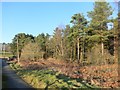
by Craig Wallace geograph for square NH5033 A fence runs along the edge of the conifer plantation. The area outside is... (more)
|
|
Edge of the Forest
by Des Blenkinsopp geograph for square SO6419 Pretty much the last fling of the Forest of Dean in this direction. Still a lot... (more)
Tags:
Forest Edge
top:Woodland, Forest
|

|
The edge of Hospital Plantation
by Graham Robson geograph for square NY2123 Looking across the open fell towards the edge of Hospital Plantation, part of... (more)
|

|
Forest path, Falla Brae
by Jim Barton geograph for square NT2840 The path skirts the edge of the forest above fields at Eshiels.
Tags:
top:Farm, Fishery, Market Gardening
Farmland
Forest Edge
Forest Path
type:Geograph
Glentress Forest
top:Paths
top:Woodland, Forest
|

|
Stile on the edge of Delamere Forest
by Stephen Craven geograph for square SJ5472 |

|
Edge of forestry, Stroupster, Caithness
by Claire Pegrum geograph for square ND3468 Looking towards Stroupster Wind Farm.
Most of the forest was cleared to make... (more)
Tags:
top:Boundary, Barrier
Edge of Forestry
top:Energy Infrastructure
subject:Fence
Forest Edge
type:Geograph
Wind Farm
Wind Turbine
top:Woodland, Forest
|

|
Edge of Craig Douglas Forest
by Jim Barton geograph for square NT2927 The eastern edge of extensive plantations around the gathering grounds of the... (more)
Tags:
Cotton Grass
Forest Edge
type:Geograph
Grass Tussocks
Grassy Moorland
top:Moorland
top:Uplands
top:Woodland, Forest
|

|
Forest edge, Naver Forest, Sutherland
by Claire Pegrum geograph for square NC6741 Tags:
top:Boundary, Barrier
top:Farm, Fishery, Market Gardening
subject:Forest
Forest Boundary
Forest Edge
top:Uplands
top:Woodland, Forest
|

|
Forest edge, Falla Brae
by Jim Barton geograph for square NT2840 The boundary of Glentress Forest on the ridge descending to the visitor centre... (more)
|

|
The edge of the forest
by Ann Cook geograph for square NX8555 This is leaving the forest and heading back towards the A710.
|

|
Fence, Boblainy Forest
by Craig Wallace geograph for square NH4639 A deer fence heading up the forest edge. The slope is covered with orange bracken.
Tags:
place:Boblainy Forest
top:Boundary, Barrier
plant:Bracken
Deer Fence
Forest Edge
type:Geograph
top:Moorland
top:Woodland, Forest
|

|
Autumnal tree, Yair Hill Forest
by Jim Barton geograph for square NT4332 A tree standing out at the edge of the forest seen from Yair Hope.
|

|
Into the sun, Thornielee Forest
by Jim Barton geograph for square NT4037 Following the Cairns Trail by the forest edge on a bright morning.
Tags:
Drystane Dyke
Drystone Wall
Forest Edge
Forest Path
type:Geograph
Hill Pasture
top:Paths
Walker
Waymark Post
top:Woodland, Forest
|

|
Walkers in Thornielee Forest
by Jim Barton geograph for square NT4037 On the Cairns Trail following the forest edge.
Tags:
Drystane Dyke
Drystone Wall
Forest Edge
Forest Path
type:Geograph
top:Paths
Thin Snow Cover
top:Uplands
Walkers
top:Woodland, Forest
|

|
Looking along Forest edge
by David Pashley geograph for square TL8096 Tags:
top:Flat Landscapes
subject:Forest
Forest Edge
type:Geograph
Thetford Forest
top:Woodland, Forest
|
|
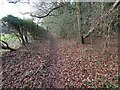
Path along edge of forest
by David Pashley geograph for square TL9392 Well worn path as it is near caravan site.
Tags:
top:Farm, Fishery, Market Gardening
top:Flat Landscapes
Forest Edge
Forest Path
type:Geograph
subject:Path
top:Paths
Thetford Forest
top:Woodland, Forest
|

|
By the southern edge of Crychan Forest
by Andrew Hill geograph for square SN8236 A scrubby bank below the forest track gives way to pastoral fields and scattered... (more)
Tags:
Countryside View
place:Crychan Forest
Fields
Forest Edge
subject:Forestry
type:Geograph
Pasture
top:Woodland, Forest
|

|
Forest edge on steep slopes of Gornoeth
by Andrew Hill geograph for square SN9457 The top of the short path steeply connecting a forest ride with the main... (more)
Tags:
Bwlchiliau
top:Farm, Fishery, Market Gardening
Footpath
Forest Edge
type:Geograph
Gornoeth
Grazing Land
Hillside
subject:Path
Trees
top:Woodland, Forest
|

|
Forest edge above Soonhope
by Jim Barton geograph for square NT2640 The wavy boundary of Glentress Forest on Janet's Brae after snow showers... (more)
|

|
Forest edge to Whiteknowe Head
by Jim Barton geograph for square NT2729 This forest is less than 35 years old - it does not appear on the Harvey Map... (more)
|

|
Deer fence at the forest edge
by Richard Dorrell geograph for square NG6611 I am never quite sure whether deer fences round forests are meant to keep the... (more)
Tags:
top:Boundary, Barrier
place:Braigh an Uird Forest
Deer Fence
Forest Edge
place:Isle of Skye
top:Woodland, Forest
|

|
Forest edge north-west of Soar-y-Mynydd, Ceredigion
by Roger D Kidd geograph for square SN7653 This is a detached area of the Tywi Forest. In late winter, the bleached straw... (more)
Tags:
Coniferous Forest
Elenydd
Forest Edge
top:Grassland
Moorland Landscape
top:Uplands
top:Woodland, Forest
|

|
Forest edge north-west of Soar-y-Mynydd, Ceredigion
by Roger D Kidd geograph for square SN7653 This is a detached area of the Tywi Forest. In late winter, the bleached straw... (more)
|

|
Traquair path below Cadon Bank
by Jim Barton geograph for square NT3335 The path follows the lower edge of the woodland around Taniel Hill to meet the... (more)
Tags:
top:Farm, Fishery, Market Gardening
Field Edge
Forest Edge
type:Geograph
top:Paths
Surfaced Path
top:Woodland, Forest
|

|
Edge of Cademuir Forest, Peebles
by Jim Barton geograph for square NT2438 A view of the town and Glentress Forest on the skyline.
Tags:
Forest Edge
type:Geograph
top:Moorland
top:Paths
place:Peebles
Thinly Lying Snow
top:Woodland, Forest
|

|
Fence and wall, Whiteside Edge
by Jim Barton geograph for square NT2645 The boundary of Heathpool Forest, a plantation contiguous with Glentress Forest... (more)
|

|
Forest edge, by the Fannich road
by Craig Wallace geograph for square NH2963 Some pine and birch trees alongside the road to Loch Fannich.
Tags:
Coniferous Forest
Forest Edge
type:Geograph
top:Moorland
Private Road
top:Roads, Road Transport
top:Woodland, Forest
|

|
Edge of Forest
by David Pashley geograph for square TL8287 |

|
Forest edge
by Jim Barton geograph for square NT3734 Rough grazing in Glen Mead north of Elibank and Traquair Forest.
Tags:
top:Farm, Fishery, Market Gardening
Forest Edge
type:Geograph
Grassy Moorland with Rushes
Hill Sheep
top:Moorland
top:Woodland, Forest
|

|
Forest edge
by David Pashley geograph for square TL8195 Tags:
top:Farm, Fishery, Market Gardening
subject:Forest
Forest Edge
type:Geograph
top:Lowlands
top:Woodland, Forest
|

|
Looking along forest edge
by David Pashley geograph for square TL7792 |

|
Forest edge
by David Pashley for square TL7893 Tags:
Breckland Norfolk
type:Cross Grid
subject:Forest
Forest Edge
top:Heath, Scrub
top:Lowlands
top:Woodland, Forest
|
|
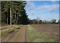
Edge of forest view
by David Pashley geograph for square TL7995 Tags:
Breckland Norfolk
top:Farm, Fishery, Market Gardening
Forest Edge
type:Geograph
top:Lowlands
top:Roads, Road Transport
Thetford Forest
subject:Track
top:Village, Rural Settlement
top:Woodland, Forest
|

|
The edge of the forest
by David Pashley geograph for square TL8097 Beyond the hedge is arable land.
|

|
Forest edge, Bier Law
by Jim Barton geograph for square NT3736 Elibank and Traquair Forest bordering a block of hill pasture on the north side... (more)
Tags:
Coniferous Plantation
Drystane Dyke
Drystone Wall
Forest Edge
type:Geograph
Hill Pasture
top:Uplands
top:Woodland, Forest
|

|
Open hill and forest edge above the Elan valley
by Andrew Hill geograph for square SN9063 Just below Cefn Llanerchi above Llanerchi Wood.
Tags:
top:Barren Plateaux
Elan Valley Area
subject:Forest
Forest Edge
type:Geograph
Snow
top:Uplands
top:Woodland, Forest
|
