
|
Forest activities at High Lodge
by Bill Boaden
geograph for square TL8185
The Forestry Commission runs a site with numerous forest activities such as zip... (more)
|
|
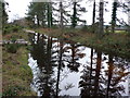
Flooded Forestry Track
by Nigel Mykura
geograph for square SY8792
This flooded track through the woods was only passable by clambering from one... (more)
|
|
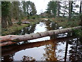
Flooded Forestry Track
by Nigel Mykura
geograph for square SY8792
The track was flooded to a depth of one foot and the fallen tree made this part... (more)
|
|
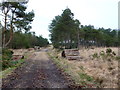
Forestry Track Philliols Heath
by Nigel Mykura
geograph for square SY8792
Much of this heath is criss-crossed with forestry tracks lined with stacks of... (more)
|
|
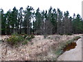
Forestry on Philliols Heath
by Nigel Mykura
geograph for square SY8692
The heath in this area has a patchwork of open heathland alternating with wooded... (more)
|
|
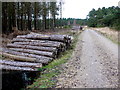
Forestry Track on Philliols Heath
by Nigel Mykura
geograph for square SY8691
This track runs north from Bere Lodge into the heath. The logs seemed to have... (more)
|

|
Forestry work in Tiddesley Wood
by Philip Halling
geograph for square SO9245
Evidence of forestry work in Tiddesley Wood.
|

|
The track into Corriedoo Forest
by Ann Cook
geograph for square NX6883
Forestry work is ongoing in this forest.
|

|
Clear felled area of Thetford Forest
by David Pashley
geograph for square TL7997
Quadrilateral Covert Thetford Forest. Clear felled on approximately 60-70 year cycle.
|

|
Forestry work taking place
by Philip Halling
geograph for square SO1525
Tree felling was taking place here above the cottage of Cwm-Shenkin on the... (more)
|

|
Forestry logging
by Philip Halling
geograph for square SO1425
Tree trunks being transported down a very step hillside on the western slopes of... (more)
|

|
Forestry work in Penyard Park
by Philip Halling
geograph for square SO6123
Forestry work on the northern wooded slopes of Penyard Park.
|

|
forestry by horse
by Stephen Craven
geograph for square SD9771
Category: Forestry
Logs being removed from Crookacre Wood in the traditional manner by horse. The... (more)
|

|
Track between Birkenside and Morriston
by M J Richardson
geograph for square NT5741
With the remains of forestry operations - two of several large dumps of bits of... (more)
|

|
Path into the woodlands, with warning of forestry work ahead
by David Smith
geograph for square SX6259
|

|
Clearing up after last gale
by David Pashley
geograph for square TL7997
|

|
Forestry thinning operation
by David Pashley
for square TL8899
|

|
Forest harvest in Sunart
by M J Richardson
geograph for square NM7660
Timber waiting to be removed from Forestry Commission plantations at Camuschoirk.
|

|
Forestry Operations
by Tom Richardson
geograph for square NT0515
|

|
Forestry operations, The Wilderness
by N Chadwick
geograph for square TQ8430
|

|
Excavations in Brechfa Forest below Rhosddu, Rhydargaeau Road, Carmarthen
by David Jones
geograph for square SN4627
|

|
Forestry operations next to road south of Ystradfellte
by David Gearing
geograph for square SN9110
|

|
Forestry Yard by Quarry Moor Brake
by David Smith
geograph for square SS4204
|

|
Forestry work in Cock Wood
by Julian P Guffogg
geograph for square TQ8823
|

|
Logging on the Malvern Hills
by Philip Halling
for square SO7537
Stacks of timber on the Eastnor Castle estate on the edge of the Malvern Hills.
|

|
Track between Birkenside and Morriston
by M J Richardson
geograph for square NT5741
With the remains of forestry operations - one of several large dumps of bits of... (more)
|

|
Path to Elba, and Edin's Hall Broch
by M J Richardson
geograph for square NT7860
With the results of some timber felling activity. The Historic Scotland sign... (more)
|

|
Timber loading along forest road
by Trevor Littlewood
geograph for square SE5291
A small-scale forestry operation in woodland to the east of Arden Great Moor.
|

|
Recently cultivation between Conifer blocks
by David Pashley
for square TL7892
|

|
Freshly cut timber by the track, Grizedale Forest
by Karl and Ali
geograph for square SD3295
Harvesting operations are underway along this bridleway which descends towards... (more)
|

|
Logs ready for collection
by Hugh Venables
geograph for square TL7791
Two large piles of logs on Mount Ephraim, Thetford Forest.
|

|
Wood chippings, Haysden Country Park
by N Chadwick
geograph for square TQ5746
|

|
Timber stacks, Soonhope
by Jim Barton
geograph for square NT2641
Logging is in progress in the plantations here; the timber stacks are on the... (more)
|

|
Where's the path?
by Jim Barton
geograph for square NT2641
A slight obstacle across the path from Soonhope Burn below Glenbield, where a... (more)
|

|
Machine tracks, Soonhope
by Jim Barton
geograph for square NT2641
Muddy tracks left by a forest harvester in the plantation east of the Soonhope... (more)
|

|
Can you smell it?
by James Allan
geograph for square NO2903
An outdoor plank sawing station in Lochmuir Wood.
|

|
Clearcut forest on Old Intake
by Karl and Ali
geograph for square SD3698
|

|
Clearcut forest on Highs Moss, Claife Heights
by Karl and Ali
geograph for square SD3798
The footpath across this lot was a mess of timber brashings, roots and mud. The... (more)
|

|
Harvested timber, High Pate Crag
by Karl and Ali
geograph for square SD3897
|
