|
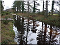
Flooded Forestry Track
by Nigel Mykura
geograph for square SY8792
The track was flooded to a depth of one foot and the fallen tree made this part... (more)
|
|
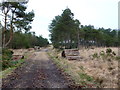
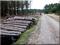
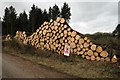
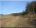
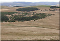
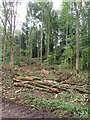
Forestry Track Philliols Heath
by Nigel Mykura
geograph for square SY8792
Much of this heath is criss-crossed with forestry tracks lined with stacks of... (more)
|
|
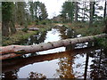
Flooded Forestry Track
by Nigel Mykura
geograph for square SY8792
This flooded track through the woods was only passable by clambering from one... (more)
|
|
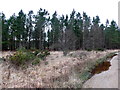
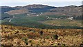
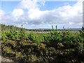
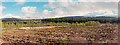
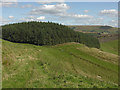
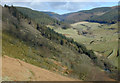
Forestry on Philliols Heath
by Nigel Mykura
geograph for square SY8692
The heath in this area has a patchwork of open heathland alternating with wooded... (more)
|
|
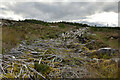
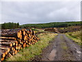
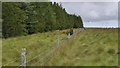
Forestry Track on Philliols Heath
by Nigel Mykura
geograph for square SY8691
This track runs north from Bere Lodge into the heath. The logs seemed to have... (more)
|
|
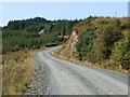
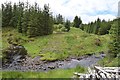
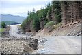
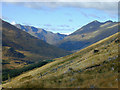
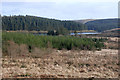
West Loch Awe Timber Haul Route
by Patrick Mackie
geograph for square NM9211
|
|
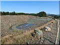
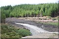
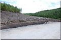
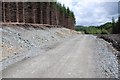
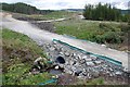
Borrow Pit for the West Loch Awe Timber Haul Route
by Patrick Mackie
geograph for square NM9311
|
|
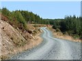
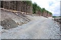
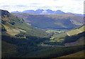
West Loch Awe Timber Haul Route
by Patrick Mackie
geograph for square NM9312
|
|
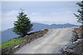
West Loch Awe Timber Haul Route
by Patrick Mackie
geograph for square NM9412
|
|
West Loch Awe Timber Haul Route
by Patrick Mackie
geograph for square NM9412
|
|
West Loch Awe Timber Haul Route
by Patrick Mackie
geograph for square NM9412
Looking east.
|
|
Roads in Inverliever Forest
by Patrick Mackie
for square NM8907
The road running across the image is the West Loch Awe Timber Haul Route.
|
|
Abhainn Fionain
by Patrick Mackie
geograph for square NM9518
A view from the West Loch Awe Timber Haul Route.
|
|
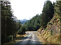
West Loch Awe Timber Haul Route
by Patrick Mackie
for square NM8706
In Inverliever Forest.
|
|
West Loch Awe Timber Haul Route
by Patrick Mackie
geograph for square NM8806
In Inverliever Forest.
|
|
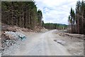
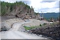
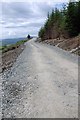
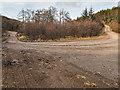
West Loch Awe Timber Haul Route under construction
by Patrick Mackie
geograph for square NM8806
In Inverliever Forest.
|
|
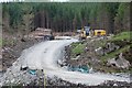
West Loch Awe Timber Haul Route under construction
by Patrick Mackie
geograph for square NM8806
In Inverliever Forest. Logs from felled trees will be hauled out once the road opens.
|
|
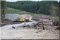
West Loch Awe Timber Haul Route under construction
by Patrick Mackie
for square NM8806
In Inverliever Forest.
|
|
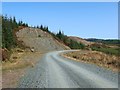
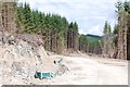
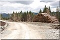
West Loch Awe Timber Haul Route
by Patrick Mackie
geograph for square NM8706
The depth of the peat is visible on the edge of the new road.
|
|
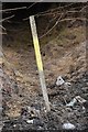
Chain marker 4000m
by Patrick Mackie
for square NM8706
Marking 4000m of the West Loch Awe Timber Haul Route from its southern end at Salachry.
|
|
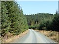
West Loch Awe Timber Haul Route
by Patrick Mackie
geograph for square NM8706
Looking out of Inverliever Forest.
|
|
West Loch Awe Timber Haul Route
by Patrick Mackie
geograph for square NM8706
In Inverliever Forest.
|
|
West Loch Awe Timber Haul Route
by Patrick Mackie
geograph for square NM8706
In Inverliever Forest.
|
|
West Loch Awe Timber Haul Route
by Patrick Mackie
geograph for square NM8705
I expected this tree to be lost, but the new road just skirts it.
|
|
West Loch Awe Timber Haul Route
by Patrick Mackie
geograph for square NM8705
Looking out of Inverliever Forest.
|
|
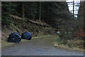
Culvert on West Loch Awe Timber Haul Route
by Patrick Mackie
geograph for square NM8807
|
|
Welfare unit for timber haul road construction
by Patrick Mackie
geograph for square NM8807
|
|
Stopped at the services
by Patrick Mackie
geograph for square NM8806
The yellow cabin is a welfare unit including toilet accommodation.
|
|
Cleared Forestry in Inveroykel Wood, Ross-shire
by Andrew Tryon
geograph for square NH4896
Lines of brash and debris from a forestry clearance operation at Inveroykel... (more)
|
|
Forestry work
by Philip Halling
geograph for square SW8952
Forestry work on Forestry land near Trendeal to the north-west of New Mills.
|
|
In Thrunton Wood
by Russel Wills
geograph for square NU0609
Looking across young conifers over clear fell to mature timber ready for harvesting.
|
|
Forestry track and log piles (2), Kilsyth Hills
by Alan O'Dowd
geograph for square NS7382
Clear-felling of commercial forestry plantations of non-native conifer trees is... (more)
|
|
Forestry clear fell on Meall a' Charra
by Nigel Brown
geograph for square NH0412
Category: Forestry clear fell
Taken from the old stalkers' path which zigzags up the slope from the... (more)
|
|
Track in Penhydd forestry area
by eswales
geograph for square SS8093
Category: Forestry track
A photograph taken at a spot by the very short stretch of forestry track in the... (more)
|
|
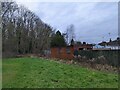
The forestry compound
by Bob Harvey
geograph for square TF0820
The forestry compound is bounded on three sides by a woodland drain.
|
|
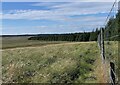
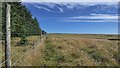
Edge of forestry below Hill of Oliclett, Caithness
by Claire Pegrum
geograph for square ND2846
The fence marks the boundary of the land managed by Forestry and Land Scotland... (more)
|
|
Edge of forestry below Hill of Oliclett, Caithness
by Claire Pegrum
geograph for square ND2846
The fence marks the boundary of the land managed by Forestry and Land Scotland... (more)
|
|
Edge of forestry near Camster, Caithness
by Claire Pegrum
geograph for square ND2345
The fence marks the boundary of the land managed by Forestry and Land Scotland... (more)
|
|
Commercial Forestry
by valenta
geograph for square NH7035
Viewed from the Forestry Commission Littlemill Esker and Kettle Hole trail, this... (more)
|
|
Forestry Infrastructure
by valenta
geograph for square NH4836
My OS maps show the track on the left as a ford over the Bruiach Burn, but there... (more)
|
|
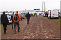
A wet day at APF 2014
by Michael Trolove
geograph for square SP0757
With September forecast to be one of the driest on record I chose to visit the... (more)
|
|
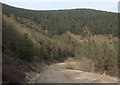
Forestry road above Blaengarw
by eswales
geograph for square SS8993
Category: Forestry road
A forestry road seen approaching a bend at the base of a wooded cliff on the... (more)
|
|
Forestry entrance
by Nigel Brown
geograph for square SN9569
Category: Forestry
The notice on the gate proclaims that this is private forestry.
|
|
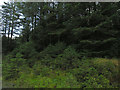
Forestry on Bryn Deilos
by Nigel Brown
geograph for square SN7256
Category: Forestry
Planted forestry behind, naturally seeded trees bounding the forest road in the... (more)
|
|
Forestry on Lan Lwyd
by Nigel Brown
geograph for square SN7675
Category: Forestry
Part of the moderate amount of forestry which lies to the south of the... (more)
|
|
Forestry on Esgair Ddu
by Nigel Brown
geograph for square SN7669
Category: Forestry
Away from the crest, the shallow slopes of Esgair Ddu are marshy, and here have... (more)
|
|
Forestry around Llyn Blaenmelindwr
by Nigel Brown
geograph for square SN7183
Category: Forestry
Fairly recent planting close by, with mature forestry in the distance.
|
|
Forestry in Gleann na Squaib
by Nigel Brown
geograph for square NH2185
Category: Forestry
Looking down from the stalkers' path climbing Druim na Saobhaidhe. Judging... (more)
|
|
Forestry above the Afon Mynach
by Nigel Brown
geograph for square SN7577
Category: Forestry
This is the first bit of forestry encountered on this bank of the Mynach; at the... (more)
|
|
Forestry thinning, Fire Wood
by David Hawgood
geograph for square SU7291
Signs warn of forestry thinning operations in Fire Wood and Queen Wood, this... (more)
|