
|
Former Roman road near Tolpuddle, Dorset
by Malc McDonald
geograph for square SY8195
This section of a minor lane in Dorset is on the route of a former Roman road.
|

|
Former Roman road, Witchampton, near Wimborne Minster
by Malc McDonald
geograph for square ST9706
A minor lane in Dorset countryside, near the town of Wimborne Minster. The lane... (more)
|
|
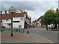
Buntingford Market Place and High Street
by Malc McDonald
geograph for square TL3629
This image was taken at the north end of Buntingford's Market Place,... (more)
|
|
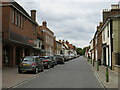
Buntingford High Street
by Malc McDonald
geograph for square TL3629
The high street in Buntingford, a market town in north Hertfordshire. This road... (more)
|
|
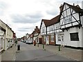
Buntingford High Street
by Malc McDonald
geograph for square TL3629
The high street in Buntingford, a market town in north Hertfordshire. This road... (more)
|
|
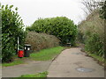
Roman Road, Broadstone
by Malc McDonald
geograph for square SY9995
This path follows the route of an old Roman Road along the boundary of... (more)
|
|
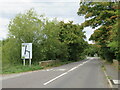
Roman Road, Broadstone
by Malc McDonald
geograph for square SY9996
This path, on the edge of Broadstone, follows the route of a Roman road. The... (more)
|
|
Ermine Street, near Buntingford
by Malc McDonald
geograph for square TL3531
This section of Ermine Street, which follows the route of a Roman Road, used to... (more)
|

|
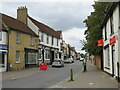
Road junction near Wimborne Minster
by Malc McDonald
geograph for square ST9706
A crossroads in Dorset countryside, near the town of Wimborne Minster. A... (more)
|
|
Buntingford High Street
by Malc McDonald
geograph for square TL3629
The high street in Buntingford, a market town in north Hertfordshire. This road... (more)
|

|
Field, line of former Roman Road
by TCExplorer
geograph for square SJ5406
Bit of history required for this one. Watling Street, a former Roman Road, once... (more)
|

|
The B4090 road through Feckenham, Worcs
by P L Chadwick
geograph for square SP0061
The road follows what used to be the ancient saltway track between Alcester and... (more)
|

|
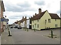
Old field oak by the former line of Watling Street
by TCExplorer
for square SJ5304
You wouldn't know it otherwise, but this old oak stands slightly to the... (more)
|
|
Buntingford High Street
by Malc McDonald
geograph for square TL3629
The road in the foreground, as far as the side turning on the right, is Ermine... (more)
|

|
A litter of stones
by Bob Harvey
geograph for square TF0527
There are not many broken stones like this in these fields of heavy clay. But... (more)
|

|
Buckle or Icknield Street
by Christine Johnstone
geograph for square SP1049
Looking south along the former Roman road.
|

|
Public footpath and former course of Watling Street Roman Road
by TCExplorer
geograph for square SJ6010
|

|
Former course of Watling Street
by TCExplorer
geograph for square SJ6010
You would barely know it, but this is marked as the line of the old Roman Road,... (more)
|

|
Rudgate
by Bill Boaden
geograph for square SE4643
A former Roman road heading roughly in the direction of Boston Spa. The crash... (more)
|

|
Roman Road
by Keith Evans
geograph for square TM2876
Modern road following the course of a Roman Road near to Little Whittingham... (more)
|
|
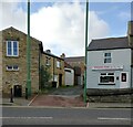
Old houses on New Watling Street
by Robert Graham
geograph for square NZ1251
This street runs north from the crossroads in the centre of the village of... (more)
|

|
View down the B6309
by Robert Graham
geograph for square NZ0657
Looking west from just east of Kipperlynn. This is the old Roman road of Dere... (more)
|

|
Stopping the Romans
by Neil Owen
geograph for square ST5658
This inauspicious road is Stratford Lane; it was originally a Roman road, albeit... (more)
|

|
Stratford Lane
by Neil Owen
geograph for square ST5658
Looking southwest along what was a minor Roman road, but is now a narrow country... (more)
|

|
Entrance to Clay Hall Farm, Buckle Street
by Christine Johnstone
geograph for square SP1049
Looking north on the Roman Road, Icknield Street.
|

|
Looking down Corbridge Road
by Robert Graham
geograph for square NZ1153
This is the B6309 running down the hill to Ebchester. Medomsley Cross Roads is... (more)
|

|
Road junction on the B6309 at Leadgate
by Robert Graham
geograph for square NZ1252
This road branching off to the west leads to the local industrial estates. The... (more)
|

|
Looking down Dere Street
by Robert Graham
geograph for square NZ0657
View NW down the old Roman road, now the B6309. The road starts to rise here as... (more)
|

|
Looking along the B6309 at Kipperlynn
by Robert Graham
geograph for square NZ0657
View SE up the road to Whittonstall at the top of the bank in the distance. This... (more)
|

|
Looking east along the B6309
by Robert Graham
geograph for square NZ0557
The old Roman road of Dere Street.
|

|
Road junction at Apperley Dene
by Robert Graham
geograph for square NZ0558
Junction of Lead Road on the left with the B6309, the old Roman road of Dere... (more)
|

|
Road and pasture west of Lapley, Staffordshire
by Roger D Kidd
geograph for square SJ8613
The road is called Roman Road, and branches off Watling Street north of Brewood.
|

|
View down the B6309
by Robert Graham
geograph for square NZ0856
South of Wittonstall. This road is the old Roman Dere Street, leading north to... (more)
|

|
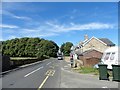
A welcome stone in Northover
by Neil Owen
geograph for square ST5223
The ancient settlement has Roman roots, indicated by the original name of... (more)
|
|
East end of Whittonstall
by Robert Graham
geograph for square NZ0757
View looking west down the main street, the B6309. This is an old village on a... (more)
|

|
View from the bank leading up to Whittonstall
by Robert Graham
geograph for square NZ0757
The B6309, the old Roman road of Dere Street, climbs sharply up the escarpment... (more)
|

|
Farm buildings at Kipperlynn
by Robert Graham
geograph for square NZ0657
Viewed looking west. This farm is beside the B6309, the old Roman Dere Street.... (more)
|

|
Roadside trees
by Robert Graham
geograph for square NZ0657
Including a magnificent Ash, beside the B6309 west of Kipperlynn. View looking... (more)
|
|
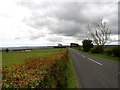
View down the B6309 south of Wittonstall
by Robert Graham
geograph for square NZ0756
This is the line of Roman Dere Street. This section ran between the forts at... (more)
|
|
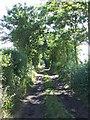
Toggs Lane
by Keith Evans
geograph for square TM2975
This track follows the course of a Roman Road near to Silverley Green, Suffolk.
|

|
Footpath stile
by TCExplorer
geograph for square SJ6110
Easier to traverse after I had gone at it with some secateurs...
|

|
The footpath crosses a potato field
by TCExplorer
geograph for square SJ6110
Potatoes looking stressed considering the lack of rainfall, following the driest... (more)
|

|
Watling Street field
by TCExplorer
for square SJ6110
|

|
Meadow adjacent to the A5
by TCExplorer
geograph for square SJ6010
Used to be Watling Street
|

|
Footpath / Watling Street approaching Overley Hill Cottage
by TCExplorer
geograph for square SJ6010
|

|
Round Church St, Cambridge
by David Hallam-Jones
geograph for square TL4458
The Grade I-listed Church of the Holy Sepulchre (a.k.a. “The Round Church”).... (more)
|
|
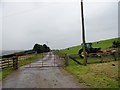
Track running west from Heugh farm
by Robert Graham
geograph for square NZ1843
Although you never think it, this was once the Roman road of Dere Street.
|

|
Ermin Way near the entrance to Stratton Park
by Vieve Forward
geograph for square SP0104
|

|
The Fosse Way in Fossebridge
by Steve Daniels
geograph for square SP0811
|

|
The Fosse Way passing Fossebridge
by Steve Daniels
geograph for square SP0711
|
