
|
Derelict Building at St Andrew's Dock
by David Dixon
geograph for square TA0727
Former offices (?) near the disused lock entrance to the former St Andrew's... (more)
|
|
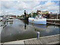
Hull Marina
by Malc McDonald
geograph for square TA0928
Boats moored in Hull Marina, which occupies the former Humber Dock. The black... (more)
|

|
Russia Dock Woodland, Rotherhithe
by Robin Stott
geograph for square TQ3679
Russia Dock Woodland is a linear park, created by Southwark Council in 1980 by... (more)
|

|
Old graving docks in Liverpool
by Marathon
geograph for square SJ3389
This former graving dock is off Canning Dock. Beyond is another former dock... (more)
|

|
Royal Albert Dock and London City Airport
by Chris Allen
for square TQ4280
The vast body of water is the former Royal Albert Dock. The airport is on the... (more)
|
|
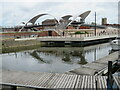
Humber Dock and footbridge over Castle Street, Hull
by Malc McDonald
geograph for square TA0928
The bridge in the background is a footbridge over the A63 as it passes to the... (more)
|

|
Lord Line Building, St Andrew's Dock
by David Dixon
geograph for square TA0727
Derelict trawler company offices at the eastern end of the former St... (more)
|

|
Derelict St Andrew's Dock
by David Dixon
geograph for square TA0727
Former access road at the derelict St Andrew's Fish Dock.
|

|
The Former St Andrew's Dock, Hull
by David Dixon
geograph for square TA0727
|

|
Former entrance to Morpeth Dock
by Chris Allen
geograph for square SJ3289
A sewage works extends across what appears to have been a former entrance lock.... (more)
|

|
Former dock gates, Rotherhithe
by Chris Allen
geograph for square TQ3580
These are at the entrance to the lock that gave access to the now filled in... (more)
|
|
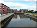
Former Oil Dock, Diglis, Worcester
by Chris Allen
geograph for square SO8453
This dock off the River Severn was the centre of a large inland oil port... (more)
|

|
Portishead Marina (former Dockland)
by David Dixon
geograph for square ST4776
Portishead is a coastal town on the Severn Estuary, 6 miles to the west of... (more)
|
|
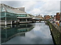
Prince's Quay, Hull
by Malc McDonald
geograph for square TA0928
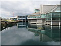
The former Prince's Dock in Hull. The Prince's Quay shopping centre... (more)
|
|
Prince's Quay, Hull
by Malc McDonald
geograph for square TA0928
The former Prince's Dock in Hull. The Prince's Quay shopping centre... (more)
|

|
An old graving dock in Liverpool
by Marathon
for square SJ3489
This former graving dock is off Canning Dock. It contains the pilot cutter... (more)
|

|
Thames Link, Rotherhithe
by Chris Allen
geograph for square TQ3580
This water is the former entrance lock to Surrey Docks and the entrance gates... (more)
|
|
Apartments at Portishead Marina
by David Dixon
geograph for square ST4777
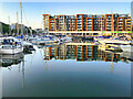
Portishead is a coastal town on the Severn Estuary, 6 miles to the west of... (more)
|
|
Boats in Portishead Marina
by David Dixon
geograph for square ST4776
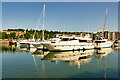
Portishead is a coastal town on the Severn Estuary, 6 miles to the west of... (more)
|
|
Portishead Marina
by David Dixon
geograph for square ST4776
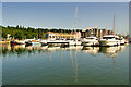
Portishead is a coastal town on the Severn Estuary, 6 miles to the west of... (more)
|
|
Portishead Marina
by David Dixon
geograph for square ST4776
Portishead is a coastal town on the Severn Estuary, 6 miles to the west of... (more)
|

|
The former Mountstuart graving docks, Cardiff Bay
by Christine Johnstone
geograph for square ST1974
Once a shipbuilding site. A graving dock is a basin which can be pumped out to... (more)
|

|
Two fishing boats at Barrow-in-Furness
by Chris Allen
geograph for square SD1869
These two boats are tucked against the walls at the former entrance to the... (more)
|

|
The former Half Tide Basin, Victoria Dock Village, Hull
by Ian S
geograph for square TA1028
With St James Court West in the background.
|

|
The former Half Tide Basin, Victoria Dock Village, Hull
by Ian S
geograph for square TA1028
|
|
Housing on St. Mary's Island, Chatham
by Malc McDonald
geograph for square TQ7670
New housing on the quayside at one of Chatham's former docks.
|

|
Grand Union Canal - former FMC dock
by Chris Allen
geograph for square TQ1777
A dock formerly used by the canal carriers Fellows, Morton and Clayton (FMC),... (more)
|

|
Derelict Dock, River Tyne
by David Dixon
geograph for square NZ3566
Former graving dock at Middle Dock on the River Tyne.
|

|
Four levels at Tobacco Dock, Wapping
by Robin Stott
geograph for square TQ3480
In the days of the London Docks, Tobacco Dock served the huge Tobacco Warehouse,... (more)
|

|
Ships’ masts, Tobacco Dock, Wapping
by Robin Stott
geograph for square TQ3480
In the days of the London Docks, Tobacco Dock served the huge Tobacco Warehouse,... (more)
|

|
The former Outer Basin, Victoria Dock Village, Hull
by Ian S
geograph for square TA1028
|

|
The former Outer Basin, Victoria Dock Village, Hull
by Ian S
for square TA1028
|

|
Onega Gate, Rotherhithe
by Robin Stott
geograph for square TQ3679
This bus stop on Salter Road is placed for access to the Russia Dock Woodland on... (more)
|

|
West on Tobacco Dock, Wapping
by Robin Stott
geograph for square TQ3480
In the days of the London Docks, Tobacco Dock served the huge Tobacco Warehouse,... (more)
|

|
Walkways and water, Tobacco Dock, Wapping
by Robin Stott
geograph for square TQ3480
In the days of the London Docks, Tobacco Dock served the huge Tobacco Warehouse,... (more)
|

|
Former dock on the south bank of the Humber Estuary
by Graham Hogg
geograph for square TA0423
The dock once served the nearby tile and brick works.
|
|
St Saviour's dock, Bermondsey
by Stephen Craven
geograph for square TQ3379
The dock is essentially the tidal creek at the mouth of the River Neckinger,... (more)
|

|
Queensway Tunnel ventilation shaft building
by Chris Allen
geograph for square SJ3289
Built on the former Morpeth Branch Dock. Seen across the former entrance to Morpeth Dock
|
|
The Winding House, former Victoria Dock
by Chris Allen
geograph for square TA1028
This housed a steam engine for operating a Patent Slipway in the Victoria Dock.... (more)
|

|
Former warehouses, Leith
by Chris Allen
geograph for square NT2676
Now converted to accommodation and business premises, particularly restaurants.... (more)
|

|
A shark and an ostrich
by Neil Owen
geograph for square ST5872
The 'shark' is a city docks ferry, whilst the Ostrich is the pub on... (more)
|

|
Portishead, former dock
by Mike Faherty
geograph for square ST4776
Once extending further South, and serving cargo boats in the local trade, later... (more)
|

|
The Lost Trawlermen Memorial Sculpture, St Andrew's Quay
by David Dixon
geograph for square TA0726
This 9ft tall steel sculpture depicting 13 trawlermen and a young boy standing... (more)
|

|
Transpennine Trail at St Andrew's Retail Park
by David Dixon
geograph for square TA0626
Shore path near the Hull Makro store.
|

|
St Andrew's Retail Park, B&Q Extra
by David Dixon
geograph for square TA0626
|

|
The Sailmakers, St Andrew's Quay Retail Park
by David Dixon
geograph for square TA0726
Pub/restaurant at the entrance to the St Andrew's Quay retail park.
|

|
St Andrew's Quay Retail Park
by David Dixon
geograph for square TA0726
|

|
Pizza Hut, St Andrew's Quay Retail Park
by David Dixon
geograph for square TA0726
|
|
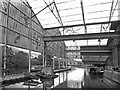
Moored under the Rafters
by Des Blenkinsopp
geograph for square TQ1777
This was formerly a covered dock basin where canal boats could load in the dry.... (more)
|

|
Lock gates to the former St Andrew's dock Hull
by Steve Fareham
geograph for square TA0727
|
