
|
The Singing Fryer, Cleckheaton Road
by Stephen Craven
geograph for square SE1628
|

|
Foster Park, Denholme
by Stephen Craven
geograph for square SE0734
The building to the right is the old school house; the primary school building... (more)
|

|
The Old School House
by Richard Croft
geograph for square SK8362
19th century former school house at 108 Low Street
|

|
Hope End School House
by Sandy Gerrard
geograph for square SO7140
|

|
View across the Common, Nun Monkton
by Alan Murray-Rust
geograph for square SE5057
On the left the late 19th century village school, still in use. Next to it, The... (more)
|

|
The Old School House near Stanford on Soar
by Jonathan Clitheroe
geograph for square SK5422
|

|
Former Congregational Church, Ashburton
by Derek Harper
geograph for square SX7569
Listed and described at... (more)
|

|
The Old School House, Briggswath, Sleights
by Stephen Craven
geograph for square NZ8608
|

|
The School House, Carnbee
by Richard Sutcliffe
geograph for square NO5306
|

|
Former Pisgah Chapel
by Emma M Baker
geograph for square SN7700
This is an original tin chapel in Cilfrew. It sports ecclesiastical Gothic style... (more)
|

|
The Old Schoolhouse, Hutton-le-Hole
by David Dixon
geograph for square SE7090
Built in 1875 to replace a smaller school near the beck, this building housed... (more)
|

|
Rookery Hill, Oakford
by Derek Harper
geograph for square SS9121
The village street climbs past the junction with Crosspark Hill on the right. On... (more)
|

|
Kyme Lodge (formerly The Old Schoolhouse), Newton Kyme
by Alan Murray-Rust
geograph for square SE4644
Built in 1787 for Robert Fairfax of Newton Kyme Hall as the schoolmaster's... (more)
|

|
The Old School House on northeast side of School Lane
by Roger Templeman
geograph for square SK8822
Ordnance Survey records indicate that a flush bracket benchmark (serial number... (more)
|

|
Sinclair Street, Halkirk
by Malc McDonald
geograph for square ND1359
Housing on Sinclair Street in Halkirk, a small town in the far north of... (more)
|

|
The Old School House and The Old School on SE side of Leake Lane
by Luke Shaw
geograph for square SK5422
|

|
Former school house, Pontefract Road, Ferrybridge
by Stephen Craven
geograph for square SE4824
|
|
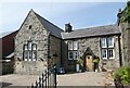
Old School House, Harelaw
by Oliver Dixon
geograph for square NZ1652
The inscription over the door reads "1846 National School". The school... (more)
|
|
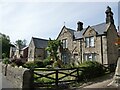
Old school buildings at Harelaw
by Oliver Dixon
geograph for square NZ1652
In the foreground is the former schoolmaster's house (dated 1886), beyond... (more)
|

|
The Old School Team Room
by Chris Holifield
geograph for square SE0263
A lovely team room in the Old School, Hebden, which dates back to 1874:... (more)
|

|
Exhibition Square, York – 1971
by Alan Murray-Rust
geograph for square SE6052
This shows a York Pullman bus waiting to leave for an unidentified destination.... (more)
|

|
Church Lane, Stanhoe
by HelenK
geograph for square TF8036
On the right is All Saints' Church Link ; the... ( more) |
|
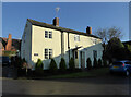
Old School House, Eckington
by Chris Allen
geograph for square SO9241
Late 18th century and now a house. Grade II Listed.
|
|
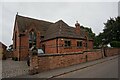
The School House, Mackworth
by Ian S
geograph for square SK3137
|

|
Old School and Schoolhouse, Moreton
by Sandy Gerrard
geograph for square SY8089
Early 19th century former school.... (more)
|

|
The Old School House, Postland Road, Crowland
by Hugh Venables
geograph for square TF2410
|

|
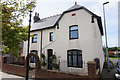
The Old School House, Orton
by Stephen Craven
geograph for square NY6208
I quote the current name of the building, although on OS maps of 1957 and... (more)
|
|
The Old Schoolhouse on Front Street, Wingate
by Ian S
geograph for square NZ3937
|

|
The Old School House, Holme Lacy
by Oliver Dixon
geograph for square SO5534
|

|
The old post office, Tong
by Stephen Craven
for square SE2230
This end of the building is a former post office, originally a... (more)
|

|
School house and church, Huntshaw
by Derek Harper
geograph for square SS5022
|
|
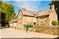
Ladock School House
by Mike Lyne
geograph for square SW8950
The School House next to St Ladoca's Church in the village of Ladock was... (more)
|

|
Stevens House, Church Street, Beeston
by Stephen Craven
geograph for square SK5236
Originally the headmaster's house for Church Street School, now privately... (more)
|
|
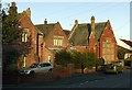
The old school house and school, South Milford
by Alan Murray-Rust
geograph for square SE4931
Classic late 19th century school, now entirely converted for residential use.
|

|
Footpath through the churchyard, Yarnscombe
by Derek Harper
geograph for square SS5623
Yarnscombe footpath 10 crosses the churchyard, as seen on the right of... (more)
|
|
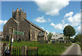
St Andrew's church, Yarnscombe
by Derek Harper
geograph for square SS5623
See also Link . The church is grade... ( more) |

|
Old School House, Pendomer
by Derek Harper
geograph for square ST5210
This is at the end of the public road (Pendomer Road, to the right). The... (more)
|
|
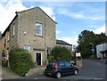
The Old School House
by Gerald England
geograph for square SJ9691
Now a residential property on the corner of George Street and John Street.
|
|
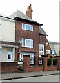
17 Handsworth New Road, Birmingham
by Alan Murray-Rust
geograph for square SP0488
This was the caretaker's or master's house for the adjacent Handsworth... (more)
|
|
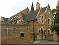
Schoolmaster's house, former All Saints School, Raleigh Street
by Alan Murray-Rust
geograph for square SK5640
Part of the extensive development by Thomas Hine based on the new All Saints... (more)
|
|
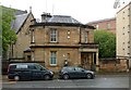
30 Eldon Street, Glasgow
by Alan Murray-Rust
geograph for square NS5766
Former janitor's house to Woodside Public School, by Robert Dalglish, dated... (more)
|

|
Janitor's House, Garnetbank School
by Alan Murray-Rust
geograph for square NS5866
Current unoccupied, but Listed Category B... (more)
|

|
Former School House, Main Street
by Roger Templeman
geograph for square SK7624
|

|
Village hall, Atherington
by Derek Harper
for square SS5923
The gable facing the lane to the north of the village, with mullions and a... (more)
|

|
Buildings, Atherington
by Derek Harper
geograph for square SS5923
|

|
Buildings, Atherington
by Derek Harper
geograph for square SS5923
The former school house and village hall just west of the church, with a listed... (more)
|

|
Former school, Wolborough Hill
by Derek Harper
geograph for square SX8570
Most of the buildings belonging to Wolborough Hill School and its successor,... (more)
|

|
Bolton-by-Bowland primary school and school house
by Bill Harrison
geograph for square SD7849
Built 1874 in "simple northern Jacobean style" (Pevsner) and Grade-II... (more)
|

|
The Old School, Huntingfield
by Christopher Hilton
geograph for square TM3374
The school was established in the mid-19th century by the Reverend Keyworth,... (more)
|
|
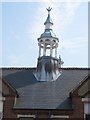
Tendring Adult Education College, St Osyth Road, Clacton-on-Sea
by Duncan Graham
for square TM1715
A close up of one of the former school's bell-towers.
The picture was... (more)
|
