|
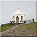
Horse rider at the Long Nab Coastguard Lookout
by Mat Fascione
geograph for square TA0294
This lookout, built in 1927, was one of several along the Yorkshire Coast which... (more)
|

|
Long Nab Coastguard Lookout
by Mat Fascione
for square TA0294
This lookout, built in 1927, was one of several along the Yorkshire Coast which... (more)
|

|
Long Nab Coastguard Lookout
by Mat Fascione
geograph for square TA0293
This lookout, built in 1927, was one of several along the Yorkshire Coast which... (more)
|

|
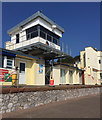
National Coastwatch lookout
by Chris Holifield
geograph for square TM2933
The Felixstowe National Coastwatch lookout is situated in Martello Tower P... (more)
|

|
Former coastguard lookout, Lindisfarne
by Philip Halling
geograph for square NU1241
The former coastguard lookout on Lindisfarne which is now open to the public,... (more)
|

|
Former Coastguard Station at Summerhill
by Gerald England
geograph for square G9076
On the left is a former Coastguard Station which was used as a lookout tower... (more)
|

|
The old coastguard lookout
by Chris Holifield
geograph for square TF6742
Previously used by the Observer Corps and, in the 1960s as a Coastguard lookout.... (more)
|

|
Coastguard's Lookout, Towan Head
by Rob Farrow
geograph for square SW7962
This small octagonal lookout was apparently built at the beginning of the C20th.... (more)
|

|
War memorial and former coastguard lookout
by Philip Halling
geograph for square NU1241
War memorial and former coastguard lookout on Lindisfarne.
|

|
"Window on the Island"
by Alan Murray-Rust
geograph for square NU1241
The former coastguard lookout tower has been refurbished in recent years as a... (more)
|

|
National Coastwatch lookout station, Rame Head
by Rob Farrow
for square SX4248
National Coastwatch Institution (NCI) is an entirely voluntary organisation... (more)
|

|
Former Coastguard Lookout
by Steve Daniels
geograph for square SZ0382
The lookout is now a visitor centre.
|

|
Hooken Lookout
by Derek Harper
geograph for square SY2188
The former coastguard lookout, with some sheep. Above them, to the left of the... (more)
|

|
Inside the Bent Rigg Coastguard Lookout
by Mat Fascione
for square NZ9900
Built around 1935, it was designated as an Auxiliary Coastguard Watch station,... (more)
|

|
Bent Rigg Coastguard Lookout along the Cleveland Way
by Mat Fascione
geograph for square NZ9900
Built around 1935, it was designated as an Auxiliary Coastguard Watch station,... (more)
|

|
Old coastguard lookout at Cemaes Head
by Mat Fascione
geograph for square SN1249
|

|
Old coastguard lookout at Cemaes Head
by Mat Fascione
geograph for square SN1249
|

|
The Rocket Cart House
by Chris Holifield
geograph for square SM8701
This building was built at the end of the 19th century to house the cart... (more)
|

|
Portreath - The Pepperpot
by Rob Farrow
for square SW6545
The so-called "Pepperpot" is a former Coastguard Lookout tower dating... (more)
|

|
Halfway House, Blakeney Point
by Hugh Venables
geograph for square TG0245
Officially the Watch House, a former Coastguard base and lookout but now... (more)
|

|
Hooken Cliffs, 2000
by Derek Harper
geograph for square SY2287
From the coast path west of Beer Head, with The Pinnacles to the left; a similar... (more)
|

|
Former Coastguard Lookout On Pedn-mÍn-du
by Rude Health
geograph for square SW3426
|

|
Site of Coastguard Lookout Hut, East Head
by Craig Wallace
geograph for square NJ6066
|

|
Site of Coastguard lookout hut
by Hugh Venables
geograph for square NJ6066
On East Head looking back towards Portsoy.
|

|
Old coastguard lookout at Cemaes Head
by Mat Fascione
geograph for square SN1249
|

|
Sheep grazing by the old coastguard lookout at Caerhays
by Simon Mortimer
geograph for square SW9641
Looking south-east from the footpath above Long Point.
|

|
Oil seed rape along the coast at Long Nab
by Mat Fascione
geograph for square TA0294
The Cleveland Way is heading south towards the Long Nab Coastguard Lookout.
|

|
Low Newton coastguard lookout
by Alan Murray-Rust
geograph for square NU2424
Built in the second quarter of the 19th century. Both the Watch House itself and... (more)
|

|
New lookout for National Coast Watch, Teignmouth Station, above Terrace Walk
by Robin Stott
geograph for square SX9473
|

|
Coastguard lookout (disused)
by Martin Dawes
geograph for square NZ9506
Above Ness Point from the clifftop path, the Cleveland Way
|

|
Beacon Brow
by Rude Health
geograph for square SD1769
Pushed up through the gorse to summit of knoll near old coastguard lookout red... (more)
|

|
Barn near Ness Point
by Derek Harper
geograph for square NZ9506
Seen from the Cinder Track in heavy rain; to the left is the coastguard lookout... (more)
|

|
Cullercoats Fisherman's Lookout
by Mat Fascione
geograph for square NZ3671
Built in 1879 on the site of a traditional fisherman's lookout, to house... (more)
|

|
Bungalow and lookout, South Down Common
by Derek Harper
geograph for square SY2188
Cliff Top Bungalow and Hooken Lookout, by Beer Bridleway 6.
|

|
Aldeburgh Beach South Lookout
by Ian Taylor
geograph for square TM4656
|

|
South Down Common
by Derek Harper
geograph for square SY2188
Beer Bridleway 6 runs along this clifftop grassland above Hooken Cliffs. Ahead... (more)
|

|
Fort Walney Tower
by Rude Health
geograph for square SD1768
Walney's coastal defences were constructed in 1911 for the Lancashire and... (more)
|

|
Sandstone cliffs along the Moray Coast
by Alan Murray-Rust
for square NJ1770
Looking towards the Gordonstoun Tower from roughly off Clashach quarry.
|

|
Cliffs below the Gordonstoun Tower
by Alan Murray-Rust
geograph for square NJ1770
Soft yellow sandstone, significantly weathered by sea action.
|