|
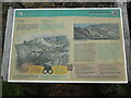
Copper Information Board on Great Orme Head
by David Hillas
for square SH7683
This information board is south of the summit of the Great Orme Head and is on... (more)
|
|
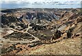
Former copper mine on Parys Mountain
by Mat Fascione
geograph for square SH4490
|
|
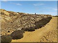
Former copper mine at Parys Mountain
by Mat Fascione
geograph for square SH4390
|

|
Wheal Kitty
by Rob Farrow
geograph for square SW7251
Looking from the carpark at SW72615131 over to Wheal Kitty about ½ mile NE of St... (more)
|
|
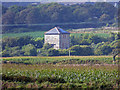
Wheal Rodney (Wheal Hampton) - converted engine house
by Chris Allen
for square SW5331
This mine was originally Wheal Rodney and was an important copper producer in... (more)
|

|
Trig point and windmill
by Mat Fascione
geograph for square SH4490
Parys Mountain Windmill is on the highest point of Parys Mountain, 138 metres... (more)
|

|
Inside the Parys Mountain Windmill
by Mat Fascione
for square SH4490
Parys Mountain Windmill is on the highest point of Parys Mountain, 138 metres... (more)
|

|
Parys Mountain Windmill
by Mat Fascione
geograph for square SH4490
Parys Mountain Windmill is on the highest point of Parys Mountain, 138 metres... (more)
|

|
Parys Mountain Windmill
by Mat Fascione
geograph for square SH4490
Parys Mountain Windmill is on the highest point of Parys Mountain, 138 metres... (more)
|
|
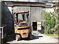
Cast iron lintel on former smithy, Wheal Busy
by Chris Allen
for square SW7344
Originally known as Chacewater Mine, Wheal Busy has a rich history of tin,... (more)
|

|
Former smithy, Wheal Busy
by Chris Allen
geograph for square SW7344
Originally known as Chacewater Mine, Wheal Busy has a rich history of tin,... (more)
|

|
Precipitation ponds, Mona Mine, Parys Mountain
by Ian Taylor
geograph for square SH4490
|

|
Parys Mountain
by Mat Fascione
geograph for square SH4390
|

|
Path on Parys Mountain
by Mat Fascione
geograph for square SH4490
|

|
Near the summit of Parys Mountain
by Mat Fascione
geograph for square SH4490
|

|
Bull Bay and Amlwch viewed from Parys Mountain
by Mat Fascione
geograph for square SH4490
|

|
Stone building at Parys Mountain
by Mat Fascione
geograph for square SH4490
|

|
View southeast from Parys Mountain
by Mat Fascione
geograph for square SH4390
|

|
Pool on Parys Mountain
by Mat Fascione
geograph for square SH4390
|

|
Path near the Parys Mountain car park
by Mat Fascione
geograph for square SH4390
|
|
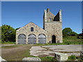
Wheal Busy - Engine Shaft pumping engine house
by Chris Allen
geograph for square SW7344
Wheal Busy was at various times mined for copper, tin and arsenic. This house... (more)
|

|
Fowey Consols, Henrietta's pumping engine house
by Chris Hodrien
for square SX0955
Fowey Consols was a successful copper mine and between 1822 and closure in 1867... (more)
|
|
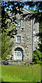
Fowey Consols, Henrietta's pumping engine house
by Chris Hodrien
for square SX0955
Fowey Consols was a successful copper mine and between 1822 and closure in 1867... (more)
|

|
Austen's 80-inch pumping engine house on Fowey Consols
by Chris Hodrien
for square SX0856
Fowey Consols was a successful copper mine and between 1822 and closure in 1867... (more)
|

|
Wheal Owles mine from Botallack
by Chris Allen
for square SW3632
These three engine houses are part of Wheal Owles. This was a tin and copper... (more)
|

|
Allen's Shaft head gear and chimney, Botallack Mine
by Chris Allen
geograph for square SW3633
This shaft and the chimney date from a period of reworking at Botallack between... (more)
|

|
Wheal Owles from Botallack
by Chris Allen
for square SW3632
These two engine houses are part of Wheal Owles. This was a tin and copper mine... (more)
|
|
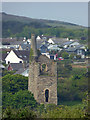
Wheal Friendly, St Agnes
by Chris Allen
geograph for square SW7251
This picturesque engine house is Listed Grade II and was erected in 1902 for a... (more)
|

|
Danescombe Mine
by Des Blenkinsopp
geograph for square SX4269
A former producer of Copper and Arsenic, the mine buildings were in ruins until... (more)
|
|
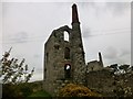
Engine houses at Wheal Hearle
by Rude Health
geograph for square SW3834
East Boscaswell also known as Wheal Hearle and records show that the mine... (more)
|
|
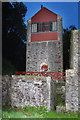
Danescombe Mine by Night
by Des Blenkinsopp
geograph for square SX4269
A former producer of Copper and Arsenic, the mine buildings were in ruins until... (more)
|
|
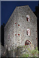
Danescombe Mine at Night
by Des Blenkinsopp
for square SX4269
A former producer of Copper and Arsenic, the mine buildings were in ruins until... (more)
|

|
Botallack Mine - arsenic labyrinth and chimney
by Chris Allen
geograph for square SW3633
These are the labyrinthine flues used to condense arsenic out of the flue gases... (more)
|

|
Botallack Mine - arsenic labyrinth and chimney
by Chris Allen
geograph for square SW3633
Between the arch on the left and the chimney on the right are the labyrinthine... (more)
|

|
Crowns Mine (disused), Botallack
by Chris Allen
geograph for square SW3633
One of the most picturesque mining landscapes in Cornwall. The upper engine... (more)
|

|
Crowns Mine (disused), Botallack
by Chris Allen
geograph for square SW3633
One of the most picturesque mining landscapes in Cornwall. The upper engine... (more)
|

|
Sygun Copper Mine
by Chris Allen
geograph for square SH6048
The view of the visitor centre and café from the viewpoint near the exit adit.... (more)
|

|
Beech Grove engine house, Dodington
by Chris Allen
geograph for square ST1740
Photographed across the line of the boundary fence of the private woods behind... (more)
|

|
Pumping engine house on the Crowns shaft, Botallack
by Chris Allen
geograph for square SW3633
This lower house was for a 30" pumping engine by Harvey & Co of Hayle... (more)
|

|
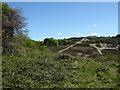
Bonsor Upper Mill
by Ian Taylor
for square SD2898
Part of the Coniston copper mines dressing floor. Ruined building, with what... (more)
|
|
Broken landscape near Wheal Busy
by Chris Allen
geograph for square SW7344
The positions and view direction are a best guess because this worked over... (more)
|

|
View down the quarry incline to Cwm Llan
by Bill Harrison
geograph for square SH6151
It was possibly associated with Braich-yr-oen copper mine.
|

|
Pennance Copper Mine, disused
by Pete Cruse
geograph for square SW7140
|

|
Sygun Copper Mine visitor cente...
by Bill Harrison
geograph for square SH6048
with Coed Maes Llifio (the field for sawing trees?) in the background and... (more)
|

|
Old pond, Parys Mountain
by Ian Taylor
geograph for square SH4390
On the west side of Parys (or Copper) Mountain.
|

|
Precipitation pond, Parys Mountain
by Ian Taylor
geograph for square SH4390
One of a series of old irregularly shaped ponds on the west side of Parys (or... (more)
|

|
Levant Mine
by Rude Health
geograph for square SW3634
Levant Mine and Beam Engine is a National Trust property at Trewellard, Pendeen,... (more)
|

|
Parys Mountain
by Ian Taylor
geograph for square SH4490
Also known as Copper Mountain. Looking across the Great Opencast, from the SE... (more)
|

|
Botallack Mine - Crowns section
by Chris Allen
geograph for square SW3633
Seen from near the later processing plant. One of the most famous mining... (more)
|

|
Surface remains at Botallack Mine
by Chris Allen
geograph for square SW3633
These visible remains date from reworking of 1904 to 1914. The tall arched... (more)
|
