Public Tags
Showing images tagged with former:Ferry tag.

|
Site of the former Hampton Loade Ferry
by Mat Fascione geograph for square SO7486 Hampton Loade Ferry was a pedestrian cable ferry linking the villages of Hampton... (more)
Tags:
top:Derelict, Disused
former:Ferry
type:Geograph
top:Lowlands
subject:River
river:River Severn
top:Rivers, Streams, Drainage
|

|
The 'Stena Voyager' departing Belfast
by Rossographer for square J4886 The withdrawn HSC 'Stena Voyager'... (more)
Tags:
Agat
place:Belfast
place:Belfast Lough
Belfast Lough
top:Business, Retail, Services
top:Coastal
top:Docks, Harbours
former:Ferry
Ferry
Ferry (Former)
Stena Line
Stena Voyager
Tug
Tugboat
top:Waste, Waste Management
|

|
Severn Road Bridge, from Beachley
by Christopher Hilton geograph for square ST5590 Taken from the former landing pier of the ferry that the bridge superseded.
Tags:
Bridge
subject:Bridge
top:Estuary, Marine
former:Ferry
former:Ferry Crossing
type:Geograph
Pier
river:River Severn
top:Roads, Road Transport
river:Severn
bridge:Severn Bridge
Severn Bridge
Severn Estuary
Severn Road Bridge
bridge:Suspension
Suspension Bridge
|

|
The Quay, Walberswick
by Simon Mortimer geograph for square TM5074 The quay was the location of the former steam ferry across the River Blyth to... (more)
Tags:
top:Coastal
top:Docks, Harbours
former:Ferry
type:Geograph
subject:Quay
Suffolk Coast and Heaths AONB
|

|
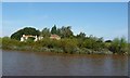
Site of ferry landing stage, Ferry Lane
by Simon Mortimer geograph for square SU7878 Wargrave used to boast two ferries across the Thames to Shiplake. The one at... (more)
|
|
Newhay Ferry Cottages, north bank, River Ouse
by Christine Johnstone geograph for square SE6630 The ferry across the tidal River Ouse was mentioned in 1538 and last used about... (more)
Tags:
top:Canals
former:Ferry
Ferry Cottage
type:Geograph
top:Housing, Dwellings
Navigable River
river:Ouse
subject:River Bank
River Ferry
top:Rivers, Streams, Drainage
Riverside Houses
Tidal River
river ouse:Yorkshire
|

|
Drowned footbridge
by Ian Calderwood geograph for square SK3927 At Christmas 2012, the flooded River Trent overtopped the banks of the Black... (more)
Tags:
Bridleway
top:Derelict, Disused
former:Ferry
Flooding
Footbridge
top:Paths
top:Rivers, Streams, Drainage
former:Wharf
|
|
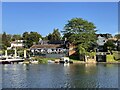
St. George and Dragon public house, Wargrave
by Simon Mortimer geograph for square SU7878 Viewed from the site of the former ferry across the river Thames at Lower Shiplake.
Tags:
top:Business, Retail, Services
former:Ferry
type:Geograph
subject:Public House
Public House and Restaurant
top:Rivers, Streams, Drainage
top:Village, Rural Settlement
|

|
Old ferry pier
by James Allan geograph for square NO4127 The jetty from which the ferry boats from Newport on Tay to Dundee left.
|

|
The Princess Selandia in Buccleuch Dock, Barrow
by Graham Robson geograph for square SD1968 The Princess Selandia is a former Scandinavian ferry and more recently a... (more)
Tags:
place:Barrow in Furness
Buccleuch Dock
top:Business, Retail, Services
top:Docks, Harbours
former:Ferry
Floating Night Club
top:Sport, Leisure
|

|
Ferry House - Beer Garden
by Colin Smith geograph for square TG3007 Idyllic spot beside an old ferry crossing on the River Yare.
Link
 Tags:
former:Ferry
type:Geograph
top:Historic Sites and Artefacts
subject:River
top:Rivers, Streams, Drainage
river:Yare
|

|
Ferry Corner - Passing Trade
by Colin Smith geograph for square TG3007 Pleasure boat passing the old ferry terminal on the River Yare by Surlingham.... (more)
Tags:
Boat
former:Ferry
type:Geograph
top:Historic Sites and Artefacts
subject:River
top:Rivers, Streams, Drainage
top:Sport, Leisure
place:Surlingham
river:Yare
|

|
The "Hebridean Princess", Belfast (May 2016)
by Albert Bridge for square J3475 The small cruise ship “Hebridean Princess” (originally the Caledonian MacBrayne... (more)
Tags:
place:Belfast
Belfast Harbour
Caledonian Macbrayne
type:Cross Grid
Cruise Ship
top:Docks, Harbours
former:Ferry
Harbour
Ship
subject:Ship
|
|
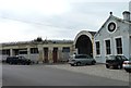
Old ferry terminal
by James Allan geograph for square NO4127 From these buildings the ferry across the Firth of Tay to Dundee used to operate... (more)
Tags:
top:Business, Retail, Services
top:Docks, Harbours
top:Estuary, Marine
former:Ferry
Fife
top:Roads, Road Transport
top:Village, Rural Settlement
|

|
Littleferry View
by Mary and Angus Hogg geograph for square NH8095 Judging from the state of the old pier, it's a long time since ferries... (more)
|
|
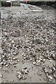
Slipway at Ferry Cottage Noss mayo
by Nick Cotter geograph for square SX5347 Invasive non-native Pacific Oysters making the foreshore difficult to access and... (more)
Tags:
Boating
top:Coastal
top:Docks, Harbours
top:Estuary, Marine
top:Farm, Fishery, Market Gardening
former:Ferry
Foreshore
subject:Foreshore
type:Geograph
Natural Harbour
Newton Ferrers
Noss Mayo
Pacific Oysters
subject:Slipway
area:South Devon
South Devon Aonb
South West Coast Path
place:The Southwest
top:Village, Rural Settlement
river:Yealm
|
