About tags on Geograph

Public Tags

Related Tags | Coverage Map
Prefix: former    Tag:  Housing·Estate  
Other tags: Housing Estate     building type:Housing Estate     category:Housing Estate     subject:Housing Estate    

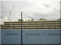
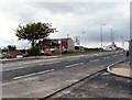
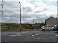
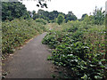
Showing images tagged with former:Housing Estate tag.

View all tagged images - In Browser

TQ3278 : The Heygate Estate in the process of demolition, from Elephant & Castle station by Christopher Hilton The Heygate Estate in the process of demolition, from Elephant & Castle station by Christopher Hilton
geograph for square TQ3278
Compare TQ3278 : Heygate Estate from Elephant & Castle station, 1995, which shows the view from the station when the estate was... (more)
SJ9894 : Ashworth Lane by Gerald England Ashworth Lane by Gerald England
geograph for square SJ9894
Looking up Ashworth Lane, the B6174 towards the crossroads with the A560. The... (more)
SJ9894 : Chain Bar Lane by Gerald England Chain Bar Lane by Gerald England
geograph for square SJ9894
Looking across Ashworth Lane to the area of Hattersley known as Chain Bar Lane.... (more)
SP1390 : Site of the Firs Estate and Berrandale Road, Castle Bromwich, northeast Birmingham by Robin Stott Site of the Firs Estate and Berrandale Road, Castle Bromwich, northeast Birmingham by Robin Stott
geograph for square SP1390
Two views of the site in 2012 are SP1390 : Berrandale Road, B36 and SP1390 : Firs estate-site of demolished tower blocks, which explains... (more)
Tags: postcode district:B36X   place:BirminghamX   area:Castle BromwichX   top:Derelict, DisusedX   type:GeographX   former:Housing Estate   top:LowlandsX   top:Suburb, Urban FringeX  
View more in the Image Search or in Browser
View images matching 'Housing Estate' anywhere in the tags
Don't click these: PotMel 1 PotMel 2
You are not logged in login | register