Public Tags
Showing latest 50 of 67 images tagged with former:Lane tag.
|
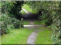
Old lane crossing a former railway
by Ian Calderwood geograph for square SK0934 A surviving section of an old lane crossing a former section of the North... (more)
Tags:
Footpath
type:Geograph
former:Lane
subject:Path
top:Paths
former:Railway
former:Railway Crossing
top:Railways
top:Roads, Road Transport
top:Suburb, Urban Fringe
|

|
Public footpath heading north from Denby Dale Road
by Christine Johnstone geograph for square SE2814 The southern end of Bullcliff Old Lane, close to the site of the former... (more)
Tags:
path:Footpath
Former Colliery Site
Former Mining Site
type:Geograph
former:Lane
subject:Path
top:Paths
Public Footpath
Public Footpath on Lane
|

|
The former Donington Lane facing south
by Ian Calderwood geograph for square SK4529 Donington Lane was cut when the A50 was built. This part is now completely... (more)
|

|
The former Donington Lane facing north
by Ian Calderwood geograph for square SK4529 Donington Lane was cut when the A50 was built. This part is still used by... (more)
|
|
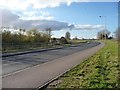
Cudworth Parkway and the former Weetshaw Lane
by Christine Johnstone geograph for square SE3910 On the right, the new curving A628 by-passing Cudworth to the north. On the... (more)
|
|
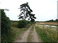
Musket Lane, near Hollingbourne
by Chris Whippet geograph for square TQ8254 This lane used to lead from the A20 to Hollingbourne but was stopped up by the... (more)
|

|
Vestigial hedge, Bullcliff Old Lane
by Christine Johnstone geograph for square SE2814 Near Woodside Farm. The lane is shown on the large-scale OS map surveyed in... (more)
Tags:
path:Footpath
type:Geograph
former:Hedge
former:Lane
subject:Path
top:Paths
Public Footpath
Public Footpath on Lane
|
|
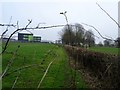
Old Lane
by Ian Calderwood geograph for square SK3339 This part of an old lane into Allestree was closed off when the schools were... (more)
Tags:
type:Geograph
subject:Lane
former:Lane
former:Path
top:Paths
top:Roads, Road Transport
top:Suburb, Urban Fringe
|

|
Bromley Lane reduced to a footpath
by Ian Calderwood geograph for square SK4521 This footpath across a single open field used to be a lane between fields. All... (more)
|

|
End of the lane
by Ian Calderwood geograph for square SK4526 This old lane used to connect with Grimes Gate, north of Diseworth. It was cut... (more)
Tags:
top:Air Transport
Airport
Airport Runway
Emergency Gate
former:Lane
former:Road
top:Roads, Road Transport
Runway
|
|
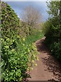
Upper Cockington Lane
by Derek Harper geograph for square SX8964 Category: Path Once one of the few roads in the vicinity, this part of the lane is now reduced... (more)
Tags:
plant:Alexanders
former:Lane
top:Lowlands
top:Paths
Public Footpath
top:Roads, Road Transport
Roadside Hedges
Roadside Tree
|
|
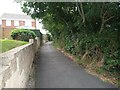
Dunkite Lane looking east
by S geograph for square ST3563 Dunkite Lane, Worle looking East..
Tags:
country:England
type:Geograph
former:Lane
place:North Somerset
North Worle
top:Paths
disused:Road
former:Road
top:Roads, Road Transport
top:Suburb, Urban Fringe
top:Village, Rural Settlement
Worle
|

|
Track to Woodthorpe Bridge
by Ian Calderwood geograph for square SK5417 Woodthorpe Bridge is, presumably, named after Woodthorpe village and this is the... (more)
|

|
Snowy Longload Lane heading for Cromford
by Ian Calderwood geograph for square SK2856 Longload Lane used to run into Cromford via Yeats Lane, to which it was joined... (more)
Tags:
type:Geograph
subject:Lane
former:Lane
lane:Longload Lane
top:Paths
top:Roads, Road Transport
Snow
top:Uplands
season:Winter
|

|
Sandy Lane
by Ian Calderwood geograph for square SK1044 Over the course of the 20th century, Sandy Lane seems to have dwindled on maps... (more)
Tags:
top:Derelict, Disused
type:Geograph
former:Lane
subject:Lane
top:Roads, Road Transport
lane:Sandy Lane
|
|
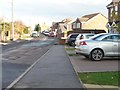
New housing on the south side of Weetshaw Close
by Christine Johnstone geograph for square SE3910 The former Weetshaw Lane is now a quiet residential no-through-road.
Tags:
top:Housing, Dwellings
former:Lane
Parked Cars
top:Roads, Road Transport
Village Houses
Village Housing
|

|
Old lane
by Ian Calderwood geograph for square SK5013 This is now just a farm track and public footpath but it's wide and well... (more)
Tags:
Farm Track
top:Farm, Fishery, Market Gardening
type:Geograph
Green Lane
former:Lane
subject:Lane
top:Paths
|

|
Footpath across a field of stubble
by Ian Calderwood geograph for square SK3320 The official line of the path runs to the right of the straight line used now,... (more)
Tags:
top:Farm, Fishery, Market Gardening
Field
Field Path
Footpath
type:Geograph
former:Lane
subject:Path
top:Paths
Stubble
Stubble in Field
former:Track
|

|
Old lane
by Ian Calderwood geograph for square SK4635 A remnant of an old hollow lane which ran from the edge of Risley, over the... (more)
|
|
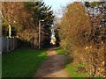
Old line of Porter's Lane
by Ian Calderwood geograph for square SK3738 This footpath follows the old line of Porter's Lane from before it was... (more)
|

|
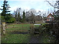
Shared path at Edginswell
by Derek Harper geograph for square SX8866 Taken from the same spot as SX8866 : Vauxhall dealership at Edginswell, looking along the former line of... (more)
Tags:
type:Geograph
Grass Verges
Lampposts
former:Lane
top:Lowlands
Metal Knee Rails
top:Paths
top:Roads, Road Transport
Shared Use Path
top:Suburb, Urban Fringe
Trees
|
|
Public footpath on the former route of Smithies Lane
by Christine Johnstone geograph for square SE3408 The road was diverted to bend under a new railway line.
Tags:
Do Not Feed
type:Geograph
former:Lane
subject:Path
top:Paths
Public Footpath
at:The Field Entrance
|

|
Deepdale Lane
by Ian Calderwood geograph for square SK1442 Deepdale Lane used to connect to Green Lane but is now just a footpath and farm... (more)
Tags:
Farm Track
top:Farm, Fishery, Market Gardening
Footpath
type:Geograph
former:Lane
subject:Lane
top:Paths
|

|
Junction of Monk's Lane and Longhill Lane, Hankelow
by Christopher Hilton geograph for square SJ6745 Tags:
End of Speed Restriction
type:Geograph
subject:Lane
former:Lane
Lane
Lane Junction
National Speed Limit
top:Roads, Road Transport
Speed Limit
Speed Limit Sign
|

|
Old lane junction near Lockington
by Ian Calderwood geograph for square SK4627 The lane to the left used to connect Lockington to Diseworth but was cut when... (more)
Tags:
Bridleway
subject:Bridleway
Bridleway Junction
Bridleway Marker Post
former:Lane
top:Paths
top:Roads, Road Transport
top:Sport, Leisure
top:Village, Rural Settlement
|

|
Sir Henry's Lane
by Ian Calderwood geograph for square SK3823 This was a coach road made for Sir Henry Crewe of Calke Abbey. It used to lead... (more)
|

|
Closed Lane
by Ian Calderwood geograph for square SK0942 This deeply-hollowed remnant of a lane used to connect with other lanes and... (more)
|

|
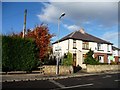
The former Sludge Lane, west of Long Causeway
by Christine Johnstone geograph for square SE3322 So named on the 1890 Wakefield (North) OS map. The road pattern changed... (more)
|
|
Shafton boundary sign, Weetshaw Close
by Christine Johnstone geograph for square SE3910 No longer seen by people coming from Cudworth as the former Weetshaw Lane has... (more)
|

|
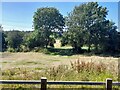
Loop of old road, Westleton Common
by Christopher Hilton geograph for square TM4468 At this point Reckford Road out of Westleton has been straightened, leaving the... (more)
|
|
A farm access crossing the old line of Gynsill Lane
by Ian Calderwood geograph for square SK5507 Gynsill Lane was diverted when the A46 Leicester Western Bypass was built.
Tags:
top:Derelict, Disused
Farm Access
top:Farm, Fishery, Market Gardening
subject:Farmland
type:Geograph
lane:Gynsill Lane
former:Lane
top:Roads, Road Transport
|

|
Thorntree Lane
by Ian Calderwood geograph for square SK2821 An unsurfaced section of the old lane no-longer accessible to traffic.
Tags:
Footpath
type:Geograph
former:Lane
subject:Lane
top:Paths
top:Suburb, Urban Fringe
road:Thorntree Lane
|

|
Hollow lane
by Ian Calderwood geograph for square SK2823 Now just a footpath but running between substantial banks and overgrown hedges... (more)
|

|
What's left of Meadow Lane
by Ian Calderwood geograph for square SK2625 The unkempt hedges line a surviving length of Meadow Lane, first cut off by... (more)
Tags:
top:Farm, Fishery, Market Gardening
Flood
type:Geograph
former:Lane
subject:Lane
road:Meadow Lane
top:Rivers, Streams, Drainage
top:Roads, Road Transport
Sewage Works
river:Trent
|

|
Snowy Longload Lane heading for Duke Street
by Ian Calderwood geograph for square SK2856 |

|
The line of an old lane
by Ian Calderwood geograph for square SK4521 Despite having its hedges removed, the curving embankment of the lane is still... (more)
Tags:
top:Farm, Fishery, Market Gardening
Fields
Footpath
Footpath Marker Post
Green Lane
subject:Lane
former:Lane
top:Paths
top:Roads, Road Transport
|

|
Old lane through Moneystone
by Ian Calderwood geograph for square SK0546 This narrow track used to be part of a lane that ran through Moneystone, before... (more)
Tags:
subject:Bridleway
Bridleway Gate
Dry Stone Walls
former:Lane
top:Paths
Public Footpath
Public Footpath Sign
top:Roads, Road Transport
Stile
top:Village, Rural Settlement
|

|
Looking down Greenhill Road towards Bullock Road
by Richard Humphrey geograph for square TL1192 This lane was closed to traffic after the A605 Elton bypass was built. It starts... (more)
|

|
Park Lane Tatham
by Tom Richardson geograph for square SD6169 Park lane at its junction with the B6480. The lane itself is now very broken up... (more)
Tags:
top:Farm, Fishery, Market Gardening
top:Grassland
former:Lane
top:Lowlands
top:Roads, Road Transport
|

|
Overgrown lane
by Ian Calderwood geograph for square SK0741 The holly hedges have been allowed to grow out of control and it's just a... (more)
Tags:
Footpath
former:Lane
Overgrown Lane
top:Paths
top:Roads, Road Transport
top:Village, Rural Settlement
|

|
A section of old lane
by Ian Calderwood geograph for square SK1064 On the Ordnance Survey First Series map of 1842, the bridleway from Pilsbury to... (more)
Tags:
Bridleway
top:Farm, Fishery, Market Gardening
type:Geograph
former:Lane
subject:Lane
top:Paths
top:Roads, Road Transport
|

|
Byter Mill Lane
by Derek Harper geograph for square SX8557 A spring view of the section of lane shown in SX8557 : Byter Mill Lane and SX8557 : Byter Mill Lane. For... (more)
Tags:
type:Geograph
former:Lane
top:Lowlands
top:Paths
top:Roads, Road Transport
Route with Public Access
fence:Timber
Woodland
top:Woodland, Forest
|

|
Mill Lane, Farnley Tyas
by Humphrey Bolton geograph for square SE1712 A lane to a mill would surely have been a right-of-way, but as the mill closed... (more)
Tags:
top:Derelict, Disused
type:Geograph
top:Grassland
Keep Out Signs
subject:Lane
former:Lane
top:Lowlands
top:Roads, Road Transport
|

|
Footpath and fields near Crossway Green, Worcestershire
by Roger D Kidd geograph for square SO8468 The footpath connects the A449 near the Mitre Oak public house with the current... (more)
|

|
Windmill Lane
by Derek Harper for square SX8762 The old lane had two posts preventing vehicles from using it, although one seems... (more)
Tags:
type:Cross Grid
former:Lane
top:Lowlands
Oak Trees
Path
top:Paths
Post
top:Roads, Road Transport
|

|
Public footpath junction, Bullcliff Old Lane
by Christine Johnstone geograph for square SE2815 At the edge of Bullcliff Wood. A newer field edge footpath is heading north-west... (more)
Tags:
path:Footpath
Footpath Junction
type:Geograph
former:Lane
Lane and Footpath Junction
subject:Path
top:Paths
Public Footpath
|

|
Track heading north to Bullcliff Grange
by Christine Johnstone geograph for square SE2915 Part of Bullcliff Old Lane, shown on the large-scale OS map surveyed in 1849-51.... (more)
|

|
Sunken lane near Wiverton
by Derek Harper geograph for square SX5654 Looking in the opposite direction to SX5654 : Sunken lane, Wiverton. The track can probably be... (more)
|

|
Marine Road, Broad Haven
by PAUL FARMER geograph for square SM8613 |

|
Old lane remnant
by Ian Calderwood geograph for square SK4040 Old maps show a lane or track here going back to 1836. The trees, on the right,... (more)
|
