About tags on Geograph

Public Tags

Related Tags | Coverage Map
Prefix: former    Tag:  Lighthouse  
Other tags: Lighthouse     building type:Lighthouse     category:Lighthouse     from:Lighthouse     place:Lighthouse     ruin:Lighthouse     subject:Lighthouse    

Showing latest 50 of 162 images tagged with former:Lighthouse tag.

View all tagged images - In Browser
:

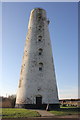
TA3328 : Arthur Street, Withernsea by Malc McDonald Arthur Street, Withernsea by Malc McDonald
geograph for square TA3328
Arthur Street is a residential road in Withernsea, on the East Yorkshire coast.... (more)
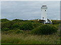
SY6868 : Portland Bill - Old Lower Lighthouse by Chris Talbot Portland Bill - Old Lower Lighthouse by Chris Talbot
geograph for square SY6868
This lighthouse was built in 1869, it has not been used as a lighthouse since... (more)
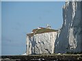
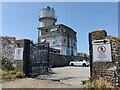
TV5695 : Belle Tout Lighthouse by PAUL FARMER Belle Tout Lighthouse by PAUL FARMER
geograph for square TV5695
Tags: Bed and Breakfast   Bed and Breakfast Accommodation   top:Coastal   type:Geograph   building type:Lighthouse   subject:Lighthouse   former:Lighthouse   Lighthouse (Disused)   Lighthouse (Former)   South Downs   national park:South Downs   place:South Downs  
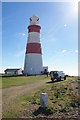
TM4448 : Orford Ness lighthouse by Christopher Hilton Orford Ness lighthouse by Christopher Hilton
geograph for square TM4448
In the foreground, the stone marker with "T.H." carved on it marks the... (more)
TV5695 : Bella Tout Lighthouse by PAUL FARMER Bella Tout Lighthouse by PAUL FARMER
geograph for square TV5695
Tags: top:Business, Retail, Services   place:East Sussex   county:East Sussex   type:Geograph   top:Historic Sites and Artefacts   subject:Lighthouse   Lighthouse   building type:Lighthouse   former:Lighthouse   Lighthouse (Former)   national park:South Downs   South Downs  
TF4925 : The East lighthouse on the River Nene by Steve  Fareham The East lighthouse on the River Nene by Steve Fareham
geograph for square TF4925
Twin lighthouses were built, on the banks of the mouth of the River Nene in 1831... (more)
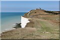
TV5695 : Eroding cliffs at the Belle Tout Lighthouse by Mat Fascione Eroding cliffs at the Belle Tout Lighthouse by Mat Fascione
geograph for square TV5695
This is the former access road to the lighthouse, now lost to erosion.
Tags: Cliffs   top:Coastal   Coastal Erosion   subject:Erosion   type:Geograph   former:Lighthouse   top:Rocks, Scree, Cliffs   national park:South Downs  
TM4448 : Orford Ness lighthouse by Christopher Hilton Orford Ness lighthouse by Christopher Hilton
for square TM4448
The ancillary building to the left collapsed into the sea in early 2020,... (more)
TM4448 : Orford Ness Lighthouse, interior of entrance hall by Christopher Hilton Orford Ness Lighthouse, interior of entrance hall by Christopher Hilton
for square TM4448
TM4249 : Orford: crossing the River Ore by Christopher Hilton Orford: crossing the River Ore by Christopher Hilton
geograph for square TM4249
Taken from a ferry over to Orford Ness. In the distance can be seen Orford Ness... (more)
TF6742 : The former lighthouse at Hunstanton on a sunny spring day by Richard Humphrey The former lighthouse at Hunstanton on a sunny spring day by Richard Humphrey
geograph for square TF6742
Tags: top:Coastal   type:Geograph   Holiday Let   former:Lighthouse   Lighthouse   subject:Lighthouse   Lighthouse (Former)   Sky Blue  
TV5695 : Belle Tout lighthouse by PAUL FARMER Belle Tout lighthouse by PAUL FARMER
geograph for square TV5695
Tags: top:Business, Retail, Services   top:Coastal   type:Geograph   top:Historic Sites and Artefacts   subject:Lighthouse   former:Lighthouse   building type:Lighthouse   Lighthouse   Lighthouse (Disused)   Lighthouse (Former)   South Downs   national park:South Downs   county:Sussex  
TV5695 : Belle Tout Lighthouse by PAUL FARMER Belle Tout Lighthouse by PAUL FARMER
geograph for square TV5695
Tags: Chalk Cliff   Chalk Cliffs   subject:Cliff   Cliffs   top:Coastal   type:Geograph   building type:Lighthouse   subject:Lighthouse   former:Lighthouse   Lighthouse   Lighthouse (Former)  
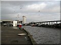
NZ3668 : Fishing boats in the Gut by Adrian Taylor Fishing boats in the Gut by Adrian Taylor
geograph for square NZ3668
The fish dock at North Shields, Fish Quay is on the right and in the background... (more)
TM4448 : South-west marker, light chamber, Orford Ness lighthouse by Christopher Hilton South-west marker, light chamber, Orford Ness lighthouse by Christopher Hilton
for square TM4448
SJ2591 : Leasowe Lighthouse by Jeff Buck Leasowe Lighthouse by Jeff Buck
geograph for square SJ2591
Leasowe Lighthouse was built in 1763 by Liverpool Corporation's Docks... (more)
Tags: top:Coastal   country:England   type:Geograph   top:Historic Sites and Artefacts   place:Leasowe   Lighthouse   former:Lighthouse   Lighthouse (Former)   county:Merseyside   place:Wirral   Wirral Peninsula  
TA3327 : St. Matthew's Church, Withernsea by Malc McDonald St. Matthew's Church, Withernsea by Malc McDonald
geograph for square TA3327
St. Matthew's Church in Withernsea, on the East Yorkshire coast. Looming... (more)
SM8003 : View towards St Ann's Head by Robin Drayton View towards St Ann's Head by Robin Drayton
geograph for square SM8003
On the left are former coastguard cottages and behind these are former... (more)
TF4925 : Guy's Head lighthouse on the west bank of the River Nene by Richard Humphrey Guy's Head lighthouse on the west bank of the River Nene by Richard Humphrey
geograph for square TF4925
North of Sutton Bridge and close to the mouth of the River Nene. This former... (more)
NH6037 : Passing Bona Lighthouse by Gerald England Passing Bona Lighthouse by Gerald England
geograph for square NH6037
The two-storey octagonal former dwelling was constructed circa 1815 and altered... (more)
Tags: date:1848   Bona Lighthouse   top:Canals   listed building:Category B   type:Geograph   top:Historic Sites and Artefacts   top:Lakes, Wetland, Bog   former:Lighthouse   Lighthouse   Loch Dochfour   loch:Loch Dochfour   loch:Loch Ness   Loch Ness   place:Lochend   person:Thomas Telford  
TF4925 : East bank lighthouse near Guy's Head north of Sutton Bridge by Richard Humphrey East bank lighthouse near Guy's Head north of Sutton Bridge by Richard Humphrey
geograph for square TF4925
Often referred to as Sir Peter Scott's lighthouse. The famous naturalist... (more)
TV5695 : Belle Tout Lighthouse by PAUL FARMER Belle Tout Lighthouse by PAUL FARMER
geograph for square TV5695
Tags: Bed and Breakfast   Bed and Breakfast Accommodation   top:Business, Retail, Services   top:Coastal   type:Geograph   building type:Lighthouse   Lighthouse   subject:Lighthouse   former:Lighthouse   national park:South Downs   South Downs  
TV5695 : Belle Tout lighthouse by Mat Fascione Belle Tout lighthouse by Mat Fascione
geograph for square TV5695
Tags: Cliffs   top:Coastal   type:Geograph   subject:Lighthouse   former:Lighthouse   top:Rocks, Scree, Cliffs   long distance path:South Downs Way  
TV5695 : Belle Tout Lighthouse by Mat Fascione Belle Tout Lighthouse by Mat Fascione
geograph for square TV5695
Tags: top:Coastal   type:Geograph   former:Lighthouse   subject:Lighthouse  
TV5695 : Bella Tout Lighthouse by PAUL FARMER Bella Tout Lighthouse by PAUL FARMER
for square TV5695
Tags: top:Business, Retail, Services   top:Coastal   type:Cross Grid   near:Eastbourne   place:Eastbourne   subject:Lighthouse   former:Lighthouse   building type:Lighthouse   place:South Downs   national park:South Downs   South Downs   area:South Downs   long distance path:South Downs Way   South Downs Way  
SY6769 : Old Higher Lighthouse, Portland by Brian Deegan Old Higher Lighthouse, Portland by Brian Deegan
geograph for square SY6769
The Old Higher Lighthouse is a disused 19th-century lighthouse on the Isle of... (more)
Tags: top:Coastal   type:Geograph   former:Lighthouse   subject:Lighthouse   Lighthouse  
HU4008 : Car Park Lighthouse by Sandy Gerrard Car Park Lighthouse by Sandy Gerrard
geograph for square HU4008
Former lighthouse from Muckle Roe which was re erected here.
Tags: top:Coastal   type:Geograph   top:Historic Sites and Artefacts   top:Islands   subject:Lighthouse   former:Lighthouse   top:Roads, Road Transport   top:Rocks, Scree, Cliffs  
TA2570 : The Old Lighthouse at Flamborough Head by Mat Fascione The Old Lighthouse at Flamborough Head by Mat Fascione
for square TA2570
Overlooking Flamborough Head Golf Club.
Tags: top:Coastal   type:Cross Grid   Golf Course   top:Historic Sites and Artefacts   subject:Lighthouse   former:Lighthouse   top:Sport, Leisure  
TR0816 : Old Dungeness Lighthouse by PAUL FARMER Old Dungeness Lighthouse by PAUL FARMER
geograph for square TR0816
Tags: top:Coastal   place:Dungeness   type:Geograph   Lighthouse   subject:Lighthouse   former:Lighthouse   top:Village, Rural Settlement  
TV5695 : Belle Tout Lighthouse by PAUL FARMER Belle Tout Lighthouse by PAUL FARMER
geograph for square TV5695
Tags: top:Coastal   East Sussex   place:East Sussex   top:Housing, Dwellings   Lighthouse   former:Lighthouse   Lighthouse (Former)   national park:South Downs   South Downs   Sussex   place:Sussex  
ST3182 : West Usk Lighthouse - Uskmouth by Mick Lobb West Usk Lighthouse - Uskmouth by Mick Lobb
for square ST3182
Formerly a lighthouse but now in private hands and operated as a... (more)
Tags: top:Coastal   top:Estuary, Marine   Guesthouse   Hotel   former:Lighthouse  
SY6769 : Coastal path near Portland Bill by Malc McDonald Coastal path near Portland Bill by Malc McDonald
geograph for square SY6769
A path along the Isle of Portland's coastline, near Portland Bill. In the... (more)
Tags: Coast Path   top:Coastal   Coastal Path   Decommissioned Lighthouse   county:Dorset   type:Geograph   place:Isle of Portland   Isle of Portland   former:Lighthouse   Lighthouse (Converted)   subject:Path   top:Paths   near:Portland Bill   near:Weymouth  
SH7584 : Lighthouse, Great Orme by Brian Deegan Lighthouse, Great Orme by Brian Deegan
geograph for square SH7584
Now a guesthouse. The lighthouse is 99 metres (325 feet) above sea level. It... (more)
Tags: top:Coastal   type:Geograph   former:Lighthouse   subject:Lighthouse   Lighthouse  
TR3241 : Dover Castle: St Mary in Castro church and the Roman lighthouse by Christopher Hilton Dover Castle: St Mary in Castro church and the Roman lighthouse by Christopher Hilton
geograph for square TR3241
The Roman lighthouse on the left later became a bell-tower for the church of St... (more)
Tags: Castle   Castle Keep   subject:Church   Church   church:Church of England   Dover   place:Dover   Dover Castle   type:Geograph   top:Historic Sites and Artefacts   former:Lighthouse   ruin:Lighthouse   top:Religious Sites   period:Roman   Roman   Roman Lighthouse   Roman Remains  
J2211 : Lighthouse, Greenore by Rossographer Lighthouse, Greenore by Rossographer
geograph for square J2211
A mere 36 feet high and built in 1830 by George Halpin Senior, the light at... (more)
Tags: top:Coastal   top:Docks, Harbours   type:Geograph   Greenore   top:Historic Sites and Artefacts   Lighthouse   subject:Lighthouse   former:Lighthouse   building type:Lighthouse   top:Village, Rural Settlement  
TV5695 : South Downs Way towards Belle Tout Lighthouse by Mat Fascione South Downs Way towards Belle Tout Lighthouse by Mat Fascione
geograph for square TV5695
Tags: top:Coastal   type:Geograph   former:Lighthouse   subject:Path   top:Paths   top:Rocks, Scree, Cliffs   national park:South Downs   long distance path:South Downs Way  
TV5795 : Chalk cliffs near the Belle Tout Lighthouse by Mat Fascione Chalk cliffs near the Belle Tout Lighthouse by Mat Fascione
geograph for square TV5795
Tags: subject:Cliff   Cliffs   top:Coastal   type:Geograph   former:Lighthouse   top:Rocks, Scree, Cliffs   national park:South Downs  
TV5695 : The South Downs Way towards the Belle Tout Lighthouse by Mat Fascione The South Downs Way towards the Belle Tout Lighthouse by Mat Fascione
geograph for square TV5695
Tags: subject:Cliff   Cliffs   top:Coastal   type:Geograph   top:Grassland   former:Lighthouse   top:Paths   top:Rocks, Scree, Cliffs   national park:South Downs   long distance path:South Downs Way  
TV5695 : Clifftop near the Belle Tout Lighthouse by Mat Fascione Clifftop near the Belle Tout Lighthouse by Mat Fascione
geograph for square TV5695
Tags: subject:Cliff   Cliffs   top:Coastal   Coastline   type:Geograph   top:Grassland   former:Lighthouse   top:Rocks, Scree, Cliffs  
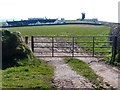
TV5695 : Track to the Belle Tout Lighthouse by Mat Fascione Track to the Belle Tout Lighthouse by Mat Fascione
geograph for square TV5695
Tags: top:Coastal   type:Geograph   former:Lighthouse   top:Roads, Road Transport   national park:South Downs   Track   subject:Track  
TV5695 : Beachy Head Road at the Horseshoe Plantation by Mat Fascione Beachy Head Road at the Horseshoe Plantation by Mat Fascione
geograph for square TV5695
On the right is the Belle Tout Lighthouse.
Tags: top:Coastal   type:Geograph   former:Lighthouse   Road   subject:Road   top:Roads, Road Transport   national park:South Downs  
TM4448 : Orford Ness lighthouse by Christopher Hilton Orford Ness lighthouse by Christopher Hilton
geograph for square TM4448
TM4448 : Orford Ness Lighthouse, interior by Christopher Hilton Orford Ness Lighthouse, interior by Christopher Hilton
for square TM4448
TA4011 : The lighthouses on Spurn Point by Mat Fascione The lighthouses on Spurn Point by Mat Fascione
geograph for square TA4011
On the right is the Spurn Point High Lighthouse, it is 128 feet (39 m) high, its... (more)
Tags: Beach   top:Coastal   top:Derelict, Disused   top:Estuary, Marine   type:Geograph   Humber Estuary   former:Lighthouse   subject:Lighthouse   place:Spurn  
TR3241 : Dover Castle: St Mary in Castro church and the Roman lighthouse by Christopher Hilton Dover Castle: St Mary in Castro church and the Roman lighthouse by Christopher Hilton
geograph for square TR3241
The Roman lighthouse on the right later became a bell-tower for the church of St... (more)
Tags: subject:Church   Church   church:Church of England   Dover   place:Dover   Dover Castle   type:Geograph   top:Historic Sites and Artefacts   former:Lighthouse   ruin:Lighthouse   top:Religious Sites   Roman   period:Roman   Roman Lighthouse   Roman Remains  
SM8002 : The Old Lighthouse, St Ann’s Head by PAUL FARMER The Old Lighthouse, St Ann’s Head by PAUL FARMER
geograph for square SM8002
Tags: top:Coastal   type:Geograph   top:Historic Sites and Artefacts   subject:Lighthouse   former:Lighthouse   Lighthouse   building type:Lighthouse   Lighthouse (Disused)   place:Pembrokeshire  
SY6769 : Fields on Portland Bill by Oliver Mills Fields on Portland Bill by Oliver Mills
geograph for square SY6769
Taken from the Old Higher Lighthouse. Showing the Old Lower Lighthouse, now a... (more)
NO4529 : East lighthouse and lighthouse cottage by Sandy Gemmill East lighthouse and lighthouse cottage by Sandy Gemmill
geograph for square NO4529
The view of the East Lighthouse and lighthouse cottage as seen from the road.... (more)
Tags: top:Docks, Harbours   former:Lighthouse  
View more in the Image Search or in Browser
View images matching 'Lighthouse' anywhere in the tags
Don't click these: PotMel 1 PotMel 2