Geograph - photograph every grid square
About tags on Geograph
Tags
Geographical Context
Subjects
Types
Other Prefixes
Public Tags
Related Tags
|
Coverage Map
Prefix:
former
Tag:
Port
Other tags:
Port
buoy:
Port
near:
Port
subject:
Port
Showing images tagged with
former:
Port
tag.
View all tagged images
-
In Browser
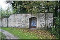
Former entrance to Brimscombe Port
by
Chris Allen
geograph for square
SO8702
Brimscombe Port on the Thames & Severn Canal has been filled in but was... (
more
)
Tags:
Brimscombe
top:
Canals
Door in Wall
former:
Port
canal:
Thames and Severn
Thames and Severn Canal
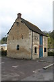
Former Brimscombe Port - salt warehouse
by
Chris Allen
geograph for square
SO8602
The large port at Brimscombe on the Stroudwater (Thames & Severn) Canal was... (
more
)
Tags:
Brimscombe
top:
Historic Sites and Artefacts
former:
Port
canal:
Warehouse
former:
Warehouse
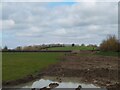
Field off Locking Moor Road
by
S
geograph for square
ST3660
On the right is Carberry Hill. On the top of Carberry Hill is Locking Castle,... (
more
)
Tags:
date:
1902
date:
1978
period:
1990s
period:
2000s
period:
2010s
6 January
6 January 1978
Carberry Hill
former:
Castle
Castle
building type:
Castle
Coin
Countryside
top:
Derelict, Disused
Edward IV
country:
England
Field
type:
Geograph
top:
Grassland
Hill
top:
Historic Sites and Artefacts
Housing Estate
January
January 1978
near:
Locking
Locking Castle
Medieval
North Somerset
top:
People, Events
former:
Port
Pottery
ruin:
Priory
top:
Religious Sites
Scheduled Monument
Stone Chamber
Sword
Uphill
Uphill Port
top:
Uplands
Woodspring Priory
View of Carberry Hill
by
S
geograph for square
ST3660
On the top of Carberry Hill is Locking Castle, which is a motte and bailey... (
more
)
Tags:
date:
1100
period:
1100s
period:
1900s
date:
1902
date:
1978
period:
1990s
period:
2000s
period:
2010s
6 January
6 January 1978
Archaeology
period:
C.1100
Carberry Hill
building type:
Castle
Castle
former:
Castle
Coin
top:
Communications
Countryside
top:
Derelict, Disused
Edward IV
country:
England
Field
type:
Geograph
top:
Grassland
Hill
top:
Historic Sites and Artefacts
Housing Estate
January
January 1978
near:
Locking
Locking Castle
North Somerset
top:
People, Events
former:
Port
Pottery
ruin:
Priory
top:
Religious Sites
Scheduled Monument
Stone Chamber
Sword
Uphill
Uphill Port
top:
Uplands
Woodspring Priory
Fleetwood's Abandoned Port
by
Gerald England
geograph for square
SD3447
Once busy with the famous Fleetwood fishing fleet the port of Fleetwood is now... (
more
)
Tags:
top:
Docks, Harbours
place:
Fleetwood
former:
Port
Field off Locking Moor Road
by
S
geograph for square
ST3660
Looking towards Carberry Hill. On the top of Carberry Hill is Locking Castle,... (
more
)
Tags:
1100s
period:
1900s
date:
1902
date:
1978
period:
1990s
period:
2000s
period:
2010s
6 January 1978
Archaeology
period:
C.1100
building type:
Castle
Coin
Countryside
top:
Derelict, Disused
Edward IV
country:
England
Field
type:
Geograph
top:
Grassland
top:
Historic Sites and Artefacts
Housing Estate
January
January 1978
near:
Locking
Locking Castle
North Somerset
top:
People, Events
former:
Port
Pottery
ruin:
Priory
top:
Religious Sites
Sword
Uphill
Uphill Port
top:
Uplands
Woodspring Priory
Porth Oer....Whistling Sands, Llyn Peninsula, Wales
by
I Love Colour
geograph for square
SH1630
Close to the village of Methlem and just under 3 miles from Aberdaron on the... (
more
)
Tags:
place:
Aberdaron
top:
Air, Sky, Weather
Beach
subject:
Beach
Beach Cove
Blue Sky
Bodyboard
Bodyboarding
Cafe
top:
Coastal
Cove
top:
Docks, Harbours
top:
Estuary, Marine
top:
Flat Landscapes
type:
Geograph
Headland
Headland (Coastal Feature)
Irish Sea
sea:
Irish Sea
place:
Llyn Peninsula
place:
Methlem
National Trust
National Trust Land
National Trust Site
National Trust Wales
place:
North Wales
former:
Port
Port
place:
Porth Oer
Rocks
Rocks at Shore
top:
Rocks, Scree, Cliffs
Rocky Beach
beach:
Sand
Sand
Sand Beach
Scattered Rocks
Sea
Seascape
Sky
top:
Sport, Leisure
Surfing
Waves
place:
Whistling Sands
Field off Locking Moor Road
by
S
geograph for square
ST3660
Tags:
date:
period:
1900s
period:
1970s
date:
1978
period:
1990s
period:
2000s
period:
2010s
Archaeology
building type:
Castle
Coin
Countryside
top:
Derelict, Disused
Edward IV
country:
England
Field
type:
Geograph
top:
Grassland
top:
Historic Sites and Artefacts
Housing Estate
near:
Locking
Locking Castle
North Somerset
top:
People, Events
former:
Port
ruin:
Priory
top:
Religious Sites
Stone
Sword
Uphill
Uphill Port
top:
Uplands
Woodspring Priory
Cross-river view from Linthouse
by
Alan Murray-Rust
geograph for square
NS5466
A rather bland landscape that has history. The brown area in the foreground... (
more
)
Tags:
river:
Clyde
top:
Derelict, Disused
type:
Geograph
meet:
Glasgow 2019
top:
Housing, Dwellings
former:
Port
top:
Rivers, Streams, Drainage
top:
Suburb, Urban Fringe
housing:
Tower Block
Houses on Shore Road, Glencaple
by
Christine Johnstone
geograph for square
NX9968
Some of the first houses to be built after the quay was completed in 1747.
Tags:
type:
Geograph
place:
Glencaple
Old Village Houses
former:
Port
subject:
Village
Village Housing
top:
Village, Rural Settlement
View more in the Image Search
or
in Browser
View images matching 'Port' anywhere
in
the tags
Don't click these:
PotMel 1
PotMel 2
☰
Home
View
Search
Marked Images
Maps
Browser
Explore
Showcase
New Images
Collections
Interact
Games
Discussions
Blog
Contributors
Submit
Statistics
Leaderboards
General
FAQ
Help Pages
Sitemap
Contact Us
Support Us
sponsored by
🔍︎
What to search:
Photos
Enter keywords or a location/postcode to search nearby images
Enter a Grid Reference
Placenames
Collections
Website Pages
Everything
Others:
Advanced Search
|
Image Browser
Or:
Coverage Map
|
Searchable Map
You are not logged in
|
login
|
register