Public Tags
Tag: Gate·on·Track
Showing images tagged with Gate on Track tag.
|
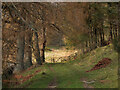
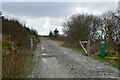
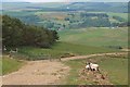
Gate near Newby
by Jim Barton geograph for square NT2637 A gate (or more accurately a hurdle) on the track to the east of the Glensax Burn.
Tags:
top:Country EstatesX
Gate on Track
type:GeographX
top:PathsX
top:Roads, Road TransportX
TrackX
Trees by a TrackX
top:Woodland, ForestX
|
|
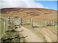
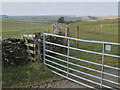
Gates near Whit Beck
by Adrian Taylor geograph for square NY2825 These gates are at a junction of bridleways. The bridleway climbing to the left... (more)
Tags:
top:Boundary, BarrierX
BridlewayX
Bridleway JunctionX
Cumbria WayX
ldp:Cumbria WayX
subject:GateX
Gate on BridlewayX
Gate on Track
GatesX
type:GeographX
top:PathsX
ldp:The Cumbria WayX
long distance footpath:The Cumbria WayX
The Cumbria WayX
top:UplandsX
|
|
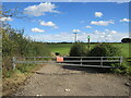
Gate near Eynsford
by Malc McDonald geograph for square TQ5463 An access gate leading onto farmland near the village of Eynsford in Kent.
Tags:
near:EynsfordX
top:Farm, Fishery, Market GardeningX
GateX
subject:GateX
Gate Across Rural TrackX
Gate MetalX
Gate on Track
type:GeographX
county:KentX
near:SwanleyX
|
|
Metal gate, Stony Crag
by Adrian Taylor for square SD2781 The gate leads out of the farm yard at Stony Crag. It is the route of The... (more)
Tags:
type:Cross GridX
CumbriaX
long distance path:Cumbria WayX
ldp:Cumbria WayX
long distance footpath:Cumbria WayX
Cumbria WayX
subject:GateX
Gate on Track
Gateway on FootpathX
Metal GateX
top:PathsX
top:Roads, Road TransportX
The Cumbria WayX
long distance path:The Cumbria WayX
TrackX
top:Village, Rural SettlementX
|
|
Gate on track to Riccarton Junction
by Jim Barton geograph for square NT5301 Until this track was built in 1963 there was no road to the community that lived... (more)
|
|
Gates near Whit Beck
by Adrian Taylor geograph for square NY2825 These gates are at a junction of bridleways. The bridleway climbing to the left... (more)
Tags:
top:Boundary, BarrierX
BridlewayX
Bridleway JunctionX
CumbriaX
ldp:Cumbria WayX
Cumbria WayX
subject:GateX
Gate on Track
type:GeographX
top:PathsX
The Cumbria WayX
long distance footpath:The Cumbria WayX
long distance path:The Cumbria WayX
top:UplandsX
|
|
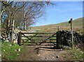
Gate at Longlands
by Adrian Taylor geograph for square NY2635 The gate gives access from the road at Longlands onto the track to Green Head.... (more)
|
|
Gate on The Cumbria Way
by Adrian Taylor geograph for square SD2892 The gate is on the public footpath from Delicars to Coniston which is also the... (more)
Tags:
top:Boundary, BarrierX
Cumbria WayX
ldp:Cumbria WayX
Field Gate on FootpathX
subject:GateX
Gate on Track
Gateway on FootpathX
type:GeographX
Lake DistrictX
top:PathsX
ldp:The Cumbria WayX
long distance path:The Cumbria WayX
long distance footpath:The Cumbria WayX
The Cumbria WayX
|
|
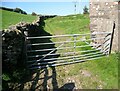
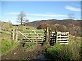
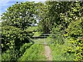
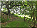
The lane from Bullpot
by Adrian Taylor geograph for square SD6681 The lane from Bullpot continues beyond the gate as an unfenced public bridleway... (more)
Tags:
top:Boundary, BarrierX
GateX
Gate in Dry Stone WallX
Gate on BridlewayX
Gate on Track
type:GeographX
subject:LaneX
Long GrassX
top:PathsX
top:UplandsX
Yorkshire Dales National ParkX
|
|
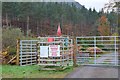
Deer stalking season, Glen Orrin
by Jim Barton geograph for square NH4552 A notice at the gate on the track up the glen to the Orrin Reservoir informs... (more)
|
|
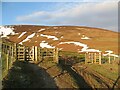
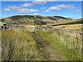
Track by the Drumelzier Burn
by Jim Barton geograph for square NT1433 The main track climbs SE to reach the ridge on Pykestone Hill, with other tracks... (more)
Tags:
BurnX
Gate on Track
type:GeographX
Heather and Grass MoorlandX
Hill TrackX
top:MoorlandX
top:PathsX
top:Rivers, Streams, DrainageX
top:Roads, Road TransportX
top:UplandsX
|
|
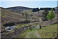
Track above Nether Kidston
by Jim Barton geograph for square NT2343 The track comes up past the farm to meet the Old Drove Road on the east side of... (more)
Tags:
top:CommunicationsX
top:Farm, Fishery, Market GardeningX
FarmlandX
Gate on Track
type:GeographX
Hill TrackX
Mobile Phone MastX
top:MoorlandX
top:PathsX
|
|
Track to Heathpool Common
by Jim Barton geograph for square NT2544 A track descending through sheep pastures on the north side of Collie Law.
Tags:
Coniferous PlantationX
top:Farm, Fishery, Market GardeningX
Gate on Track
type:GeographX
top:GrasslandX
Hill PastureX
Hill TrackX
top:PathsX
top:Roads, Road TransportX
top:Woodland, ForestX
|
|
Lane near Fleming Hall
by Adrian Taylor geograph for square NY0403 The lane is a public bridleway and runs from Seascale Hall to Gosforth.
Tags:
top:Boundary, BarrierX
BridlewayX
county:CumbriaX
CumbriaX
Gate on BridlewayX
Gate on Track
type:GeographX
Grassy LaneX
subject:LaneX
top:LowlandsX
top:Roads, Road TransportX
|
|
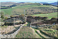
Farm track near Whitchesters
by Jim Barton geograph for square NT4710 The track is used by the Nan Lyle Circular walk, indicated by the waymark disc.
Tags:
top:Farm, Fishery, Market GardeningX
FarmlandX
Gate on Track
type:GeographX
Nan Lyle WalkX
top:PathsX
top:Roads, Road TransportX
Waymark DiscX
|
|
Gate along Pry Lane
by Des Blenkinsopp geograph for square SU2692 Pry Lane is now a quiet green lane and bridleway, but looking at the map, in the... (more)
|
|
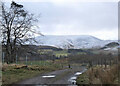
Farm track and Dundreich
by Jim Barton geograph for square NT2348 The snow level has crept down to about 400m in a cold northerly airstream. Snow... (more)
|
|
Eastern edge of Harehead Wood
by Jim Barton geograph for square NT4428 The exit from the plantation on Harehead Hill.
|
|
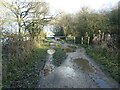
No unauthorised entry, Aire & Calder towpath
by Christine Johnstone geograph for square SE3824 The south bank towpath, just east of the M62. Pedestrians and cyclists are permitted.
Tags:
Aire & Calder NavigationX
canal:Aire and CalderX
Aire and Calder NavigationX
subject:Canal TowpathX
top:CanalsX
Gate on Track
type:GeographX
No Unauthorised EntryX
|