About tags on Geograph

Public Tags

Related Tags | Coverage Map
Prefix: gatepost    Tag:  Concrete  
Other tags: Concrete     barrier:Concrete     bridge:Concrete     building material:Concrete     fence:Concrete     footbridge:Concrete     footpath sign:Concrete     footpath signpost:Concrete     footpath steps:Concrete
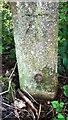
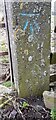
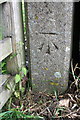
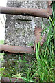
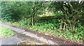
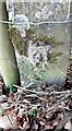
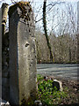
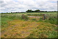
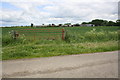
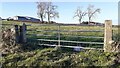
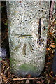
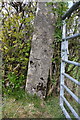
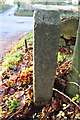
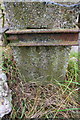
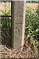
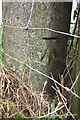
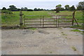
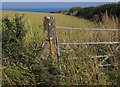
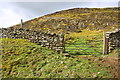
     gateposts:Concrete     seat:Concrete    

Showing images tagged with gatepost:Concrete tag.

View all tagged images - In Browser
:

TQ7324 : Concrete gatepost, Clappers Crossing by Adrian Taylor Concrete gatepost, Clappers Crossing by Adrian Taylor
for square TQ7324
Beside Northbridge Street at the site of Clappers Crossing, only a single... (more)
SD9953 : Field gateway on south side of Brackenley Lane by Roger Templeman Field gateway on south side of Brackenley Lane by Roger Templeman
geograph for square SD9953
Ordnance Survey documents indicate that a benchmark levelled at 163.449m above... (more)
SU6085 : Wallingford Road (B4009) at Ash Cottages by Roger Templeman Wallingford Road (B4009) at Ash Cottages by Roger Templeman
geograph for square SU6085
Four of the area's characteristic square cross-section concrete gateposts... (more)
SD6395 : Field west of Four Lane Ends by Roger Templeman Field west of Four Lane Ends by Roger Templeman
geograph for square SD6395
Ordnance Survey records indicate that a benchmark levelled at 185.111m above... (more)
SE2938 : Benchmark on concrete gatepost on SE side of A6120 near Tunnel How Hill by Roger Templeman Benchmark on concrete gatepost on SE side of A6120 near Tunnel How Hill by Roger Templeman
for square SE2938
Ordnance Survey cut mark benchmark levelled at 119.293m above Newlyn Datum verified 1957
Tags: BenchmarkX   type:Close LookX   gatepost:Concrete   Ordnance SurveyX   top:Suburb, Urban FringeX  
NY8465 : Benchmark on concrete gatepost on south side of rural road west of Haydon Church by Roger Templeman Benchmark on concrete gatepost on south side of rural road west of Haydon Church by Roger Templeman
for square NY8465
Ordnance Survey cut mark benchmark levelled at 168.030m above Newlyn Datum verified 1954
NZ1802 : Benchmark on concrete gatepost at gateway from Gilling Road by Roger Templeman Benchmark on concrete gatepost at gateway from Gilling Road by Roger Templeman
for square NZ1802
Ordnance Survey cut mark benchmark described on the Bench Mark Database at... (more)
SE0064 : Benchmark on concrete gatepost, SE side on Moor Lane by Roger Templeman Benchmark on concrete gatepost, SE side on Moor Lane by Roger Templeman
for square SE0064
Ordnance Survey cut mark benchmark described on the Bench Mark Database at... (more)
SE2938 : Disused gateway on SE side of Ring Road Moortown by Roger Templeman Disused gateway on SE side of Ring Road Moortown by Roger Templeman
for square SE2938
There is an Ordnance Survey benchmark SE2938 : Benchmark on concrete gatepost on SE side of A6120 near Tunnel How Hill on the right hand concrete gatepost
Tags: type:Close LookX   gateposts:Concrete   Ordnance SurveyX   top:PathsX   PavementX   top:Suburb, Urban FringeX   TreesX   top:Woodland, ForestX  
NY4162 : Benchmark on concrete gatepost at gateway on SW side of road east of Wide Open Dikes by Roger Templeman Benchmark on concrete gatepost at gateway on SW side of road east of Wide Open Dikes by Roger Templeman
for square NY4162
Ordnance Survey cut mark benchmark levelled at 34.585m above Newlyn Datum verified 1972
SD4777 : Cut benchmark on concrete gatepost at Coldwell Parrock by Karl and Ali Cut benchmark on concrete gatepost at Coldwell Parrock by Karl and Ali
for square SD4777
By Silverdale Road at an altitude of 31.961m asl.
SE2887 : Gateway on Lord's Lane by Roger Templeman Gateway on Lord's Lane by Roger Templeman
geograph for square SE2887
Buildings of Bridge Grange Farm can be seen on the horizon. There is an OS... (more)
SE2787 : Gateway near north end of Lord's Lane by Roger Templeman Gateway near north end of Lord's Lane by Roger Templeman
geograph for square SE2787
The right hand reinforced concrete gatepost has cracked with the loss of an OS... (more)
NY4442 : Field gateway on NW side of road at Sceugh Hill Farm by Roger Templeman Field gateway on NW side of road at Sceugh Hill Farm by Roger Templeman
geograph for square NY4442
There is an Ordnance Survey benchmark NY4442 : Benchmark on gatepost at gateway on NW side of road at Sceugh Hill Farm on the inside face of the... (more)
SP4504 : Benchmark on gatepost at field entrance from Cumnor Road by Roger Templeman Benchmark on gatepost at field entrance from Cumnor Road by Roger Templeman
for square SP4504
Ordnance Survey cut mark benchmark described on the Bench Mark Database at... (more)
SD6295 : Benchmark on gatepost beside B6257 near Bowers by Roger Templeman Benchmark on gatepost beside B6257 near Bowers by Roger Templeman
for square SD6295
Ordnance Survey cut mark benchmark described on the Bench Mark Database at... (more)
SP3124 : Old gatepost with benchmark beside Old London Road by Roger Templeman Old gatepost with benchmark beside Old London Road by Roger Templeman
for square SP3124
Ordnance Survey cut mark benchmark described on the Bench Mark Database at... (more)
SU3990 : Benchmark behind clamp on gatepost near Woodhill Farm by Roger Templeman Benchmark behind clamp on gatepost near Woodhill Farm by Roger Templeman
for square SU3990
Ordnance Survey cut mark benchmark described on the Bench Mark Database at... (more)
SE3495 : Gatepost with benchmark, Mounstrall Lane by Roger Templeman Gatepost with benchmark, Mounstrall Lane by Roger Templeman
for square SE3495
Ordnance Survey cut mark benchmark described on the Bench Mark Database at... (more)
SE2887 : Benchmark on gatepost, Lord's Lane by Roger Templeman Benchmark on gatepost, Lord's Lane by Roger Templeman
for square SE2887
Ordnance Survey cut mark benchmark described on the Bench Mark Database at... (more)
SD5192 : Benchmark on gatepost of #41 Greengate Lane by Roger Templeman Benchmark on gatepost of #41 Greengate Lane by Roger Templeman
for square SD5192
Category: Bench Mark
Ordnance Survey cut mark benchmark levelled at 72.314m above Newlyn Datum verified 1972
NY8465 : Field gateway on south side of rural road east of The Tofts by Roger Templeman Field gateway on south side of rural road east of The Tofts by Roger Templeman
geograph for square NY8465
There is an Ordnance Survey benchmark NY8465 : Benchmark on concrete gatepost on south side of rural road west of Haydon Church on the road face of the right... (more)
NY4162 : Field gateway on SW side of rural road east of Wide Open Dikes by Roger Templeman Field gateway on SW side of rural road east of Wide Open Dikes by Roger Templeman
geograph for square NY4162
There is an Ordnance Survey benchmark NY4162 : Benchmark on concrete gatepost at gateway on SW side of road east of Wide Open Dikes on the gatepost at the right... (more)
SD7759 : Field gateway onto Old Oliver Road near Ragged Hall by Luke Shaw Field gateway onto Old Oliver Road near Ragged Hall by Luke Shaw
geograph for square SD7759
Ordnance Survey records show there was a benchmark cut on gatepost here, see... (more)
NZ1802 : Field gateway off Gilling Road (B6274) by Roger Templeman Field gateway off Gilling Road (B6274) by Roger Templeman
geograph for square NZ1802
There is an OS benchmark NZ1802 : Benchmark on concrete gatepost at gateway from Gilling Road on the gatepost at the right hand side of... (more)
SD6295 : Gateway beside B6257 west of Bowers by Roger Templeman Gateway beside B6257 west of Bowers by Roger Templeman
geograph for square SD6295
There is an OS benchmark SD6295 : Benchmark on gatepost beside B6257 near Bowers on the gatepost at the left hand side of the gateway
Tags: road:B RoadX   gatepost:Concrete   HedgerowsX   gate:MetalX   Ordnance SurveyX   top:Roads, Road TransportX   top:UplandsX  
SE2586 : Former gateway beside minor road near High Ash Bank by Roger Templeman Former gateway beside minor road near High Ash Bank by Roger Templeman
geograph for square SE2586
There is an OS benchmark SE2586 : Concrete post in hedge near High Ash Bank on the front of the right hand side... (more)
SU3990 : Gate across track towards disused rifle range by Roger Templeman Gate across track towards disused rifle range by Roger Templeman
geograph for square SU3990
There is an OS benchmark SU3990 : Benchmark behind clamp on gatepost near Woodhill Farm on the left hand gatepost
SE3495 : Howe Hill viewed past gateway on Mounstrall Lane by Roger Templeman Howe Hill viewed past gateway on Mounstrall Lane by Roger Templeman
geograph for square SE3495
There is an OS benchmark SE3495 : Gatepost with benchmark, Mounstrall Lane on the front of the gatepost
SD6395 : Field gateway from Howgill Lane north of Chapel Bridge by Roger Templeman Field gateway from Howgill Lane north of Chapel Bridge by Roger Templeman
geograph for square SD6395
Ordnance Survey records indicate that a benchmark levelled at 152.924m above... (more)
SD6394 : Gateway on west side of Howgill Lane by Roger Templeman Gateway on west side of Howgill Lane by Roger Templeman
geograph for square SD6394
Ordnance Survey records indicate that a benchmark levelled at 178.924m above... (more)
SE0064 : Gateway on SE side of Moor Lane by Roger Templeman Gateway on SE side of Moor Lane by Roger Templeman
geograph for square SE0064
There is an OS benchmark SE0064 : Benchmark on concrete gatepost, SE side on Moor Lane on the front face of the right hand gatepost
SE2586 : Concrete post in hedge near High Ash Bank by Roger Templeman Concrete post in hedge near High Ash Bank by Roger Templeman
for square SE2586
Ordnance Survey cut mark benchmark described on the Bench Mark Database at... (more)
SP4504 : Field entrance from Cumnor Hill by Roger Templeman Field entrance from Cumnor Hill by Roger Templeman
geograph for square SP4504
There is an OS benchmark SP4504 : Benchmark on gatepost at field entrance from Cumnor Road on the concrete post at the left hand side... (more)
SP3124 : Cross roads for Old London Road and A361 by Roger Templeman Cross roads for Old London Road and A361 by Roger Templeman
geograph for square SP3124
There is an OS benchmark SP3124 : Old gatepost with benchmark beside Old London Road on the concrete post on the right hand side... (more)
SX9050 : Gate and post near The Daymark by Derek Harper Gate and post near The Daymark by Derek Harper
geograph for square SX9050
The military road to the battery on Froward Point is characterised by concrete... (more)
SD8845 : Gateway for track off Kelbrook Road by Roger Templeman Gateway for track off Kelbrook Road by Roger Templeman
geograph for square SD8845
Tags: gateposts:Concrete   gate:MetalX   Ordnance SurveyX   top:PathsX   Roadside TreesX   top:Suburb, Urban FringeX  
NY3254 : Gateway to field on northwest side of road southwest of Stonerigg by Luke Shaw Gateway to field on northwest side of road southwest of Stonerigg by Luke Shaw
geograph for square NY3254
SD6490 : Gate across Cycle Route 68 east of Holme Fell by Roger Templeman Gate across Cycle Route 68 east of Holme Fell by Roger Templeman
geograph for square SD6490
The toppled stone SD6490 : Stone on verge on south side of road near gate east of Holme Fell on the verge in the foreground may be a boundary... (more)
SD6490 : Gated road (also Cycle Route 68) approaching Holme Fell by Roger Templeman Gated road (also Cycle Route 68) approaching Holme Fell by Roger Templeman
geograph for square SD6490
The wall is on a parish boundary
SK8833 : View across A607 to fields on NW side of the A607 by Luke Shaw View across A607 to fields on NW side of the A607 by Luke Shaw
geograph for square SK8833
SK9034 : #1 Gresley Court from Trent Road by Phil Richards #1 Gresley Court from Trent Road by Phil Richards
geograph for square SK9034
There is an OS benchmark SK9034 : Benchmark on #1 Gresley Court on the right hand side of the house near... (more)
NY7026 : Gateway to slope leading to Dufton Pike by Roger Templeman Gateway to slope leading to Dufton Pike by Roger Templeman
geograph for square NY7026
Tags: gatepost:Concrete   Dry Stone WallsX   type:GeographX   gate:MetalX   top:MoorlandX   Ordnance SurveyX   Rocky MoorlandX   top:UplandsX  
NZ1402 : Gateway off Hurgill Road by Roger Templeman Gateway off Hurgill Road by Roger Templeman
geograph for square NZ1402
SE1893 : Junction of Moor Lane and lane to Well Close House by Roger Templeman Junction of Moor Lane and lane to Well Close House by Roger Templeman
geograph for square SE1893
SE0351 : Gateways at junction of Height Lane and Skipton Moor Lane by Roger Templeman Gateways at junction of Height Lane and Skipton Moor Lane by Roger Templeman
geograph for square SE0351
Tags: gateposts:Concrete   gates:MetalX   top:PathsX   Road and Bridleway JunctionX   top:Roads, Road TransportX   top:UplandsX   Wooden GatesX  
View more in the Image Search or in Browser
View images matching 'Concrete' anywhere in the tags
Don't click these: PotMel 1 PotMel 2
You are not logged in login | register