About tags on Geograph

Public Tags

Related Tags | Coverage Map
Prefix: gateposts    Tag:  Brick  
Other tags: Brick     building material:Brick     gatepost:Brick     landscaping material:Brick     water trough:Brick    

Showing latest 50 of 98 images tagged with gateposts:Brick tag.

View all tagged images - In Browser
:

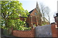
NY4056 : Wall on south side of Victoria Place east of Howard Place junction by Roger Templeman Wall on south side of Victoria Place east of Howard Place junction by Roger Templeman
geograph for square NY4056
There is an Ordnance Survey benchmark NY4056 : Benchmark on brick wall on south side of Victoria Place on the wall pier between the... (more)
Tags: gateposts:Brick   Brick Wall   Brick Wall Piers   type:Geograph   gate:Metal   Ordnance Survey   top:Suburb, Urban Fringe   Trees  
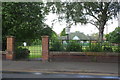
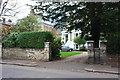
NY3954 : Entrance to St James Bowling Green, Norfolk Street by Roger Templeman Entrance to St James Bowling Green, Norfolk Street by Roger Templeman
geograph for square NY3954
There is an Ordnance Survey benchmark NY3954 : Benchmark on wall at entrance to St James Bowling Green in the bricks on the wall left... (more)
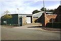
NY4054 : Council Depot on east side of Boustead's Grassing by Roger Templeman Council Depot on east side of Boustead's Grassing by Roger Templeman
geograph for square NY4054
There is an Ordnance Survey benchmark NY4054 : Benchmark on gatepost base at entrance to Council depot yard, Boustead's Grassing on the concrete base of the... (more)
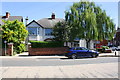
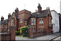
SK5836 : Nos 89a and 91 Melton Road at Clumber Road junction by Roger Templeman Nos 89a and 91 Melton Road at Clumber Road junction by Roger Templeman
geograph for square SK5836
There is an OS benchmark SK5836 : Benchmark on brick gatepost of 89a Melton Road on the brick gatepost at the left hand side... (more)
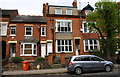
SK5704 : Nos. 179 and 181 Hinckley Road by Roger Templeman Nos. 179 and 181 Hinckley Road by Roger Templeman
geograph for square SK5704
There is an OS benchmark SK5704 : Benchmark on brick post outside #179 Hinckley Road on the brick wall pier left of the left... (more)
SK5642 : #77A Nottingham Road at Langtry Grove junction by Roger Templeman #77A Nottingham Road at Langtry Grove junction by Roger Templeman
geograph for square SK5642
There is an OS benchmark SK5642 : Benchmark on wall of Langtry Grove in shadow of tree on the brick wall left of the entrance gatepost
SK8009 : Junction of Main Street and Somerby Road by Roger Templeman Junction of Main Street and Somerby Road by Roger Templeman
geograph for square SK8009
There is an OS benchmark SK8009 : Benchmark on gatepost at entrance to Gates Garden Centre on the left hand brick gatepost to the... (more)
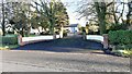
SD4264 : Brick gateposts at entrance to car park beside Rita's Cafe by Roger Templeman Brick gateposts at entrance to car park beside Rita's Cafe by Roger Templeman
geograph for square SD4264
Ordnance Survey documents indicate that a benchmark levelled at 7.740m above... (more)
Tags: gateposts:Brick   top:Business, Retail, Services   Cafe   type:Geograph   Public Carpark   top:Roads, Road Transport  
SK8508 : Entrance to building on Church Street by Roger Templeman Entrance to building on Church Street by Roger Templeman
geograph for square SK8508
There is an OS benchmark SK8508 : Benchmark on Church Street gatepost on the right hand gatepost
Tags: gateposts:Brick   Ordnance Survey   top:Roads, Road Transport   building material:Stone and Brick   top:Suburb, Urban Fringe   Urban Street  
SE4091 : 'Hunters Chase', with rebuilt gateposts and walls by Roger Templeman 'Hunters Chase', with rebuilt gateposts and walls by Roger Templeman
geograph for square SE4091
Tags: gateposts:Brick   Brick Walls   housing:Bungalow   top:Housing, Dwellings   gates:Metal   top:Roads, Road Transport   Rural Road   top:Village, Rural Settlement  
SK3771 : Vehicle access for #58 Newbold Road by Luke Shaw Vehicle access for #58 Newbold Road by Luke Shaw
geograph for square SK3771
Ordnance Survey records indicate that in 1961 there was a benchmark levelled at... (more)
SP8688 : Entrance to St Brendan's Catholic Primary School from Beanfield Avenue by Phil Richards Entrance to St Brendan's Catholic Primary School from Beanfield Avenue by Phil Richards
geograph for square SP8688
There is an OS benchmark SP8688 : Benchmark on gatepost at entrance to St Brendan's Presbytery on the ivy-clad left hand brick gatepost
SK5703 : #138 Westcotes Drive, a care home by Roger Templeman #138 Westcotes Drive, a care home by Roger Templeman
geograph for square SK5703
There is an OS benchmark SK5703 : Benchmark on wall at #138 Westcotes Drive on the wall right of the wall gatepost near... (more)
SK6004 : Wood Hill gateways at rear of St Saviours Church by Roger Templeman Wood Hill gateways at rear of St Saviours Church by Roger Templeman
geograph for square SK6004
There is an OS benchmark SK6004 : Benchmark on gatepost on Wood Hill on the left hand gatepost beside the wooden gate
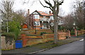
NZ2814 : Junction of Cleveland Avenue and Abbey Road by Roger Templeman Junction of Cleveland Avenue and Abbey Road by Roger Templeman
geograph for square NZ2814
The house at the corner, #16 Abbey Road, has the name 'Rydale' on its... (more)
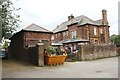
SU6284 : Genesis offices and Glebe Farm, Icknield Road by Roger Templeman Genesis offices and Glebe Farm, Icknield Road by Roger Templeman
geograph for square SU6284
SK8053 : Magnus C of E Academy, Earp Avenue by Roger Templeman Magnus C of E Academy, Earp Avenue by Roger Templeman
geograph for square SK8053
There is an OS benchmark SK8053 : Benchmark on gatepost of Magnus C of E Academy on the base of the right hand gatepost of... (more)
TQ1780 : Entrance to #18 Mattock Lane by Roger Templeman Entrance to #18 Mattock Lane by Roger Templeman
geograph for square TQ1780
There is an OS benchmark TQ1780 : Benchmark on wall pier outside #18 Mattock Lane on the wall pier to the right of the right... (more)
SU7373 : Entrance to Vanbrugh Court, London Road by Roger Templeman Entrance to Vanbrugh Court, London Road by Roger Templeman
geograph for square SU7373
There is as OS benchmark SU7373 : Benchmark on gatepost at entrance to #31 Vanbrugh Court on the gatepost at the right hand side of... (more)
SU7272 : Lodge at entrance to Reading School from Erleigh Road by Roger Templeman Lodge at entrance to Reading School from Erleigh Road by Roger Templeman
geograph for square SU7272
There is an OS benchmark SU7272 : Benchmark on gatepost at entrance to Reading School on the brick gatepost at the right hand... (more)
SU7173 : The Almshouses, Castle Street by Roger Templeman The Almshouses, Castle Street by Roger Templeman
geograph for square SU7173
There is an OS benchmark SU7173 : Benchmark on the Almshouses, Castle Street on the near corner of the brick almshouse... (more)
NY4161 : Entrance to Highfield Grange by Roger Templeman Entrance to Highfield Grange by Roger Templeman
geograph for square NY4161
There is an Ordnance Survey benchmark NY4161 : Benchmark on brick pier at entrance to Highfield Grange on the right hand brick pier
NY4053 : Garage block at rear of Nos. 63 and 65 Upperby Road by Luke Shaw Garage block at rear of Nos. 63 and 65 Upperby Road by Luke Shaw
geograph for square NY4053
There is an Ordnance Survey benchmark NY4053 : Benchmark on garage block at rear of No. 63 Upperby Road (Stapleton House) on the garage block near the... (more)
SK5742 : No. 47 Mapperley Hall Drive at Woodland Drive junction by Luke Shaw No. 47 Mapperley Hall Drive at Woodland Drive junction by Luke Shaw
geograph for square SK5742
There is an Ordnance Survey benchmark SK5742 : Benchmark on wall pier beside gate of #47 Mapperley Hall Drive on the brick pier on the right... (more)
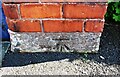
NY4054 : Benchmark on gatepost  base at entrance to Council depot yard, Boustead's Grassing by Roger Templeman Benchmark on gatepost base at entrance to Council depot yard, Boustead's Grassing by Roger Templeman
for square NY4054
Ordnance Survey cut mark benchmark described on the Bench Mark Database at... (more)
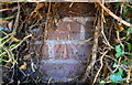
Tags: Benchmark   gatepost:Brick   type:Close Look   Ordnance Survey   top:Suburb, Urban Fringe  
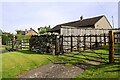
NY5634 : 'Glenavon' on east side of Salkeld Road by Roger Templeman 'Glenavon' on east side of Salkeld Road by Roger Templeman
geograph for square NY5634
There is an Ordnance Survey benchmark NY5634 : Benchmark on wall on east side of Salkeld Road on a stone at the far end of... (more)
Tags: gateposts:Brick   housing:Detached House   Dry Stone Wall   type:Geograph   top:Housing, Dwellings   gate:Metal   Ordnance Survey   top:Village, Rural Settlement   gateposts:Wooden   Wooden Fences  
NY4944 : Entrance to 'Eden Hill' by Luke Shaw Entrance to 'Eden Hill' by Luke Shaw
geograph for square NY4944
There is an Ordnance Survey benchmark NY4944 : Benchmark on brick gatepost at entrance to 'Eden Hill' on the left hand gatepost... (more)
SP8688 : Benchmark on gatepost at entrance to St Brendan's Presbytery by Phil Richards Benchmark on gatepost at entrance to St Brendan's Presbytery by Phil Richards
for square SP8688
Ordnance Survey cut mark benchmark described on the Bench Mark Database at... (more)
Tags: Benchmark   gatepost:Brick   type:Close Look   plant:Ivy   Ordnance Survey   top:Religious Sites   top:Suburb, Urban Fringe  
TF1900 : Benchmark on gatepost  at entrance to #1 Garton End Road by Roger Templeman Benchmark on gatepost at entrance to #1 Garton End Road by Roger Templeman
for square TF1900
Ordnance Survey cut mark benchmark described on the Bench Mark Database at... (more)
Tags: Benchmark   gatepost:Brick   type:Close Look   Ordnance Survey   top:Suburb, Urban Fringe  
SE2535 : Nos. 21 and 23 Lancastre Grove by Roger Templeman Nos. 21 and 23 Lancastre Grove by Roger Templeman
geograph for square SE2535
There is an OS benchmark SE2535 : Benchmark on gatepost of #21 Lancastre Grove on the right hand gatepost at the entrance... (more)
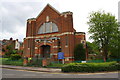
SK5704 : Westcotes United Reformed Church, Hinckley Road by Roger Templeman Westcotes United Reformed Church, Hinckley Road by Roger Templeman
geograph for square SK5704
There is an OS benchmark SK5704 : Benchmark on gatepost at entrance to Westcotes United Reformed Church on the church's right hand gatepost
TQ1781 : Entrance to Monpelier Primary School, Helena Road by Roger Templeman Entrance to Monpelier Primary School, Helena Road by Roger Templeman
geograph for square TQ1781
There is an OS benchmark TQ1781 : Benchmark on Helena Road school gatepost at the base of the left hand gatepost
SU7682 : Church Street entrance gates to Henley Trinity School by Roger Templeman Church Street entrance gates to Henley Trinity School by Roger Templeman
geograph for square SU7682
There is an OS benchmark SU7682 : Benchmark on gatepost at school entrance, Church Street on the base of the centre gatepost
SU1782 : Entrance to Coate Water Country Park from Marlborough Road by Roger Templeman Entrance to Coate Water Country Park from Marlborough Road by Roger Templeman
geograph for square SU1782
There is an OS benchmark SU1782 : Benchmark on gatepost at Marlborough Road entrance to Coate Water on the second gatepost from the left
Tags: gateposts:Brick   top:Country Estates   Ordnance Survey   top:Paths   top:Suburb, Urban Fringe  
SK5239 : Entrance to Wollaton Park from Wollaton Road by Roger Templeman Entrance to Wollaton Park from Wollaton Road by Roger Templeman
geograph for square SK5239
NY0938 : Springwell House on SW side of road SE of Bullgill by Luke Shaw Springwell House on SW side of road SE of Bullgill by Luke Shaw
geograph for square NY0938
Tags: gateposts:Brick   Brick Wall   housing:Detached House   type:Geograph   House Name Sign   top:Housing, Dwellings   Roadside Hedgerow   Tree   top:Village, Rural Settlement   gate:Wooden  
NY2546 : Throstle View on south side of road at High Longthwaite by Luke Shaw Throstle View on south side of road at High Longthwaite by Luke Shaw
geograph for square NY2546
SK5434 : Nos. 1 and 3 Dalehead Road by Roger Templeman Nos. 1 and 3 Dalehead Road by Roger Templeman
geograph for square SK5434
Ordnance Survey documents indicate that a benchmark levelled at 42.264m above... (more)
SE3053 : #68A Leadhall Lane by Roger Templeman #68A Leadhall Lane by Roger Templeman
geograph for square SE3053
NY4253 : Nos. 504 and 502 London Road by Roger Templeman Nos. 504 and 502 London Road by Roger Templeman
geograph for square NY4253
There is an Ordnance Survey benchmark NY4253 : Benchmark on NW face of #504 London Road on the right hand side of the... (more)
NY4650 : Croft House on east side of Peter Gate by Roger Templeman Croft House on east side of Peter Gate by Roger Templeman
geograph for square NY4650
There is an Ordnance Survey benchmark NY4650 : Benchmark on wall on south side of Croft House, east side of Peter Gate on the left hand end of the... (more)
NY4052 : Houses on east side of Durdar Road, opposite recreation ground by Roger Templeman Houses on east side of Durdar Road, opposite recreation ground by Roger Templeman
geograph for square NY4052
Ordnance Survey records indicate that a benchmark levelled at 48.091m above... (more)
NY4154 : 'Nevele' on SE side of Harraby Grove by Luke Shaw 'Nevele' on SE side of Harraby Grove by Luke Shaw
geograph for square NY4154
There is an Ordnance Survey benchmark NY4154 : Benchmark on the garage of 'Nevele', Harraby Grove in the bricks on the left hand... (more)
NY4056 : Armstrong Watson building on west side of Lismore Place and south side of Victoria Place by Luke Shaw Armstrong Watson building on west side of Lismore Place and south side of Victoria Place by Luke Shaw
geograph for square NY4056
There is an Ordnance Survey benchmark NY4056 : Damaged benchmark on corner wall pier at junction of Lismore Place and lane on the pier at the near end of... (more)
NY3756 : Nos. 72 and 74 Moorhouse Road by Roger Templeman Nos. 72 and 74 Moorhouse Road by Roger Templeman
geograph for square NY3756
There is an Ordnance Survey benchmark NY3756 : Benchmark on No. 72 Moorhouse Road on the side of the right hand... (more)
NY4059 : Entrance to Townhead Farm by Luke Shaw Entrance to Townhead Farm by Luke Shaw
geograph for square NY4059
There is an Ordnance Survey benchmark NY4059 : Benchmark on brick outbuilding at Townhead Farm on the brick face of the... (more)
NY3957 : Semi-detached houses on NW side of Waverley Road by Luke Shaw Semi-detached houses on NW side of Waverley Road by Luke Shaw
geograph for square NY3957
Ordnance Survey records indicate that a benchmark levelled at 18.459m above... (more)
TL1798 : Entrance to No. 192 Thorpe Road by Phil Richards Entrance to No. 192 Thorpe Road by Phil Richards
geograph for square TL1798
There is an Ordnance Survey benchmark TL1798 : Benchmark on pier of roadside boundary wall of No. 192 Thorpe Road on the wall pier right of the... (more)
SK6103 : No. 135 Evington Lane by Phil Richards No. 135 Evington Lane by Phil Richards
geograph for square SK6103
There is an Ordnance Survey benchmark SK6103 : Benchmark on integral garage of No. 135 Evington Lane on the right hand side of the... (more)
SK6103 : Nos.52 and 54 Evington Lane by Roger Templeman Nos.52 and 54 Evington Lane by Roger Templeman
geograph for square SK6103
Ordnance Survey documents indicate that in 1965 a benchmark levelled at 78.343m... (more)
View more in the Image Search or in Browser
View images matching 'Brick' anywhere in the tags
Don't click these: PotMel 1 PotMel 2