
|
Hudson Beare Building, Edinburgh University, 1964
by Alan Murray-Rust
geograph for square NT2670
Formerly the Physics Department lecture theatre. This attractive building is now... (more)
|

|
Church of St Luke, Broughton Sulney (Upper Broughton)
by Alan Murray-Rust
for square SK6826
This late Norman aisle arcade arch is the earliest surviving fabric of the... (more)
|

|
Gatehouse, Stormont
by Rossographer
geograph for square J3974
Gatehouse at the Massey Avenue entrance to the Stormont Estate in Belfast. Built... (more)
|

|
Jenners Depository, Balgreen, Edinburgh
by Christine Johnstone
geograph for square NT2172
Built in 1925 as the warehouse of Jenners department store. Sold in 2005 and now... (more)
|

|
Lothian Chambers
by Ian Capper
geograph for square NT2573
Former Midlothian county offices, designed by architect James McIntyre Henry and... (more)
|

|
Morning light on Royal Crescent
by Keith Edkins
geograph for square NS5765
57 bay terrace block by Alexander Taylor, 1839-51. Grade B listed.
|

|
Sea wall and East tower at Chapel Gardens
by Oliver Dixon
geograph for square NT3194
16th century grade B listed structure on the shore at West Wemyss. The tower may... (more)
|

|
West tower, Chapel Gardens
by Oliver Dixon
geograph for square NT3194
16th century grade B listed tower on the shore at West Wemyss. The Fife Coastal... (more)
|

|
West tower, Chapel Gardens
by Oliver Dixon
geograph for square NT3194
16th century grade B listed tower on the shore at West Wemyss. The Fife Coastal... (more)
|

|
Nairn Building
by Oliver Dixon
geograph for square NT2892
The former Nairn mill, grade B listed, dates from 1868 and stands at the... (more)
|
|
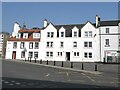
Harbour Place, Burntisland
by Oliver Dixon
geograph for square NT2385
These handsome buildings on Harbour Place are all grade B listed. The main... (more)
|
|
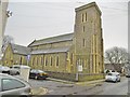
Worthing, Christ Church
by Mike Faherty
geograph for square TQ1402
Parish church on Grafton Road; 1840s, Grade B listed by Historic England:... (more)
|
|
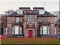
Maryhill House Elgin
by valenta
geograph for square NJ2062
Maryhill House now the home to the occupational health service, is grade B... (more)
|

|
Holme Rose Bridge
by valenta
geograph for square NH8148
Holme Bridge over the River Nairn carries the old coaching road from Cawdor to... (more)
|

|
Biggleswade, St. Andrew's
by Mike Faherty
geograph for square TL1844
Parish church on Shortmead Street; C14 and later, listed by Historic England... (more)
|

|
Ram Fountain
by Gerald England
geograph for square NT0805
This sculpture of a bronze ram by William Brodie on a tall plinth of boulders... (more)
|

|
Moffat Old Courthouse
by Gerald England
geograph for square NT0805
The Old Courthouse is a Grade B listed building... (more)
|

|
Moffat Old Courthouse
by Gerald England
geograph for square NT0805
The Old Courthouse is a Grade B listed building... (more)
|

|
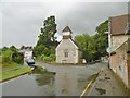
Bemerton, St. John's
by Mike Faherty
geograph for square SU1230
Parish church on Lower Road, dating from 1860. Listed by Historic England (Grade... (more)
|
|
Bemerton, St. Andrew's
by Mike Faherty
geograph for square SU1230
Norman church at the corner of Lower Road and Church Lane, noted for the... (more)
|

|
Congregational Church, Tweedale Street
by Ian Capper
geograph for square NM8530
Founded in 1805. The present building dates from 1880. Category B designated -... (more)
|

|
Forteath Mausoleum
by valenta
for square NJ1662
Forteath family mausoleum, grade "B" listed, circa 1850.
|

|
Stockport, St. Peter's
by Mike Faherty
geograph for square SJ8990
Anglican church on St. Peter's Square; C18, listed by Historic England... (more)
|

|
River Orrin
by valenta
geograph for square NH4751
River Orrin just before it flows under the mid 19th-century grade "B"... (more)
|

|
Invernauld Bridge over the Allt Mòr
by valenta
geograph for square NC4900
Grade B listed early 19th century bridge over the Allt Mòr Burn. The rusty iron... (more)
|
|
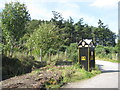
AA Box 504 - Ardgay
by M J Richardson
geograph for square NH6387
A Grade-B listed building - from Canmore... (more)
|

|
Bath, St. Swithin's
by Mike Faherty
geograph for square ST7565
Walcot Parish Church, on Walcot Street; completed in 1777. Listed by English... (more)
|

|
Foulden and Mordington Parish Church
by Graham Robson
geograph for square NT9355
The Parish Church of Foulden and Mordington. The church belongs to the Church of... (more)
|

|
The old Granton Hotel
by Alan Murray-Rust
geograph for square NT2377
Built in 1838, probably designed by John Henderson, as part of the Duke of... (more)
|

|
Former bonded warehouse at Granton
by Alan Murray-Rust
geograph for square NT2377
Built in 1845 as part of the Duke of Buccleuch's development of the harbour... (more)
|

|
Fountain, Dumfries High Street
by Graham Robson
geograph for square NX9776
A colourful fountain situated on High Street, Dumfries. It was erected in 1882... (more)
|

|
Former Hawkhead Hospital administration block, Paisley, Renfrewshire
by Claire Pegrum
geograph for square NS5062
The building which now comprises the flats of 1-6 Tait Circle was formerly the... (more)
|

|
Former Hawkhead Hospital cottages, Paisley, Renfrewshire
by Claire Pegrum
geograph for square NS5062
The building, now 21-27 Accord Avenue, was formerly four cottages for male staff... (more)
|

|
Glendeal House, Paisley, Renfrewshire
by Claire Pegrum
geograph for square NS5062
The building now called Glendeal House was formerly the porters' lodge of... (more)
|

|
20-25 Ardmillan Terrace and 60-64 Angle Park Terrace, Edinburgh
by Claire Pegrum
geograph for square NT2372
The building is Category B listed and its listing describes it as
"John... (more)
|

|
11 Ettrick Road, Edinburgh
by Claire Pegrum
geograph for square NT2371
The building is Category B listed and its listing describes it as... (more)
|

|
Diabaig Harbour
by Ian Taylor
geograph for square NG7959
The pier is Category B listed - see... (more)
|

|
Diabaig Harbour
by Ian Taylor
geograph for square NG7959
The pier is Category B listed - see... (more)
|
|
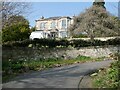
Bendameer House
by Oliver Dixon
for square NT2186
Category B listed building on the hillside above the Fife Coast Path. At one... (more)
|

|
Harlaw Academy
by Bill Harrison
geograph for square NJ9305
One of Aberdeen's city-centre secondary schools, and a fierce rival of... (more)
|

|
The Bastille, Aberdeen
by Chris Allen
geograph for square NJ9306
The Bastille was built as a flax warehouse in 1911-13. It formed part of... (more)
|

|
Granton gasholder
by M J Richardson
for square NT2277
A landmark both on the ground and from the air. A B-listed structure... (more)
|

|
Invershiel Bridges
by M J Richardson
geograph for square NH1885
Two bridges over the River Lael. The new one built in 1964 for the Scottish... (more)
|

|
Rubislaw Terrace (study in greyness)
by Bill Harrison
geograph for square NJ9205
Seen on a day when granite and sky are almost indistinguisbhable, this fine... (more)
|

|
Victoria Buildings, Bridge Street, Aberdeen
by Bill Harrison
geograph for square NJ9305
From ca. 1880; B-listed:... (more)
|

|
Columba Hotel
by Ian Capper
geograph for square NM8530
1902 hotel. Category B designated - see... (more)
|

|
The entrance to the Masonic Arms
by M J Richardson
for square NX6056
A hotel and restaurant on Ann Street, Gatehouse of Fleet.
|

|
Ann Street, Gatehouse of Fleet
by M J Richardson
geograph for square NX6056
A pair of cottages that seem to be available for holiday letting. Earlier they... (more)
|

|
Fife Coastal Path at West Wemyss
by Oliver Dixon
geograph for square NT3294
The 16th century towers and sea wall at Chapel Gardens can be seen above the shore.
|

|
Cardy House, Lower Largo
by M J Richardson
geograph for square NO4202
A large house between the old railway and the Cardy Net Works, dating from 1873,... (more)
|
