About tags on Geograph

Public Tags

Related Tags | Coverage Map
Tag:  Grassy·Path  

Showing latest 50 of 151 images tagged with Grassy Path tag.

View all tagged images - In Browser
:

NN2606 : Grassy path rising for Beinn Narnain by Trevor Littlewood Grassy path rising for Beinn Narnain by Trevor Littlewood
geograph for square NN2606
The mountain walker is heading for Beinn Narnain. Grassy slopes rise to the... (more)
Tags: type:Geograph   Grassy Mountain Slopes   Grassy Path   Mountain Walker   subject:Path   top:Paths   top:Sport, Leisure   top:Uplands  
TL8097 : Grassy path off forest road by David Pashley Grassy path off forest road by David Pashley
geograph for square TL8097
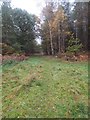
Grassy path off forest road 161.
Tags: subject:Forest   Forest Path   type:Geograph   Grassy Path   top:Lowlands   top:Paths   Thetford Forest   top:Woodland, Forest  
SH6345 : A pleasant, grassy path heading for Cnicht by Trevor Littlewood A pleasant, grassy path heading for Cnicht by Trevor Littlewood
geograph for square SH6345
The path climbing for Cnicht is also now the route of the Cambrian Way. The... (more)
Tags: type:Geograph   Grassy Path   Mountain   top:Paths   Rock Outcrops   top:Rocks, Scree, Cliffs   top:Uplands  
NX8899 : Grassy path approaching Morton Castle by Trevor Littlewood Grassy path approaching Morton Castle by Trevor Littlewood
geograph for square NX8899
The path connects rough parking at the end of a minor road on the north side of... (more)
NT8909 : Ridge rising between the Wholehope and Usway Burns by Trevor Littlewood Ridge rising between the Wholehope and Usway Burns by Trevor Littlewood
geograph for square NT8909
The ridge is seen heading north from the vicinity of Copper Snout between the... (more)
Tags: type:Geograph   Grassy Path   Grassy Ridge   top:Paths   top:Rivers, Streams, Drainage   top:Uplands   Valley  
SJ8148 : Alsagers Bank: footpath between houses by Jonathan Hutchins Alsagers Bank: footpath between houses by Jonathan Hutchins
geograph for square SJ8148
SD3989 : Woodland Path by Adrian Taylor Woodland Path by Adrian Taylor
geograph for square SD3989
A woodland path in Blake Holme Plantation near Ludderburn Park.
SD2891 : The Cumbria Way on Torver Low Common by Adrian Taylor The Cumbria Way on Torver Low Common by Adrian Taylor
geograph for square SD2891
The Cumbria Way follows a grassy path beside gorse bushes on Torver Low Common... (more)
SS9673 : Restricted byway south east of Llysworney by eswales Restricted byway south east of Llysworney by eswales
geograph for square SS9673
A fairly representative image of the approximately 550 metres long restricted... (more)
SR9496 : Path by Merrion Camp fence by M J Roscoe Path by Merrion Camp fence by M J Roscoe
geograph for square SR9496
The Coast Path runs parallel with the B4319 between the boundary fence and the... (more)
SD6688 : Path with Brown Knott ahead by Trevor Littlewood Path with Brown Knott ahead by Trevor Littlewood
geograph for square SD6688
The grassy path soon turns down to the left, leaving the ridge and becoming a... (more)
Tags: type:Geograph   Grassy Path   top:Paths   top:Uplands  
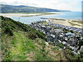
SH6115 : Path overlooking Barmouth by Malc McDonald Path overlooking Barmouth by Malc McDonald
geograph for square SH6115
A grassy path on the steep hill overlooking the town of Barmouth, on the Welsh... (more)
Tags: place:Abermaw   place:Barmouth   place:Barmouth/Abermaw   top:Coastal   type:Geograph   Grass Path   Grassy Path   county:Gwynedd   subject:Hillside   Hillside   top:Paths   Steep Hillside   View From Hillside   View of Town   View to Sea   country:Wales  
SO4493 : Path heading downhill by Trevor Littlewood Path heading downhill by Trevor Littlewood
geograph for square SO4493
The grassy path descends towards Church Stretton from a road-end car park above... (more)
Tags: Deciduous Woodland   type:Geograph   Grassy Path   top:Paths   top:Woodland, Forest  
SD2783 : The Cumbria Way near Broughton Beck by Adrian Taylor The Cumbria Way near Broughton Beck by Adrian Taylor
geograph for square SD2783
The public footpath between Broughton Beck village and Knapperthaw (next... (more)
Tags: top:Boundary, Barrier   Cumbria   long distance footpath:Cumbria Way   long distance path:Cumbria Way   Cumbria Way   ldp:Cumbria Way   subject:Field   type:Geograph   Grassy Path   Grassy Slope   top:Paths   Slope   Sloping Field   The Cumbria Way   ldp:The Cumbria Way   long distance path:The Cumbria Way  
SN1201 : Grassy path into Tenby Cemetery by Jaggery Grassy path into Tenby Cemetery by Jaggery
geograph for square SN1201
Into the northeast side of the cemetery from the lane named Slippery Back.
SN1201 : Grassy path along the top of Tenby Cemetery by Jaggery Grassy path along the top of Tenby Cemetery by Jaggery
geograph for square SN1201
Eastwards towards the exit to the lane named Slippery Back.
SD4079 : Path on Hampsfell by Adrian Taylor Path on Hampsfell by Adrian Taylor
geograph for square SD4079
The grassy path between the limestone outcrops near the summit of Hampsfell is a... (more)
NZ0739 : Trees above and below grassy way by Trevor Littlewood Trees above and below grassy way by Trevor Littlewood
geograph for square NZ0739
The grassed road / path contours along the eastern slope of the valley of the... (more)
Tags: Deciduous Trees   type:Geograph   Grassy Path   top:Lowlands   top:Paths   top:Roads, Road Transport  
NZ0738 : Distorted larch tree beside grassy path by Trevor Littlewood Distorted larch tree beside grassy path by Trevor Littlewood
geograph for square NZ0738
The path is above Thistlewood Lane just outside Wolsingham and is heading... (more)
TG1939 : Grassy path between wall and shrubs by David Pashley Grassy path between wall and shrubs by David Pashley
geograph for square TG1939
Tags: type:Geograph   Grassy Path   top:Historic Sites and Artefacts   top:Lowlands   subject:Path   top:Paths   top:Village, Rural Settlement  
TG1939 : Grassy path beside wall by David Pashley Grassy path beside wall by David Pashley
geograph for square TG1939
Tags: type:Geograph   Grassy Path   top:Historic Sites and Artefacts   top:Lowlands   subject:Path   top:Paths   top:Village, Rural Settlement  
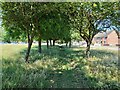
SK5505 : Tree-lined grassy path by Ian Calderwood Tree-lined grassy path by Ian Calderwood
geograph for square SK5505
A nice bit of natural shade between the traffic on New Parks Way and New Parks Boulevard.
Tags: type:Geograph   Grassy Path   top:Paths   top:Suburb, Urban Fringe   subject:Tree   Tree-Lined Path  
SX8862 : Path to Duchy Drive by Derek Harper Path to Duchy Drive by Derek Harper
geograph for square SX8862
A grassy path from the steep woodland of the Hollicombe Lake valley to... (more)
Tags: top:Boundary, Barrier   type:Geograph   Grassy Path   Hedge   Houses   top:Housing, Dwellings   top:Lowlands   top:Paths   top:Suburb, Urban Fringe   fence:Timber  
TG3234 : Grassy Path to locked gate by David Pashley Grassy Path to locked gate by David Pashley
geograph for square TG3234
Tags: type:Geograph   Grassy Path   top:Historic Sites and Artefacts   top:Lowlands   subject:Path   top:Paths   top:Village, Rural Settlement  
TG3430 : Grassy path Crostwight Heath by David Pashley Grassy path Crostwight Heath by David Pashley
geograph for square TG3430
Tags: type:Geograph   Grassy Path   top:Heath, Scrub   top:Lowlands   subject:Path   top:Paths   top:Village, Rural Settlement  
TL8394 : Grassy path on edge of STANTA by David Pashley Grassy path on edge of STANTA by David Pashley
geograph for square TL8394
Tags: top:Defence, Military   type:Geograph   top:Grassland   Grassy Path   top:Lowlands   subject:Path   top:Paths  
TL7893 : Looking to the end of grassy path by David Pashley Looking to the end of grassy path by David Pashley
geograph for square TL7893
Tags: type:Geograph   Grassy Path   top:Heath, Scrub   top:Lowlands   subject:Path   top:Paths   top:Woodland, Forest  
TL7793 : Looking West along grassy path by David Pashley Looking West along grassy path by David Pashley
for square TL7793
Tags: Breckland Norfolk   type:Cross Grid   Grassy Path   top:Heath, Scrub   top:Lowlands   subject:Path   top:Paths   top:Woodland, Forest  
ST2392 : Gateway on forestry track below Pegwn-y-bwlch by M J Roscoe Gateway on forestry track below Pegwn-y-bwlch by M J Roscoe
geograph for square ST2392
Newly painted metal gate and stile just before a sharp bend in the track in... (more)
SD8363 : Grassy path between High Hill and Sugar Loaf Hill by Christine Johnstone Grassy path between High Hill and Sugar Loaf Hill by Christine Johnstone
geograph for square SD8363
Public footpath heading north across open access land.
Tags: type:Geograph   top:Grassland   Grassy Path   Open Access Moorland   subject:Path   Public Footpath   national park:Yorkshire Dales  
SO8006 : West along a grassy path in the north of Stonehouse by Jaggery West along a grassy path in the north of Stonehouse by Jaggery
geograph for square SO8006
The fence is on the north side of the street named Brisbane, part of the Little... (more)
Tags: type:Geograph   Grassy Path   top:Paths   top:Suburb, Urban Fringe  
NX4268 : Grassy way heading towards Garlies Wood by Trevor Littlewood Grassy way heading towards Garlies Wood by Trevor Littlewood
geograph for square NX4268
The path is heading towards the wood which is beyond the initial group of trees.
NZ0450 : Priory Cottage, Muggleswick by Trevor Littlewood Priory Cottage, Muggleswick by Trevor Littlewood
geograph for square NZ0450
Priory Cottage faces on to a broad, walled, grassy path climbing to All Saints... (more)
SD3978 : Hawthorns on Hampsfell by Adrian Taylor Hawthorns on Hampsfell by Adrian Taylor
geograph for square SD3978
The sheep pastures near the summit of Hampsfell are characterised by a few... (more)
TG1939 : Grassy path alongside internal wall by David Pashley Grassy path alongside internal wall by David Pashley
geograph for square TG1939
Tags: type:Geograph   Grassy Path   top:Historic Sites and Artefacts   top:Lowlands   top:Paths   top:Village, Rural Settlement   subject:Wall  
NT2541 : Path contouring Ven Law by Jim Barton Path contouring Ven Law by Jim Barton
geograph for square NT2541
Crossing the grassy slope to the east of the A703 on the outskirts of Peebles.
Tags: type:Geograph   top:Grassland   Grassy Path   Hillside   top:Paths   top:Suburb, Urban Fringe  
SV9212 : Gate with faded sign by David Lally Gate with faded sign by David Lally
geograph for square SV9212
Possibly an old PRIVATE sign? According to the OS the track ahead is a right of way..
ST1629 : Stoney Lane, Bishops Lydeard by Jaggery Stoney Lane, Bishops Lydeard by Jaggery
geograph for square ST1629
Viewed from West Street looking towards the village church tower.... (more)
Tags: Grassy Path   colour:Green   top:Paths  
SE0497 : New bracken growth west of Cogden Gill by Trevor Littlewood New bracken growth west of Cogden Gill by Trevor Littlewood
geograph for square SE0497
Mid-June and new-season bracken growth is well under way on this moorland... (more)
TG2929 : Grassy Track beside Housing Estate by David Pashley Grassy Track beside Housing Estate by David Pashley
geograph for square TG2929
Tags: type:Geograph   Grassy Path   top:Lowlands   top:Paths   top:Sport, Leisure   top:Suburb, Urban Fringe  
SO1009 : Grassy public footpath in Llechryd by Jaggery Grassy public footpath in Llechryd by Jaggery
for square SO1009
A public footpath sign Link alongside... (more)
NZ7405 : Public footpath descending into Great Fryup Dale by Christine Johnstone Public footpath descending into Great Fryup Dale by Christine Johnstone
geograph for square NZ7405
On the access track to Shaw End Farm, not the grassy path [which leads to a... (more)
ST6091 : Grassy track towards St Arilda's Church, Oldbury-on-Severn by Jaggery Grassy track towards St Arilda's Church, Oldbury-on-Severn by Jaggery
geograph for square ST6091
The track leads to steps up to the south side of the church.
SJ8051 : Stile on footpath towards Great Oak Road by Jonathan Hutchins Stile on footpath towards Great Oak Road by Jonathan Hutchins
geograph for square SJ8051
Tags: near:Audley   public footpath:Audley FP 25   top:Farm, Fishery, Market Gardening   type:Geograph   top:Grassland   Grassy Path   Mown Grassy Footpath   top:Paths   subject:Stile   Stile  
SE0329 : Footpath descending towards Upper Heys Wood by Chris Heaton Footpath descending towards Upper Heys Wood by Chris Heaton
geograph for square SE0329
Grassy public footpath heading down to the upper reaches of Luddenden Dean via... (more)
SE0524 : Pigman Lane, Luddendenfoot by Humphrey Bolton Pigman Lane, Luddendenfoot by Humphrey Bolton
geograph for square SE0524
This grassy lane is Sowerby Bridge FP146.
Tags: type:Geograph   top:Grassland   Grassy Path   subject:Lane   top:Lowlands   top:Paths   Public Footpath   footpath gate:Wooden  
SU5666 : A grassy path turns along the shore of a flooded gravel pit near Woolhampton by Robin Stott A grassy path turns along the shore of a flooded gravel pit near Woolhampton by Robin Stott
geograph for square SU5666
NY3758 : The Cumbria Coastal Way at Skew Bank by Adrian Taylor The Cumbria Coastal Way at Skew Bank by Adrian Taylor
geograph for square NY3758
The Cumbria Coastal Way follows a field edge path at Skew Bank above the River... (more)
Tags: Cumbria   long distance path:Cumbria Coastal Way   long distance footpath:Cumbria Coastal Way   Cumbria Coastal Way   subject:Field   type:Geograph   top:Grassland   Grassy Path   King Charles III England Coast Path   top:Paths  
NY3559 : The Cumbria Coastal Way near Beaumont by Adrian Taylor The Cumbria Coastal Way near Beaumont by Adrian Taylor
geograph for square NY3559
On the east bank of the River Eden near Beaumont, The Cumbria Coastal Way... (more)
Tags: Cumbria   long distance footpath:Cumbria Coastal Way   long distance path:Cumbria Coastal Way   Cumbria Coastal Way   Field Edge Path   type:Geograph   Grassy Path   King Charles III England Coast Path   top:Lowlands   top:Paths   subject:River   river:River Eden   River Eden   top:Rivers, Streams, Drainage  
SM7609 : Signpost at Coast Footpath junction by M J Roscoe Signpost at Coast Footpath junction by M J Roscoe
for square SM7609
The footpath (permissive) to the left goes through the gate, along the side of a... (more)
Tags: top:Boundary, Barrier   type:Cross Grid   Grassy Path   National Trust Land   subject:Path   top:Paths   footpath signpost:Wooden  
View more in the Image Search or in Browser
View images matching 'Grassy Path' anywhere in the tags
Don't click these: PotMel 1 PotMel 2