|
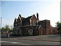
The Beggars Bush at the crossroads third view - New Oscott, Birmingham
by Martin Richard Phelan
geograph for square SP0994
The present Beggars Bush is the third building on this site, dating from 1927.... (more)
|
|
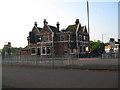
The Beggars Bush at the crossroads second view - New Oscott, Birmingham
by Martin Richard Phelan
geograph for square SP0994
The present Beggars Bush is the third building on this site, dating from 1927.... (more)
|
|
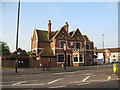
The Beggars Bush at the crossroads first view - New Oscott, Birmingham
by Martin Richard Phelan
geograph for square SP0994
The present Beggars Bush is the third building on this site, dating from 1927.... (more)
|

|
Hawthorn bush, Bookham Common.
by Alan Hunt
geograph for square TQ1256
A fine crop of berries on this hawthorn bush making a splash of colour beside... (more)
|

|
Hawthorn bush on Butser Hill
by Oliver Dixon
geograph for square SU7120
Beyond, the land drops away steeply towards Petersfield.
|

|
Hawthorn bushes on farmland north of railway east of Morecambe South Junction
by Luke Shaw
geograph for square SD4664
|

|
Slope with hawthorn bushes
by Trevor Littlewood
geograph for square SE8457
The slope descends to the junction of Bradeham Dale with Wayrham Dale which is... (more)
|

|
Autumn berries beside the railway path
by Robert Graham
geograph for square NZ1049
Autumn view on the Lanchester Valley Railway Path. Big crop of haws on the bushes.
|

|
Remains of pumping house on a snowy day
by Patrick Roper
geograph for square TQ7818
This small grove of hawthorns and an oak in Churchland Fields grows on the... (more)
|

|
A good crop of berries
by Robert Graham
for square NZ1049
Hawthorn berries, commonly called Haws, beside the Lanchester Valley Railway Walk.
|
|
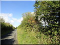
Autumn hedge along the lane
by Robert Graham
geograph for square NZ1148
Hawthorn berries and Rose Hips on bushes in the hedge here. This is the lane... (more)
|

|
Woodland and plantation across Deep Dale
by Trevor Littlewood
geograph for square SE8156
Deep Dale is part of Bishop Wilton Wold. The view is across the valley from Cot... (more)
|

|
Hawthorn bush in the valley of the Howden Burn
by Oliver Dixon
geograph for square NY7362
|

|
Footpath alongside Brook Drain near Glinton
by Paul Bryan
geograph for square TF1506
This footpath runs alongside Brook Drain between Lincoln Road and North Fen Road... (more)
|

|
Footpath alongside Brook Drain near Glinton
by Paul Bryan
geograph for square TF1506
This footpath runs alongside Brook Drain between Lincoln Road and North Fen Road... (more)
|

|
Hawthorn in full flower beside Gilderdale Burn
by Trevor Littlewood
geograph for square NY6947
Two hawthorns in this view, upstream, into the valley of the Gilderdale Burn.... (more)
|

|
Haws on the golf course
by Derek Harper
geograph for square SX9371
A spectacular display of hawthorn berries lures the coast path walker to their... (more)
|

|
Sheep near Stone Barrow Lane
by Adrian Taylor
geograph for square SD2573
Sheep on the rough limestone pasture between Stone Barrow Lane and Bolton Heads.... (more)
|

|
Hawthorns above The Lynches Wood
by Derek Harper
geograph for square SP1340
From Weston-sub-edge footpath 26 soom after emerging from the wood, as it... (more)
|

|
Track from Hawthorns Lane towards Weets Gate
by Luke Shaw
geograph for square SD9263
Ordnance Survey documents indicate that a benchmark levelled at 376.239m above... (more)
|

|
Winter field
by Adrian Taylor
geograph for square NY4963
Snow lingers in the shadow of the hedge and a few hardy cattle brave the cold... (more)
|

|
South bank of the River Soar, near Barrow upon Soar
by Christine Johnstone
geograph for square SK5816
Cattle, blossoming hawthorn, towpath and public footpath.
|

|
Spur clad in hawthorn, in Deep Dale
by Trevor Littlewood
geograph for square SE8255
OS mapping suggests that Deep Dale be regarded as part of Bishop Wilton Wold.
|

|
Lone hawthorn on sloping field
by Trevor Littlewood
geograph for square SN7823
A bridleway climbs south-eastwards from the farm at Gellygron, (the Beacons Way... (more)
|

|
Valley of Backside Beck
by Trevor Littlewood
geograph for square SD6997
The near slope of Backside Beck is shown on OS Landranger 91 as having an area... (more)
|
|
Grune
by Adrian Taylor
geograph for square NY1356
The sand and shingle spit leading up to Grune Point has been enclosed into... (more)
|

|
Field gateway on SW side of A6071 opposite Bush on Lyne Cottage
by Roger Templeman
geograph for square NY4066
|

|
Electric Transmission Infrastructure off the A1246
by Chris Heaton
geograph for square SE4628
Pylons advancing into the distance as seen from the Great North Road near Fairburn.
|
|
Overgrown footpath along south side of River Lyne opposite Haggistone Holm
by Luke Shaw
geograph for square NY4166
|

|
Descending down to Botton Bridge (1)
by Chris Heaton
geograph for square SD6562
In the upper reaches of the Hindburn Vslley
|

|
Stock Bridge taking footpath over Stock Beck
by Roger Templeman
geograph for square SD8648
|

|
Footpath approaching Stock Bridge
by Roger Templeman
geograph for square SD8648
The notice describes Ribble River Trust's Stock Bridge Habitat Restoration Scheme
|

|
Smailsburn farmhouse
by Trevor Littlewood
geograph for square NY9441
The farm at Smailsburn is beside an incline of the disused Rookhope and... (more)
|

|
Gilthwaiterigg Beck
by Adrian Taylor
geograph for square SD5296
Gilthwaiterigg Beck near Lowgroves Wood, Skelsmergh. The beck is a tributary of... (more)
|

|
Bridleway gate near Stot Hill
by Adrian Taylor
geograph for square NY9550
The public bridleway from Stothill Plantation to Coat House Farm passes through... (more)
|

|
Footpath near Fell End
by Adrian Taylor
geograph for square SD3978
The public footpath from Spring Bank to Hampsfell Hospice near Fell End.
|

|
Long Lane near Pickle Wood, Lowick
by Adrian Taylor
geograph for square SD2786
The minor road from Lowick to Kiln Bank is also the route of The Cumbria Way... (more)
|

|
Moorland on south side of Hedleyhope Burn
by Trevor Littlewood
geograph for square NZ1341
The moorland is part of the Hedleyhope Fell Nature Reserve. The Durham Wildlife... (more)
|

|
Rough pasture on Humphrey Head
by Adrian Taylor
geograph for square SD3874
The pasture is used for grazing both sheep and cattle. The limestone bedrock... (more)
|

|
Slope declining into Worsen Dale
by Trevor Littlewood
geograph for square SE8055
Worsen Dale with an exposure of chalk on its western slope from a path on its east side.
|
