Public Tags
Showing images tagged with hfov:120 tag.

|
120 degree panorama of Peel seafront
by Richard Hoare geograph for square SC2484 |
|
Landscape near Wymondham
by Bob Harvey geograph for square SK8619 It was a splendid day for photography, but there was a cold wind, so I went... (more)
Tags:
hfov:120
120 Degree Panorama
subject:Farm
top:Farm, Fishery, Market Gardening
type:Geograph
top:Lowlands
panorama:Wideangle
near:Wymondham
|

|
A field in Lincolnshire
by Bob Harvey geograph for square SK9221 Walk over a small footbridge and this vista of ancient quarries, farmland, and... (more)
Tags:
hfov:120
Blue Sky White Clouds
top:Farm, Fishery, Market Gardening
subject:Field
type:Geograph
county:Lincolnshire
top:Lowlands
near:North Witham
subject:Panorama
season:Summer
panorama:Wideangle
|
|
Pen y Bryn Park
by Barry Hunter geograph for square SH7042 Overlooking western part of the Village and even down to Tremadog Bay
Tags:
hfov:120
vfov:90
Asphalt
top:Coastal
Panorama
top:Park and Public Gardens
Road
top:Sport, Leisure
top:Uplands
top:Village, Rural Settlement
panorama:Wideangle
|

|
Pillar Craig
by Lairich Rig geograph for square NS5479 There are several basaltic formations here in the Squirrel Wood, and nearby, but... (more)
Tags:
hfov:120
Columnar Jointing
subject:Crag
top:Geological Interest
top:Rocks, Scree, Cliffs
The Squirrel Wood
bucket:Wideangle
panorama:Wideangle
|

|
Carman Quarry
by Lairich Rig geograph for square NS3679 See NS3678 : Carman Quarry for the main description. Click on the end-note title for... (more)
Tags:
hfov:120
top:Derelict, Disused
subject:Quarry
former:Quarry
top:Quarrying, Mining
bucket:Wideangle
panorama:Wideangle
|
|
The ruins of East Arkleston
by Lairich Rig geograph for square NS5065 See NS5065 : The ruins of East Arkleston for the main description. The present view shows the ruined... (more)
Tags:
hfov:120
top:Derelict, Disused
ruin:Farm Building
top:Farm, Fishery, Market Gardening
panorama:Wideangle
|

|
Barshaw Park: the pond
by Lairich Rig geograph for square NS4964 The pond was overflowing at a point nearby (NS4964 : Barshaw Park: the pond) because of recent wet... (more)
|
|
Barshaw Park: the pond
by Lairich Rig geograph for square NS4964 The pond was running over at this corner because of recent wet weather. See... (more)
|

|
Mound beside the River Leven
by Lairich Rig geograph for square NS3977 This large mound is artificial, but its purpose is not clear; see NS3977 : Mound beside the River Leven... (more)
Tags:
hfov:120
top:Historic Sites and Artefacts
Mound
near:River Leven
place:Vale of Leven Industrial Estate
bucket:Wideangle
panorama:Wideangle
top:Woodland, Forest
|
|
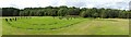
Kinneil Roman fortlet
by Lairich Rig geograph for square NS9780 For an earlier photo, see NS9780 : Kinneil Fortlet on the Antonine Wall. The present photograph, showing the whole... (more)
Tags:
hfov:120
vfov:40
Antonine Wall
Archaeology
top:Historic Sites and Artefacts
place:Kinneil
period:Roman
Roman Fortlet
panorama:Wideangle
bucket:Wideangle
|

|
Barrs Terrace and Barrs Road, Cardross
by Lairich Rig geograph for square NS3477 Category: Panorama Barrs Terrace is on the left. For the individual streets, see NS3477 : Barrs Terrace, Cardross and NS3478 : Barrs Road, Cardross.
Tags:
hfov:120
vfov:30
place:Cardross
top:Housing, Dwellings
top:Roads, Road Transport
weather:Snow
top:Suburb, Urban Fringe
panorama:Wideangle
bucket:Wideangle
season:Winter
|
