Public Tags
Showing images tagged with hill:Brown Clee tag.
|
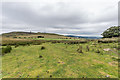
Titterstone Clee Hill and Brown Clee
by Ian Capper geograph for square SO6077 Looking across to two significant Shropshire hills from near Random Farm, with a... (more)
Tags:
hill:Brown Clee
type:Geograph
farm:Random Farm
hill:The Wrekin
hill:Titterstone Clee Hill
top:Uplands
|

|
North from Titterstone Clee Hill
by Ian Capper geograph for square SO5978 Looking north from the slopes of Titterstone Clee Hill, with Brown Clee in the background.
|

|
North from Titterstone Clee Hill
by Ian Capper geograph for square SO6078 Looking north from the slopes of Titterstone Clee Hill, with Brown Clee in the... (more)
|
|
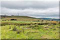
Titterstone Clee Hill, Brown Clee and The Wrekin
by Ian Capper geograph for square SO6077 Looking across to three significant Shropshire hills from near Random Farm.
Tags:
hill:Brown Clee
type:Geograph
farm:Random Farm
hill:The Wrekin
hill:Titterstone Clee Hill
top:Uplands
|

|
Boulder field
by Ian Capper geograph for square SO5978 Boulder field below the summit of Titterstone Clee Hill, with Brown Clee in the... (more)
|

|
Corvedale farmland, near Castlemoor
by Christine Johnstone geograph for square SO5588 With Brown Clee, Shropshire's highest hill, on the horizon.
Tags:
hill:Brown Clee
top:Farm, Fishery, Market Gardening
subject:Farmland
type:Geograph
taken from:The Field Entrance
|
