Public Tags
Tag: Holly·Trees
Showing images tagged with Holly Trees tag.

|
Holly trees along the road to Little Town
by Christine Johnstone geograph for square NY2319 There are quite a few mature holly trees along the roadside, east of Birkrigg.
Tags:
subject:Farmland
type:Geograph
tree:Holly
Holly Trees
national park:Lake District
place:Newlands Valley
top:Roads, Road Transport
Roadside Trees
Rough Pasture
|

|
Holly Tree
by valenta geograph for square NH6249 This solitary holly has managed to gain a foothold amongst the beech and scots... (more)
|

|
Holly lined footpath
by Stephen Burton geograph for square SJ9792 This footpath lined with old Holly Trees is thought to be several hundred years... (more)
|

|
A self-sown Holly
by Bob Harvey for square TF0820 Struggling against the brambles, is this little miniature Holly Tree
Tags:
place:Bourne Woods
type:Close Look
Forestry Commission Land
plant:Holly
Holly Tree
top:Lowlands
subject:Tree
top:Wild Animals, Plants and Mushrooms
top:Woodland, Forest
|

|
Holly trees in Quaker's Coppice
by Jonathan Hutchins geograph for square SJ7254 Tags:
near:Crewe
type:Geograph
trees:Holly
Holly Trees
top:Paths
subject:Tree
Woodland Path
top:Woodland, Forest
|
|
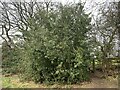
Holly tree by footpath near Wybunbury
by Jonathan Hutchins geograph for square SJ7050 The footpath and stile are almost hidden on the right hand side of the tree. The... (more)
Tags:
type:Geograph
top:Heath, Scrub
tree:Holly
Holly Tree
top:Paths
subject:Tree
top:Wild Animals, Plants and Mushrooms
near:Wybunbury
public footpath:Wybunbury FP 5
|

|
Pollarded hollies at Dunham Massey
by Stephen Craven geograph for square SJ7387 Holly is not a tree that is usually pollarded, but apparently these specimens... (more)
|
|
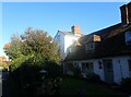
Holly Cottage, Silver Street
by Marathon geograph for square TQ8760 Holly Cottage is well-named in view of the large holly tree in front of it which... (more)
Tags:
type:Geograph
top:Historic Sites and Artefacts
Holly Tree
top:Housing, Dwellings
top:Village, Rural Settlement
|

|
Bowling Park: coppiced hollies
by Stephen Craven geograph for square SE1731 Coppicing isn't a common way of managing holly trees, but these specimens... (more)
|

|
Holly tree
by Alan Hunt geograph for square SU9446 A large holly tree on the road to the Lone Barn
|

|
Holly trees on Bignall Hill
by Jonathan Hutchins geograph for square SJ8251 Tags:
public footpath:Audley FP 92
place:Bignall Hill
top:Farm, Fishery, Market Gardening
type:Geograph
top:Grassland
subject:Hillside
Hillside Pasture
trees:Holly
Holly Trees
top:Paths
top:Woodland, Forest
|

|
Wind-swept holly tree along the bridleway
by Christine Johnstone geograph for square SE4643 Standing up to a cold north wind.
Tags:
rights of way:Bridleway
path:Bridleway
Bridleway
Farm Access Track
tree:Holly
Holly Tree
top:Paths
Public Bridleway
top:Roads, Road Transport
Windy Day
|

|
Part VI, a tree-mendous walk around Petersfield (430)
by Basher Eyre geograph for square SU7422 Holly trees in Sussex Road
|

|
Part IV, a tree-mendous walk around Petersfield (211)
by Basher Eyre for square SU7524 Nelson Drive, a holly tree
|

|
Bridge over Allt Coire Lagan
by Ian Taylor geograph for square NG4119 A slab bridge, downstream of the confluence of the Allt Coire Lagan and Allt na... (more)
Tags:
subject:Bridge
Concrete Slab
type:Geograph
Holly Berries
Holly Tree
top:Paths
top:Rivers, Streams, Drainage
Slab Bridge
|
|
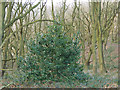
Holly tree in Post Hill woods
by Stephen Craven geograph for square SE2432 The woods are almost entirely deciduous; this holly was an exception.
|

|
Part IV, a tree-mendous walk around Petersfield (243)
by Basher Eyre geograph for square SU7424 Holly tree above a postbox in Tilmore Gardens
|

|
Part IV, a tree-mendous walk around Petersfield (214)
by Basher Eyre for square SU7524 Holly tree in Barentin Way
|

|
Holly tree at base of north side of Skirrid Fawr
by M J Roscoe geograph for square SO3318 Tree still in berry in April; the tree can be seen just beyond the foot of the... (more)
Tags:
top:Boundary, Barrier
Brecon Beacons National Park
type:Geograph
Grass Field
top:Grassland
Holly Tree
Post and Wire Mesh Fence
subject:Tree
|
|
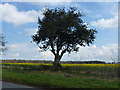
Large holly tree next to a field of rape
by Richard Humphrey geograph for square TF7935 On the cross roads north of The National Construction College (Bircham Newton... (more)
|

|
Railwalk II: the New Guildford Line (563)
by Basher Eyre geograph for square TQ0954 Holly tree in Forest Road
|

|
Holly tree with berries beside path
by David Pashley geograph for square TG1939 |

|
Footpath along bottom edge of Lumb Rough, Sowerby
by Humphrey Bolton geograph for square SE0321 This is the continuation of the path in SE0321 : Footpath through Lumb Rough, Sowerby. The path is blocked by a... (more)
|

|
Holly tree above Muker
by Stephen Craven geograph for square SD9197 The tree is growing alongside a stone wall that marks the transition from... (more)
|

|
Woodland east of Owler Park Road
by Stephen Craven geograph for square SE1049 In the foreground are a number of holly trees and some deciduous ones (probably... (more)
|

|
Holly trees in Calverley Wood
by Stephen Craven geograph for square SE1937 |

|
Holly Tree on Elwick Lane, Little Ouseburn
by Ian S geograph for square SE4560 Tags:
top:Farm, Fishery, Market Gardening
Holly Tree
|

|
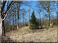
Holly tree, Cinderdale Common
by Ian Taylor geograph for square NY1619 Rannerdale Knotts is in the background, with the High Stile group of fells beyond.
|
|
Evergreen amid deciduous
by James Allan geograph for square NO4428 A holly bush surrounded by leafless trees on the Scotscraig estate.
|

|
Box Ings Lane
by Stephen Craven geograph for square SE1911 The lane has a profusion of holly trees along its length, often an indication of... (more)
|

|
Holly tunnel on Deep Lane, Cotton Stones, Sowerby
by Humphrey Bolton geograph for square SE0221 Deep Lane is a public footpath and driveway to Upper Lumb.
Tags:
Driveway
top:Grassland
Holly Tree
subject:Lane
top:Lowlands
top:Paths
Public Footpath
top:Roads, Road Transport
Tunnel of Trees
|

|
Ashley, ponies
by Mike Faherty geograph for square SU2014 New Forest ponies sheltering from the sun in a clump of holly trees.
|

|
Holly tree, Cinderdale Common
by Ian Taylor geograph for square NY1619 Overlooking Crummock Water, with Loweswater in the distance. See NY1619 : Holly tree, Cinderdale Common for... (more)
|

|
The Cemetery of St John the Baptist Church Wappenbury (1)
by Nigel Mykura geograph for square SP3770 There are no public roads in this grid square except at the extreme southeast... (more)
|
|
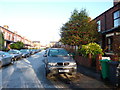
Brookfield Avenue
by Phil Champion geograph for square SJ8293 Looking north from the end of this cul-de-sac of terraced houses. A light... (more)
Tags:
Brookfield Avenue
place:Chorlton
place:Chorlton-Cum-Hardy
Cul-De-Sac
tree:Holly
Holly Tree
top:Housing, Dwellings
Pavement Parking
top:Roads, Road Transport
Snow
top:Suburb, Urban Fringe
|

|
Lone holly bush, Kinder Reservoir
by Peter Barr geograph for square SK0688 Bit of a surprise to come across this. Whether it is self sown or has been... (more)
|

|
Stoney Cross, forestry car park
by Mike Faherty geograph for square SU2511 Andrews Mare Car Park & Picnic Place, in a clump of holly.
Tags:
subject:Car Park
Holly Trees
top:Lowlands
Picnic Place
top:Roads, Road Transport
top:Sport, Leisure
top:Woodland, Forest
|

|
Wall on west side of Hauxwell Road north of The Avenue entrance
by Roger Templeman for square SE1693 Ordnance Survey records indicate that a benchmark levelled at 162.6565m above... (more)
|

|
Muddy track
by Peter Holmes geograph for square SU9524 In Pheasant Copse.
Tags:
top:Country Estates
Ferns
type:Geograph
Holly Trees
top:Roads, Road Transport
subject:Track
top:Woodland, Forest
|

|
Lane west of Highford Park
by Oliver Dixon geograph for square NY9263 The modern housing estate of Highford Park in the south-west sector of Hexham is... (more)
|

|
Whitfield triangulation pillar
by Roger Templeman geograph for square SO5420 Trig point with Ordnance Survey flush bracket benchmark with serial number S7259... (more)
|
