Public Tags
Tag: Horse·Stile
Showing images tagged with Horse Stile tag.
|
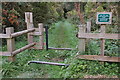
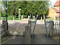
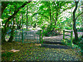
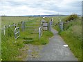
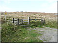
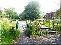
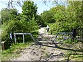
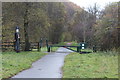
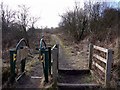
Horse stile, St Cuthbert's Way
by Jim Barton geograph for square NT6723 Another view of the stile shown in NT6723 : A 'horse stile' on St Cuthbert's Way. The sign at the side advises... (more)
|
|
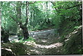
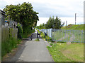
Horse stile on Hag Lane
by Oliver Dixon geograph for square SE5063 An off-road section of National Cycle Network route 65 which runs from Hornsea... (more)
Tags:
Cycle RouteX
subject:Cycle RouteX
top:Farm, Fishery, Market GardeningX
FieldX
GateX
type:GeographX
Horse Stile
National Cycle NetworkX
top:PathsX
|
|
Horse stile on Hag Lane
by Oliver Dixon geograph for square SE5063 An off-road section of National Cycle Network route 65 which runs from Hornsea... (more)
Tags:
Cycle RouteX
subject:Cycle RouteX
type:GeographX
Horse Stile
National Cycle NetworkX
top:PathsX
TreesX
top:Woodland, ForestX
|
|
Horse stile on an old lane. Knebworth
by Humphrey Bolton geograph for square TL2222 This is lane splits into Kitching Lane and Dyes Lane further along, and is... (more)
Tags:
type:GeographX
Horse Stile
top:LowlandsX
subject:PathX
top:PathsX
Public BywayX
top:Woodland, ForestX
|
|
A pair of incongruous horse stiles on NCN6
by SK53 geograph for square SK5443 The National Cycle Route broadly follows the River Leen through urban... (more)
Tags:
subject:BarrierX
CyclewayX
type:GeographX
Horse Stile
top:Lakes, Wetland, BogX
Motorcycle BarrierX
NCN Route 6X
place:Old BasfordX
top:PathsX
Shared Use PathX
top:Suburb, Urban FringeX
|
|
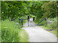
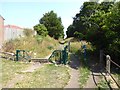
Horse stile on footpath near Sunniside Station
by Oliver Dixon geograph for square NZ2058 Horse stile and cycle access control designed to prevent unauthorised access to... (more)
Tags:
Access ControlX
type:GeographX
Horse Stile
subject:PathX
top:PathsX
Public FootpathX
WoodlandX
top:Woodland, ForestX
|
|
Stile on Brighouse Footpath 23/6, Hipperholme
by Humphrey Bolton geograph for square SE1125 This path crossed Halifax Road to a level crossing (see SE1125 : Look Both Ways) and then... (more)
Tags:
type:GeographX
Horse Stile
top:LowlandsX
subject:PathX
top:PathsX
Public FootpathX
top:Woodland, ForestX
|
|
Stiles on the Icknield Way, Lilley
by Humphrey Bolton geograph for square TL1027 This byway has been made a restricted byway, hopefully enforced by large banks... (more)
Tags:
Cycleway A-Frame StileX
type:GeographX
Horse Stile
Icknield Way TrailX
top:LowlandsX
top:PathsX
Restricted BywayX
subject:TrackX
|
|
Horse stile and kissing gate on a byway, Knebworth
by Humphrey Bolton geograph for square TL2222 In theory this track could be used by motorists, but they would find it... (more)
Tags:
type:GeographX
Horse Stile
top:LowlandsX
footpath gate:Metal KissingX
top:PathsX
Public BywayX
top:Woodland, ForestX
|
|
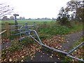
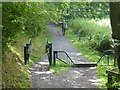
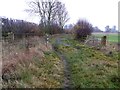
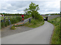
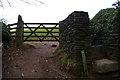
End of byway down from Pen-y-fan Pond
by M J Roscoe geograph for square SO2000 Horse stile at junction with minor road; for earlier view from road - SO2000 : Bridleway to Pen-y-fan Pond.
Tags:
top:Boundary, BarrierX
type:GeographX
Horse Stile
top:PathsX
Restricted BywayX
top:Roads, Road TransportX
subject:StileX
|
|
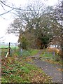
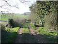
Horse stile on bridleway, Langford
by Humphrey Bolton geograph for square TL1839 Tags:
top:Farm, Fishery, Market GardeningX
type:GeographX
Horse Stile
top:LowlandsX
top:PathsX
Public BridlewayX
subject:StileX
|
|
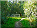
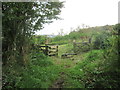
Gate and horse stile on green lane, Clothall
by Humphrey Bolton geograph for square TL2631 This is near to Hickman's Hill. The signpost is for a 'byway open to... (more)
|
|
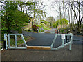
Access control on the path to the North Gare Sands
by Oliver Dixon geograph for square NZ5328 Just short of the North Gare car park (which is accessed by a separate road). A... (more)
|
|
Cycle path alongside the South Hylton extension of the Tyne and Wear Metro
by Oliver Dixon geograph for square NZ3657 The metal tubes set at an angle are designed to stop motor bikes, but are also... (more)
|
|
Railway path off Offerton Lane
by Oliver Dixon geograph for square NZ3456 The old railway from Sunderland to Penshaw forms a useful cycle route. At this... (more)
|
|
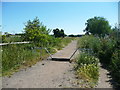
Cycle route crossing of the road down to Cox Green
by Oliver Dixon geograph for square NZ3354 The cycle route follows the line of the old railway from Sunderland to Penshaw.... (more)
Tags:
Access ControlX
subject:Cycle RouteX
Cycle RouteX
Horse Stile
top:PathsX
Railway PathX
top:Roads, Road TransportX
|
|
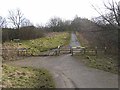
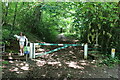
Gate and horse stile on the Rapes Highway
by Humphrey Bolton geograph for square SD9912 This is the western section of the old pack-horse route, which starts in... (more)
|
|
Reiver's Cycle Route near Big Waters
by Oliver Dixon geograph for square NZ2273 Gate and horse stile on National Cycle Route 10 (Reiver's Route).
|
|
Path junction on the old Consett and Sunderland railway
by Oliver Dixon geograph for square NZ1651 At this point, a horse stile gives access to the cutting through which the... (more)
Tags:
Cycle RouteX
Disused RailwayX
type:GeographX
Horse Stile
National Cycle NetworkX
subject:PathX
top:PathsX
Railway PathX
top:RailwaysX
|
|
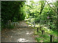
Horse stiles on the Trans-Pennine Trail, each side of a lane
by Humphrey Bolton geograph for square SE3304 The lane led to Rob Royd Bleach Works (Linen & Cotton). It is a public... (more)
Tags:
type:GeographX
top:GrasslandX
Horse Stile
top:LowlandsX
top:PathsX
Public FootpathX
top:RailwaysX
top:Roads, Road TransportX
subject:TrailX
Transpennine TrailX
|
|
Crossing point on the Tanfield Railway Path
by Oliver Dixon geograph for square NZ2360 Here the Tanfield Railway Path crosses the Whickham Highway B6317 at Lobley Hill... (more)
Tags:
Access ControlX
B RoadX
subject:CrossingX
type:GeographX
Horse Stile
PathX
top:PathsX
Railway PathX
top:Roads, Road TransportX
|
|
Bridleway at Myton Pasture
by Oliver Dixon geograph for square SE4367 Usable with difficulty by cyclists on the route from the bridge at... (more)
|
|
Access control on the Angel Cycleway
by Oliver Dixon geograph for square NZ2759 The Angel Cycleway which follows the line of a disused railway continues to the... (more)
Tags:
Access ControlX
Cycle PathX
subject:Cycle RouteX
type:GeographX
Horse Stile
top:PathsX
Railway PathX
top:RailwaysX
|
|
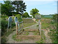
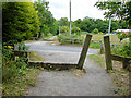
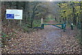
The Icknield Way at Hitchin Road
by Humphrey Bolton geograph for square TL1330 There is a convenient car park here. The horse stile prevents use by chariots.
Tags:
BywayX
top:Farm, Fishery, Market GardeningX
type:GeographX
Horse Stile
ancient highway:Icknield WayX
top:LowlandsX
top:PathsX
subject:TrackX
|
|
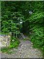
Horse stile on the Pilgrim's Way
by Oliver Dixon geograph for square TQ9152 This ancient trackway follows the Pilgrim's Way, also the North Downs Way... (more)
Tags:
type:GeographX
Horse Stile
National Cycle NetworkX
National TrailX
PathX
subject:PathX
top:PathsX
WoodX
top:Woodland, ForestX
|
|
The C2C passing under the A19
by Oliver Dixon geograph for square NZ3456 The world famous C2C cycle route here follows the A1231 before curving... (more)
|
|
Barrier on the Consett and Sunderland path
by Oliver Dixon geograph for square NZ1352 The old Stanhope and Tyne railway (also known at one point in its history as the... (more)
|
|
Barrier on the Derwent Walk above Ebchester
by Oliver Dixon geograph for square NZ1055 Constructed in 1867 and running from Swalwell on the River Tyne up to Consett,... (more)
|

|
Barrier & stiles, National Cycle Route 467, Hollybush Station
by M J Roscoe geograph for square SO1603 The barrier is located next to the dilapidated remains (right) of a former... (more)
|
|
Statue, National Cycle Route 467, Hollybush
by M J Roscoe geograph for square SO1603 The plate on the squeeze stile reads, 'Hollybush Village'. The barrier... (more)
|
|
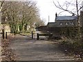
Gateway on Hall Walk around Pont Pill
by Christopher Hilton geograph for square SX1451 Tags:
top:Boundary, BarrierX
GateX
subject:GateX
Gate and StileX
type:GeographX
Horse Stile
PathX
top:PathsX
|
|
Track into Fforest-fawr from Heol-y-Fforest
by M J Roscoe geograph for square ST1382 The white post and yellow notice on the right indicate the position of a gas pipeline.
Tags:
top:Boundary, BarrierX
type:GeographX
Horse Stile
Metal GateX
top:Roads, Road TransportX
StileX
subject:TrackX
Woodland TrackX
top:Woodland, ForestX
|
|
NCR 47, Celtic Trail, Ynys Hywel
by M J Roscoe geograph for square ST1891 Barrier on National Cycle Route 47 just west of road to Ynys Hywel Activity... (more)
Tags:
top:Boundary, BarrierX
subject:Cycle RouteX
Fallen LeavesX
type:GeographX
Horse Stile
Long Distance Cycle RouteX
Metal GateX
Metal Squeeze StileX
place:Near CwmfelinfachX
top:Park and Public GardensX
top:Roads, Road TransportX
Sirhowy Valley Country ParkX
Trees in AutumnX
top:Woodland, ForestX
|
|
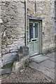
Steps by the door
by Bill Nicholls for square SP2512 Not something you see very much and I think is used even less unless they own a... (more)
|
|
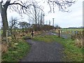
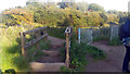
Junction of Ways. Borders Abbeys meets St Cuthbert's
by Martin Dawes geograph for square NT6623 Borders Abbey goes left at the junction onto St Cuthbert's down to Jedfoot Bridge
Tags:
long distance path:Borders Abbeys WayX
type:GeographX
Horse Stile
top:LowlandsX
top:PathsX
place:Scottish BordersX
long distance path:St Cuthberts WayX
|
|
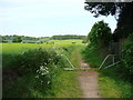
Kingshill Lane, Lilley
by Humphrey Bolton geograph for square TL1127 This is part of the John Bunyan Trail.
Tags:
top:Farm, Fishery, Market GardeningX
type:GeographX
Horse Stile
long distance path:John Bunyan TrailX
top:LowlandsX
top:PathsX
Public BridlewayX
subject:TrackX
top:Village, Rural SettlementX
|
|
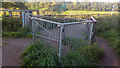
Kissing gate on path near bridge over Chorlton Brook, Chorlton Ees
by Phil Champion geograph for square SJ8093 Although quite large, the kissing gate didn't have an obvious way of... (more)
Tags:
place:Chorlton EeesX
Chorlton MeadowsX
place:Chorlton-Cum-HardyX
place:ChortonX
type:GeographX
Horse Stile
Kissing GateX
place:Mersey ValleyX
subject:PathX
top:PathsX
top:Suburb, Urban FringeX
|
|
Path west of Long Ridge Road
by Andrew Curtis geograph for square NZ1662 |
|
Kissing gate on path near bridge over Chorlton Brook, Chorlton Ees
by Phil Champion geograph for square SJ8093 Although quite large, with several padlocks attached, this kissing gate... (more)
Tags:
place:Chorlton EeesX
Chorlton EesX
Chorlton MeadowsX
place:Chorlton-Cum-HardyX
place:ChortonX
type:GeographX
Horse Stile
Kissing GateX
place:Mersey ValleyX
subject:PathX
top:PathsX
top:Suburb, Urban FringeX
|