Geograph - photograph every grid square
About tags on Geograph
Tags
Geographical Context
Subjects
Types
Other Prefixes
Public Tags
Related Tags
|
Coverage Map
Tag:
House·Entrance·Road
Showing images tagged with
House Entrance Road
tag.
View all tagged images
-
In Browser
Search within these images
:
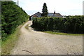
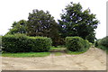
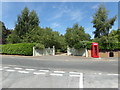
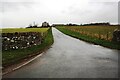
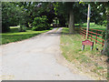
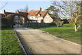
Entrance to 175 Outwell Road
by
Geographer
geograph for square
TF4905
Off the A1101 Outwell Road
Tags:
A1101
X
at:
Emneth
X
subject:
Entrance
X
Farm Entrance
X
Farm Entrance Drive
X
Farm Entrance Gateway
X
Farm Entrance Road
X
top:
Farm, Fishery, Market Gardening
X
type:
Geograph
X
near:
Holly End
X
House Entrance
X
House Entrance Driveway
X
House Entrance Gateway
X
House Entrance Road
top:
Housing, Dwellings
X
Outwell Road
X
off:
The A1101 Outwell Road
X
top:
Village, Rural Settlement
X
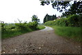
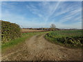
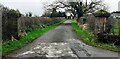
Entrance to Orsborn Cottages
by
Geographer
geograph for square
TM3876
Off Grange Road
Tags:
subject:
Entrance
X
Entrance
X
Entrance Road
X
Entrance Track
X
type:
Geograph
X
off:
Grange Road
X
Grange Road
X
House Entrance
X
House Entrance Driveway
X
House Entrance Road
House Entrance Track
X
top:
Housing, Dwellings
X
at:
Mells
X
to:
Orsborn Cottages
X
Orsborn Cottages
X
top:
Roads, Road Transport
X
top:
Suburb, Urban Fringe
X
at:
The Entrance to Orsborn Cottages
X
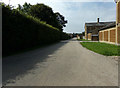
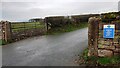
Entrance to Narford Hall and Fairfax & Favor
by
Geographer
geograph for square
TF7613
Off Narford Road
Tags:
Business Entrance
X
top:
Business, Retail, Services
X
subject:
Entrance
X
Fairfax & Favor
X
type:
Geograph
X
House Entrance
X
House Entrance Driveway
X
House Entrance Gates
X
House Entrance Gateway
X
House Entrance Road
top:
Housing, Dwellings
X
to:
Narford Hall
X
off:
Narford Road
X
top:
Roads, Road Transport
X
at:
West Acre
X
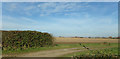
Entrance to East View (Waterworks Cottages)
by
Geographer
geograph for square
TM3875
Off Grange Road
Tags:
East View
X
subject:
Entrance
X
Entrance Gateway
X
Entrance Road
X
type:
Geograph
X
Grange Road
X
near:
Halesworth
X
House Entrance
X
House Entrance Driveway
X
House Entrance Gateway
X
House Entrance Road
House Name Sign
X
top:
Housing, Dwellings
X
top:
Village, Rural Settlement
X
at:
Walpole
X
Waterworks Cottages
X
to:
Waterworks Cottages
X
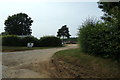
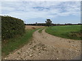
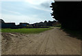
Entrance to South Acre Hall & Petticoat Drove Track
by
Geographer
geograph for square
TF8014
At the junction with Narford Road
Tags:
subject:
Entrance
X
type:
Geograph
X
House Driveway Entrance
X
House Entrance
X
House Entrance Driveway
X
House Entrance Gateway
X
House Entrance Road
top:
Housing, Dwellings
X
Narford Road
X
Petticoat Drove
X
Petticoat Drove (Track)
X
Petticoat Drove Track
X
Road Junction
X
top:
Roads, Road Transport
X
at:
South Acre
X
South Acre Hall
X
Track
X
top:
Village, Rural Settlement
X
Entrance to The Grove
by
Geographer
geograph for square
TG0723
Off Kerdiston Road
Tags:
subject:
Entrance
X
type:
Geograph
X
House Driveway Entrance
X
House Entrance
X
House Entrance Driveway
X
House Entrance Gateway
X
House Entrance Road
top:
Housing, Dwellings
X
at:
Kerdiston
X
off:
Kerdiston Road
X
The Grove
X
top:
Village, Rural Settlement
X
Entrance to The Grove
by
Geographer
geograph for square
TG0723
Off Kerdiston Road near the junction with Old Lane
Tags:
subject:
Entrance
X
type:
Geograph
X
House Driveway Entrance
X
House Entrance
X
House Entrance Driveway
X
House Entrance Road
House Entrance Track
X
top:
Housing, Dwellings
X
at:
Kerdiston
X
off:
Kerdiston Road
X
Old Lane
X
Road Junction
X
The Grove
X
top:
Village, Rural Settlement
X
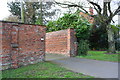
The entrance to Bell House
by
Geographer
geograph for square
TM3864
Off Bridge Street at the junction with Low Road
Tags:
to:
Bell House
X
off:
Bridge Street
X
Defibrillator
X
Defibrillator Station
X
type:
Geograph
X
House Entrance
X
House Entrance Gates
X
House Entrance Gateway
X
House Entrance Road
top:
Housing, Dwellings
X
at:
Kelsale
X
Low Road
X
subject:
Road Junction
X
former:
Telephone Box
X
Telephone Box (Adopted)
X
top:
Village, Rural Settlement
X
Footpath & entrance to Snow's Hall
by
Geographer
geograph for square
TM3570
Off Hubbard's Hill
Tags:
subject:
Entrance
X
Footpath
X
Footpath Sign
X
type:
Geograph
X
House Driveway Entrance
X
House Entrance
X
House Entrance Driveway
X
House Entrance Gateway
X
House Entrance Road
top:
Housing, Dwellings
X
Hubbards Hill
X
off:
Hubbards Hill
X
top:
Paths
X
at:
Peasenhall
X
to:
Snows Hall
X
Snows Hall
X
top:
Village, Rural Settlement
X
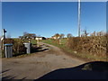
Entrance to Hall Farm & South Acre Hall
by
Geographer
geograph for square
TF8014
Off Narwood Road
Tags:
subject:
Entrance
X
Farm Entrance
X
top:
Farm, Fishery, Market Gardening
X
type:
Geograph
X
to:
Hall Farm
X
House Entrance
X
House Entrance Road
top:
Housing, Dwellings
X
off:
Narwood Road
X
top:
Roads, Road Transport
X
at:
South Acre
X
to:
South Acre Hall
X
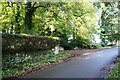
Entrance drive to Alstonby Grange
by
Roger Templeman
geograph for square
NY4064
There is an Ordnance Survey benchmark
NY4064 : Benchmark on Alstonby Grange Bridge
on top of the bridge parapet... (
more
)
Tags:
housing:
Detached House
X
For Sale Sign
X
type:
Geograph
X
House Entrance Road
top:
Housing, Dwellings
X
Ordnance Survey
X
top:
Roads, Road Transport
X
Rural Road
X
Stone Bridge Parapet
X
Streamside Trees
X
top:
Village, Rural Settlement
X
Entrance road to Bell Mount from Mile Lane
by
Roger Templeman
geograph for square
NY4929
Tags:
housing:
Detached House
X
Farm Buildings
X
top:
Farm, Fishery, Market Gardening
X
type:
Geograph
X
Grass Fields
X
House Entrance Road
top:
Housing, Dwellings
X
top:
Roads, Road Transport
X
Sheep in Field
X
Stone Walls
X
Wooden Fence Posts
X
Entrance drive to Waverton Hall from south side of A596
by
Roger Templeman
geograph for square
NY2247
Ordnance Survey documents indicate that a benchmark was levelled at 117.579 feet... (
more
)
Tags:
1GL
X
Benchmark
X
type:
Geograph
X
Grass Verges
X
House Entrance Road
Ordnance Survey
X
top:
Roads, Road Transport
X
Roadside Hedgerows
X
gateposts:
Stone
X
top:
Suburb, Urban Fringe
X
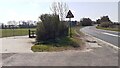
Entrance road to Mounsey Bank from east side of A6
by
Luke Shaw
geograph for square
NY5035
Tags:
Dry Stone Walls
X
top:
Farm, Fishery, Market Gardening
X
Field Gateway
X
type:
Geograph
X
Grass Field
X
House Entrance Road
House Name Sign
X
gate:
Metal
X
top:
Roads, Road Transport
X
gateposts:
Stone
X
Former stables and entrance to Blackwell House on SW side Durdar Road
by
Roger Templeman
geograph for square
NY4052
There is an Ordnance Survey benchmark
NY4052 : Benchmark on former stables on SW side of Durdar Road
on the brick wall about 5m... (
more
)
Tags:
Brick Wall
X
Former Stables
X
type:
Geograph
X
Grass Verge
X
House Entrance Road
top:
Roads, Road Transport
X
top:
Suburb, Urban Fringe
X
Urban Road
X
Entrance to Daleacres
by
David Pashley
geograph for square
TF8505
Tags:
subject:
Entrance
X
type:
Geograph
X
House Entrance Road
top:
Lowlands
X
top:
Roads, Road Transport
X
top:
Village, Rural Settlement
X
Brick boundary wall of #81A Barrowby Road
by
Roger Templeman
geograph for square
SK9036
There is an OS benchmark
SK9036 : Benchmark on wall angle outside #81A Barrowby Road
on the corner of the wall on the far side... (
more
)
Tags:
Brick Walls
X
type:
Geograph
X
House Entrance Road
House Name Sign
X
Ordnance Survey
X
top:
Suburb, Urban Fringe
X
Trees
X
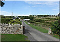
Entrance drive to Lazonby Hall from rural road
by
Luke Shaw
geograph for square
NY5440
There is an Ordnance Survey benchmark
NY5440 : Benchmark on stone at base of wall SE of entrance drive to Lazonby Hall
on a stone at the base of the... (
more
)
Tags:
type:
Geograph
X
Grass Verge
X
Hedge on Wall
X
House Entrance Road
top:
Roads, Road Transport
X
Rural Road
X
Trees
X
A7 approaching M6 roundabout at entrance to Albert Cottage
by
Roger Templeman
geograph for square
NY3960
Ordnance Survey records indicate that a benchmark levelled at 26.095m above... (
more
)
Tags:
road:
A Road
X
top:
Farm, Fishery, Market Gardening
X
type:
Geograph
X
Grass Field
X
House Entrance Road
gates:
Metal
X
Ordnance Survey
X
top:
Roads, Road Transport
X
Roadside Hedges
X
Skid Risk Sign
X
Speed Derestriction Signs
X
Access drive to large house at Shepherd's Pit
by
Roger Templeman
geograph for square
SP5608
Tags:
housing:
Detached House
X
type:
Geograph
X
House Entrance Road
top:
Housing, Dwellings
X
gates:
Metal
X
Ordnance Survey
X
top:
Roads, Road Transport
X
Stone Wall
X
top:
Village, Rural Settlement
X
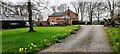
The Chapel, west side Netherby Road
by
Roger Templeman
geograph for square
NY3869
Tags:
plant:
Daffodils
X
housing:
Detached House
X
type:
Geograph
X
House Entrance Road
top:
Housing, Dwellings
X
Lawn
X
top:
Roads, Road Transport
X
top:
Suburb, Urban Fringe
X
Trees
X
gate:
Wooden
X
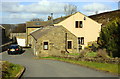
Moor End Farm, Black Moor Road
by
Roger Templeman
geograph for square
SE0336
Tags:
Farm Buildings
X
top:
Farm, Fishery, Market Gardening
X
Farmhouse
X
type:
Geograph
X
House Entrance Road
top:
Housing, Dwellings
X
Ordnance Survey
X
Iron Bollard by the Gate
by
Des Blenkinsopp
geograph for square
SZ0277
Now protecting the end of a stone wall is an iron bollard. There are a lot of... (
more
)
Tags:
Cast Iron Bollard
X
type:
Geograph
X
House Entrance Road
top:
Suburb, Urban Fringe
X
View more in the Image Search
or
in Browser
View images matching 'House Entrance Road' anywhere
in
the tags
Don't click these:
PotMel 1
PotMel 2
☰
Home
View
Search
Marked Images
Maps
Browser
Explore
Showcase
New Images
Collections
Interact
Games
Discussions
Blog
Contributors
Submit
Statistics
Leaderboards
General
FAQ
Help Pages
Sitemap
Contact Us
Support Us
sponsored by
🔍
What to search:
Photos
Enter keywords or a location/postcode to search nearby images
Enter a Grid Reference
Placenames
Collections
Website Pages
Everything
Others:
Advanced Search
|
Image Browser
Or:
Coverage Map
|
Searchable Map
You are not logged in
login
|
register