|
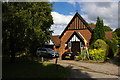
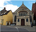
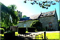
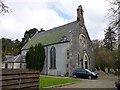
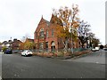
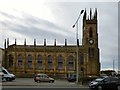
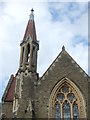
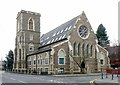
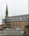
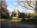
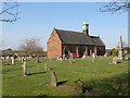
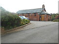
Former church of St Audrey, Commonside, Keston
by Christopher Hilton
geograph for square TQ4164
St Audrey's church was built in 1889 on the site of the former Olive's... (more)
|
|
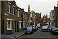
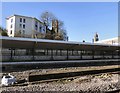
Hague Street, E2
by Christopher Hilton
geograph for square TQ3482
Before the expansion of Weavers Fields park (behind the photographer), Hague... (more)
|
|
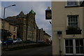
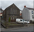
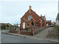
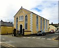
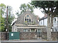
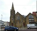
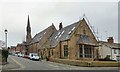
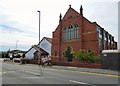
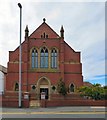
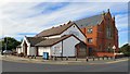
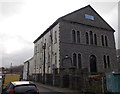
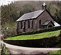
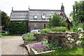
Lostwithiel: former Methodist Free Church
by Christopher Hilton
geograph for square SX1059
The former Methodist Free Church (and, beyond it, the former Sunday School) are... (more)
|
|
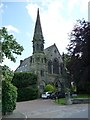
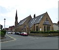
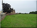
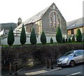
Kirklands, Carr Lane, Thorner
by Christine Johnstone
geograph for square SE3740
The Grade 2 listed former Thorner Methodist Church and attached Sunday School,... (more)
|
|
Chapel House, Malmesbury
by Jaggery
geograph for square ST9387
Former church in The Triangle converted to a house. The inscription in stone... (more)
|
|
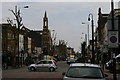
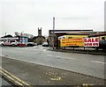
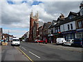
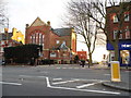
Bethnal Green Road, E2
by Christopher Hilton
geograph for square TQ3482
Looking east across the Vallance Road crossing. On the left, the former church... (more)
|
|
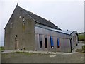
Converted Church
by Rude Health
geograph for square HY4427
This converted church is close to Brinian House, Brinian.
|
|
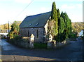
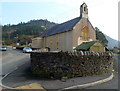
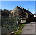
Former Methodist Church, Tintern
by Jaggery
geograph for square SO5300
Now a private residence, this was Tintern Methodist Church, built in 1861. It... (more)
|
|
St Peter's
by Tiger
geograph for square TM3272
The name of this private property preserves the dedication of the old village... (more)
|
|
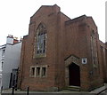
Former New Church Temple, Ynysmeudwy
by Jaggery
geograph for square SN7305
Viewed across the B4603 New Road. Now converted to residential use, the building... (more)
|
|
Former St Johns Church, Pontrhydyfen
by Jaggery
geograph for square SS7993
The former Oakwood Avenue church has been converted to residential use.
|
|
Former Barry Island Presbyterian Church
by Jaggery
geograph for square ST1166
Viewed across Earl Crescent. Now converted to residential use,
this used to be... (more)
|
|
The former Wesleyan Methodist Church, Bempton
by Christine Johnstone
geograph for square TA1872
|
|
St Mary's Court, Worcester
by Jaggery
geograph for square SO8555
Viewed from Northfield Street. The former Church of St Mary Magdalene,
built... (more)
|
|
Bell House
by Rude Health
geograph for square NT0235
Bell House is a house converted from a former church on the road between Biggar... (more)
|
|
Belmont Mansions, Shrewsbury
by Jaggery
geograph for square SJ4912
Located on the corner of Belmont and Belmont Bank, formerly St.David's... (more)
|
|
Former United Reformed Church
by Gerald England
geograph for square SD3627
The Grade II listed... (more)
|
|
Former Capel Seion, Beaumaris
by Gerald England
geograph for square SH6076
Seion Congregational Chapel was built in 1788, rebuilt in 1821 again in 1873.... (more)
|
|
Church Street
by Gerald England
geograph for square SD8111
Off Bell Lane, leading to the Grade II listed... (more)
|
|
The Studio
by Gerald England
geograph for square SD8203
When the congregation at the Grade II listed building... (more)
|
|
Heaton Park Congregational Church
by Gerald England
geograph for square SD8203
The Grade II listed building... (more)
|
|
Former village church, Norton-le-Clay
by Christine Johnstone
geograph for square SE4071
St John the Evangelist's has been converted to a house.
|
|
The New Church on Cranbrook Road
by Neil Owen
geograph for square ST5875
A church, now converted into residential use, was founded as the area was... (more)
|
|
Southeast side of Church House, Cwmfelin, Bedlinog
by Jaggery
geograph for square SO0900
Viewed in February 2019. The former St Cadoc's Church built in 1911 has... (more)
|
|
Trinity Court
by Gerald England
geograph for square SD7108
The former Holy Trinity church designed by architect Philip Hardwick is Grade II... (more)
|
|
Former Church, South Horrington
by Des Blenkinsopp
geograph for square ST5746
This church was at the centre of the former Mendip Hospital which closed in... (more)
|
|
Former Unitarian Church
by Gerald England
geograph for square SD3036
The former Blackpool Unitarian Church on the corner of Dickson Road and Banks... (more)
|
|
House formerly a church, Llanddewi Fach, Monmouthshire
by Jaggery
geograph for square ST3395
Formerly St Davids Church, accessed from Tre-Herbert Road via St Davids Lane.... (more)
|
|
Is it a spire or not?
by Neil Owen
for square ST4071
The former Congregational Chapel's slender octagonal bell-tower is... (more)
|
|
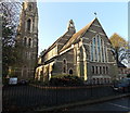
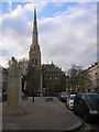
Former Church of St John The Divine, Leicester
by Alan Murray-Rust
for square SK5903
Classic Victorian urban church, 1855, by George Gilbert Scott Snr, in his... (more)
|
|
Former United Reformed Church
by Gerald England
geograph for square SD3627
The Grade II listed... (more)
|
|
Former United Reformed Church
by Gerald England
geograph for square SD3627
The Grade II listed... (more)
|
|
Tithebarn Street
by Gerald England
geograph for square SD3439
|
|
Church Mansions
by Gerald England
geograph for square SD3439
|
|
Poulton-le-Fylde United Reformed Church
by Gerald England
geograph for square SD3439
Tithebarn Street Independent chapel opened in 1809. It was restored and became a... (more)
|
|
Former Church, Lake Road, Windermere
by Graham Robson
geograph for square SD4097
A former church building on Lake Road, Windermere. The building has been... (more)
|
|
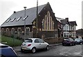
Nether Hall Road, Doncaster
by Christine Johnstone
geograph for square SE5703
Looking north-east, out of town. The imposing church has been converted to flats
|
|
Lancaster Gate, London W2
by Christopher Hilton
geograph for square TQ2680
The memorial is to Reginald Brabazon (1841-1929), 12th Earl of Meath,... (more)
|
|
Former Nazareth Church in Mountain Ash
by Jaggery
geograph for square ST0499
The building in Cardiff Road is now in residential use.
|
|
Belmont West
by Alan Murray-Rust
geograph for square NS5667
The former Belmont church, built 1893-4, has been converted recently into 24... (more)
|
|
Former church, Trimdon Colliery
by Malc McDonald
geograph for square NZ3836
A former church in the village of Trimdon Colliery, in County Durham.
|
|
Bolton Station
by Gerald England
geograph for square SD7108
Looking across the tracks and out of Bolton Station towards the former Holy... (more)
|
|
Old Trinity Church, Whitebrook
by Jaggery
geograph for square SO5306
Former church converted to a holiday cottage.
|
|
Former St Peters Church, Nantyffyllon
by Jaggery
geograph for square SS8492
Set above the west side of Picton Street, the former church has been converted... (more)
|
|
A change of use
by Anthony Vosper
geograph for square SY0582
The former St John's C of E church.
Has been turned into a private... (more)
|
|
Former Congregational Church, Green Lane, Belper
by Alan Murray-Rust
geograph for square SK3447
Built in 1872 replacing an earlier church, in Gothic style. In its turn replaced... (more)
|
|
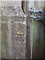
Back gate benchmark
by Neil Owen
for square ST8474
The old church of St John's did not serve its community for too long:... (more)
|
|
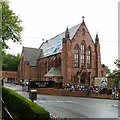
St Luke's Church, Hornsey Vale
by Jim Osley
geograph for square TQ3088
View from Stationers Park. Built 1902-1903 to the designs of architects J.E.K.... (more)
|
|
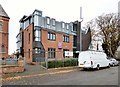
Converted church on the corner of Burrard Road and Finchley Road
by David Howard
geograph for square TQ2585
The building to the left of it is the Open University local headquarters
|
|
Magdalene House, formerly St Mary Magdalene's Church
by Roger Templeman
geograph for square SE2591
|