|
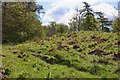
Corby's Bridge Iron Age and Romano-British settlement
by Russel Wills
geograph for square NU1209
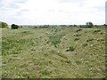
This settlement lies on a level area of ground on the steep slopes above... (more)
|
|
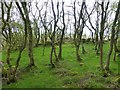
Remains of iron age settlement near Sidwood
by Oliver Dixon
geograph for square NY7789
An ancient oak dominates this clearing in the forest which is the site of an... (more)
|
|
Limestone outcrop near Green Slacks
by Adrian Taylor
geograph for square SD2773
A cluster of wind shaped trees have gained a foothold in the grikes in the... (more)
|
|
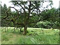
Iron Age Hill Fort
by Alan Hughes
geograph for square SS8876
Dense summer vegetation fills the ditch which separates the two tree-lined... (more)
|
|
Woodcutts Common, ditch
by Mike Faherty
geograph for square ST9618
Ditch and embankment, part of an extensive Iron Age and Romano-British... (more)
|
|
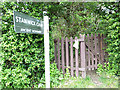
Stanwick Iron Age Camp
by Oliver Dixon
geograph for square NZ1812
The belt of woodland at the far side of the field marks one of the earthworks... (more)
|
|
Stanwick Iron Age Camp
by Oliver Dixon
geograph for square NZ1712
The belt of woodland marks one of the earthworks enclosing Stanwick Iron Age... (more)
|
|
Earthwork in Stanwick Iron Age Camp
by Oliver Dixon
geograph for square NZ1712
One of the earthworks enclosing Stanwick Iron Age Camp, a huge site extending to... (more)
|
|
Entrance to Stanwick Iron Age Camp
by Oliver Dixon
for square NZ1712
Stanwick Iron Age Camp occupies a huge site extending to 300 hectares. The camp... (more)
|
|
Stanwick Iron Age Camp
by Oliver Dixon
geograph for square NZ1712
The belt of woodland marks one of the earthworks enclosing Stanwick Iron Age... (more)
|
![SE2144 : Chevin Forest Park [15] by Christine Johnstone](https://s1.geograph.org.uk/geophotos/03/88/56/3885677_69f3883f_120x120.jpg)
|
Chevin Forest Park [15]
by Christine Johnstone
geograph for square SE2144
Iron Age enclosure site at Foxscar.
|
|
Cotswold Way on Shenberrow Hill
by Derek Harper
geograph for square SP0833
|
|
Site of Iron age settlement
by Mick Garratt
geograph for square SE2144
|
|
Mine Howe Iron Age Settlement
by Sandy Gerrard
geograph for square HY5106
Once a hive of activity now deserted.... (more)
|
|
Footpath to Pins Knoll
by Derek Harper
geograph for square SY5490
|
|
Berwickshire Coast Path above Rough Heugh
by Oliver Dixon
geograph for square NT8769
The hillock on the skyline is the site of an Iron Age settlement.
|
|
On top of the ramparts
by Neil Owen
geograph for square SP1721
This gate, also on the Gustav Holst Way, is actually on top of some large... (more)
|
|
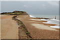
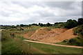
Gabions, Hengistbury Head Beach
by Rob Noble
geograph for square SZ1690
These gabions (see Link ) installed for just a... ( more) |
|
Iron-Age enclosure, The Carrs, Mixenden, Ovenden
by Humphrey Bolton
geograph for square SE0529
This is a D-shaped area surrounded by a ditch. See... (more)
|
|
Iron-Age enclosure, The Carrs, Mixenden, Ovenden
by Humphrey Bolton
geograph for square SE0529
This is a D-shaped area surrounded by a ditch. See... (more)
|
|
Iron Age roundhouse ruin
by Hugh Venables
geograph for square SM7208
About two hundred people lived on Skomer Island two thousand years ago.
|
|
Ancient settlement site, Janet's Brae
by Jim Barton
geograph for square NT2640
The northern edge of the rampart enclosing a former settlement, now within... (more)
|
|
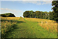
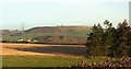
Towards Brandon
by Derek Harper
geograph for square NU0416
|
|
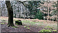
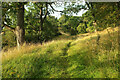
Path, Shenbarrow Hill
by Derek Harper
geograph for square SP0733
Circling Shenbarrow Hill camp, which is on the right... (more)
|
|
Ham Hill
by Bill Harrison
geograph for square ST4717
Ham Hill is a site of special scientific interest (SSSI), a country park and a... (more)
|
|
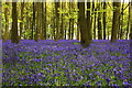
Bluebells, Badbury Clump
by Rob Noble
geograph for square SU2694
Another fine show this year.
|