Public Tags
Tag: Iron·Bridge
Other tags: name:Iron Bridge
structure:Iron Bridge
Showing latest 50 of 142 images tagged with Iron Bridge tag.
|
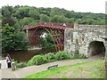
Iron bridge, Ironbridge
by Malc McDonald geograph for square SJ6703 The iron bridge from which the village of Ironbridge is named. The bridge,... (more)
Tags:
Bridge
subject:Bridge
type:Geograph
Grade 1 Listed
Grade I Listed
Grade I Listed Structure
top:Historic Sites and Artefacts
Iron Bridge
structure:Iron Bridge
place:Ironbridge
Ironbridge Gorge
Listed Structure
National Cycle Network
National Cycle Network Route 45
NCN
NCN45
River Severn
river:River Severn
top:Rivers, Streams, Drainage
Severn Gorge
county:Shropshire
Sustrans Route 45
near:Telford
subject:UNESCO World Heritage Site
Unesco World Heritage Site
|
|
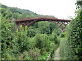
Path at Ironbridge
by Malc McDonald geograph for square SJ6703 A path along the bank of the River Severn at Ironbridge, with a view towards the... (more)
Tags:
Footpath
path:Footpath
type:Geograph
Grade 1
Grade 1 Listed
Grade I Listed
Grade I Listed Structure
top:Historic Sites and Artefacts
Iron Bridge
structure:Iron Bridge
place:Ironbridge
subject:Path
top:Paths
Public Footpath
Scheduled Monument
county:Shropshire
near:Telford
|

|
Aldford Iron Bridge
by Jeff Buck geograph for square SJ4160 Aldford Iron Bridge is a bridge crossing the River Dee north of Aldford linking... (more)
Tags:
Aldford
Bridge
top:Country Estates
Eaton Hall
Iron Bridge
top:Paths
River Dee
top:Rivers, Streams, Drainage
|

|
Aldford Iron Bridge
by Jeff Buck geograph for square SJ4160 Aldford Iron Bridge is a bridge crossing the River Dee north of Aldford linking... (more)
|

|
Aldford Iron Bridge
by Jeff Buck geograph for square SJ4160 Aldford Iron Bridge is a bridge crossing the River Dee north of Aldford linking... (more)
|

|
Aldford Iron Bridge
by Jeff Buck geograph for square SJ4160 Aldford Iron Bridge is a bridge crossing the River Dee north of Aldford linking... (more)
|

|
The Iron Bridge, Exeter
by A J Paxton geograph for square SX9192 The Iron Bridge was built for the Improvement Commissioners of Exeter from parts... (more)
Tags:
subject:Bridge
top:City, Town Centre
type:Geograph
top:Historic Sites and Artefacts
structure:Iron Bridge
Iron Bridge
top:Roads, Road Transport
|

|
Early iron bridge in Croome Park
by Philip Halling geograph for square SO8744 One of a pair of early wrought iron bridges in Croome landscape park. The... (more)
Tags:
subject:Bridge
Bridge
top:Country Estates
Footbridge
type:Geograph
top:Historic Sites and Artefacts
Iron Bridge
|

|
Eastern end of Iron Bridge over the River Taff between Tongwynlais and Morganstown
by Jaggery geograph for square ST1381 Viewed from the western end of Iron Bridge Road, Tongwynlais.
Iron Bridge is a... (more)
|

|
Sawmill Bridge, Leven
by Bill Kasman geograph for square NO3700 The Sawmill Bridge (known locally as the Iron Brig) over the River Leven has... (more)
Tags:
top:City, Town Centre
top:Construction, Development
type:Geograph
Iron Bridge
Iron Brig
top:Paths
top:Railways
River Leven
top:Roads, Road Transport
Sawmill Bridge
|

|
Underside of the Iron Bridge, Exeter
by A J Paxton geograph for square SX9192 The Iron Bridge was cast at the Blaina ironworks in Monmouthshire in 1834-5,... (more)
Tags:
subject:Bridge
top:City, Town Centre
type:Geograph
top:Historic Sites and Artefacts
Iron Bridge
structure:Iron Bridge
top:Public Buildings and Spaces
top:Roads, Road Transport
|

|
Albert Bridge from Glasgow Green
by Stephen Craven geograph for square NS5964 The bridge, listed category A (LB32667) was built in 1868-1871 to replace an... (more)
Tags:
date:1871
Category A Listed
type:Geograph
Iron Bridge
top:Park and Public Gardens
Road Bridge
top:Roads, Road Transport
|

|
The Iron Bridge, Cragside
by Ian Capper geograph for square NU0702 The Iron Bridge over Debdon Burn on the Cragside Estate, with a wooden... (more)
Tags:
top:Country Estates
building:Cragside
place:Cragside
stream:Debdon Burn
type:Geograph
Grade II(star) Listed
top:Housing, Dwellings
structure:Iron Bridge
top:Rivers, Streams, Drainage
near:Rothbury
|

|
Iron Bridge, Stourhead Gardens
by Philip Halling geograph for square ST7733 The Iron Bridge dates from 1860 and was made by the foundry of Maggs and... (more)
Tags:
subject:Bridge
Footbridge
type:Geograph
Iron Bridge
top:Lakes, Wetland, Bog
National Trust Property
top:Park and Public Gardens
top:Paths
|

|
Nene Viaduct, Peterborough
by Paul Bryan geograph for square TL1998 The Nene Viaduct spans the River Nene just south of Peterborough station. It was... (more)
Tags:
Bridge
Bridge Over River
Cast Iron Bridge
top:City, Town Centre
railway:East Coast Main Line
East Coast Main Line
East Coast Mainline
railway:East Coast Mainline
ECML
type:Geograph
Iron Bridge
river:Nene
place:Peterborough
Railway Bridge
Railway Bridge Over River
Railway Viaduct
top:Railways
River Nene
top:Rivers, Streams, Drainage
Viaduct
subject:Viaduct
|

|
Nene Viaduct, Peterborough
by Paul Bryan geograph for square TL1998 The Nene Viaduct spans the River Nene just south of Peterborough station. It was... (more)
Tags:
Cast Iron Bridge
top:City, Town Centre
railway:East Coast Main Line
East Coast Main Line
East Coast Mainline
railway:East Coast Mainline
ECML
Iron Bridge
river:Nene
place:Peterborough
Railway Bridge
building type:Railway Bridge
Railway Bridge Over River
Railway Viaduct
top:Railways
River Nene
top:Rivers, Streams, Drainage
subject:Viaduct
Viaduct
|

|
Abraham Darby's Iron Bridge
by John Winder for square SJ6703 Built in 1779, this was a revolutionary structure in its day, being the first to... (more)
Tags:
subject:Bridge
Cast Iron Bridge
Film Photography
top:Historic Sites and Artefacts
top:Industry
Iron Bridge
place:Ironbridge
Medium Format
taken:Night
Night Photography
top:Rivers, Streams, Drainage
|

|
Scamell's Bridge
by Jonathan Kington geograph for square SU1430 This iron bridge, now carrying Nelson Road over the River Avon, originally... (more)
|

|
Urn finial on the iron bridge
by Neil Owen for square SO8932 The iron bridge linking Quay Street to Borough Mills is a fine example of a... (more)
Tags:
subject:Bridge
top:City, Town Centre
type:Close Look
Decorative Urn
top:Docks, Harbours
top:Historic Sites and Artefacts
Iron Bridge
|

|
Crossing the iron bridge, Ironbridge
by Bill Harrison geograph for square SJ6703 The much photographed grade-I listed (LB1038659... (more)
Tags:
Church of England
type:Geograph
top:Historic Sites and Artefacts
Iron Bridge
top:Religious Sites
river:River Severn
top:Rivers, Streams, Drainage
|

|
The Iron Bridge in Marks Hall Park
by Marathon geograph for square TL8425 Marks Hall Estate was left to the nation in the will of Thomas Phillips Price in... (more)
Tags:
top:Country Estates
Footbridge
type:Geograph
Iron Bridge
top:Park and Public Gardens
top:Paths
top:Rivers, Streams, Drainage
|

|
The Iron Bridge in Marks Hall Park
by Marathon for square TL8425 Marks Hall Estate was left to the nation in the will of Thomas Phillips Price in... (more)
Tags:
top:Country Estates
type:Cross Grid
Iron Bridge
top:Park and Public Gardens
top:Paths
top:Rivers, Streams, Drainage
|

|
The iron bridge at Ironbridge
by John Winder geograph for square SJ6703 Taken with a Mamiya C330 film camera. For the same shot by night, see... (more)
Tags:
Black and White Photography
subject:Bridge
Film Photography
type:Geograph
top:Historic Sites and Artefacts
Iron Bridge
place:Ironbridge
Ironbridge Gorge Museum Trust
Medium Format
river:Severn
Severn Gorge
top:Village, Rural Settlement
|

|
The Iron Bridge, Ironbridge
by Stephen McKay geograph for square SJ6703 The bridge, which has given the village its name, dates from 1779 and was the... (more)
Tags:
subject:Bridge
Gorge
top:Historic Sites and Artefacts
Iron Bridge
top:Paths
River Severn
top:Rivers, Streams, Drainage
Viewpoint
|
|
Dobson Bridge, Queen's Park
by David Dixon geograph for square SD7009 Dobson Bridge, crossing the lodge adjacent to the River Croal in Queen's... (more)
|

|
The Iron Bridge, Ironbridge
by Chris Allen geograph for square SJ6703 Cast iron bridge of 1779 and cast nearby in a coke fired blast furnace. An... (more)
|

|
The Iron Bridge, Ironbridge - joint details
by Martin Tester for square SJ6703 The designer of the world's first cast iron arch bridge, architect Thomas... (more)
Tags:
subject:Bridge
type:Close Look
top:Historic Sites and Artefacts
Iron Bridge
place:Ironbridge
river:River Severn
top:Rivers, Streams, Drainage
top:Village, Rural Settlement
|

|
The Iron Bridge at Night
by Des Blenkinsopp geograph for square SJ6703 The star attraction of the Ironbridge Gorge is the bridge itself.
Built in 1779... (more)
|

|
Victorian iron bridge over the chine
by Neil Owen for square SZ0790 Middle Chine is a shortish but steep wooded valley that leads from Westbourne... (more)
Tags:
subject:Bridge
Chine
type:Close Look
Iron Bridge
top:Paths
top:Roads, Road Transport
top:Suburb, Urban Fringe
|

|
The Iron Bridge, Exeter
by Chris Allen geograph for square SX9192 Tags:
subject:Bridge
Cast Iron Bridge
place:Exeter
type:Geograph
top:Historic Sites and Artefacts
Iron Bridge
top:Roads, Road Transport
|

|
Western end of Iron Bridge over the River Taff between Morganstown and Tongwynlais
by Jaggery geograph for square ST1381 Viewed from the Morganstown side. Iron Bridge Road is on the Tongwynlais
side... (more)
|
|
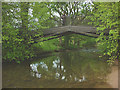
Iron bridge over the River Lyvennet, Crossrigg Hall
by Karl and Ali geograph for square NY6024 The bridleway crosses the river via this ornate iron bridge, very much in... (more)
Tags:
Iron Bridge
top:Lowlands
river:Lyvennet
Metal Bridge
top:Paths
Public Bridleway
top:Rivers, Streams, Drainage
Walker
|

|
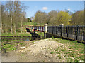
Iron Bridge, Exeter
by Christine Johnstone geograph for square SX9192 Spanning the steep Longbrook valley north-west of the city centre. Cast iron,... (more)
|
|
Dobson Bridge
by David Dixon geograph for square SD7009 Dobson Bridge was erected in 1878 to link the original park with a later... (more)
|

|
River Croal, Dobson Bridge
by David Dixon geograph for square SD7009 Dobson Bridge was erected in 1878 to link the original park with a later... (more)
|

|
Queen's Park, River Croal and Dobson Bridge
by David Dixon geograph for square SD7009 Dobson Bridge was erected in 1878 to link the original park with a later... (more)
|

|
The Iron Bridge over the River Ock
by Steve Daniels geograph for square SU4996 A small single span cast iron bridge cast by Acramans of Bristol for the Wilts... (more)
|

|
Sawmill Bridge, Leven
by Bill Kasman geograph for square NO3700 After being closed for some time the Sawmill Bridge (known locally as the... (more)
Tags:
Elm Park
type:Geograph
Iron Bridge
top:Railways
River Leven
top:Roads, Road Transport
Sawmill Bridge
top:Suburb, Urban Fringe
|

|
Sawmill Bridge, Leven
by Bill Kasman geograph for square NO3700 After being closed for some time the Sawmill Bridge (known locally as the... (more)
Tags:
Elm Park
type:Geograph
Iron Bridge
top:Paths
River Leven
top:Roads, Road Transport
Sawmill Bridge
top:Suburb, Urban Fringe
|

|
Railway bridge ID plate
by Bill Kasman for square NO3700 More commonly known as a 'strike plate' these plates identify bridges... (more)
Tags:
type:Close Look
Iron Bridge
Levenmouth Rail Link
top:Paths
top:Railways
Sawmill Bridge
top:Suburb, Urban Fringe
|

|
Sawmill Bridge, Leven
by Bill Kasman geograph for square NO3700 This bridge has been temporarily closed to allow for replacement of the bridge... (more)
Tags:
top:Construction, Development
type:Geograph
Iron Bridge
Iron Brig
top:Paths
top:Railways
River Leven
top:Roads, Road Transport
Sawmill Bridge
|

|
Uisge Dubh passing beneath iron bridge
by Trevor Littlewood geograph for square NH0038 Bridges taking estate roads over rivers and streams in remote country are often... (more)
Tags:
type:Geograph
Iron Bridge
Overhanging Trees
River
top:Rivers, Streams, Drainage
top:Roads, Road Transport
top:Rocks, Scree, Cliffs
Rocky River Bed
top:Uplands
|

|
Railway bridge ID plate
by Bill Kasman for square NO3700 More commonly known as a 'strike plate' these plates identify bridges... (more)
|

|
Scale model of Iron Bridge
by Ian Capper geograph for square SJ6903 Half-scale model of the Ironbridge Iron Bridge at Blists Hill Open Air Museum.
Tags:
place:Blists Hill
museum:Blists Hill Open Air Museum
top:Educational Sites
type:Geograph
Iron Bridge
Model
|

|
Marshall's bridge over the Hol Beck
by Stephen Craven geograph for square SE2932 There are many little bridges over this channelled river (a minor tributary of... (more)
Tags:
date:1849
bridge:Factory Access Over River
Grade II Listed
top:Historic Sites and Artefacts
Iron Bridge
top:Rivers, Streams, Drainage
top:Suburb, Urban Fringe
|

|
St Anne's Well Brewery, Exeter
by Chris Allen geograph for square SX9192 This complex includes an 1878 brewhouse and extensions of c1886. Brewing ceased... (more)
Tags:
Brewery
Bridge
top:City, Town Centre
place:Exeter
top:Historic Sites and Artefacts
top:Industry
Iron Bridge
|

|
Iron Bridge Lodge
by Jeff Buck geograph for square SJ4160 Iron Bridge Lodge is a house on the Aldford Approach to Eaton Hall. The house... (more)
|

|
Road Closed
by Bill Kasman geograph for square NO3700 After being closed for some time the Sawmill Bridge (known locally as the... (more)
Tags:
type:Geograph
Iron Bridge
top:Paths
River Leven
Road Barrier
Road Closed
top:Roads, Road Transport
Sawmill Bridge
top:Suburb, Urban Fringe
|

|
Sawmill Bridge, Leven
by Bill Kasman geograph for square NO3700 The temporary closure of this bridge is to allow for the replacement of the... (more)
Tags:
top:Construction, Development
type:Geograph
Iron Bridge
Iron Brig
top:Paths
top:Railways
River Leven
top:Roads, Road Transport
Sawmill Bridge
|

|
Sawmill Bridge, Leven
by Bill Kasman for square NO3700 The temporary closure of this bridge will allow the bridge deck to be replaced.... (more)
Tags:
top:City, Town Centre
type:Close Look
top:Construction, Development
Iron Bridge
Iron Brig
top:Paths
top:Railways
River Leven
top:Roads, Road Transport
Sawmill Bridge
|
